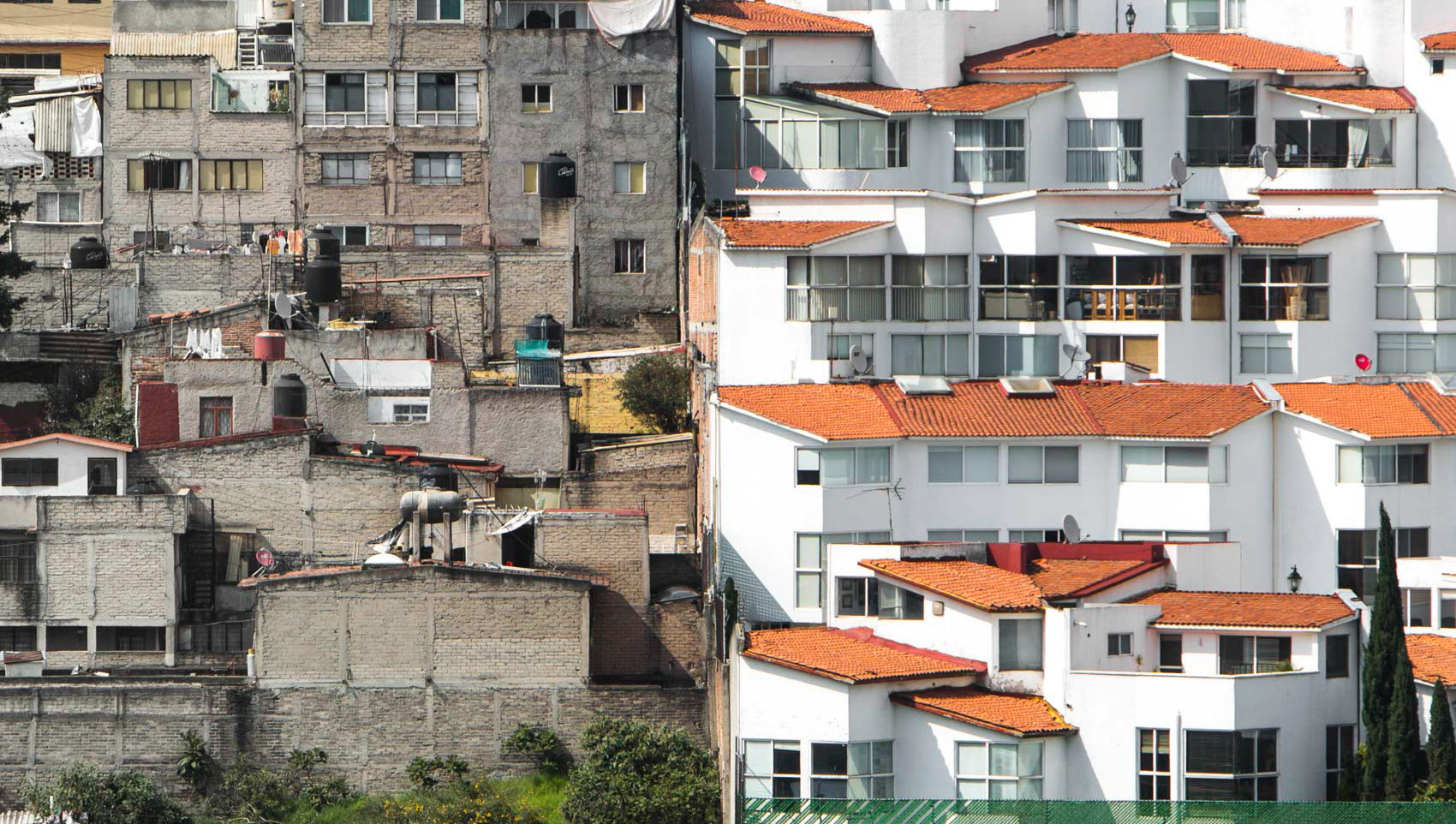
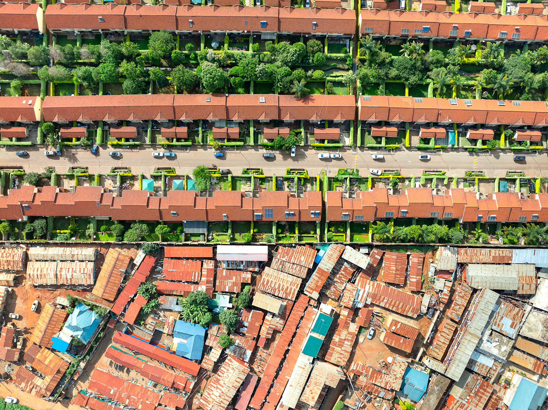
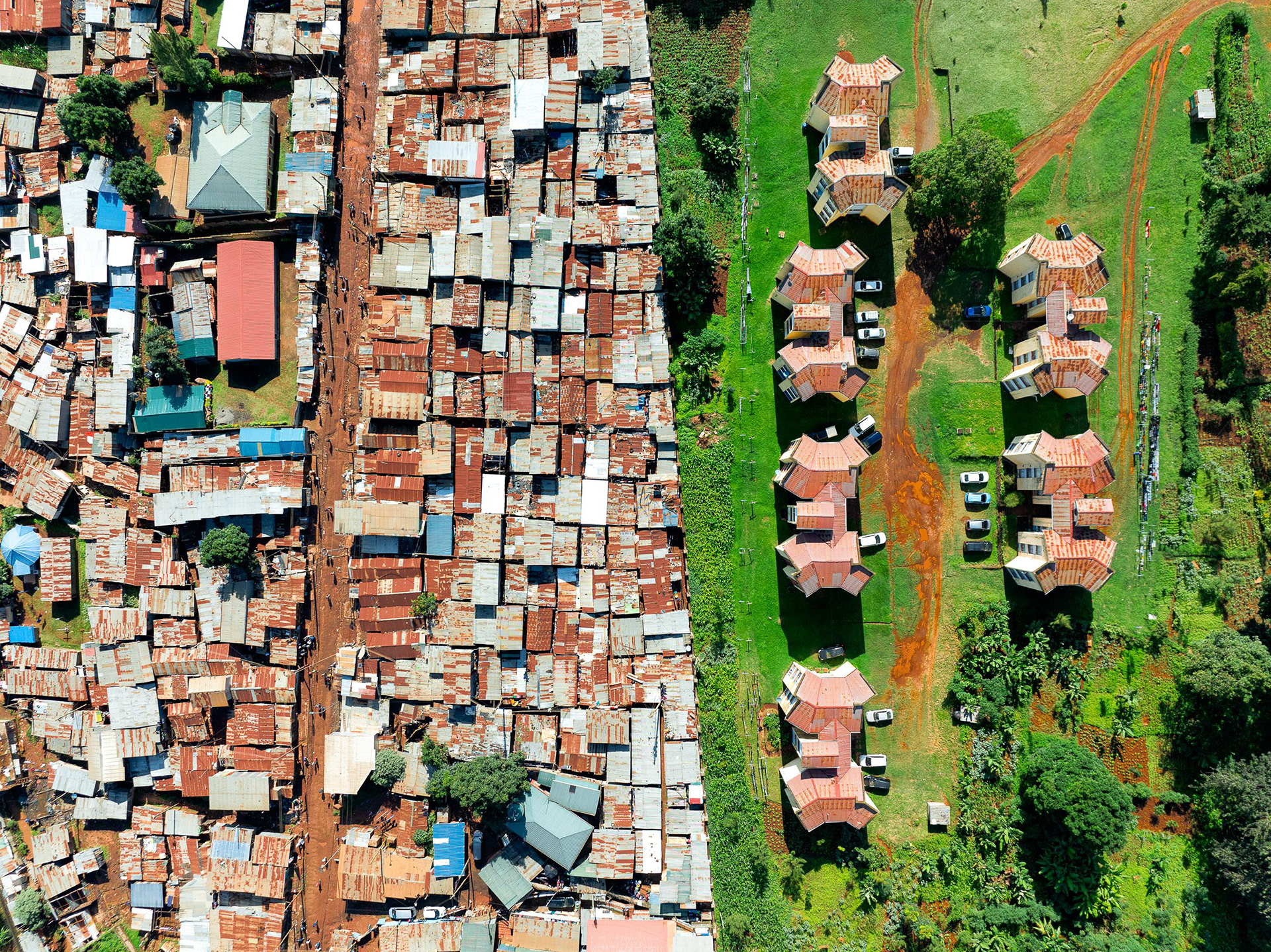
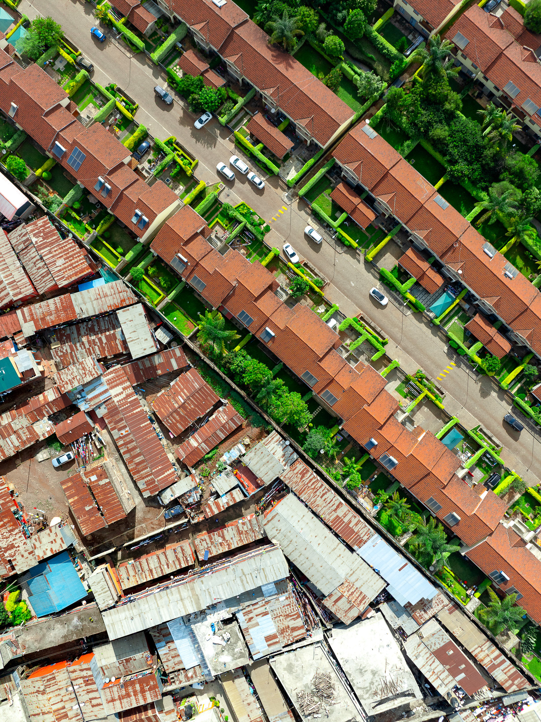
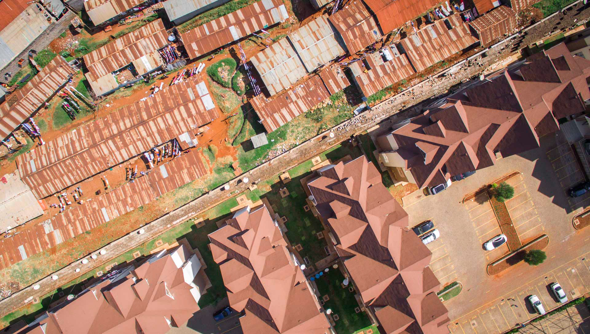
Upwardly mobile Kenyans live in planned, gated communities. Often these abut the poorest of slum communities, like this one in Loresho.
An informal settlement next to the rich suburb of Parklands. Pockets of informality are commonly found within, and next to, neighborhoods that rely on them as a source of cheap labor.
Loresho.
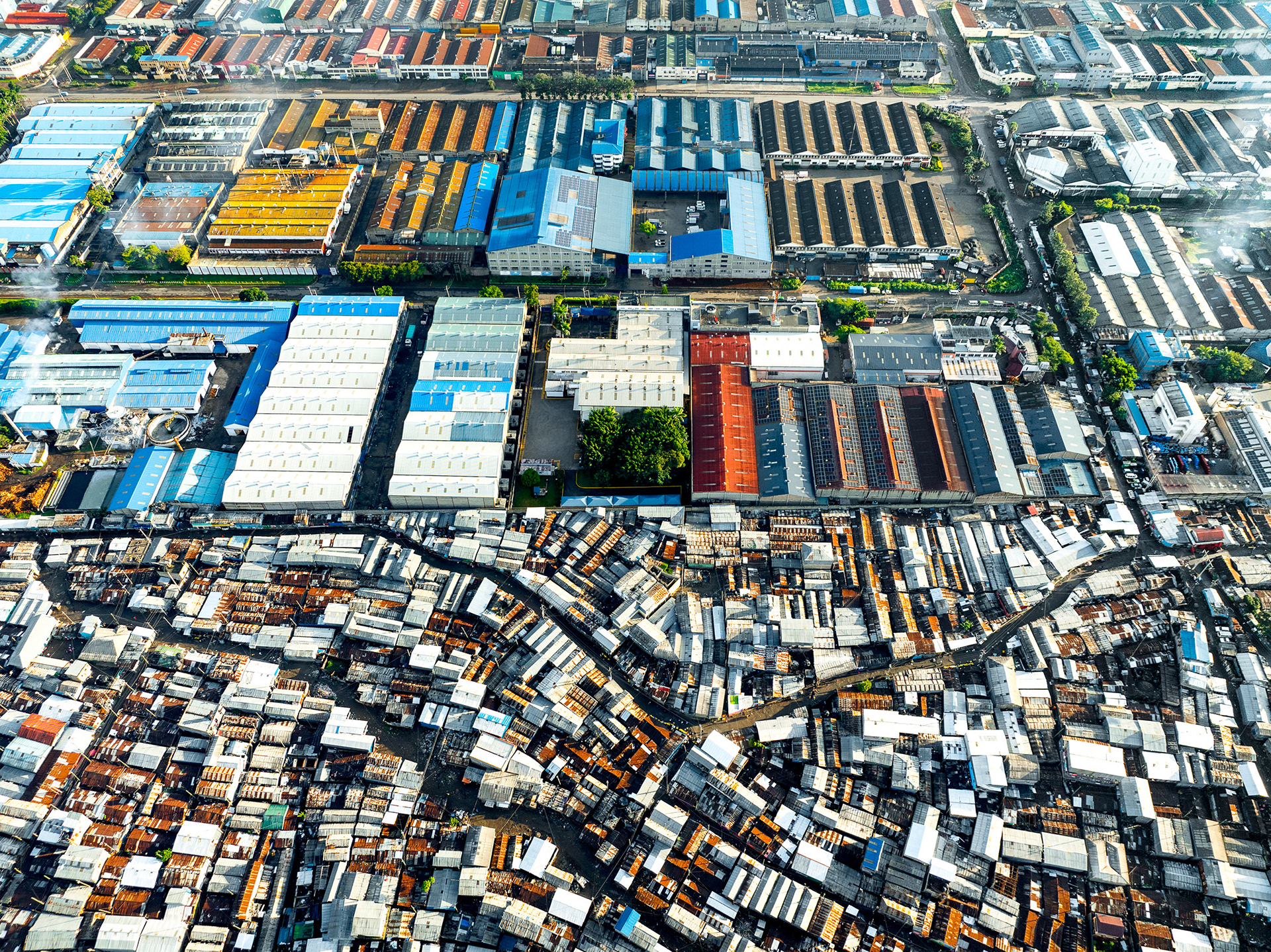
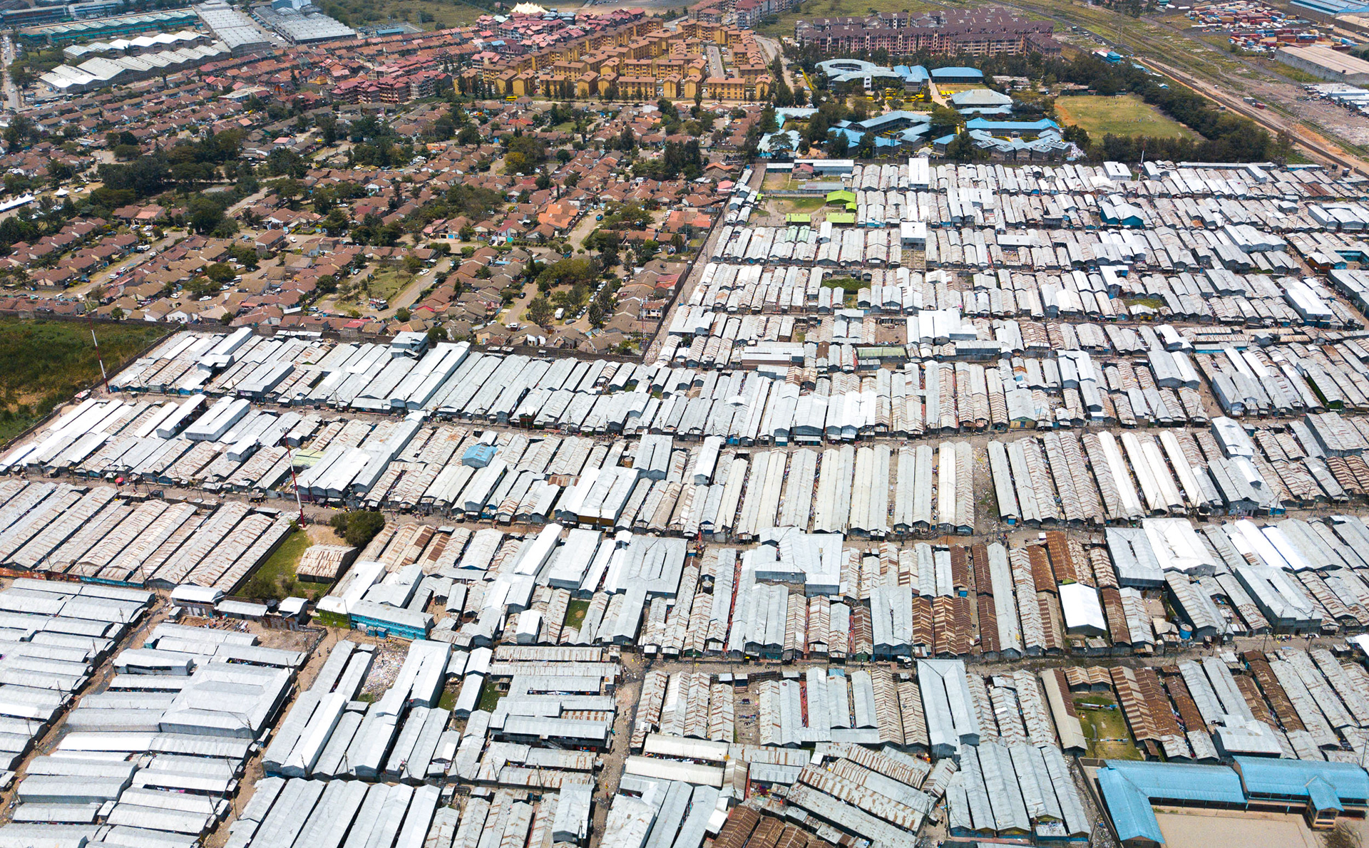
The Viwandani slum, near an industrial estate in the city centre, is part of the massive tapestry of a city growing by leaps and bounds. The rapid urbanization of cities like Nairobi is due to the fact that Africa is growing, one of the only places on Earth where populations are still increasing, and several mega cities are projected to become amongst the world's largest in just a few short decades. How are planners making sure this huge migration to the city is done equitably?
Floods and forced demolitions destroyed thousands of homes along the Nairobi River in 2024.
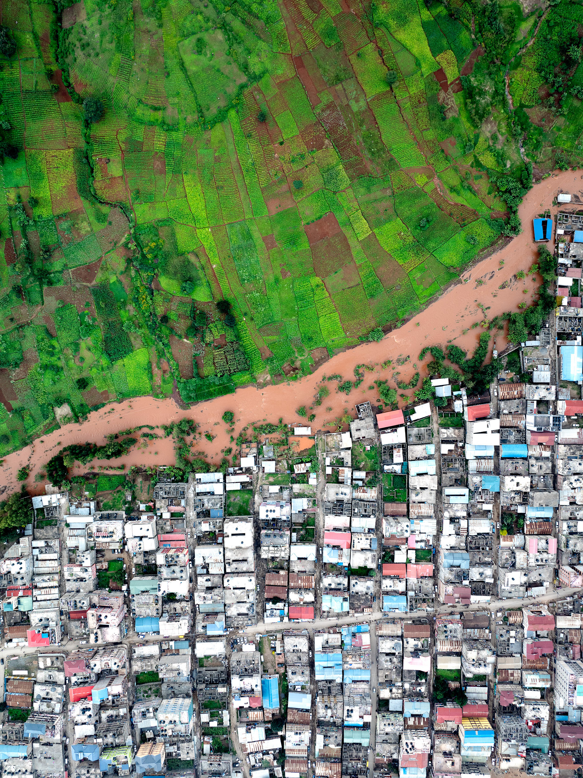
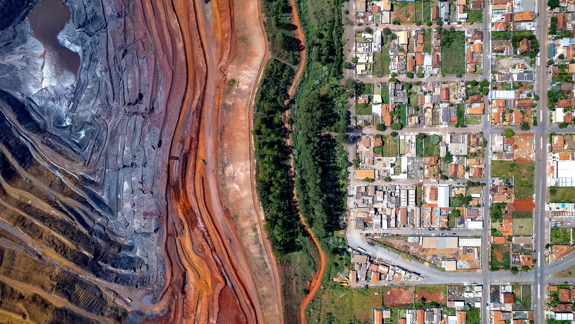
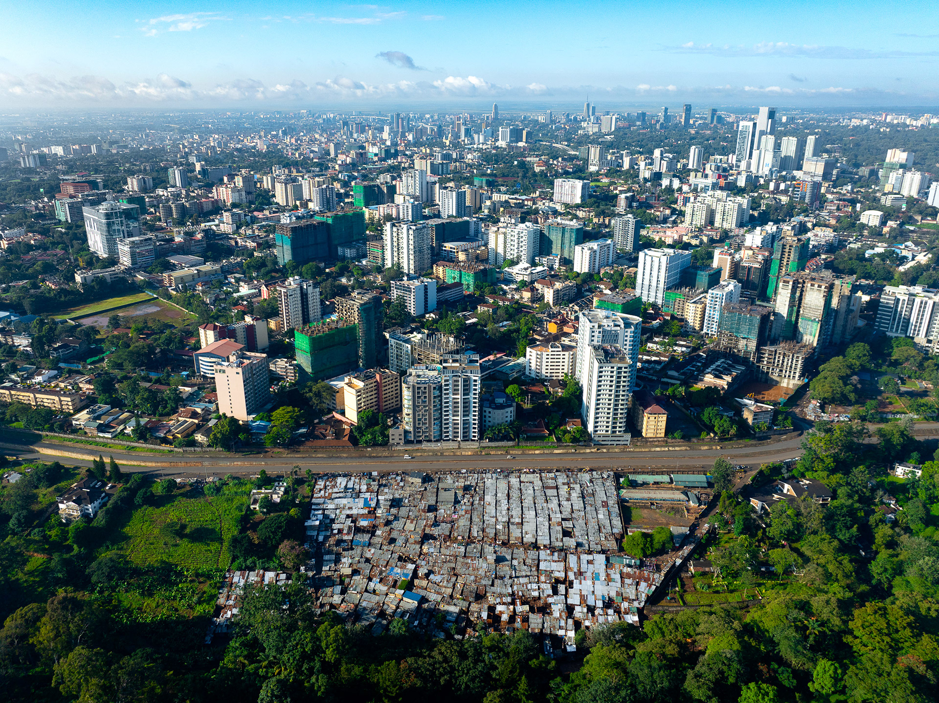
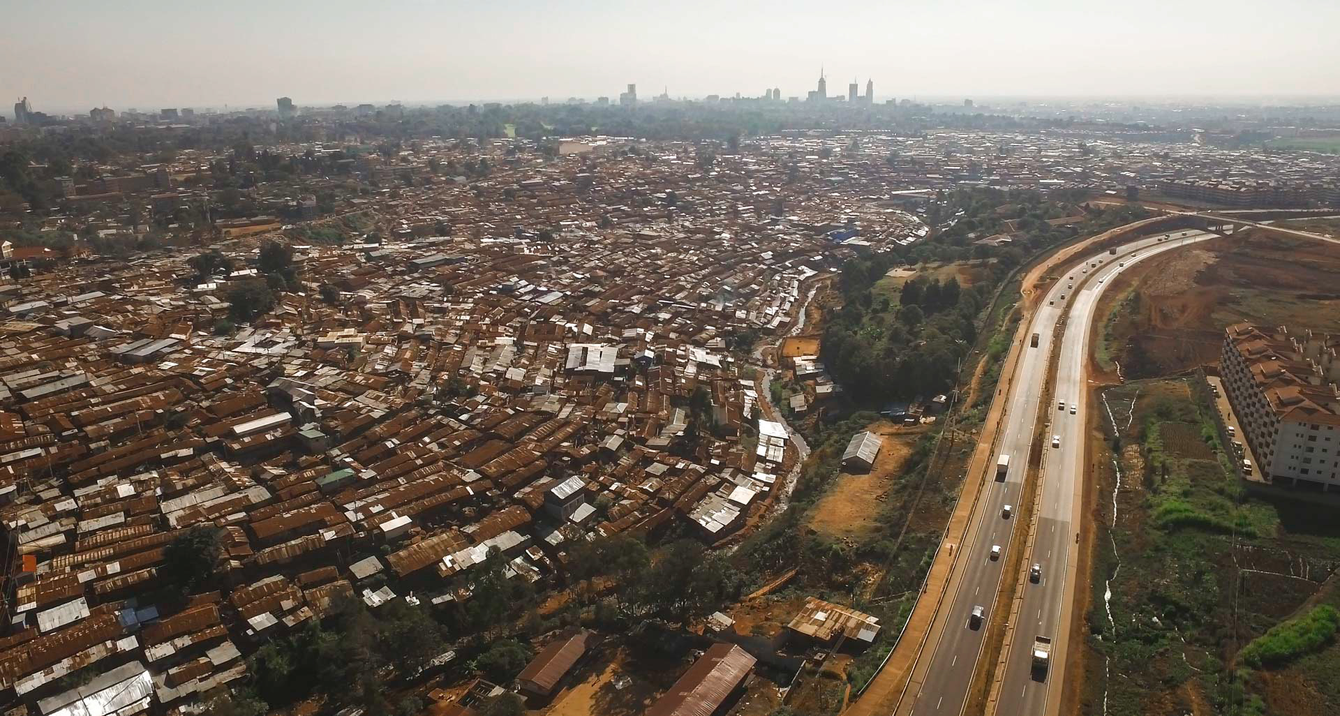
The verdant farmland of the Kenyan highlands juxtaposed with the rapacious urban sprawl of Nairobi.
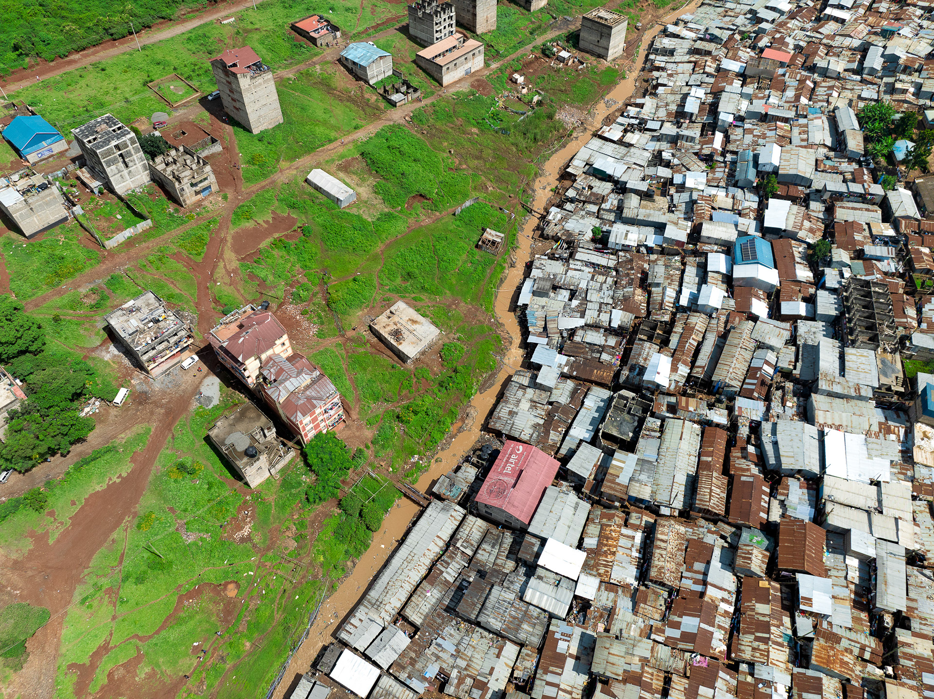
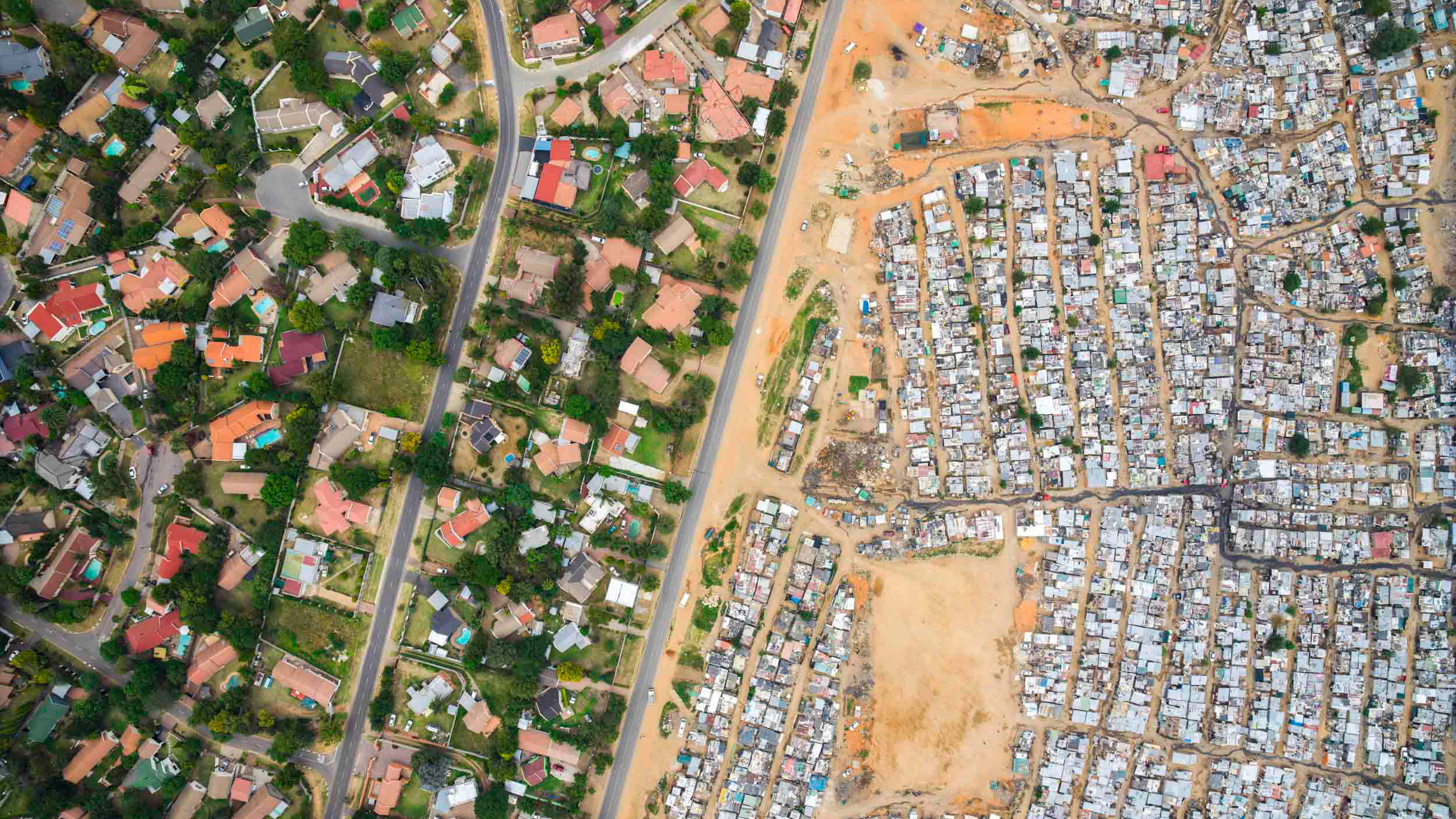
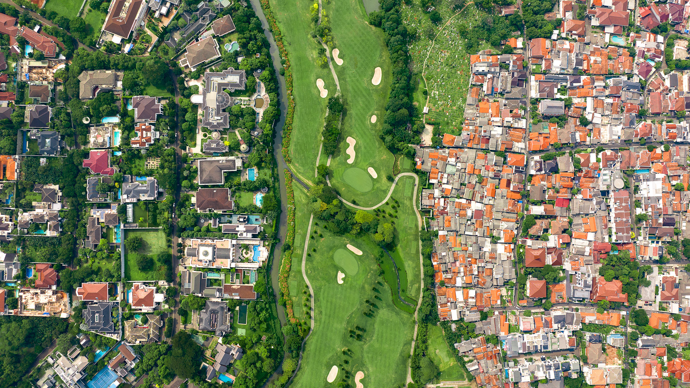
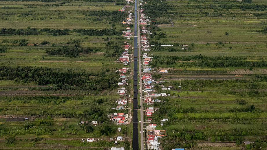
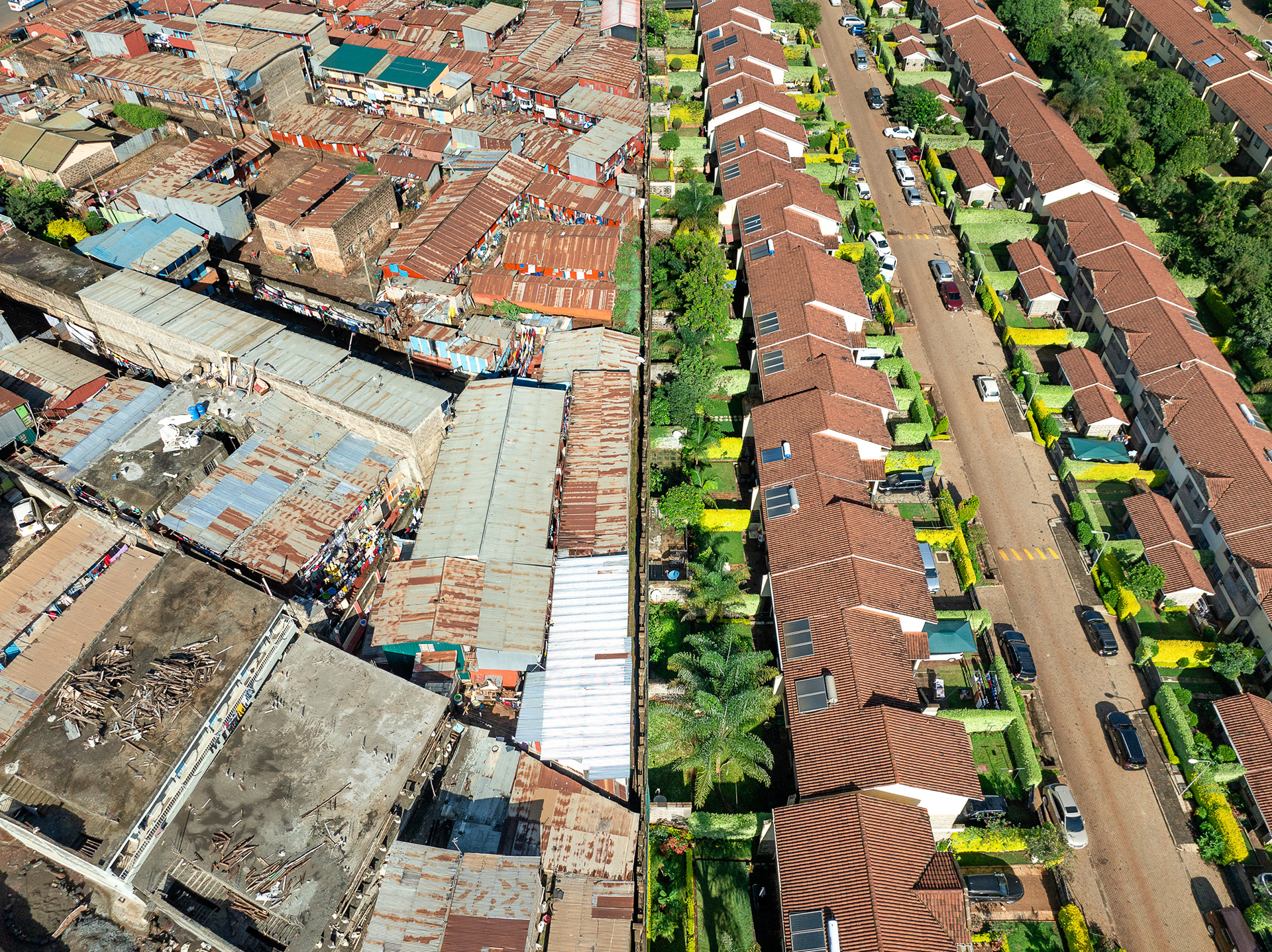
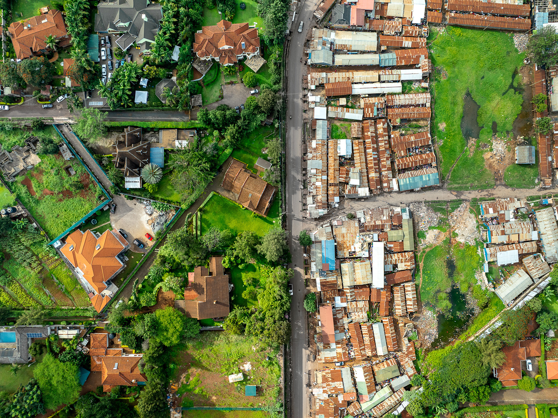
On one bank of the Motoine River in Nairobi, the tight iron roofs of Kibera press to the water's edge; on the other, large houses stand on open, green plots along Omollo Road. The river, which flows on into the silted Nairobi Dam, is all that separates the crowded settlement from the comfortable homes across it.
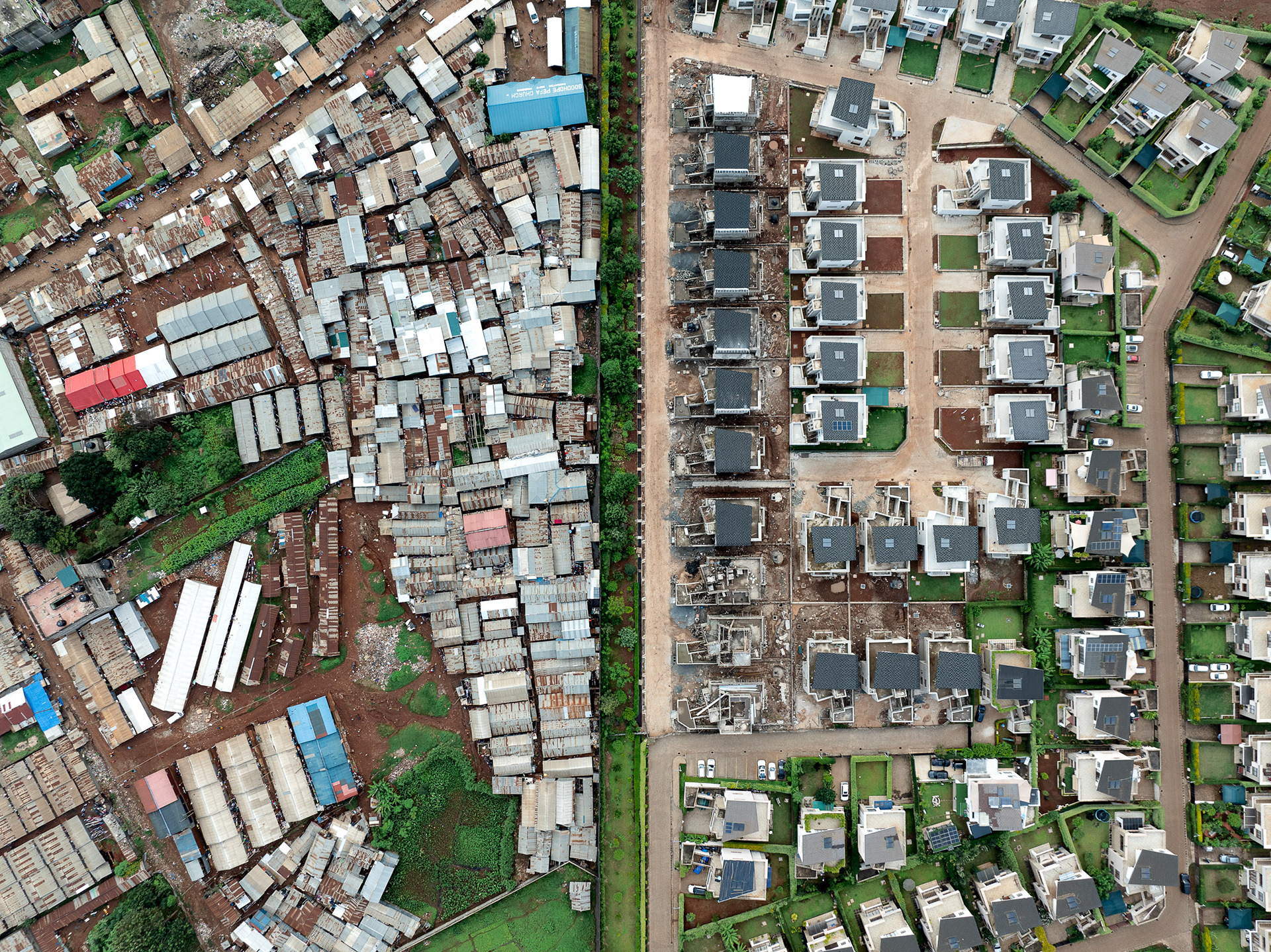
New suburbs being built in one of Nairobi's wealthiest neighborhoods, next to slum communities which exist to service them.
Loresho.
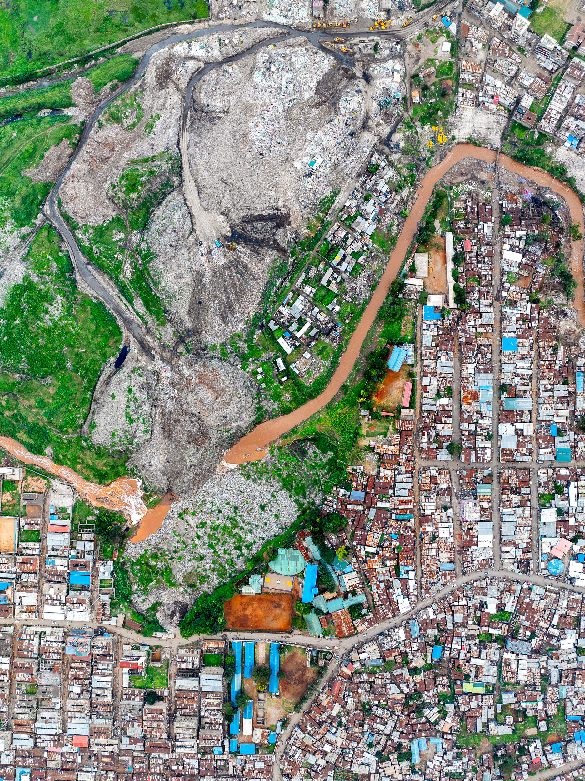
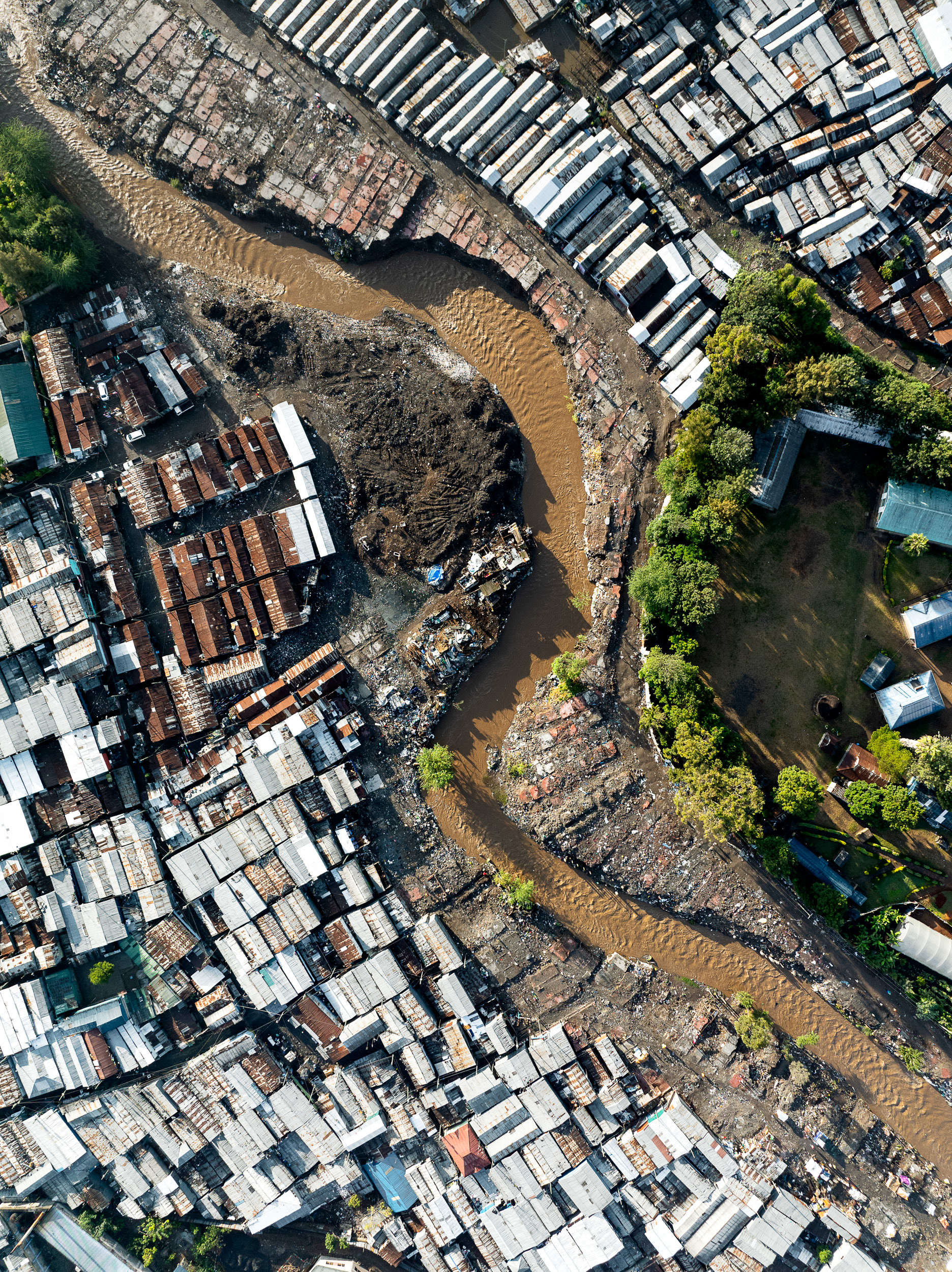
The Dandora dumpsite is one of Nairobi's grim landmarks, roughly thirty acres that still swallow some two thousand tonnes of waste a day, decades after being declared full. Thousands of waste pickers comb its smoking hills each day for metal, plastic and anything else they can sell or recycle. The mound has grown so vast it has spilled into the Nairobi River running alongside, choking the channel with garbage and leaching into the water.
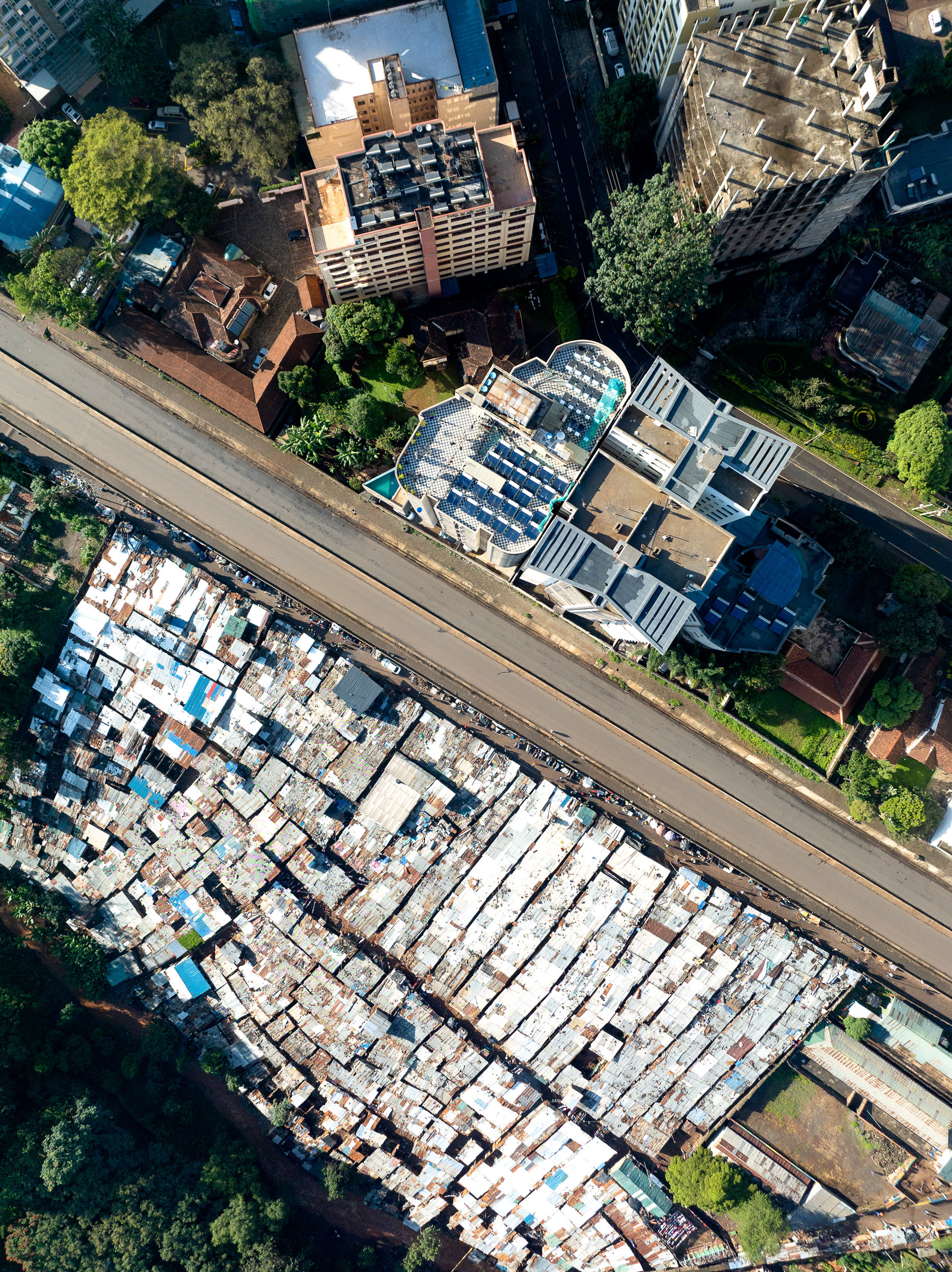
Parklands and the "Deep Sea" slums.

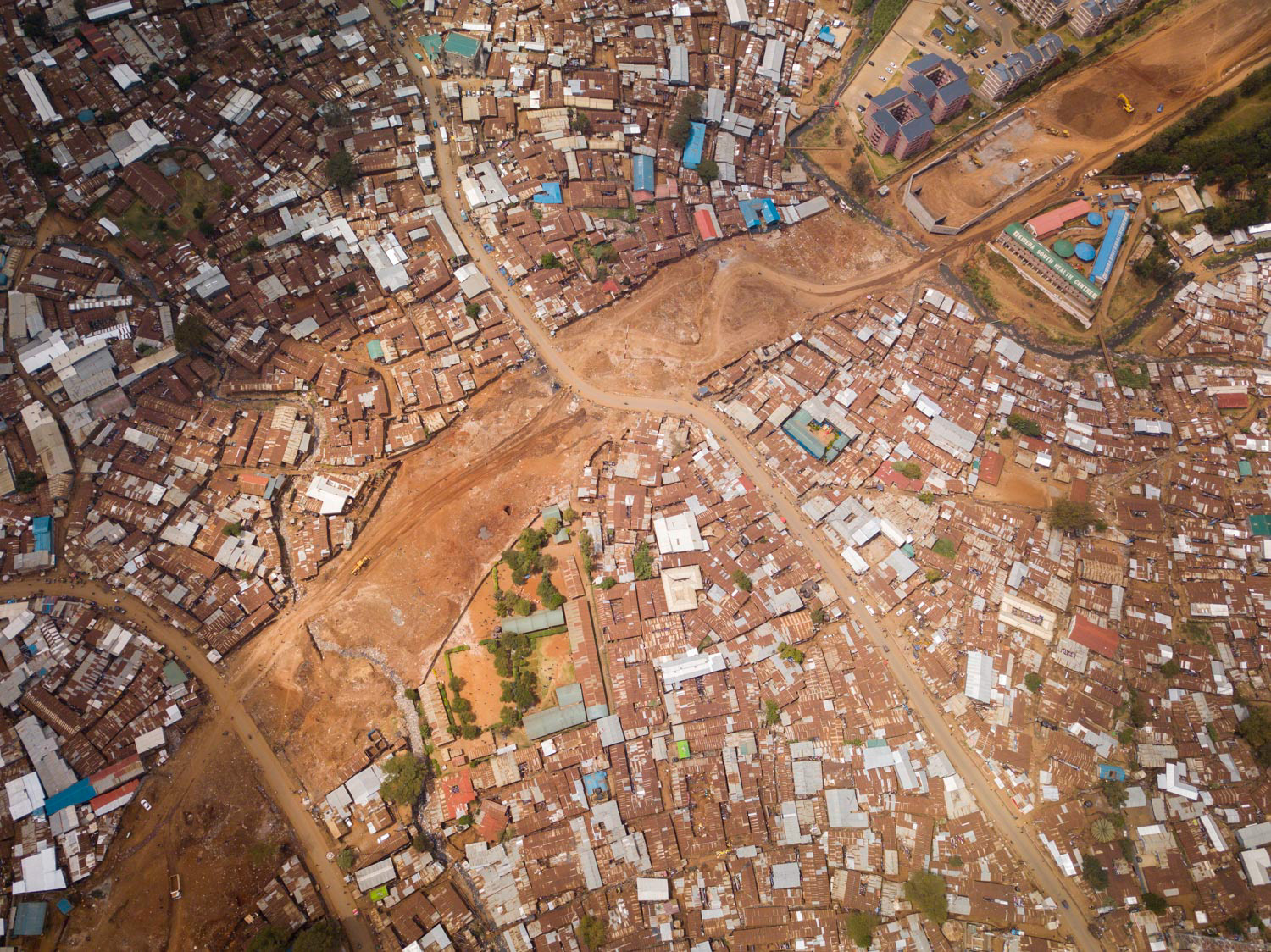
The Kilimani-Langata road connector was an audacious plan to bulldoze right through the middle of Kibera, Africa's "largest slum". In 2018, it happened two weeks before I arrived.
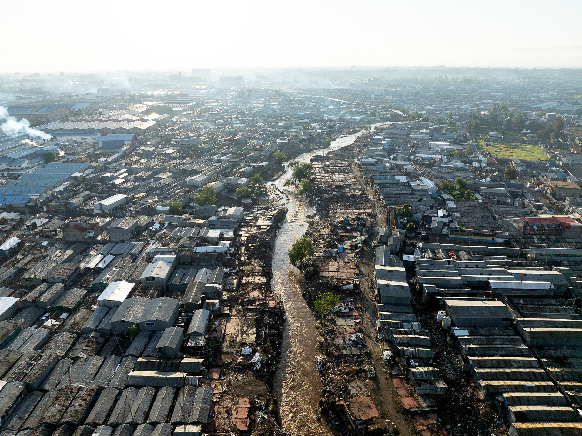
Viwandani after the flooding and demolitions of 2024.
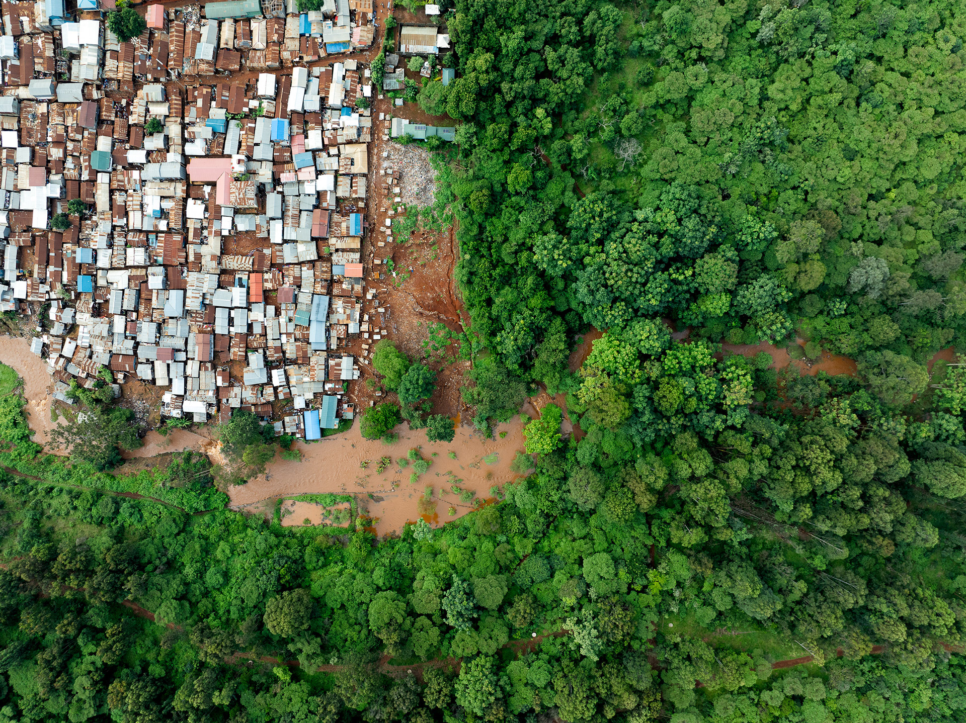
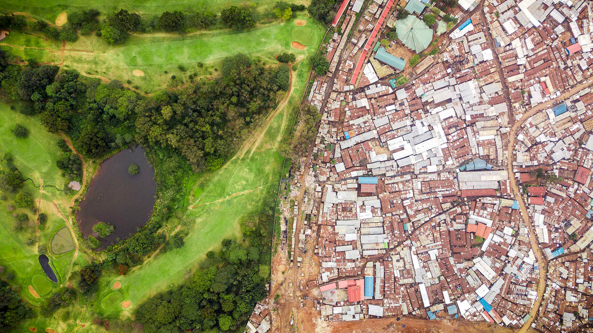
Huruma Village, on the edge of Karura Forest.
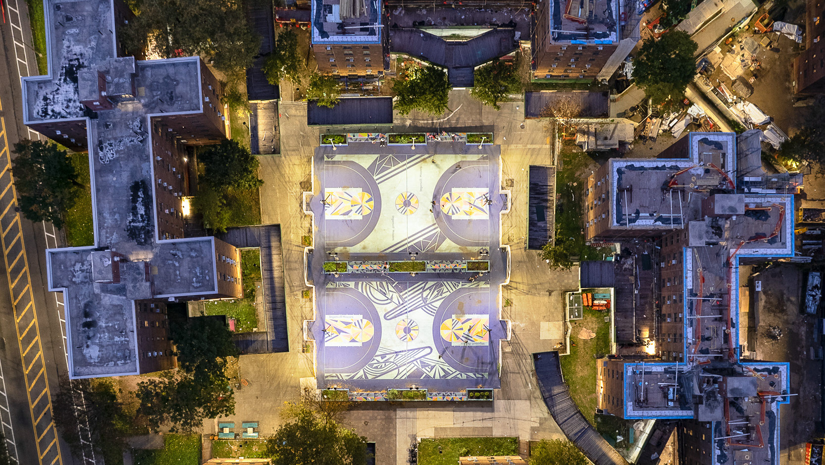
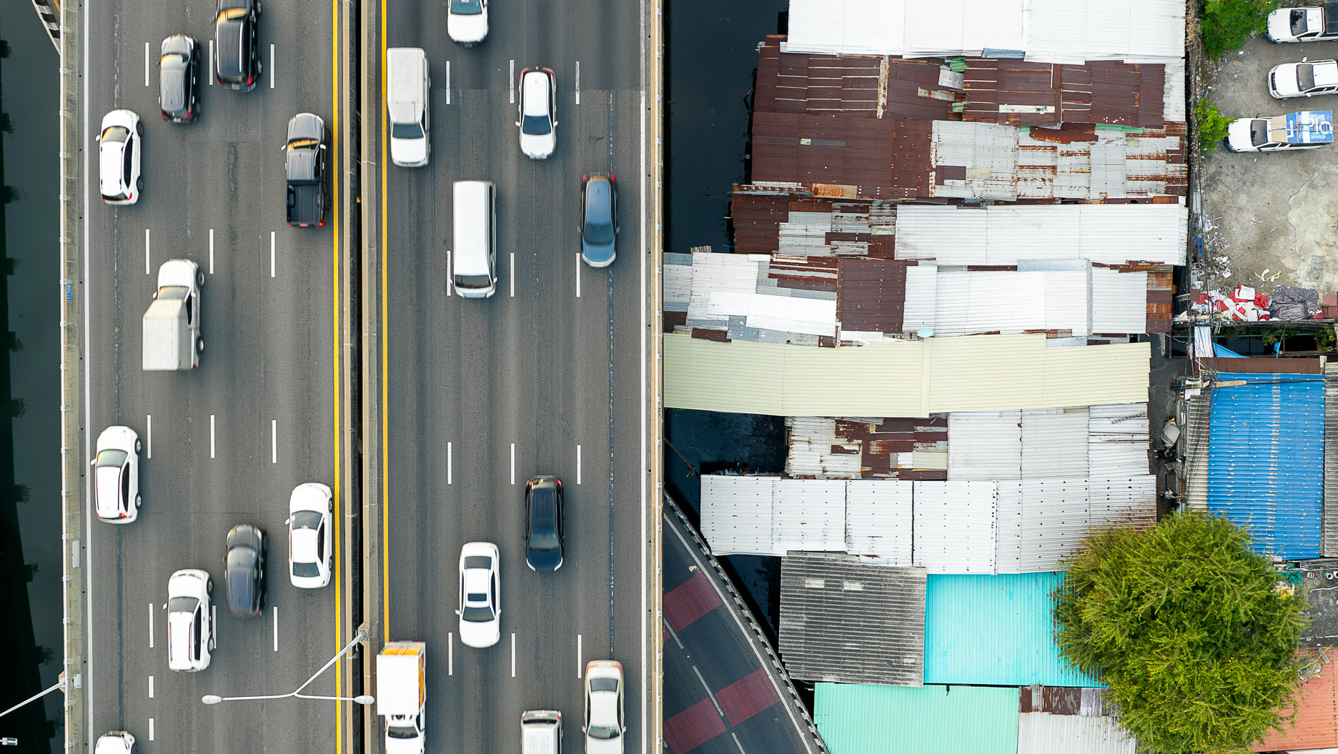
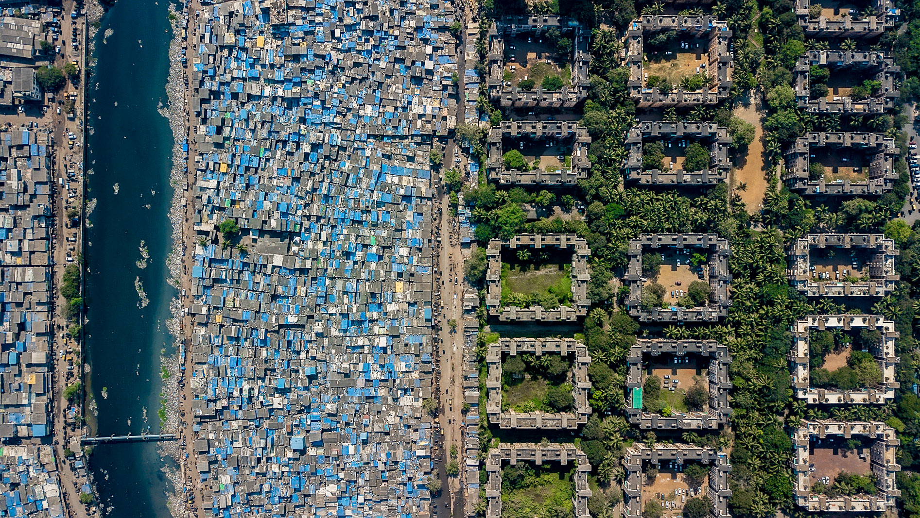
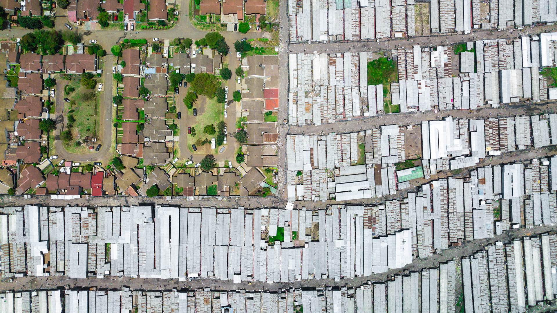
The dense settlement of Riara fits together with Imara Daima estate like two puzzle pieces.
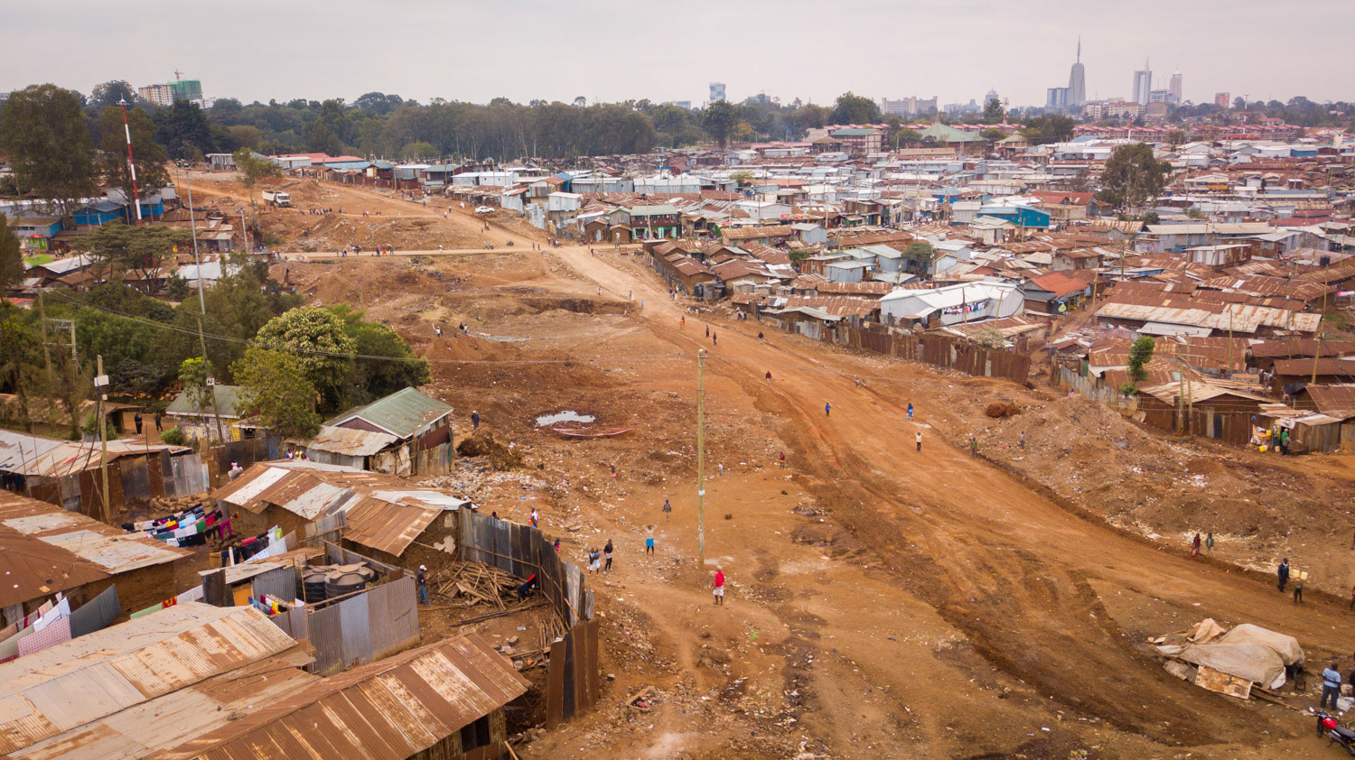
The scars of bulldozing through Nairobi's largest slum are clear. The initial stats: 11,500 people displaced, 598 structures destroyed.
The Mukuru Kwa Njema slums, next door to the Imara Daima estate.

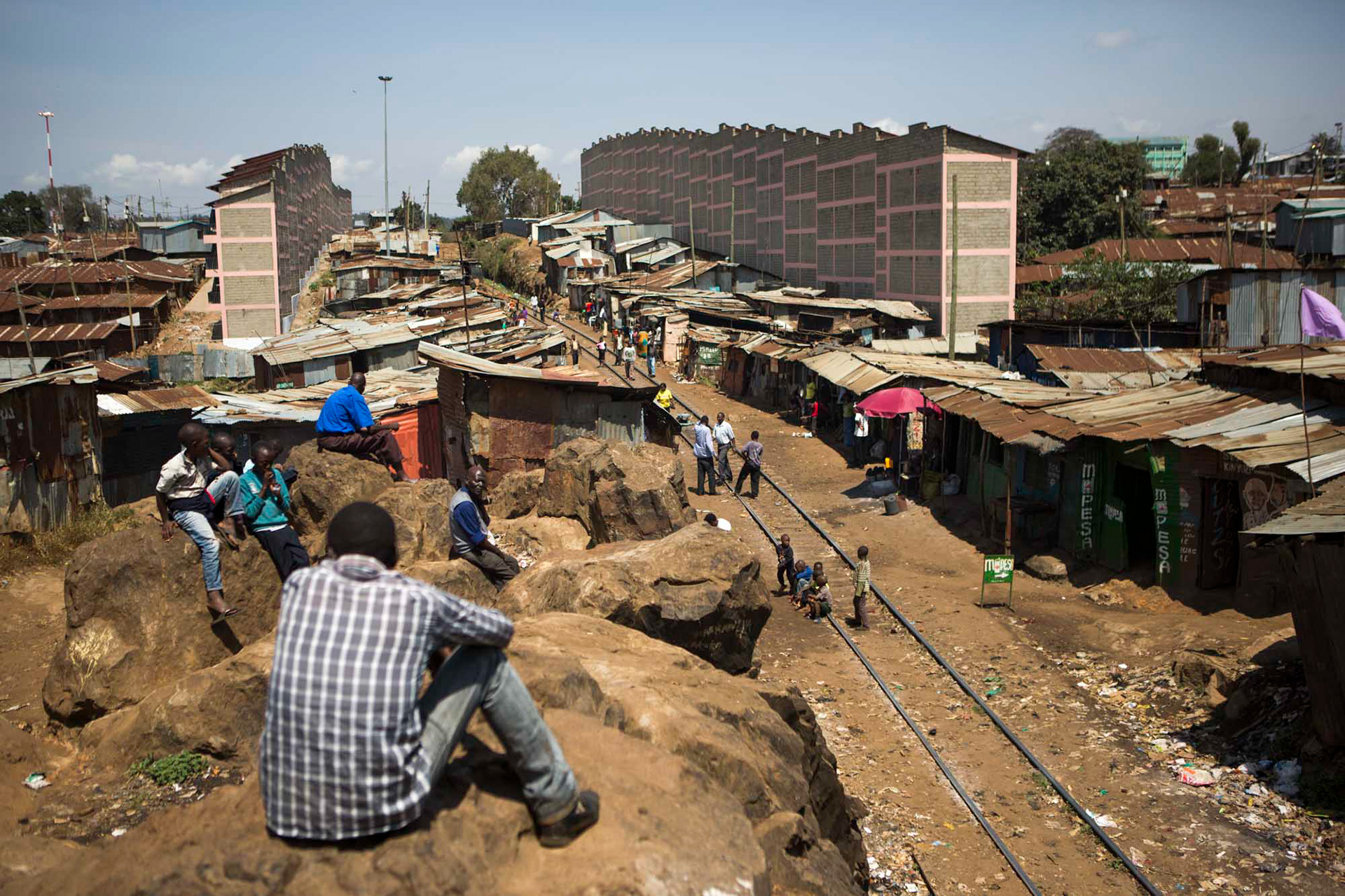
Looking at homes slated for demolition, Kibera.