On the top of a ridge in Mixco, two communities sit side by side but are divided by a fence. While residents from both communities have one road in, one from the north, and one from the south, the boundary means that they do not connect.
The straight line of a fence which separates the poor from the rich in Mixco. This location was interesting, as these communities both occupied the top of the ridge, but there was only one road in to each community - one from the north, and one from the south. The fence made it impossible to cross to the other side.
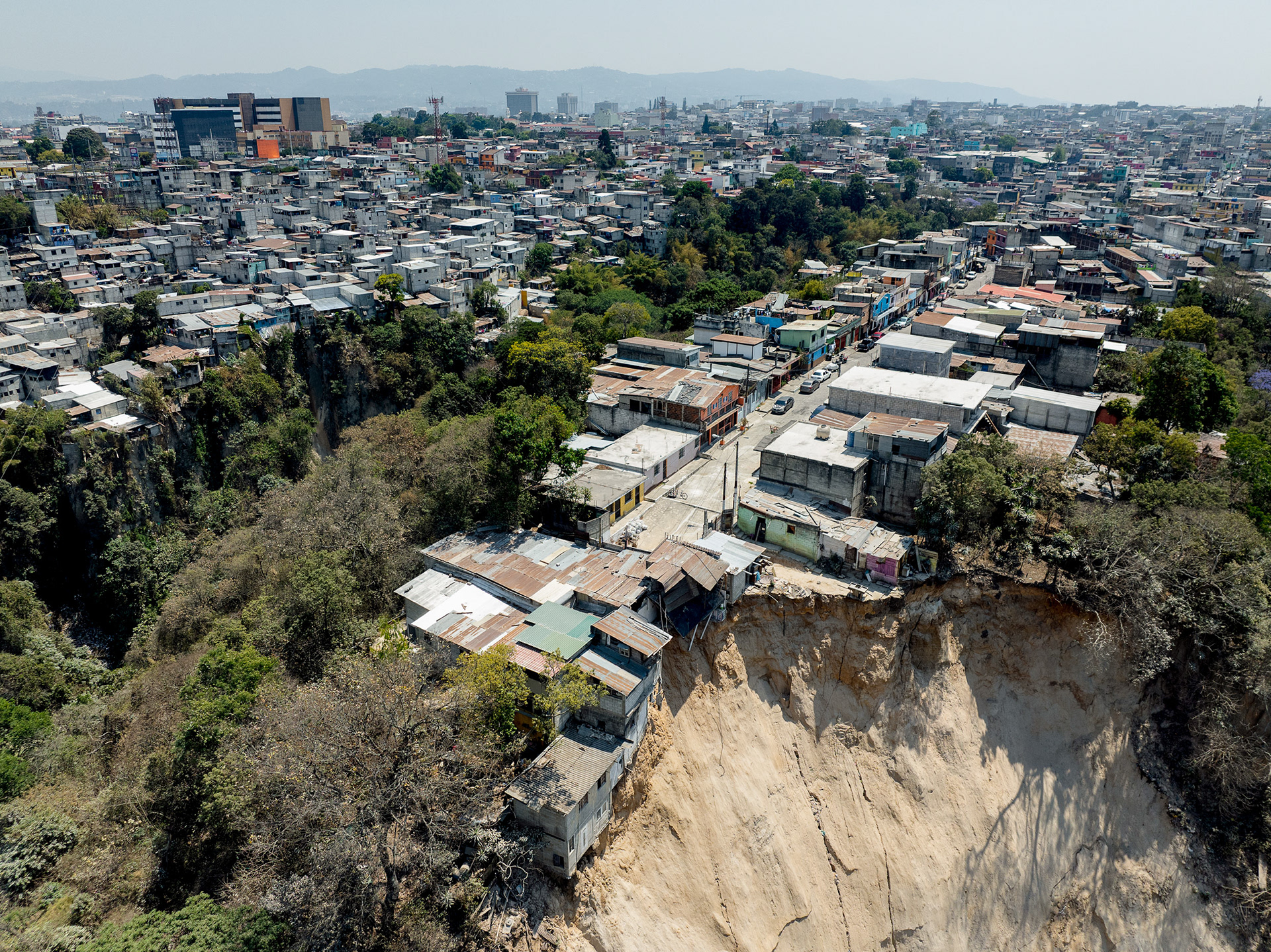
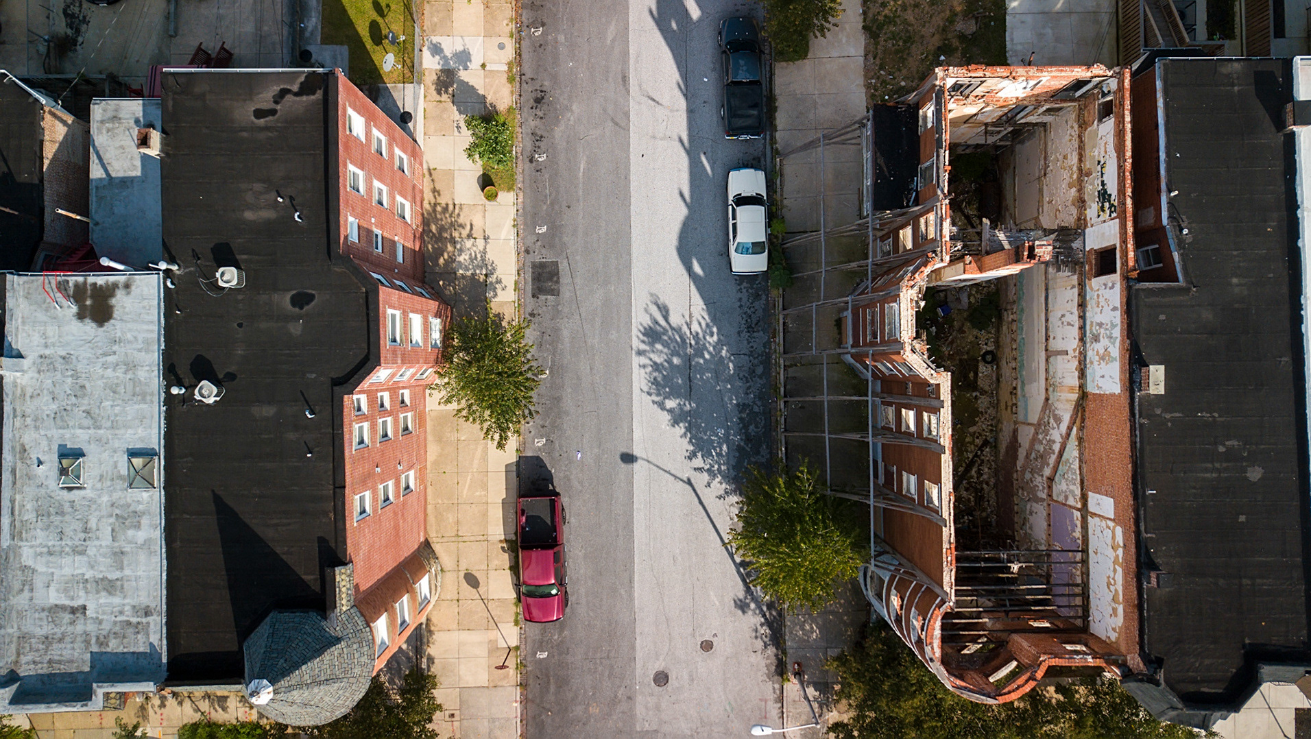
Precarious building practices in the city's poor neighborhoods occasionally lead to disasters caused by natural phenomena which Guatemala is plagued by, such as landslides, sinkholes, volcanic eruptions, earthquakes, and floods.
Sometimes communities will be built almost on top of each other - like this one in Villa Nueva, separated by a cliff of 20m.
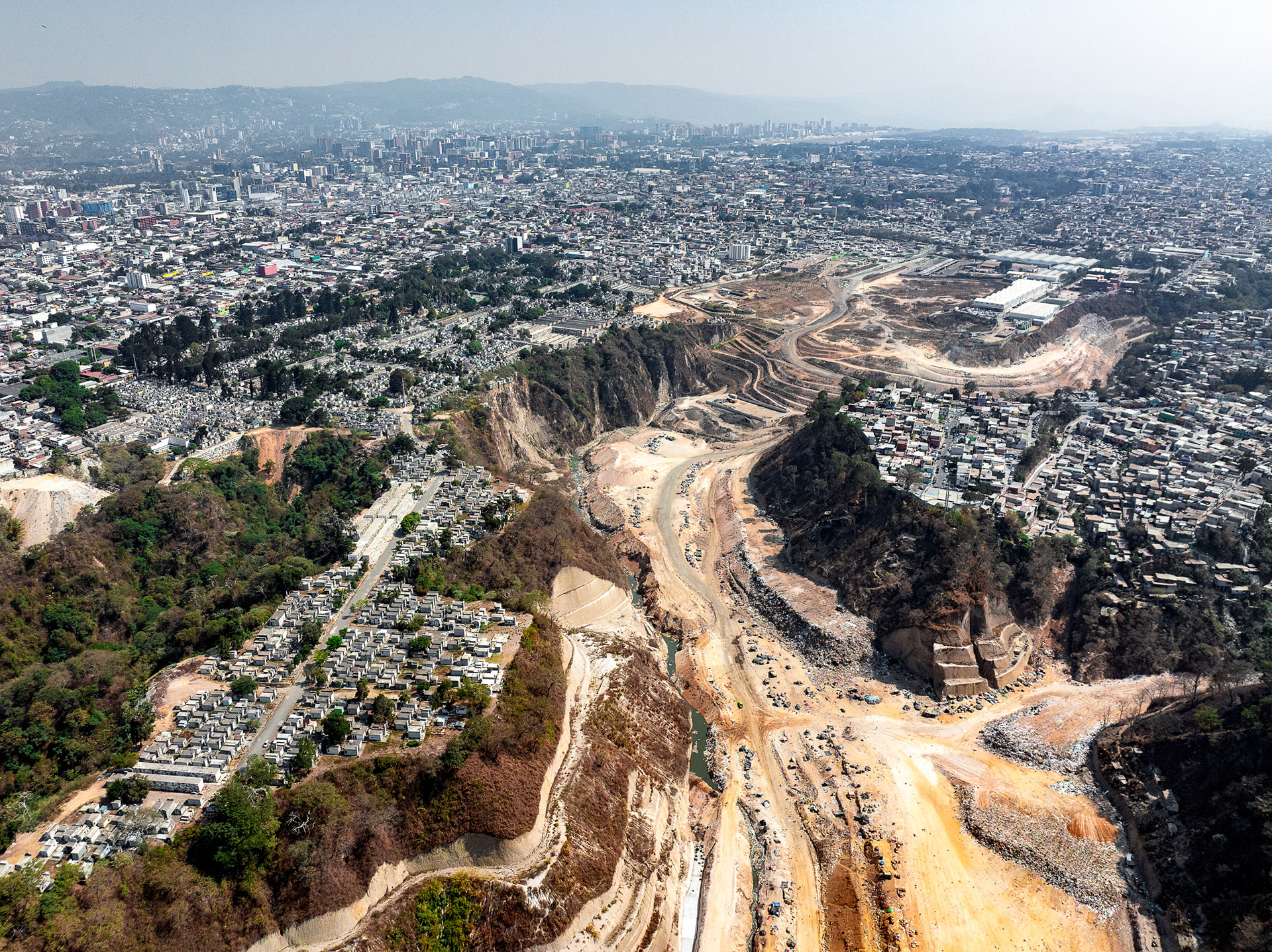
El Basurero, the city dump, the largest in Central America. It is built within one of the ravines, is surrounded by poor communities, and hosts an active population living within the trash, visible at the bottom of the image.
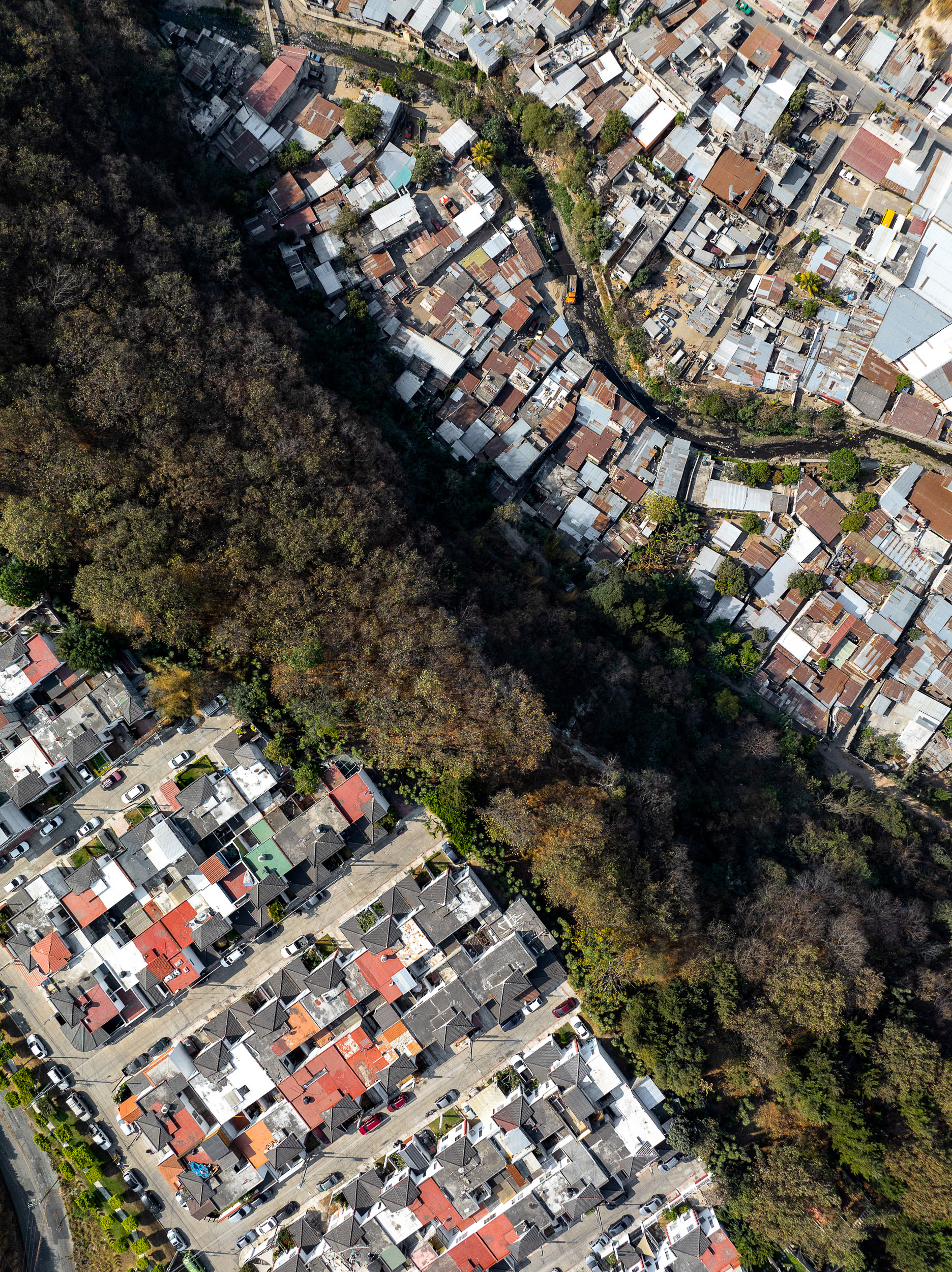
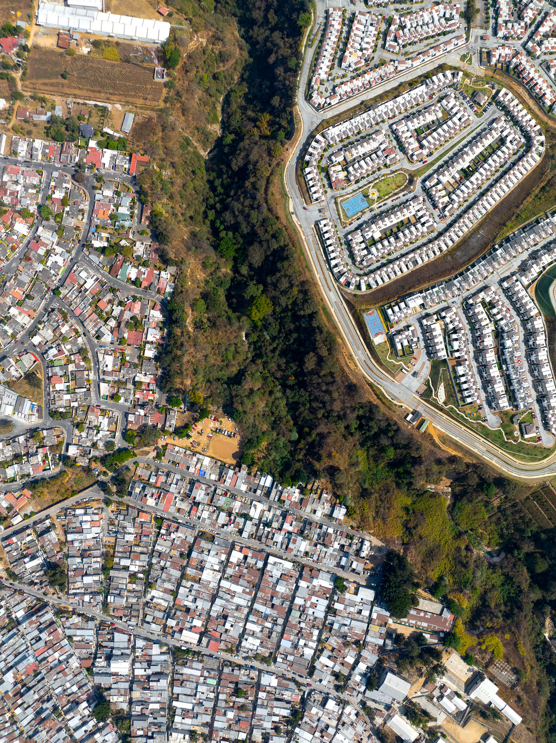
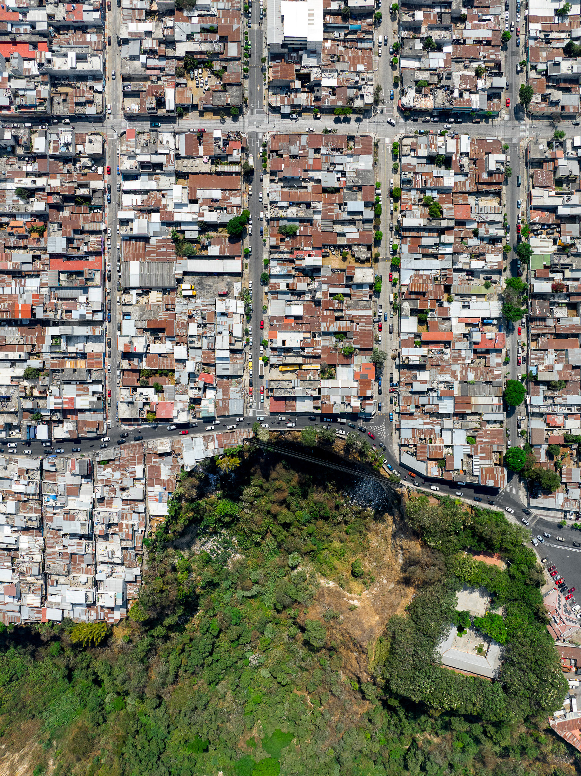
A deep ravine separates communities in Zone 5, near the city center.
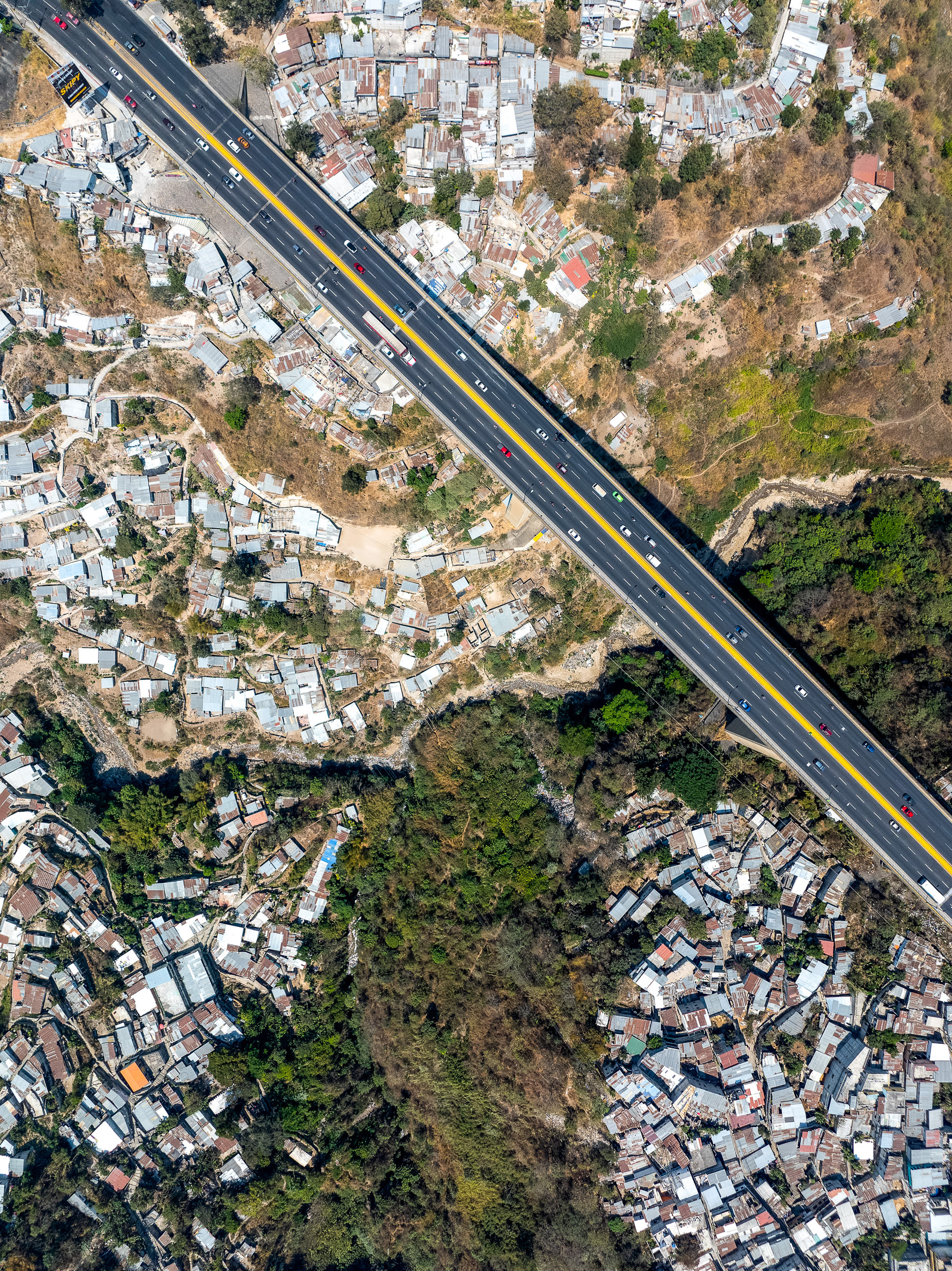
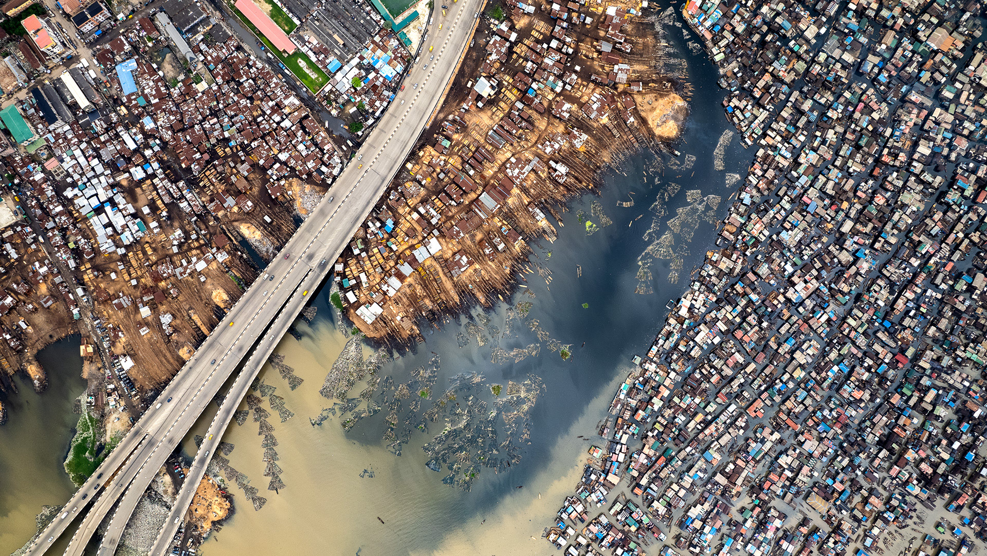
The city's main ring road passes above informal shacks which extend vertically down to the river's edge, and are essentially impossible to service or access, except by footpath.
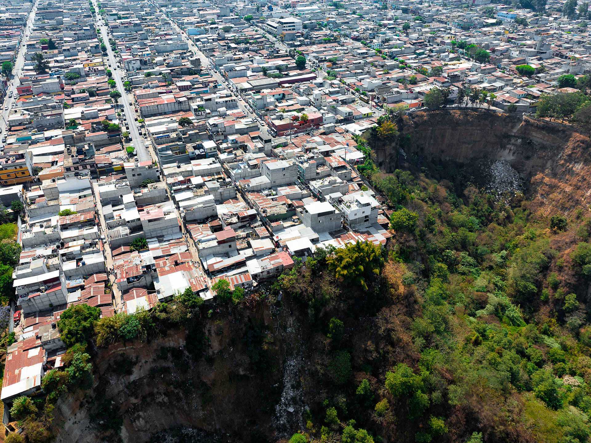
A large sinkhole in Zone 19.
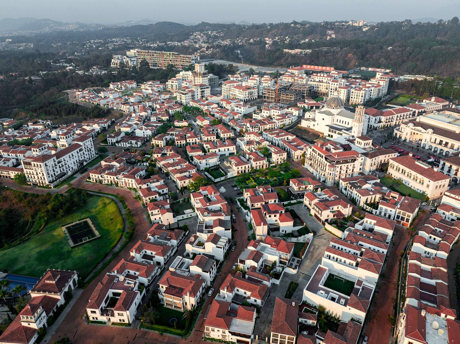
Cayalá, an enclave for the wealthy, designed as a fully contained shopping/residential micro-city in the heart of Guatemala City's tony east side.
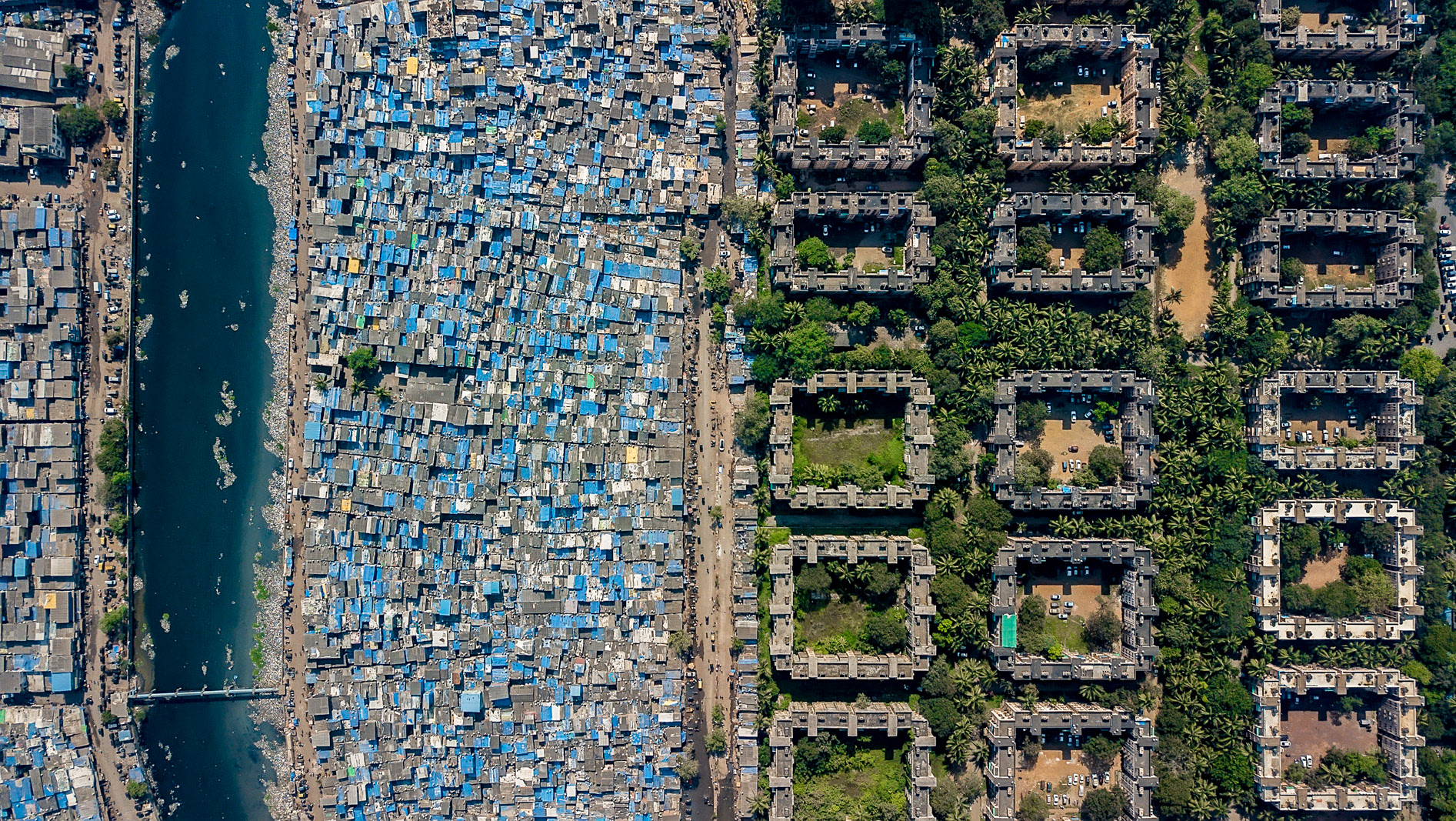
Divisions in a crime-ridden zone of Mixco, a peripheral city to the west.
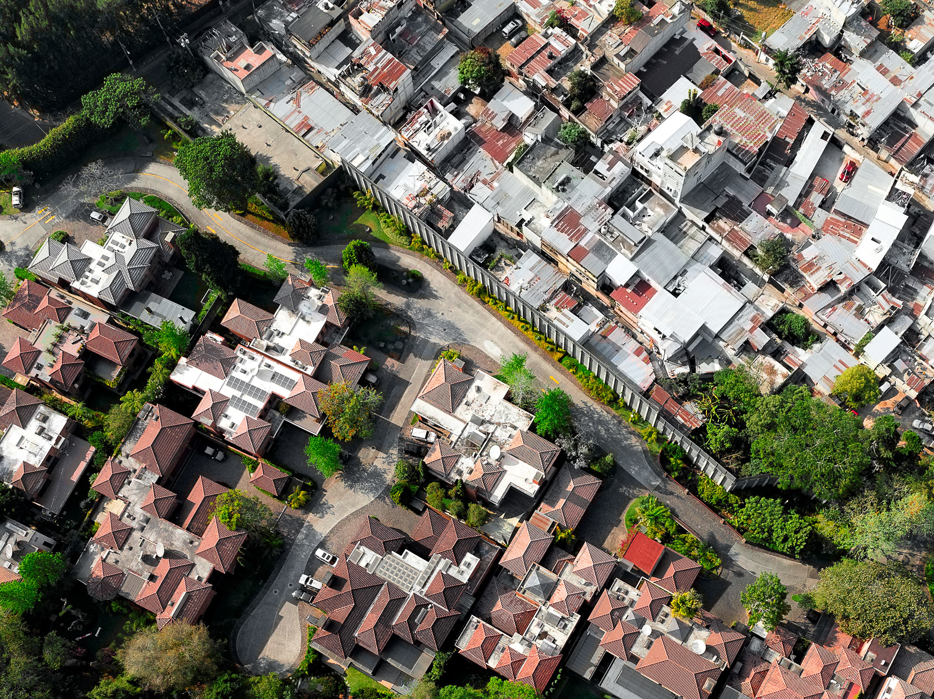
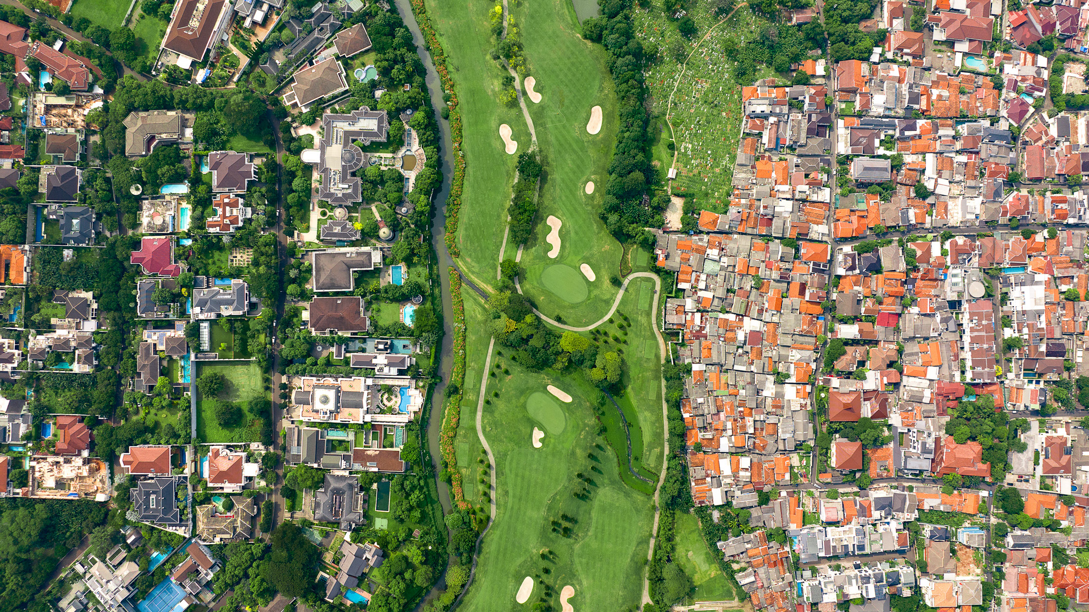
A high wall separates the poor from the golf estates in San Isidro, Zone 16.

Separation in Mixco, to the northwest of Guatemala City's center.
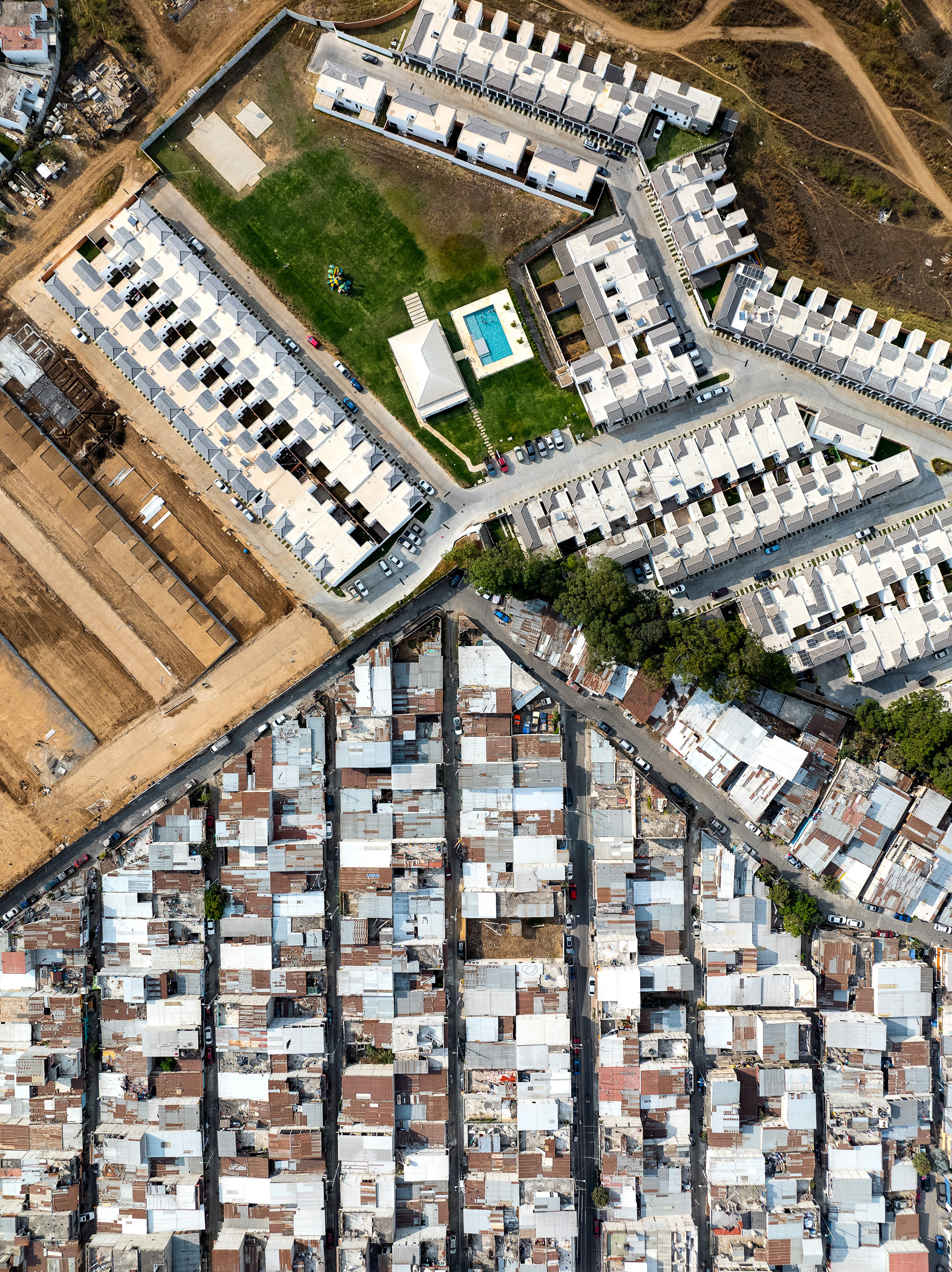
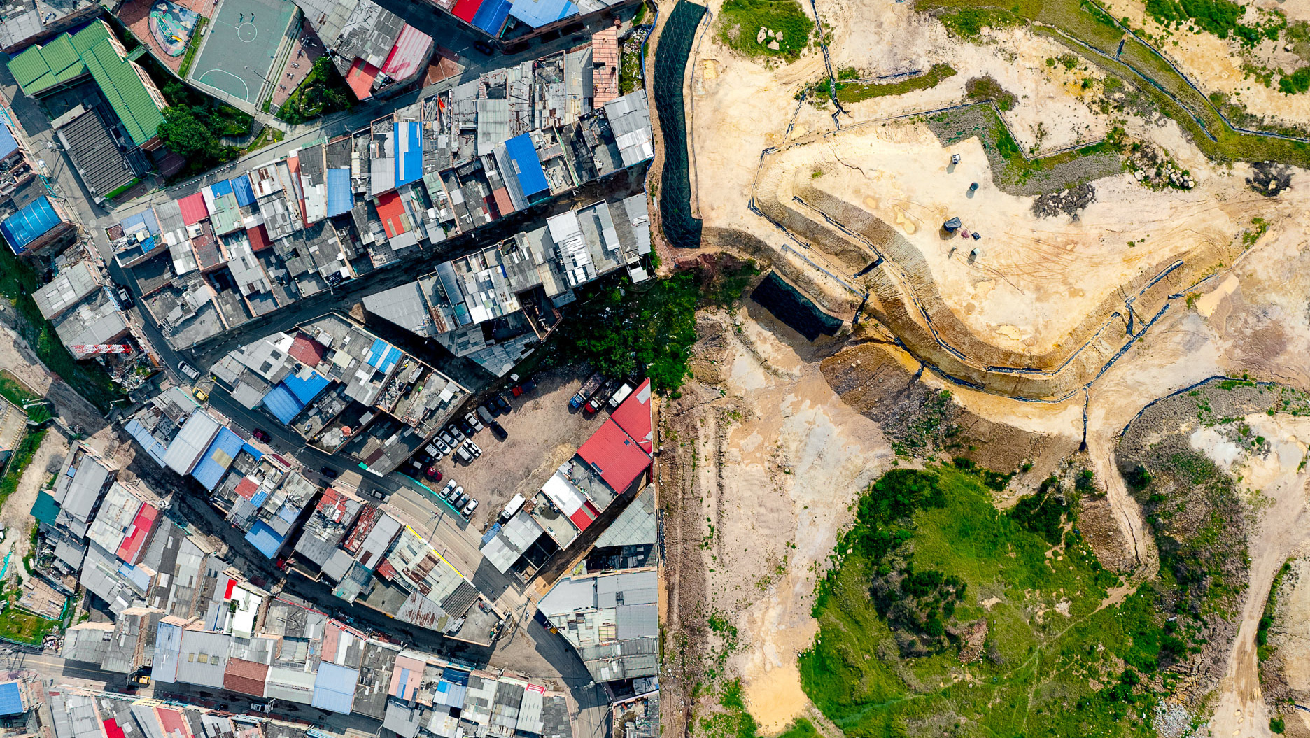
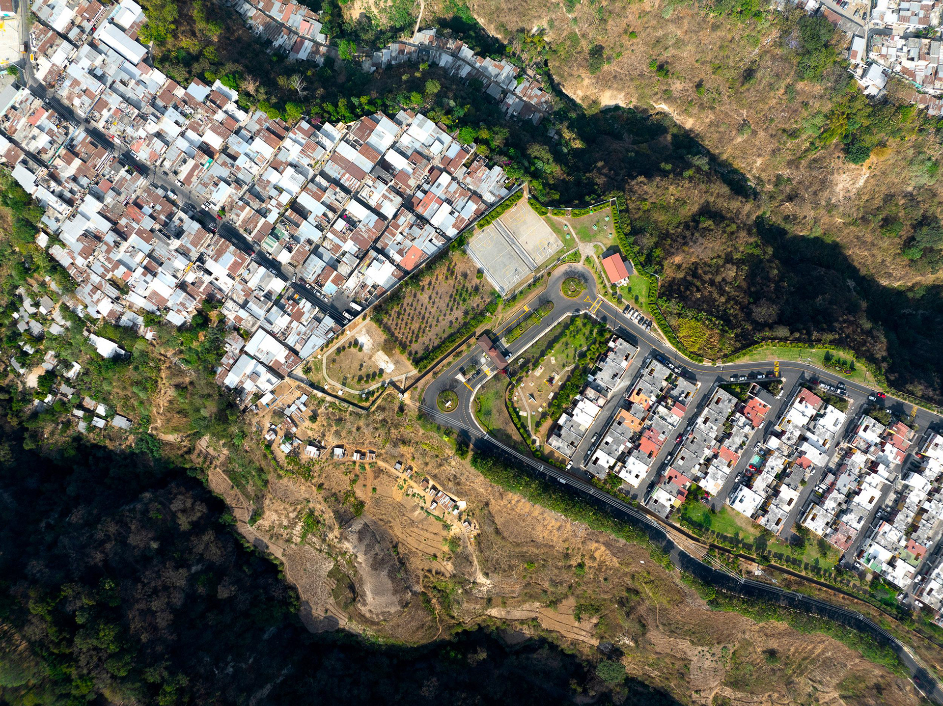
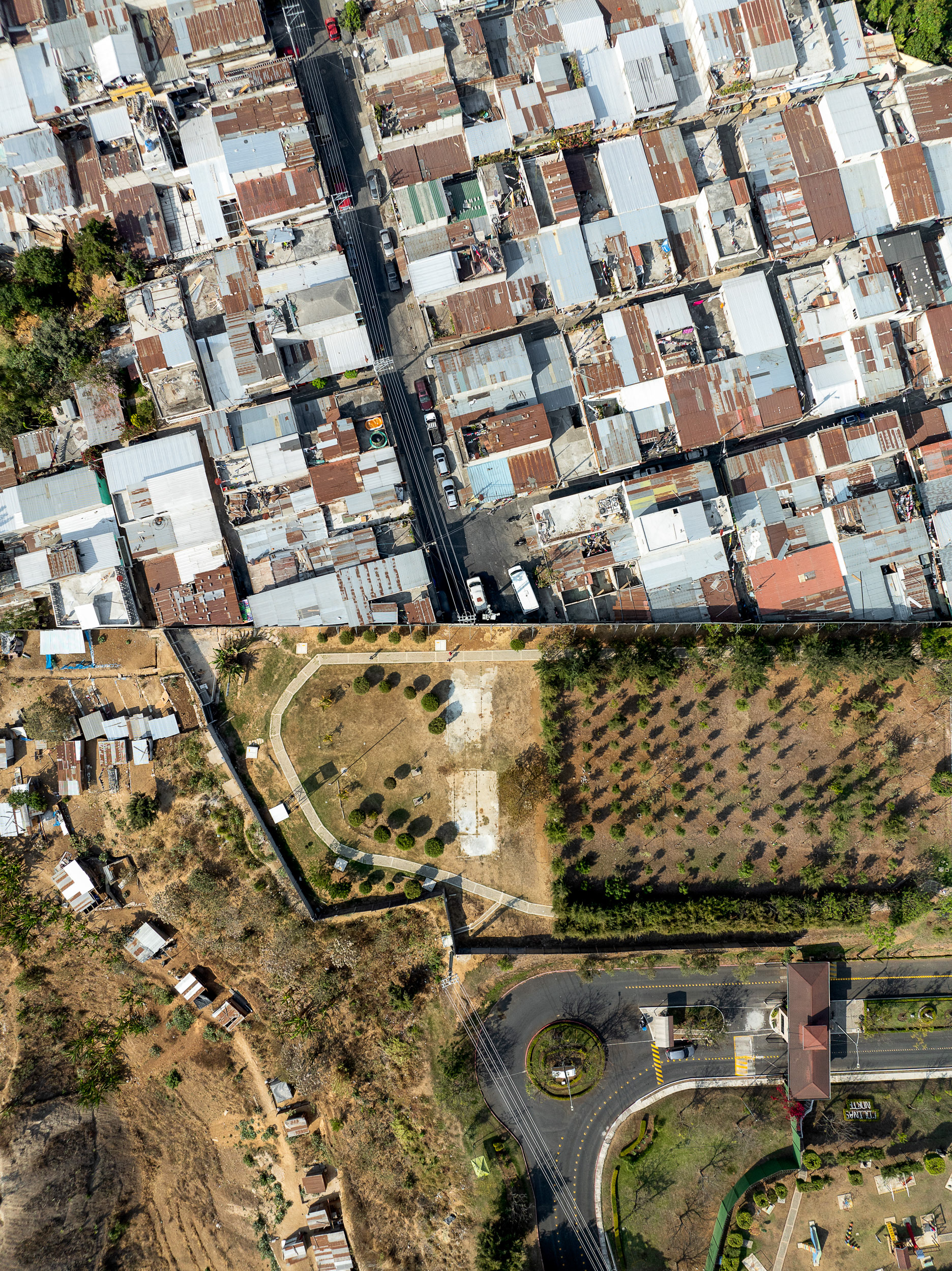
In Villa Nueva, on the southern edge of Guatemala City, a planned gated development, Ciudad Santa Clara, lays out its housing in a tight, repeating grid behind walls and guarded gates. Around it, the unplanned settlements follow no such order, growing block by block as families build what they can.
A sinkhole surrounded by the city.
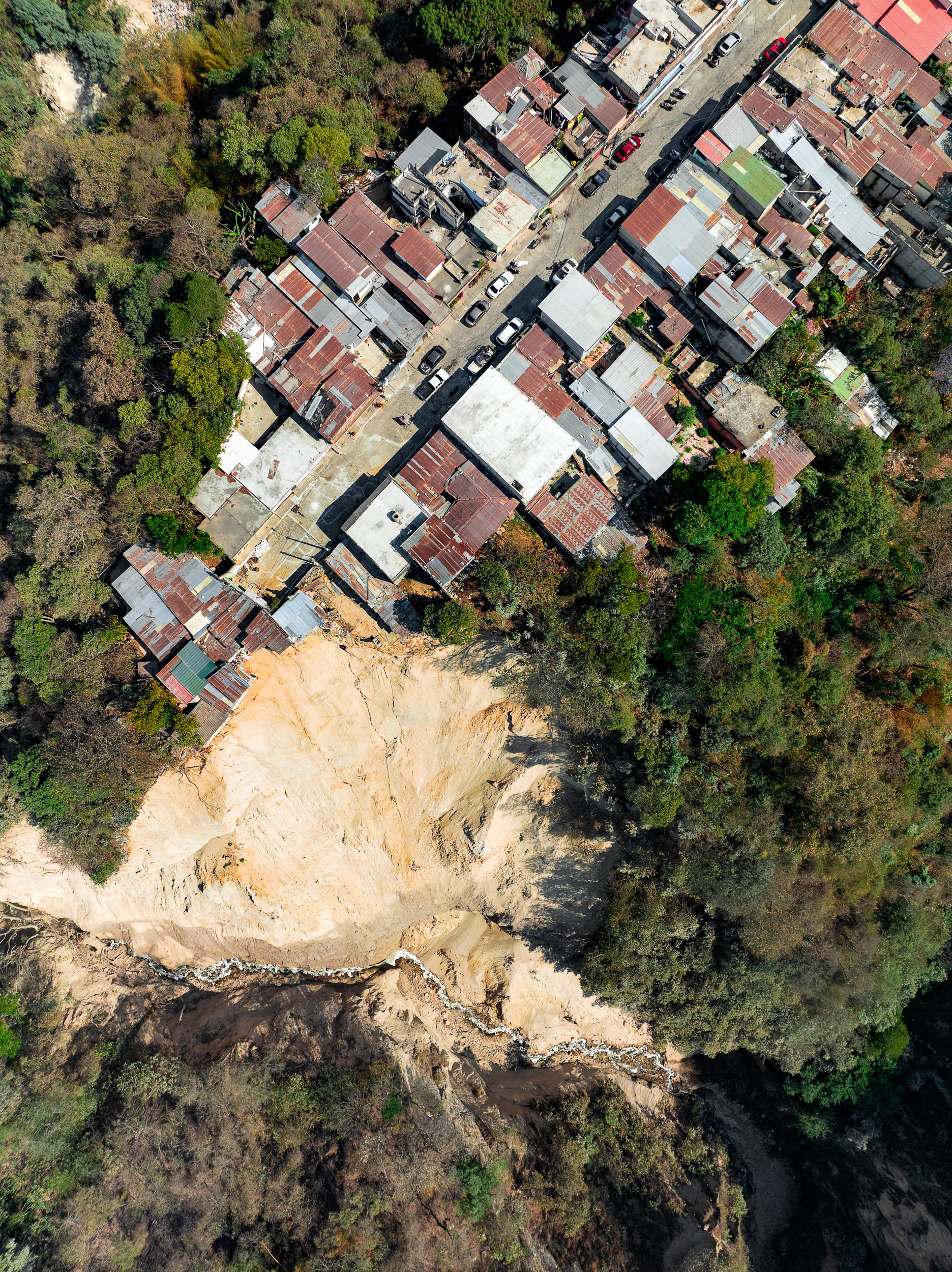
This landslide must have been fairly recent, as the homes still clung to the edge.
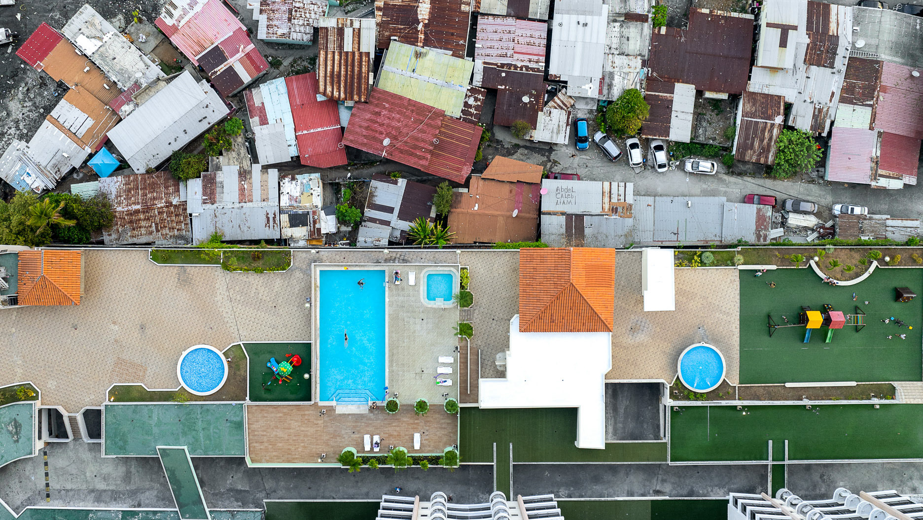
A stark contrast in living styles between the ultra-wealthy and the poor in Las Nubes.
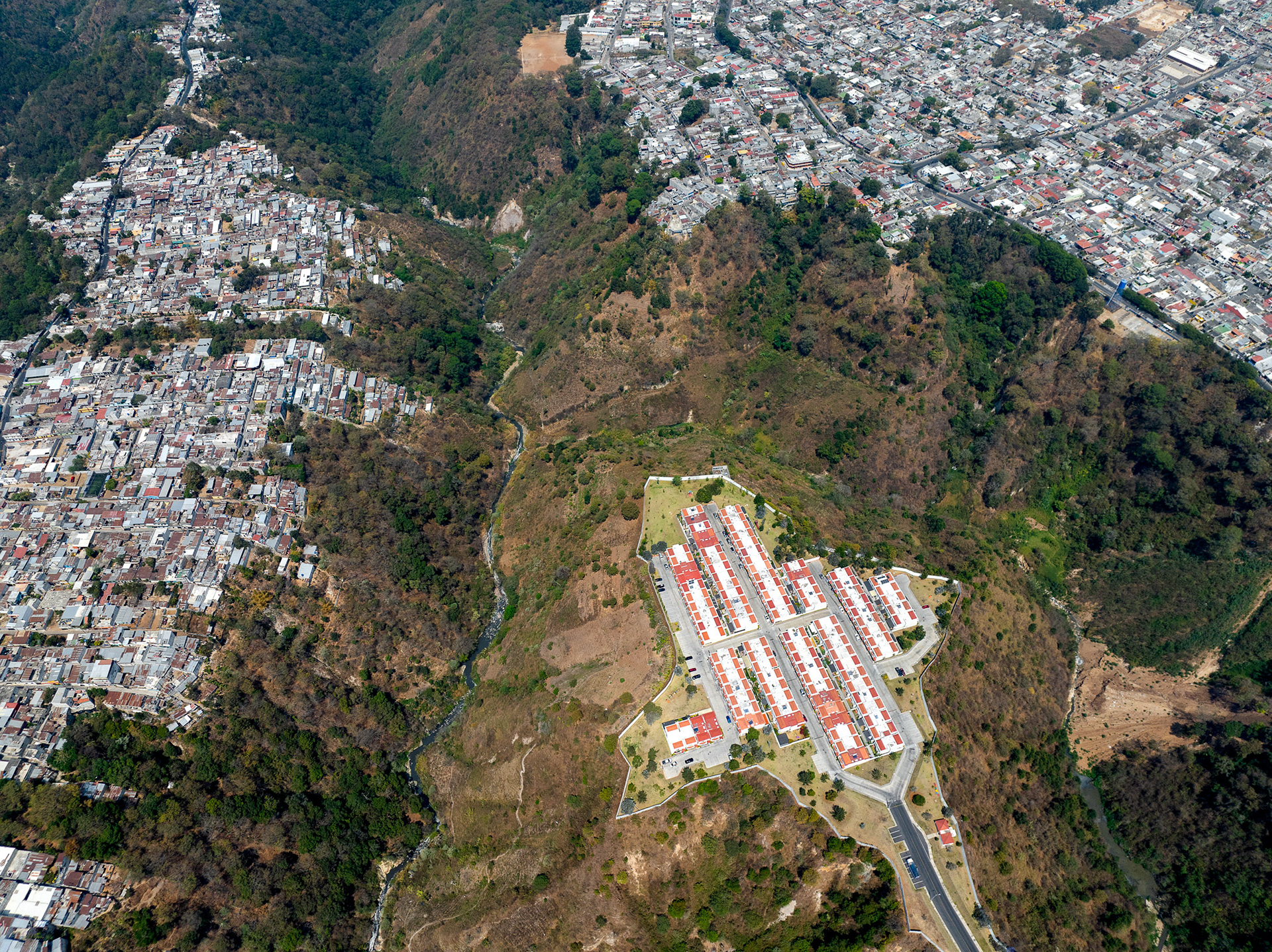
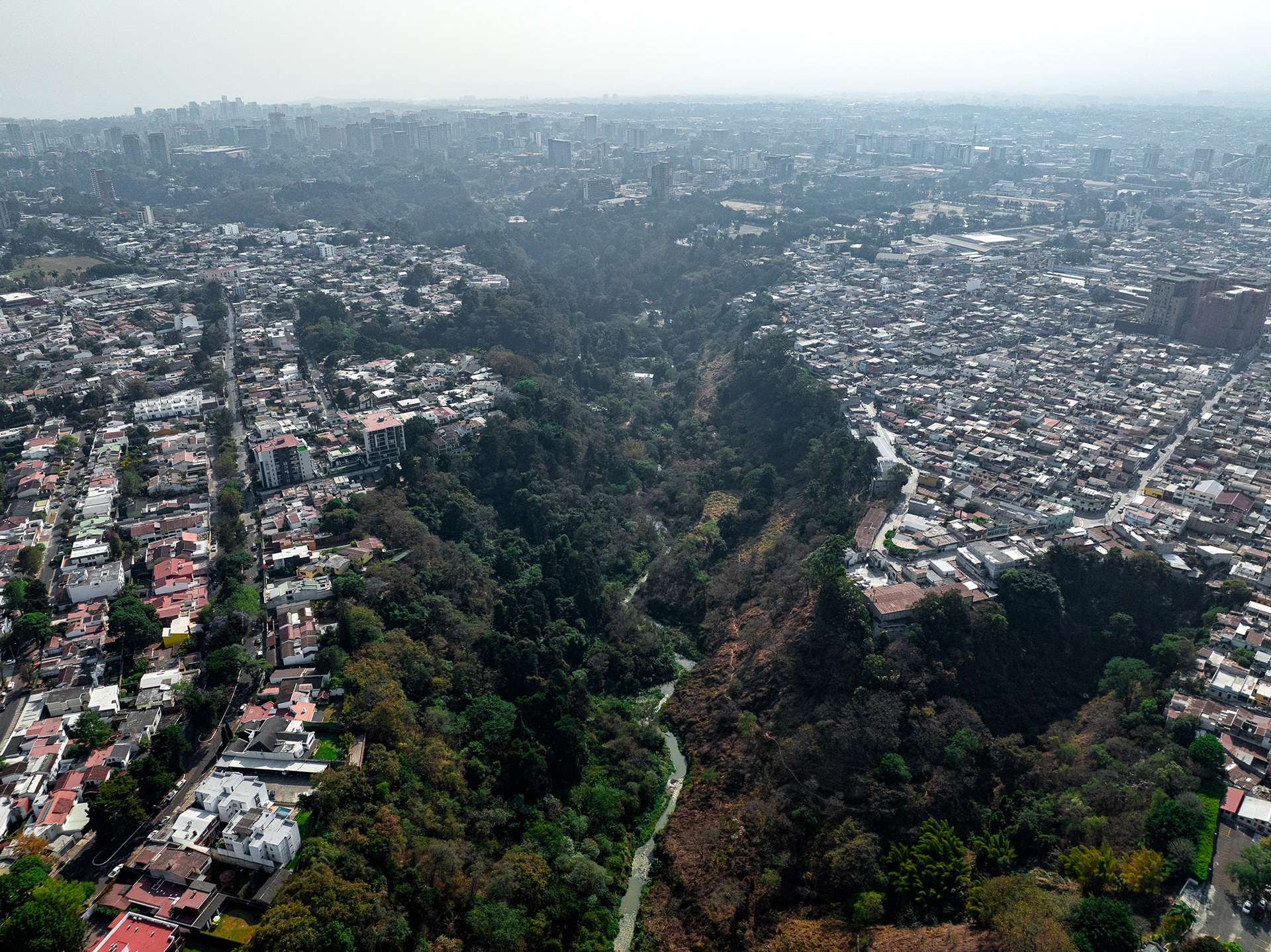
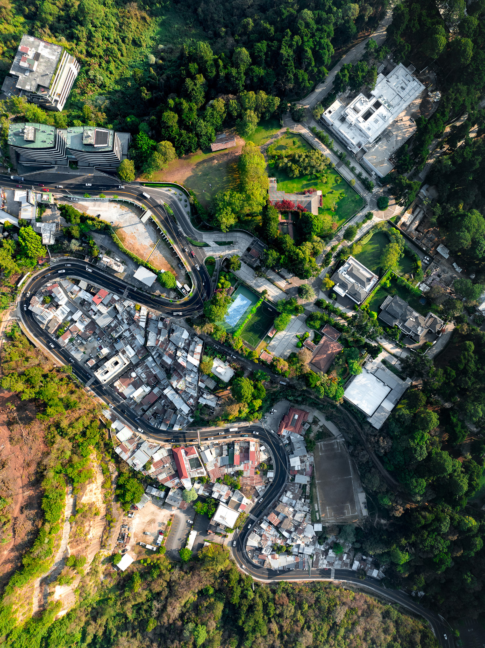
Guatemala City's topography lends itself to building on top of ridges, which are protected by deep ravines. Often, the only way to reach a neighboring community is a long, tedious detour on winding roads, providing a natural boundary for rich communities like this one in Mixco.
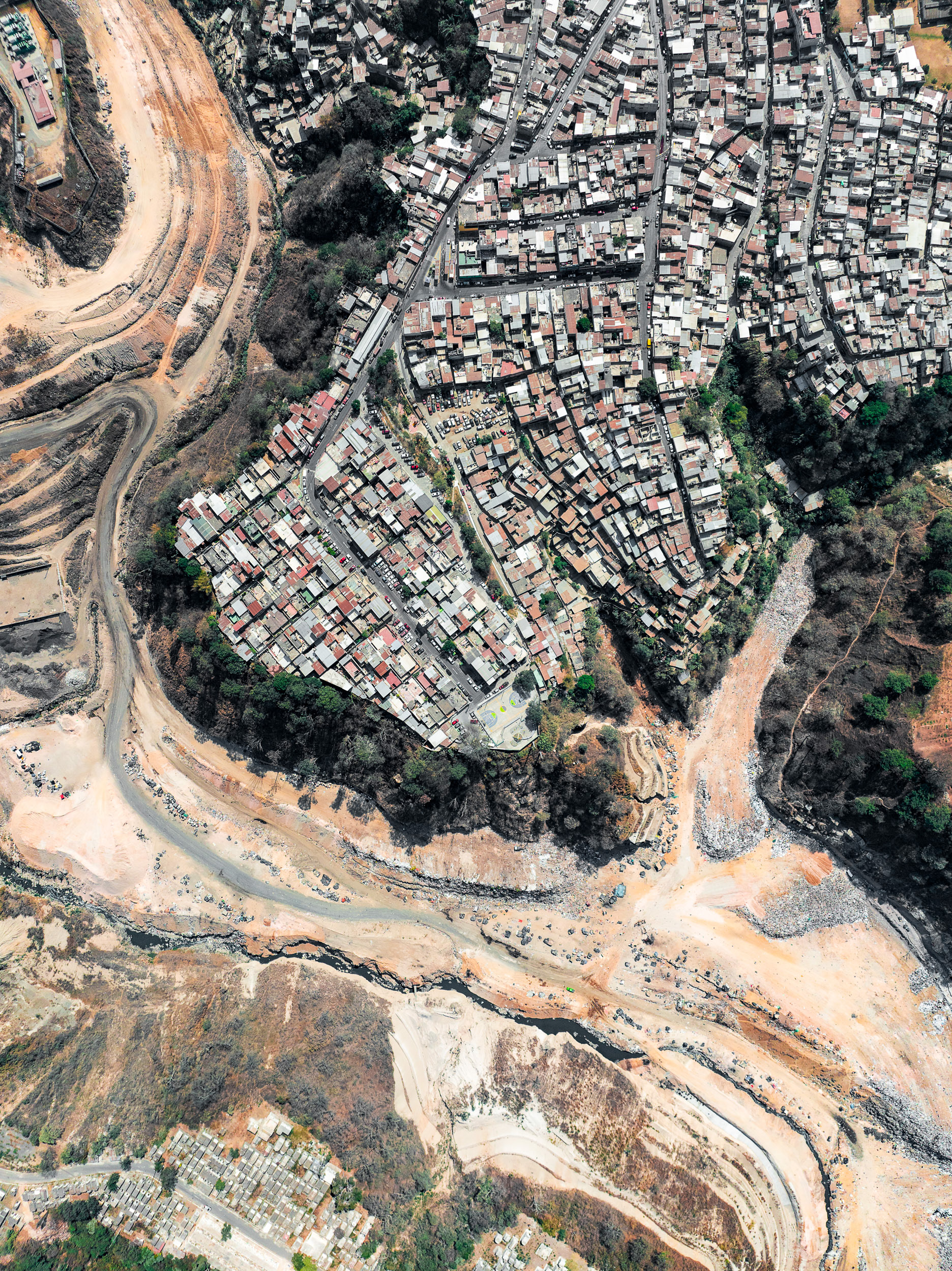
El Basurero, the Guatemala City dump, is the largest in Central America, built into a ravine in Zone 3 and taking roughly a third of the country's waste. Surrounded by poor neighborhoods, it supports thousands of waste pickers, called guajeros, who comb the heaps for plastic, metal and glass to sell, visible at the bottom of the frame.
Guatemala's volcanic topography make for beautiful photos, but it also is a reminder of the immense natural forces which beset the country and create such dramatic variations in geography within Guatemala City.
Las Nubes, Zone 16.
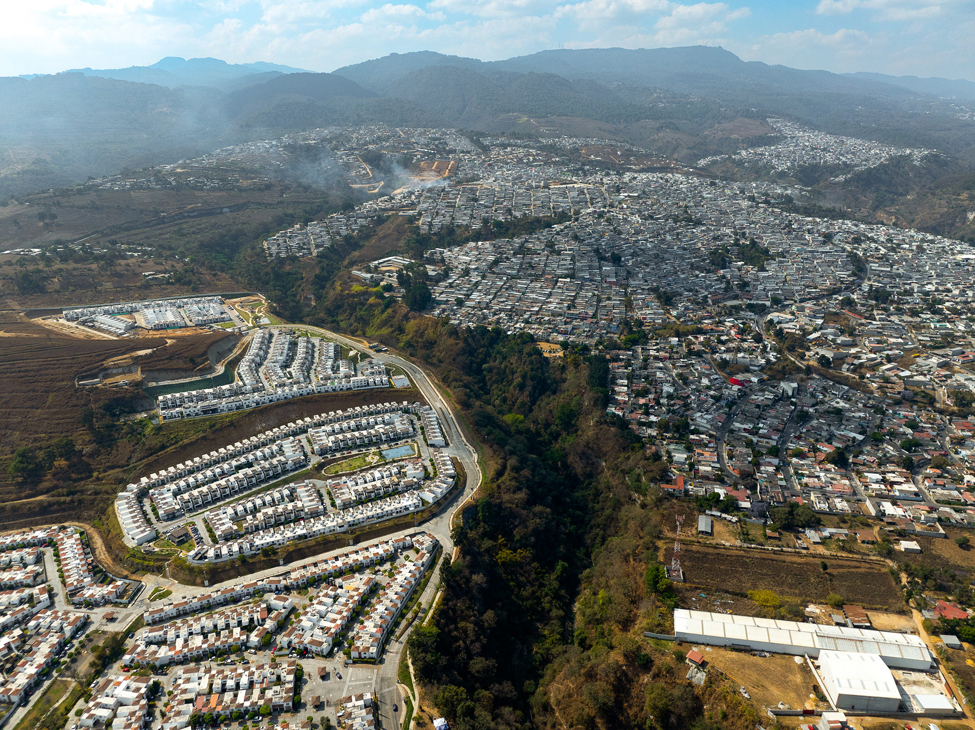
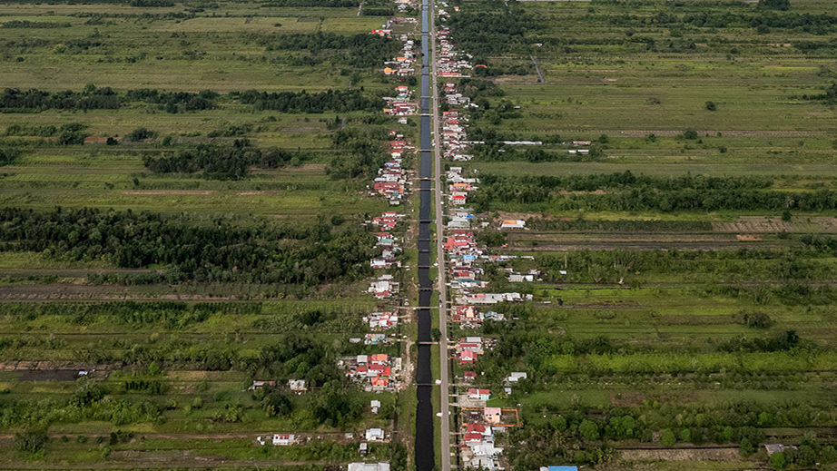
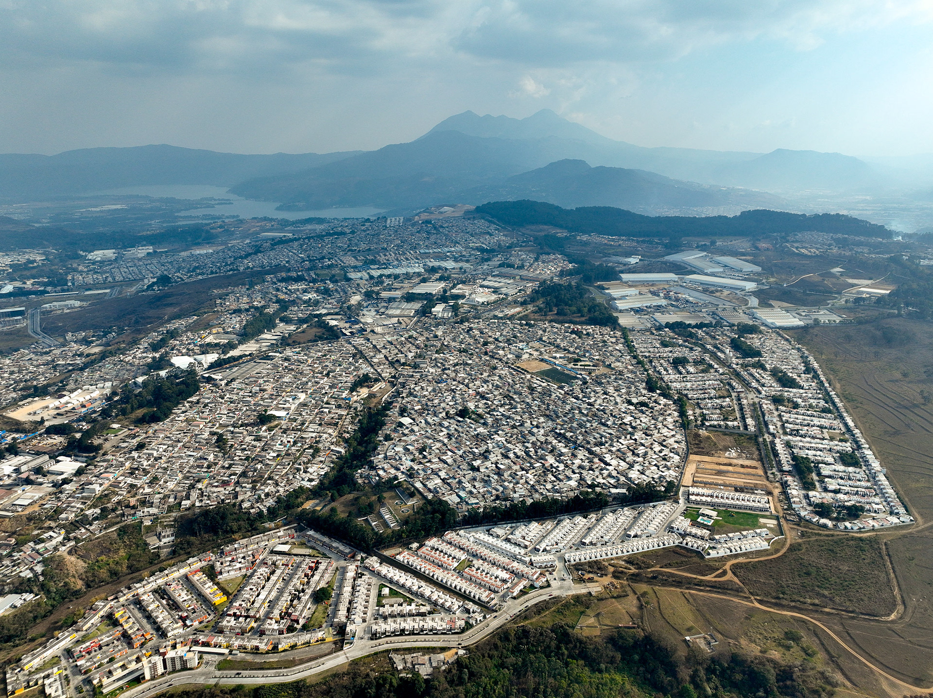
Sprawling development along the volcanic ridges to the west of the city.
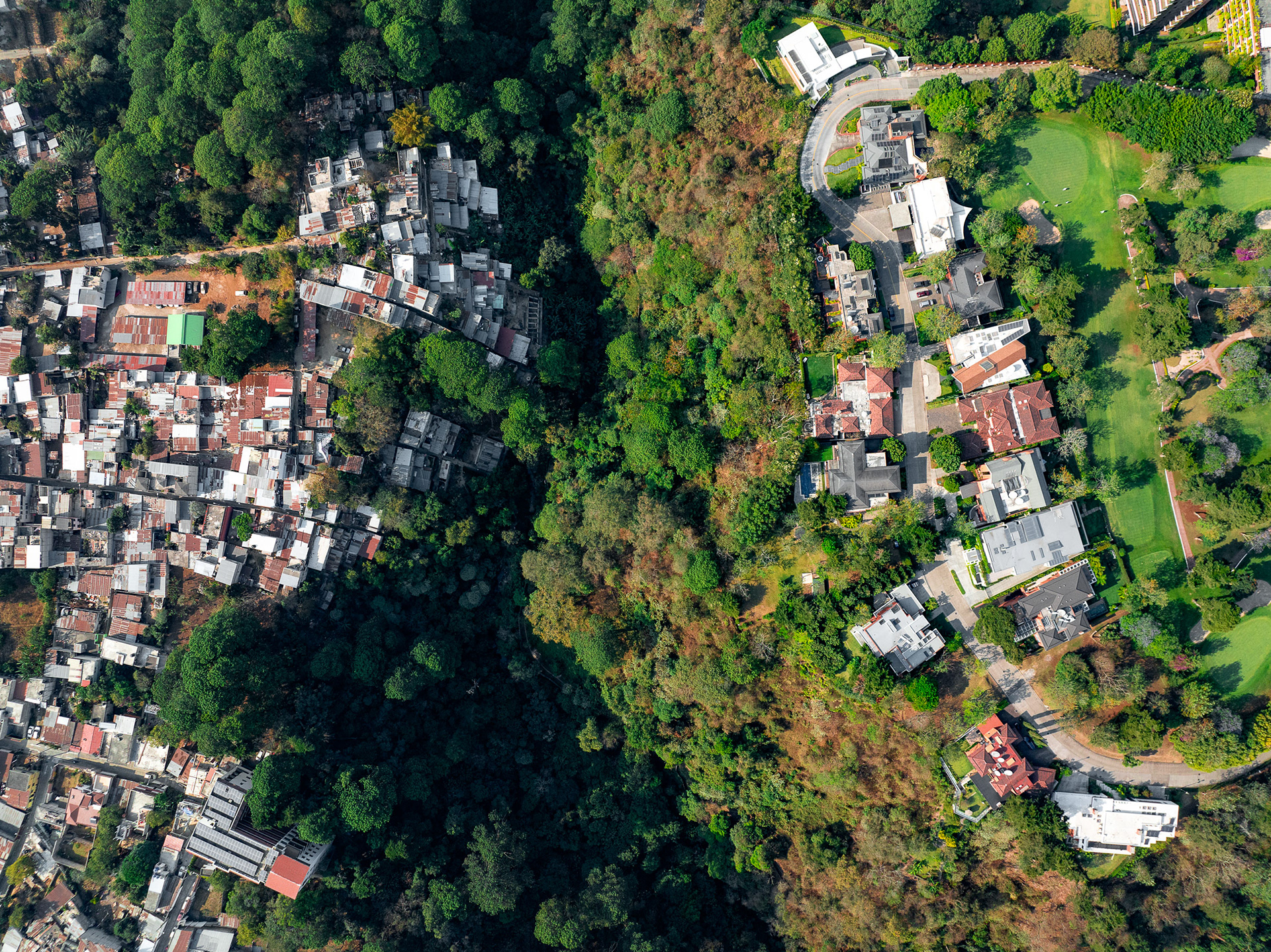
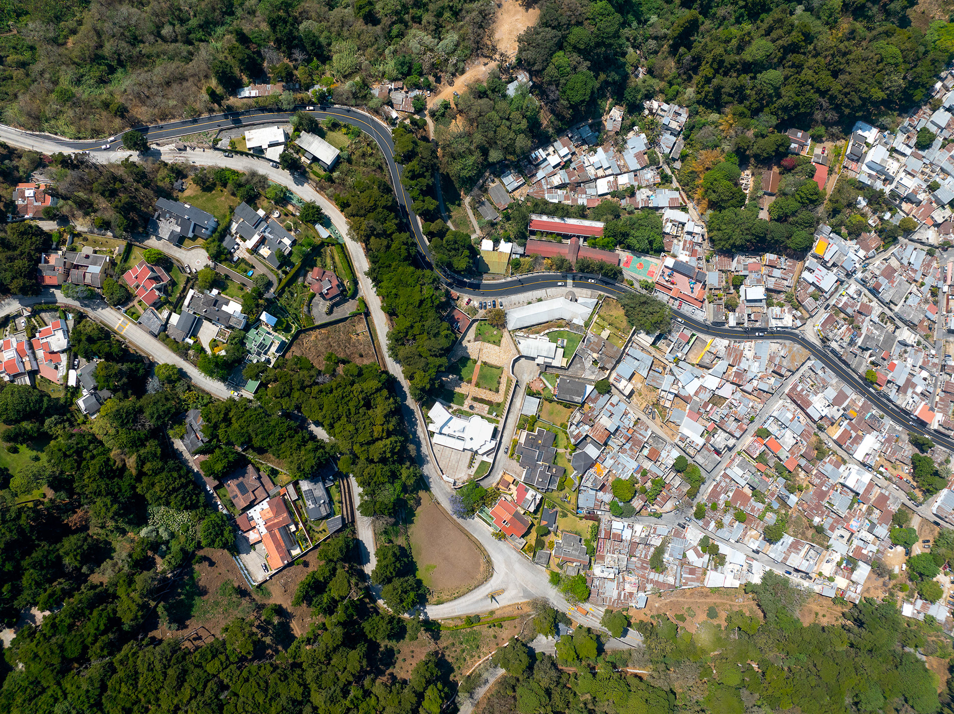
Informal homes next to a golf estate, San Isidro.