The abandoned Lee Plaza, an Art Deco icon built in 1929 as an upscale residential building. 

Detroit has emerged from a decades-long slide and America's largest municipal bankruptcy into something of a darling. "America's Comeback City: The Rebirth of Detroit" blares the headline of a recent article in Forbes, one of hundreds that clog the airwaves with tales of renaissance and economic transformation. And things, at least in some parts of the city, do look undeniably rosy. Boutique coffee roasters compete with chic soul food cafes in beautifully restored art deco skyscrapers. Starbucks and Whole Foods abound, as do craft breweries, in a type of "softening of the battlefield" before the waves of gentrifying hipsters from New York, LA, and Berlin move in. A new hockey stadium, complete with an opening 6-night residency from Detroit native Kid Rock, just opened.
But narratives of rebirth are much like the massive statue of Joe Louis' fist - mythic, outsize, and contained to the city center. In fact, a recent study released by Michigan State University states that the modest improvements in the midtown area "do nothing to address the city's core problem: disinvestment and abandonment propelled by corporate decisions framed and aided by government policies, from housing and free trade, with an overlay of stubbornly persistent racism."  
___________________________________________
Explore other cities with exclusionary infrastructure like Cape Town, Mumbai and Nairobi..
​​​​​​​​​​​​​​
Inequality Data created by the World Inequality Database.
aerial view of a highway and neighborhoods in detroit

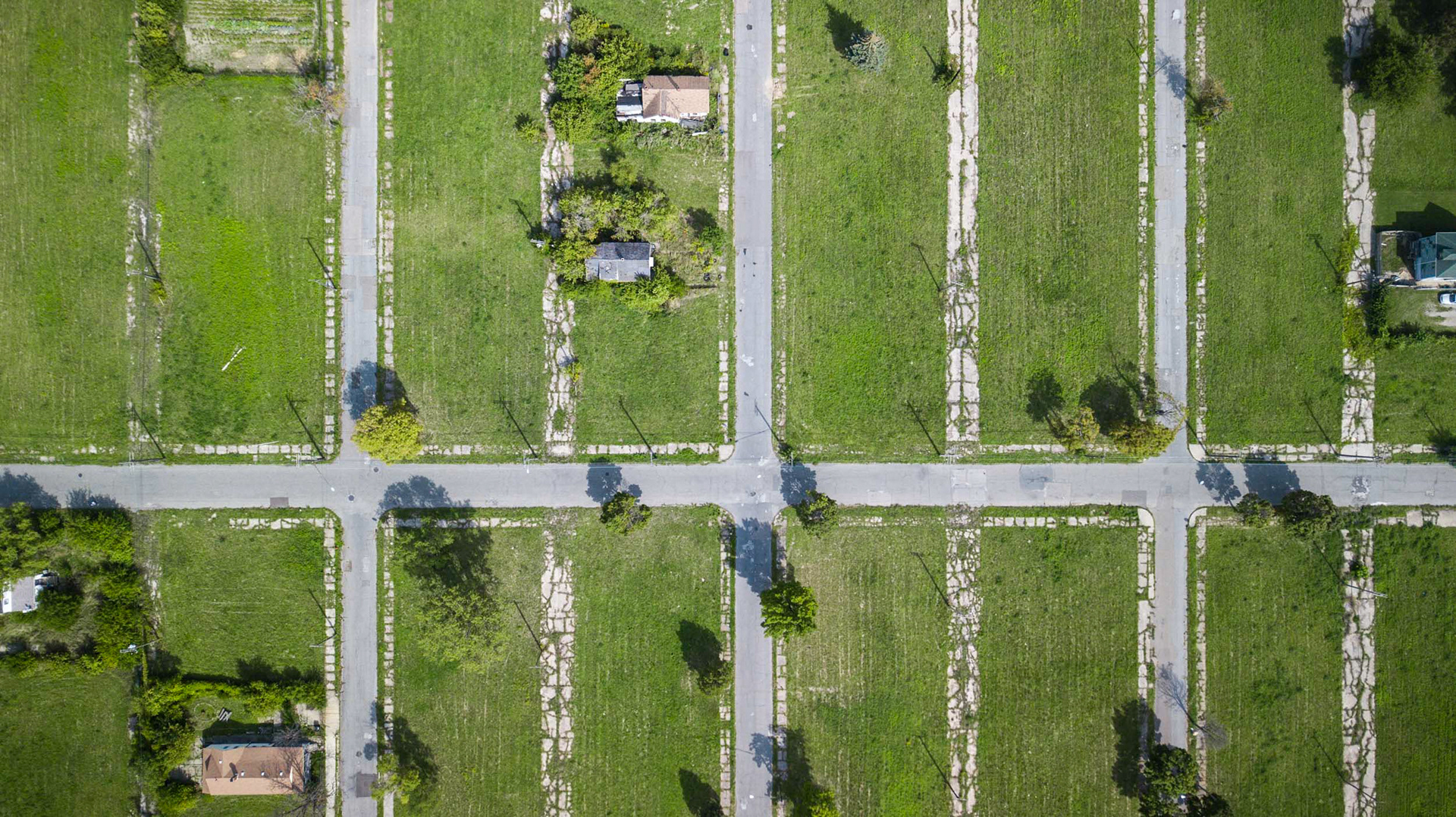
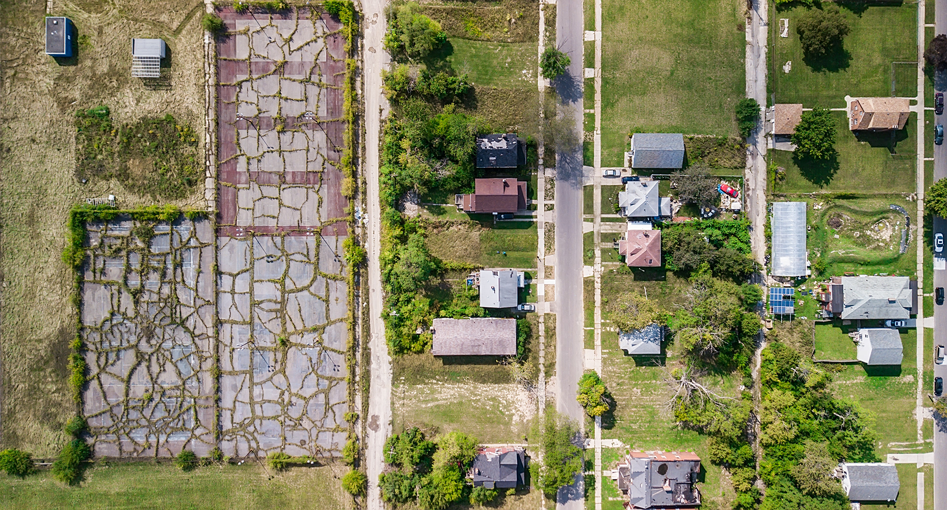
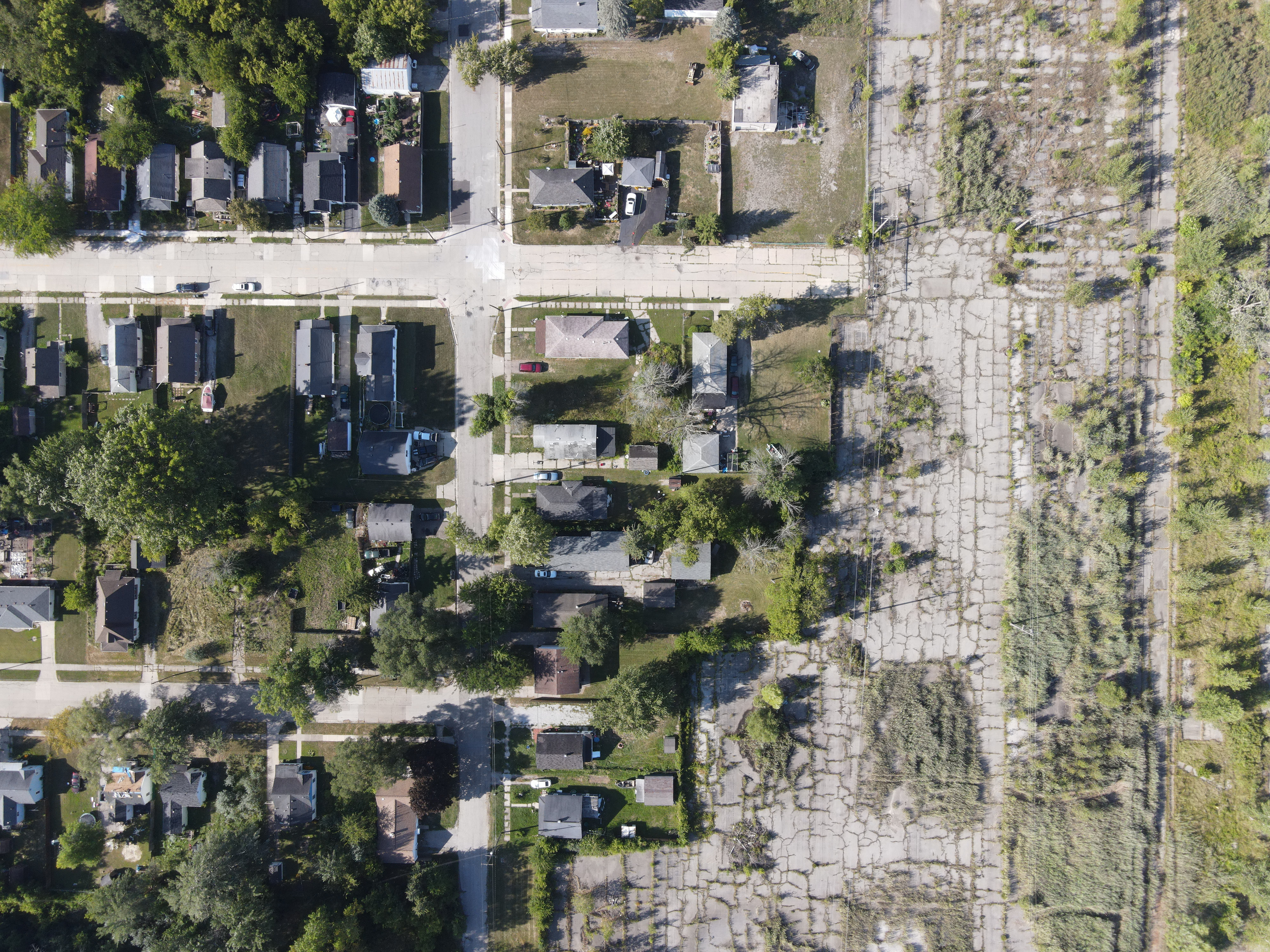
Some neighborhoods, like this one near Highland Park, are totally decimated by the flight from the city during a long period of decline. 

aerial view of a highway and neighborhoods in detroit

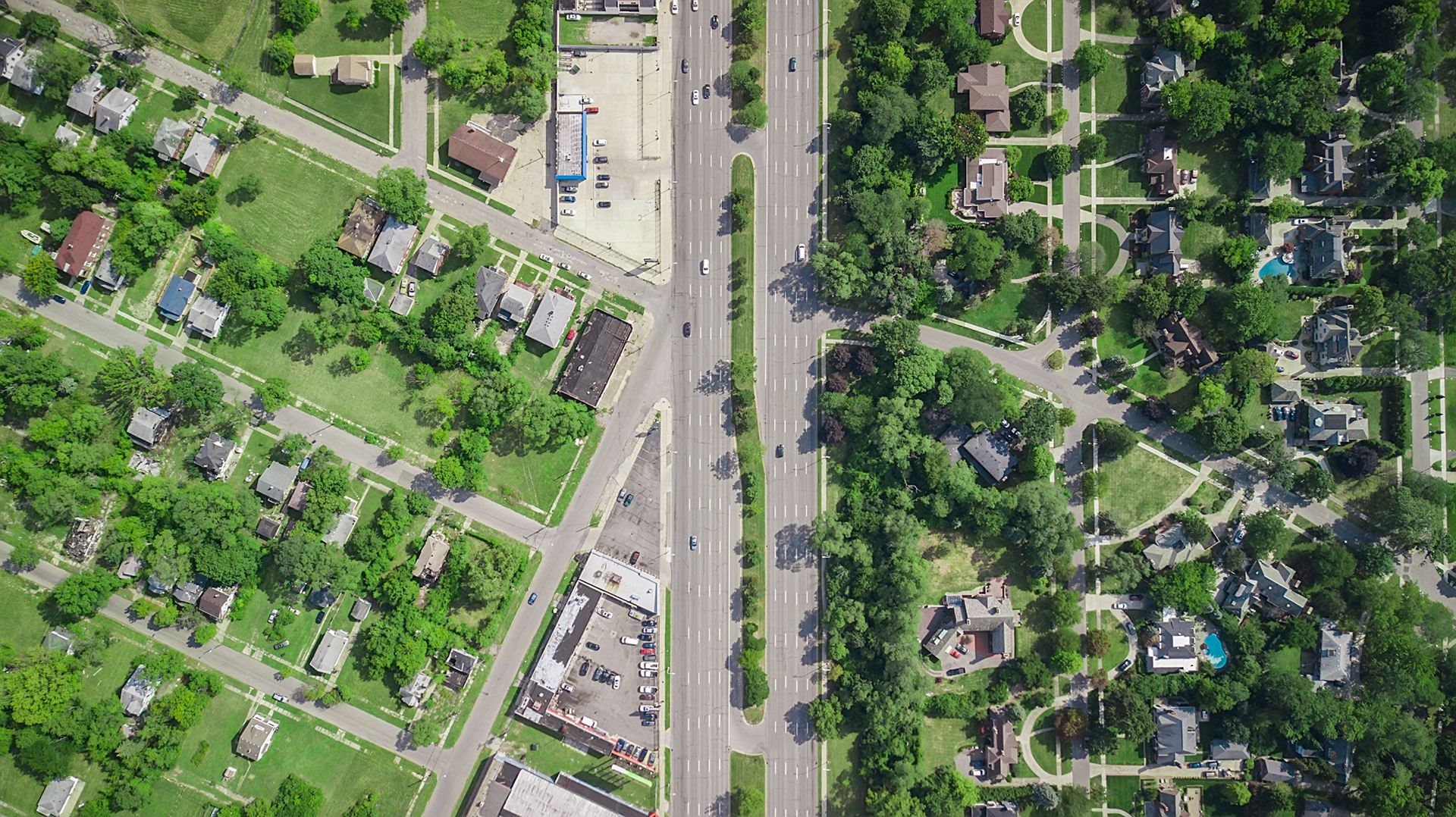
Woodward Avenue is a major north-south route in Detroit, and the very first paved road in America. In certain areas, like this one near Highland Park, it's easy to see which neighborhoods are suffering under Detroit's decline.
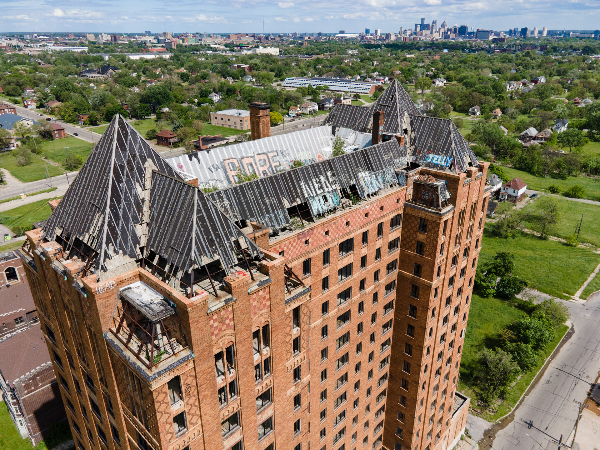
aerial view of houses in detroit

(Above) Grosse Point Park is one of the wealthiest neighborhoods in Detroit, but it's not technically within the city's boundaries. The Fox Canal separates it from the now-sparsely populated Jefferson Chalmers neighborhood.

Grosse Pointe Park / Detroit
The boundary between Grosse Pointe and Detroit is an emblematic of the divide between affluent white suburbs and the predominantly African-American city next to it.
Gross Pointe was, and still is, a wealthy enclave bordering Lake St. Clair. Houses are large and expensive, the asphalt smooth, the lawns nicely manicured. The projected reputation of the area was a carefully managed strategy, as evidenced by the discovery in 1960 of the "Grosse Pointe System", a ranking system developed by the community to be carried out on prospective home buyers (rankings were based on complexion, religion, "way of living" and "reputation"). Blacks, Mexicans, and people of "Oriental descent" were not even considered. 
The westernmost section is known as "Grosse Pointe Park", separated from Detroit by a series of infrastructural barriers set up by the Grosse Pointe Park community to intentionally make it difficult to transit between the two.​​​​​​​
For example, many roads which lead from Detroit to Grosse Pointe have just been walled off completely, including Goethe, Brooks, and Korte. Other roads, such as Kercheval, have been famously re-engineered (currently a narrow roundabout exists with a large steel sculpture in the middle, but previously it was blockaded multiple times by gigantic planters, sheds for a farmer's market (facing towards Grosse Pointe), and mounds of snow). 
That's not the only boundary road, either. To the north, Mack Avenue does the same thing, with the same blockades (Wayburn, Grayton, and multiple alleyways) and traffic diversions (Somerset, Beaconsfield).  
aerial view of houses in detroit

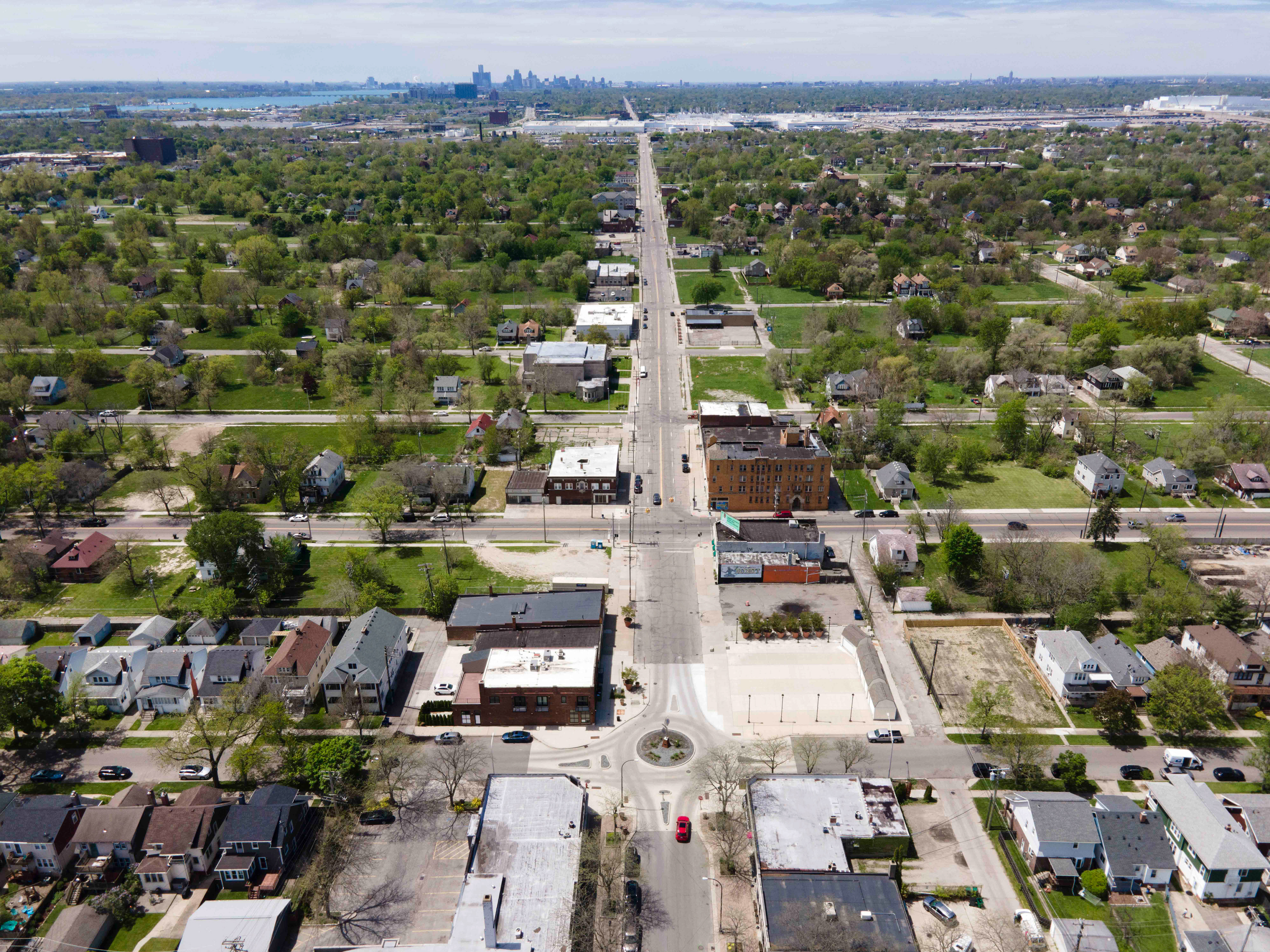
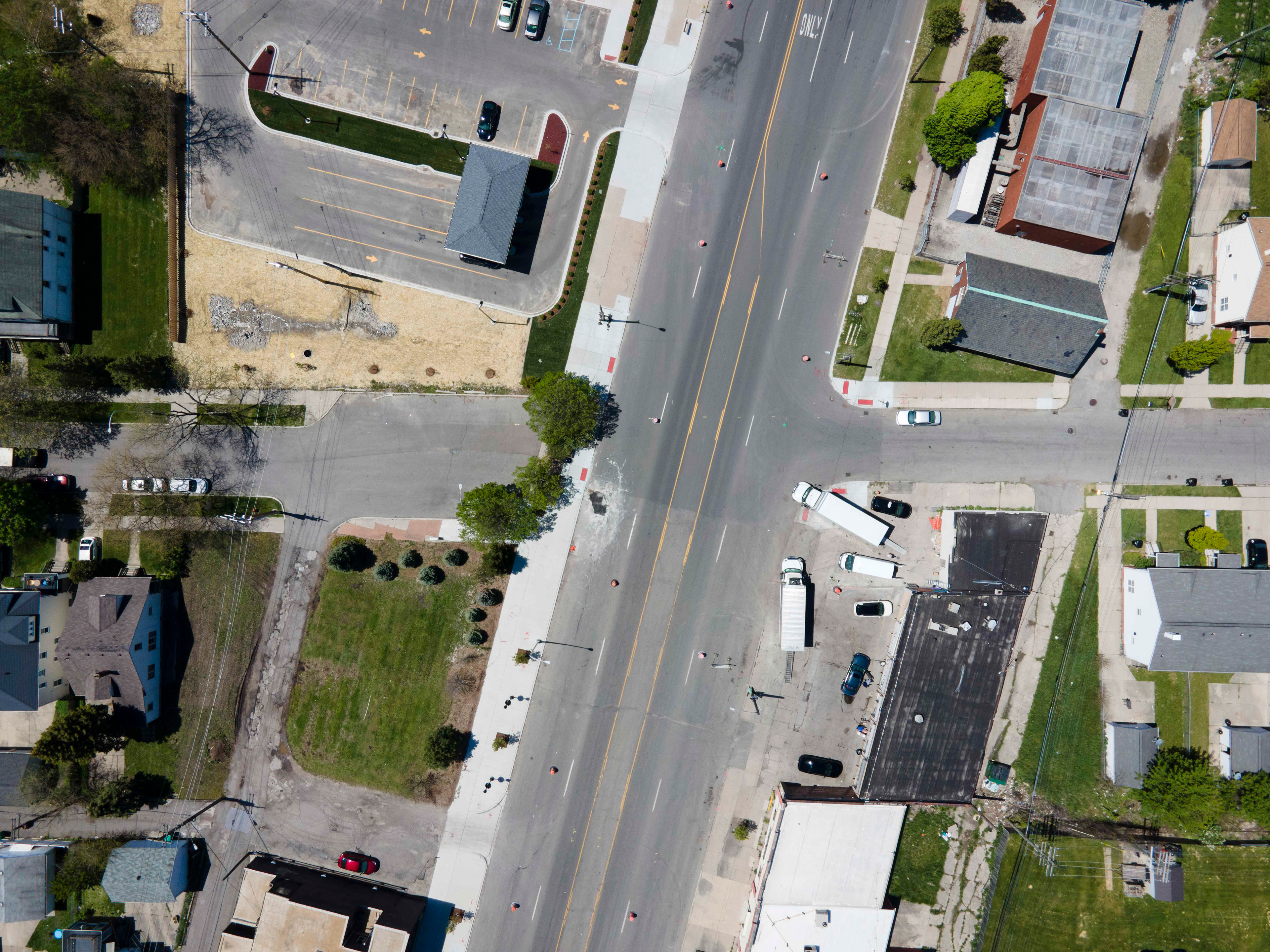
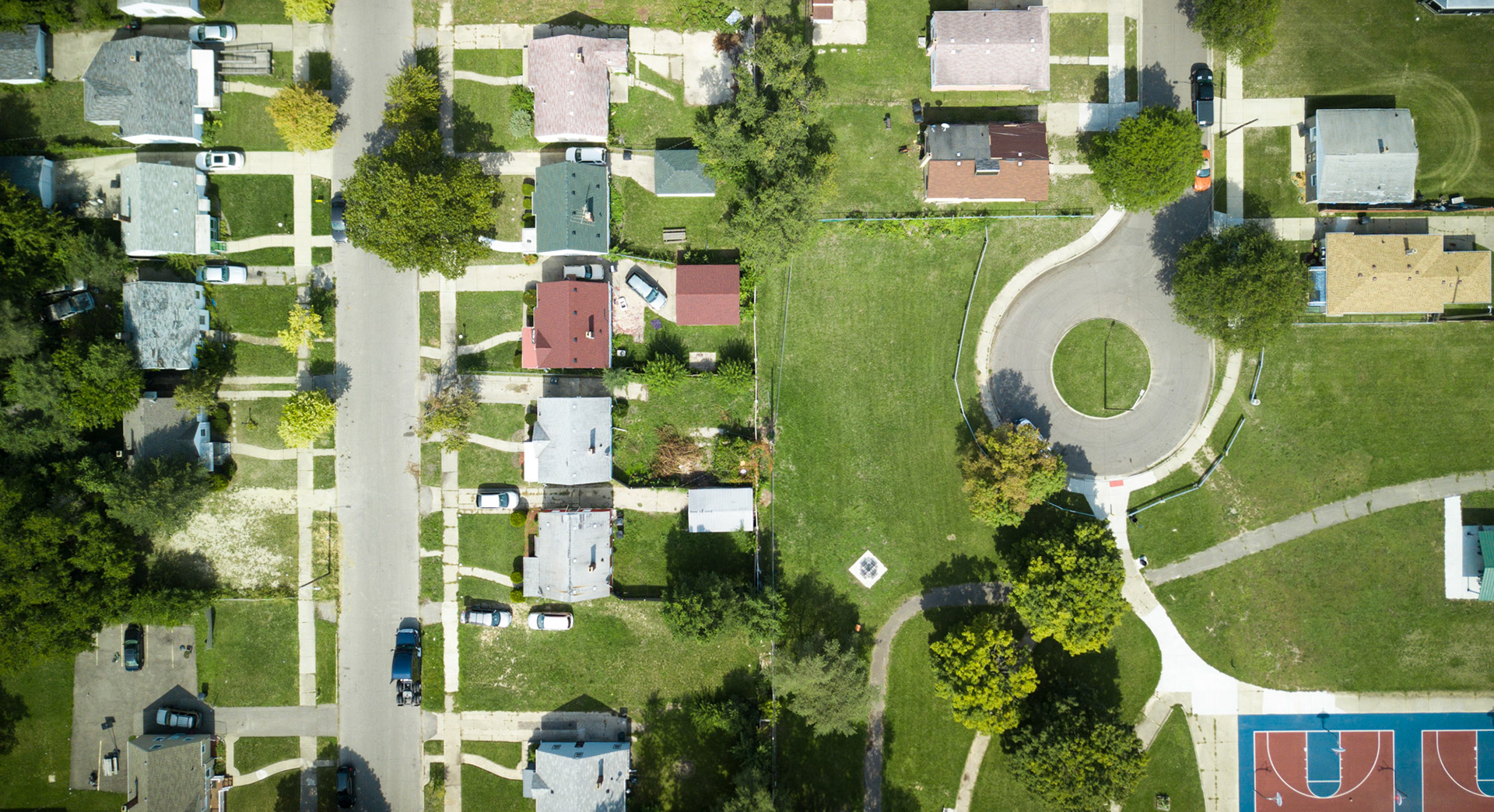
Kercheval Avenue is the main entryway into Grosse Pointe Park, leading directly to downtown Detroit. 

The residents of Grosse Pointe Park have tried for years to barricade this gateway, including using snow, oversized planters, sheds (seen in center right in this photo). After intense disputes, the barriers were removed, but a "traffic calming" roundabout is still in place.

Mack Ave and Wayburn St.
Brooks St. / St Paul St.
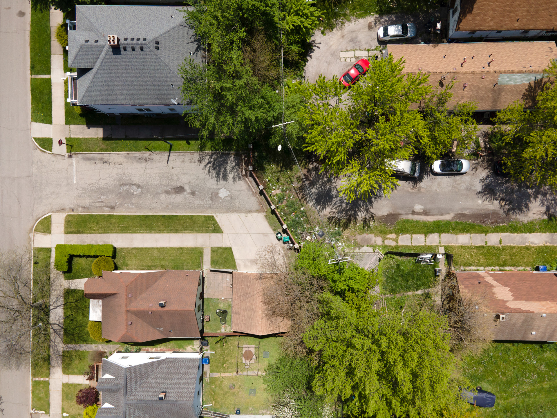
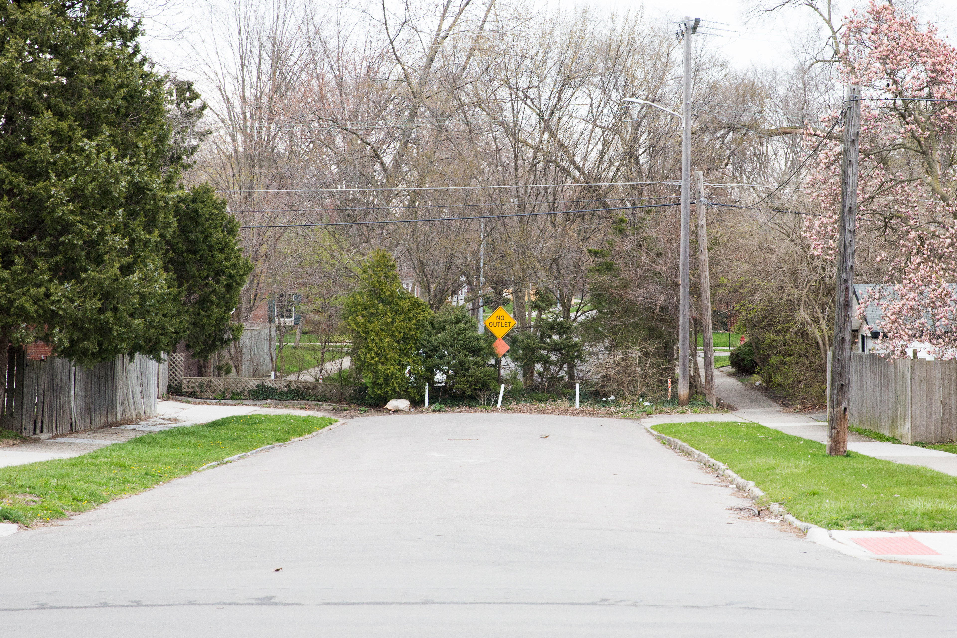
Goethe St. / Goethe Ave.

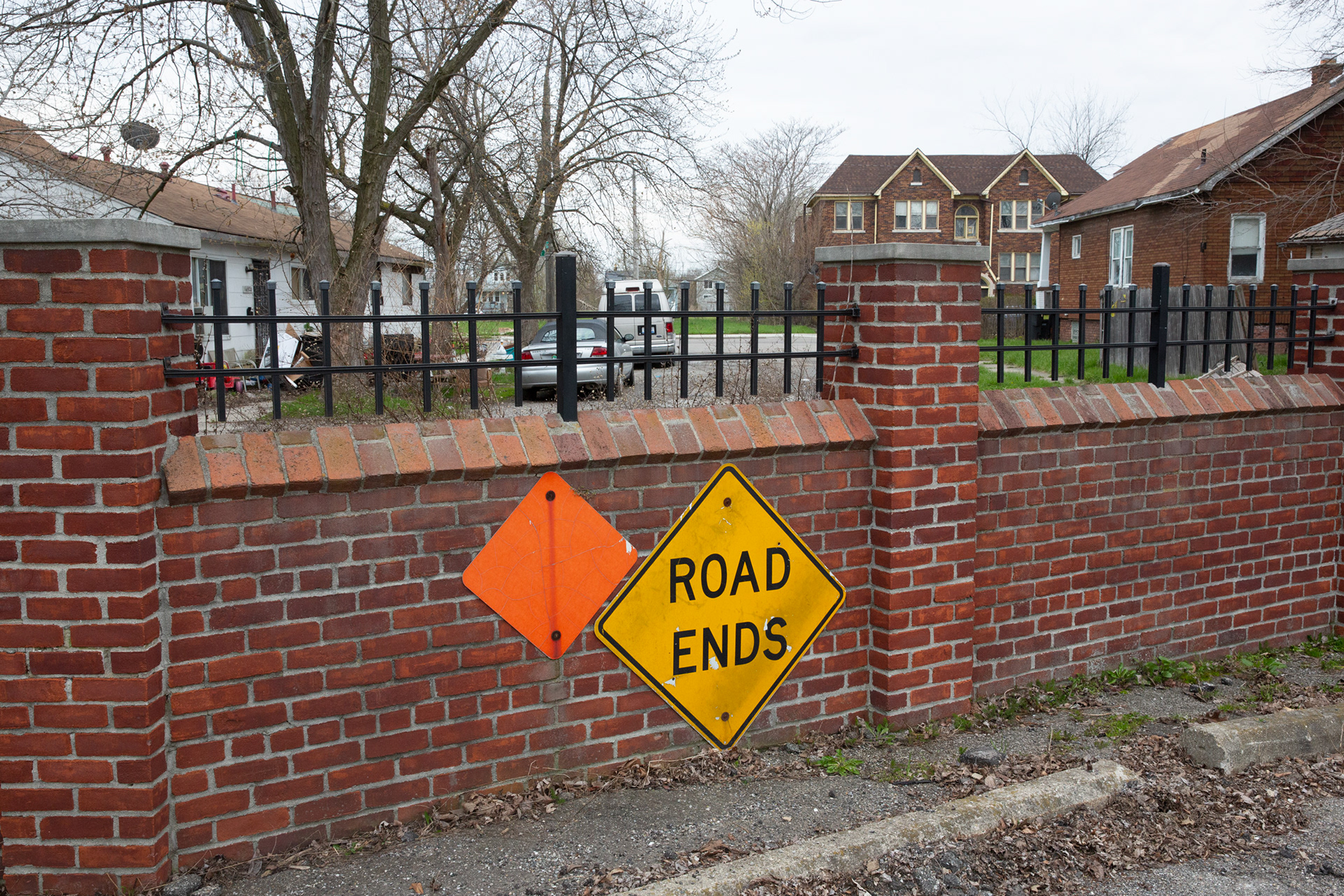
These walled-off streets, like Goethe Ave in Grosse Point Park, once connected the community to Detroit (on the opposite side). ​​​​​​​

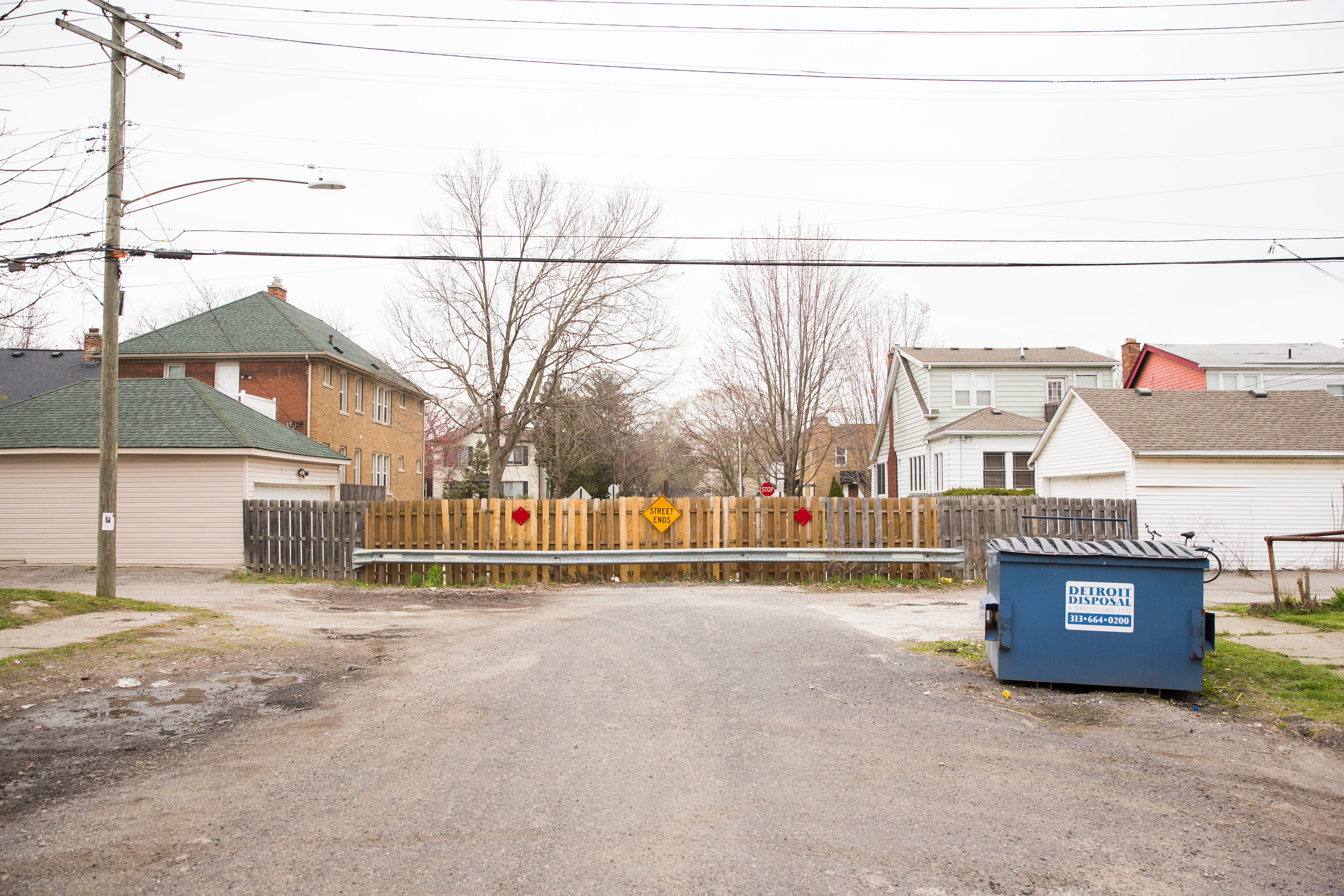
Brooks Rd. (as seen from Detroit)
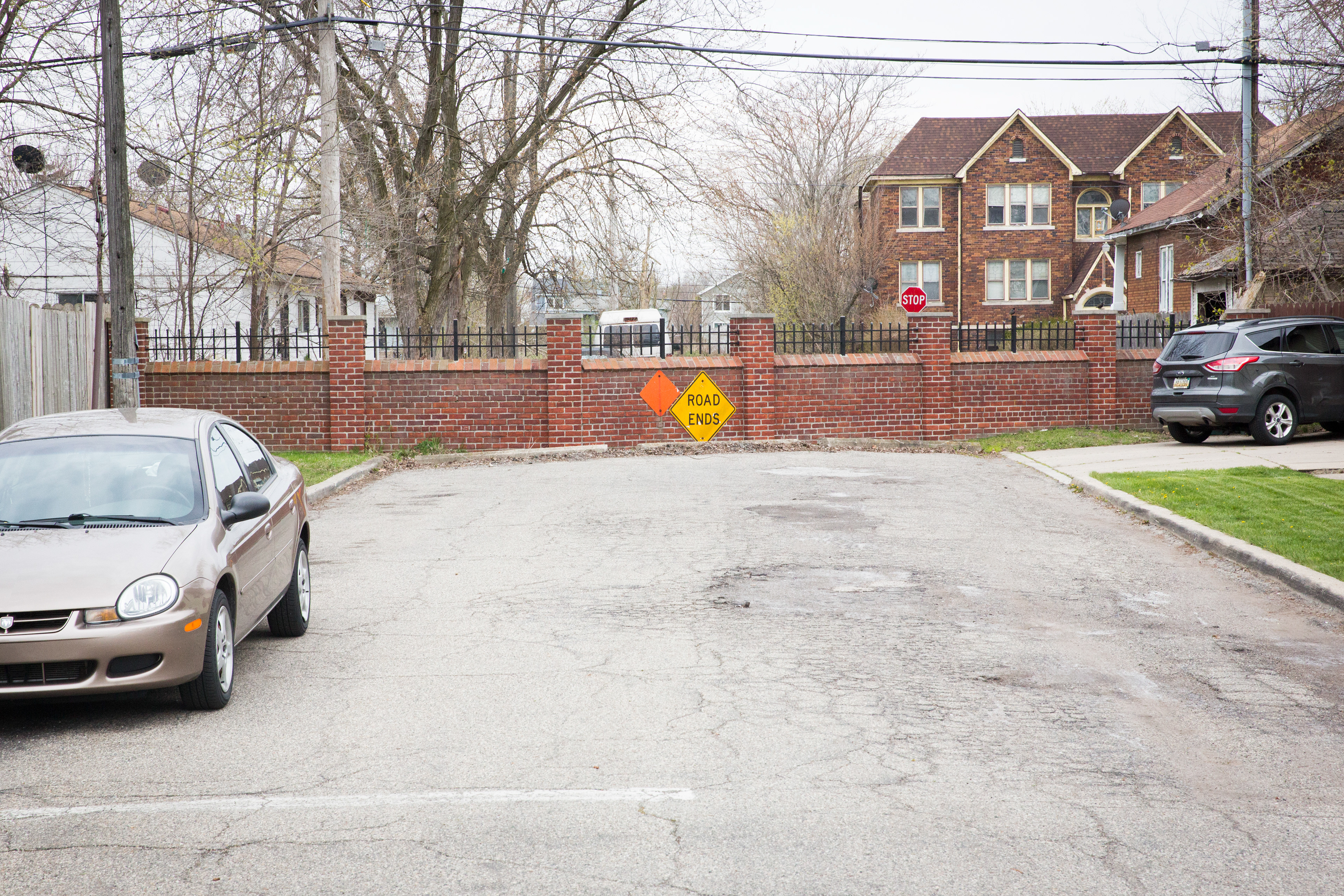
Goethe Ave (as seen from Grosse Pointe Park)
Korte Ave (as seen from Detroit)
The southwestern corner of Grosse Pointe Park is removed even further from Detroit by the Fox Canal, a road-width body of water which extends for 1.28 miles from Jefferson Road to the Detroit River. There is only one bridge that crosses the canal with direct access to Gross Pointe Park, but that crossing has been closed since the 1980s​​​​​​​
The divide between Grosse Pointe Park and Detroit has been featured many times in many other excellent photo projects, including The Other America, and that Martin Luther King even gave a speech there in 1968 decrying the racial and economic imbalance of the neighborhoods (this was three weeks before his assassination, and only months after the Detroit Riots). Other cities, notably Cleveland and St. Louis, have similar exclusions historically rooted in racism as well.
chain link fence over a canal, detroit

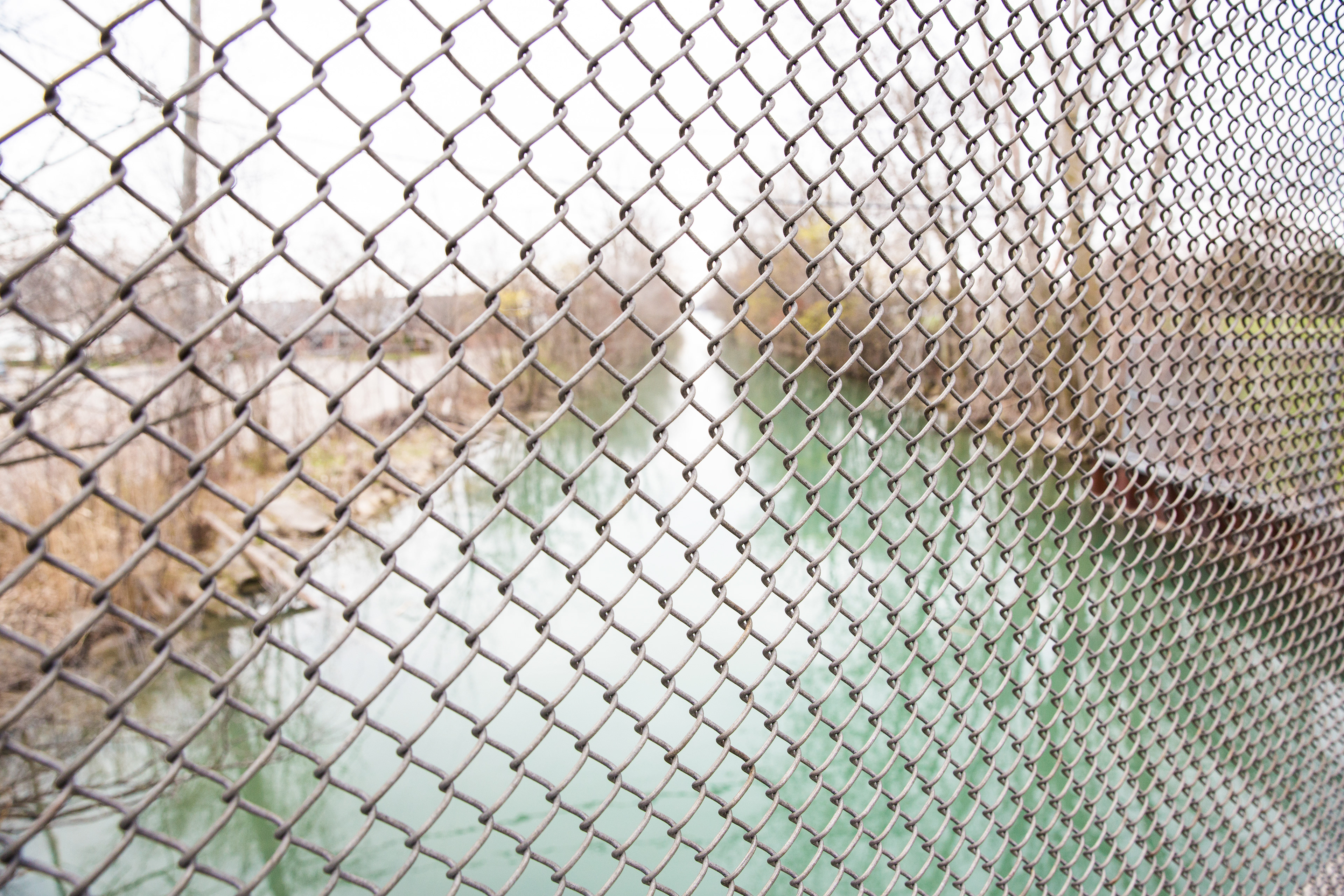
The end of Fox Canal, looking towards the Detroit River. On the left is the private beach accessible only through Grosse Pointe Park. On the right, Mariner's Park, open to all.  

The Wall
It’s a little after 3pm in Detroit’s 8 Mile neighborhood, and the cicadas are buzzing loudly in the trees. Children weave down the pavements on bicycles, while a pickup basketball game gets under way in a nearby park. The sky is a deep blue with only a hint of an approaching thunderstorm – in other words, a muggy, typical summer Sunday in Michigan’s largest city.
“8 Mile”, as the locals call it, is far from the much-touted economic “renaissance” taking place in Detroit’s centre. Tax delinquency and debt are still major issues, as they are in most places in the city. Crime and blight exist side by side with carefully trimmed hedgerows and mowed lawns, a patchwork that changes from block to block. In many ways it resembles every other blighted neighborhood in the city – but with one significant difference. Hidden behind the oak-lined streets is an insidious piece of history that most Detroiters, let alone Americans, don’t even know exists: a half mile-long, 5ft tall concrete barrier that locals simply call “The Wall”.
“Growing up, we didn’t know what that wall was for,” says Teresa Moon, President of the 8 Mile Community Organization. “It used to be a rite of passage to walk on top of the wall, like a balancing beam. You know, just kids having fun, that kind of thing. It was only later when I found out what it was for, and when I realized the audacity that they had to build it.”
concrete wall in detroit

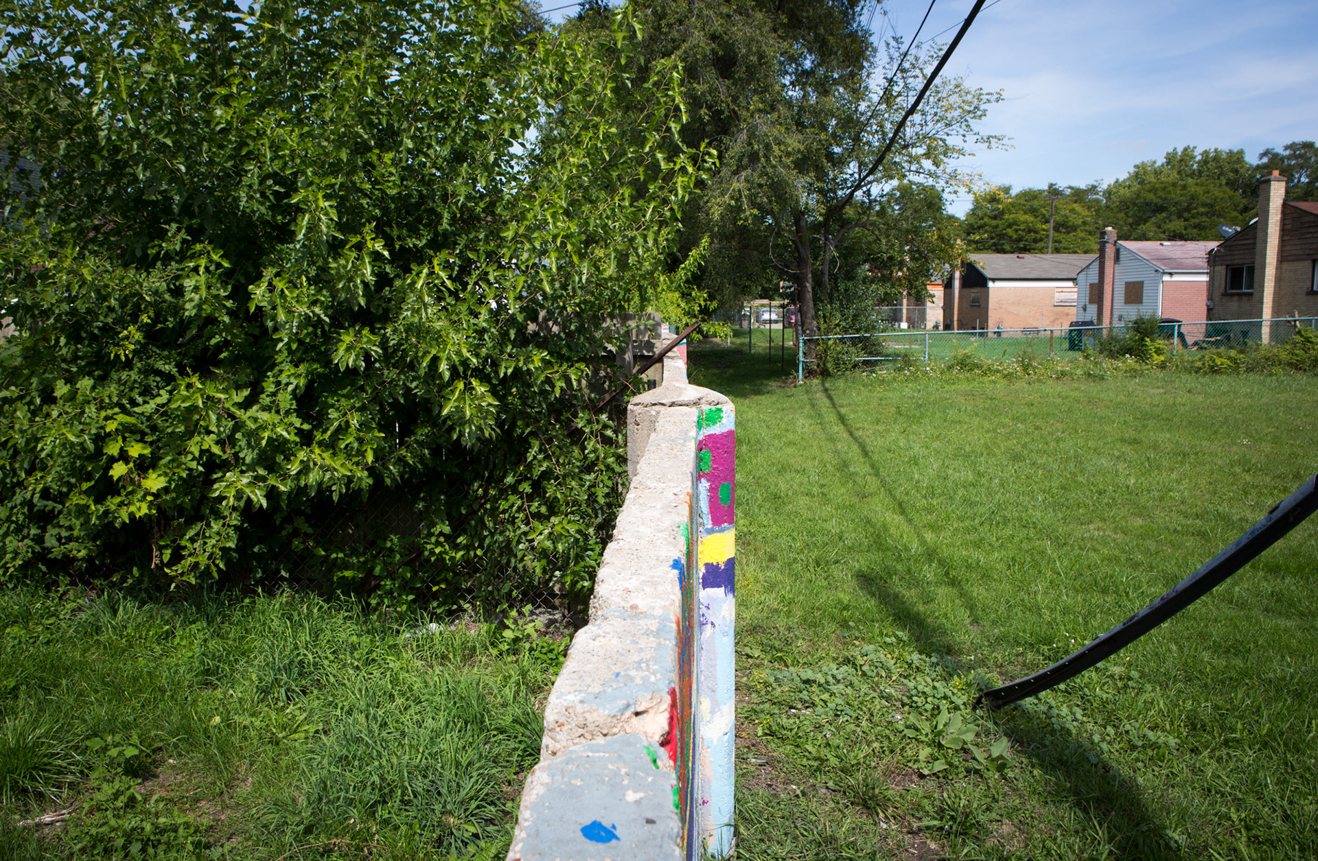
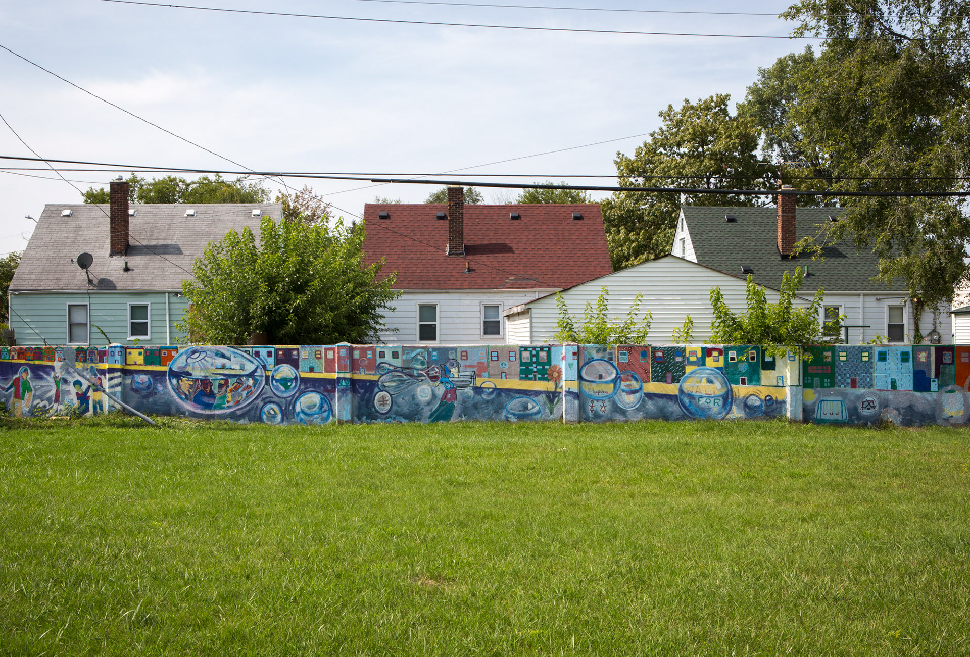
(Above) The Wall, a concrete barrier in 8 Mile, Detroit, built to divide black and white neighborhoods.

(Below) The area now is almost all black, and the wall is seen as a monument to a failed policy of segregation.

In 1942, 8 Mile was a black neighborhood – segregated by law, segregated by culture, segregated from white Oakland County by the eponymous 8 Mile Road. It was a self-contained community, filled with not only African Americans but immigrants of all colors, some of whom had built their houses with their own hands.
It was also adjacent to empty land – valuable land that developers were rapaciously turning into homes for a surging postwar population. Land that one housing developer wanted to use to build a “whites-only neighborhood”. The only problem was, he couldn’t get federal funding to develop the land unless he could prove he had a strategy to prevent black people and white people from mixing. His answer: wall off the white neighborhood with a concrete barrier.
“That wall is a monument,” says Moon. “We survived it. It’s a part of what happened, and no one feels any negativity towards what happened.”
Her neighbor, Lou Ross, agrees. “What that Wall was intended for, it didn’t work that way. It did for a minute – but it didn’t last.”
(This piece and photographs also featured in a Guardian article that I wrote on American infrastructure called "Roads To Nowhere".)
empty lots in detroit

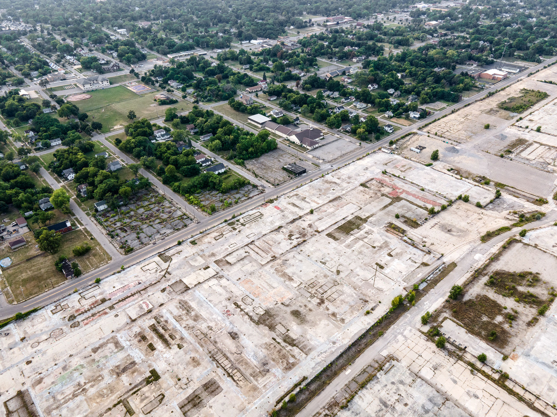
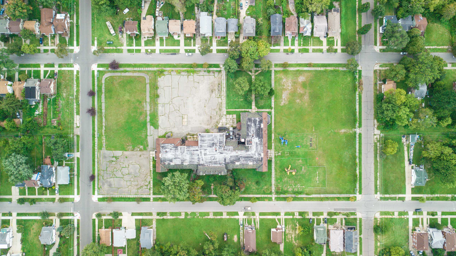
(Above) Black Bottom used to be a vibrant African-American neighborhood, but that was before redlining, the construction of I-75, and decades of neglect decimated the area. Now it is like so many other parts of Detroit - a skeleton of cracked concrete, weeds, and emptiness.

Black Bottom 
Detroit has always had a love affair with the automobile. After all, this is where they were mass-produced, where America's very first road was paved, and where firms such as GM, Ford, and Chrysler made their fortunes and caused the city to greatly prosper in the early 20th century. So in the mid-1950s, when President Eisenhower launched an ambitious plan to connect the country with massive interstates Detroit was fully prepared to offer up neighborhoods like sacrificial lambs to the excavators.  
The problem was, many of those neighborhoods were historically African-American neighborhoods, and due to a history of redlining many of them were in a dilapidated condition, making them perfect targets for destruction (and fitting into a narrative of "urban renewal" and "social cleansing"). 
One such area was the historically African American neighborhood that used to be known as Black Bottom, a vibrant, dense area in a prime location just north-east of downtown. Black Bottom had a nationally renowned music scene, and was home to many famous residents, including boxer Joe Louis and the first African American mayor of Detroit, Coleman Young. The area was economically and racially mixed, with migrants from Syria, Poland and Germany co-existing in a bustling urban area that ran from the Detroit river all the way up to Grand Ave. Young called it a “thrilling convergence of people, a wonderfully versatile and self-contained society”.
map of redlining in detroit

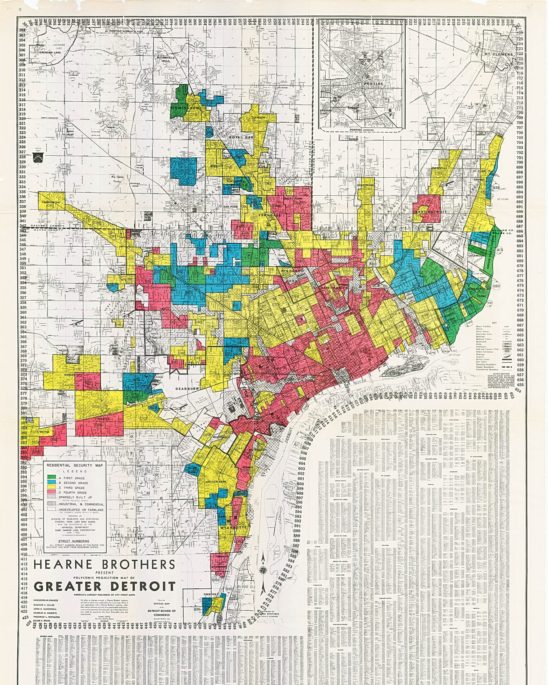
The original HOLC (Home Owner's Loan Corporation) redlining map of Detroit. Black Bottom is in the red zone, just northeast of downtown. (Note: Grosse Pointe is the green area in the far east of this image.)

satellite image of highway construction in detroit

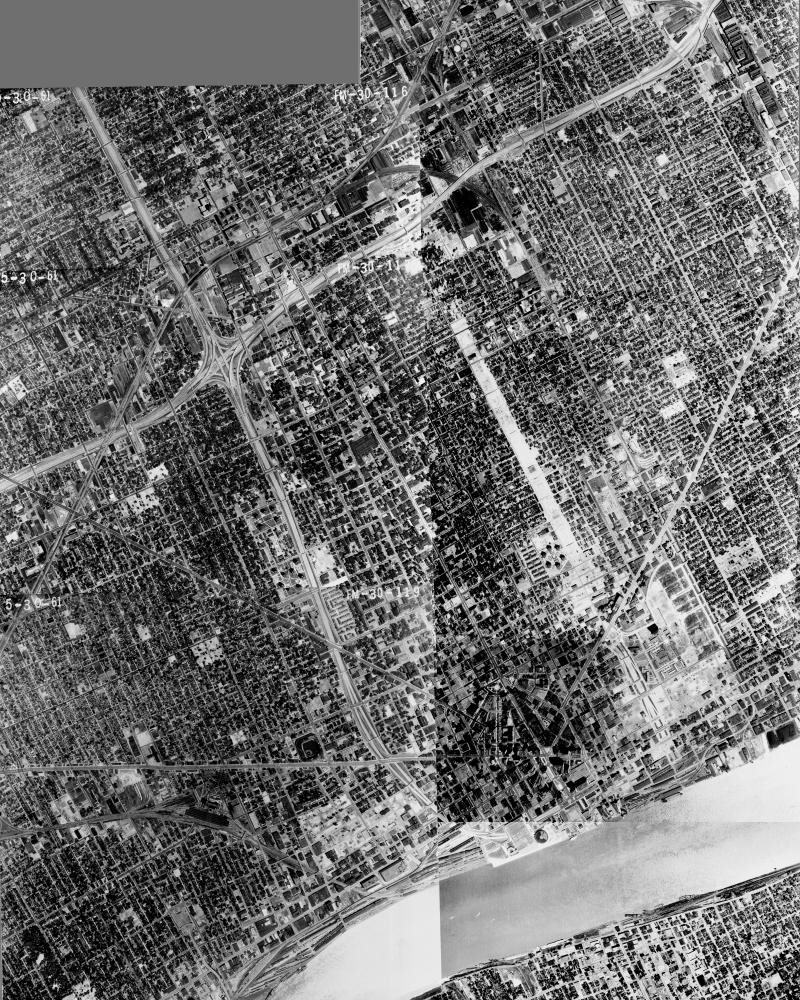
A series of aerial images I compiled from Wayne State University (possibly for the first time), showing the extent of the interstate construction in 1961. The construction of I-75/I-375 through Black Bottom is clearly visible to the northeast of downtown. 

While some improvements were applauded and created highly valuable land, like Lafayette Park, almost all of the beneficiaries of the improved housing stock were white. Tens of thousands of African Americans were either forced into high-rent properties or high-rise public housing projects. Moreover, white landowners often prevented African Americans from renting in “white communities”. The forced removals of the 1950s remain one of the single biggest upheavals in the city’s modern history, and Black Bottom was completely destroyed. All that remains today are some vacant industrial buildings, empty fields and, of course, the interstate.
aerial image of downtown detroit

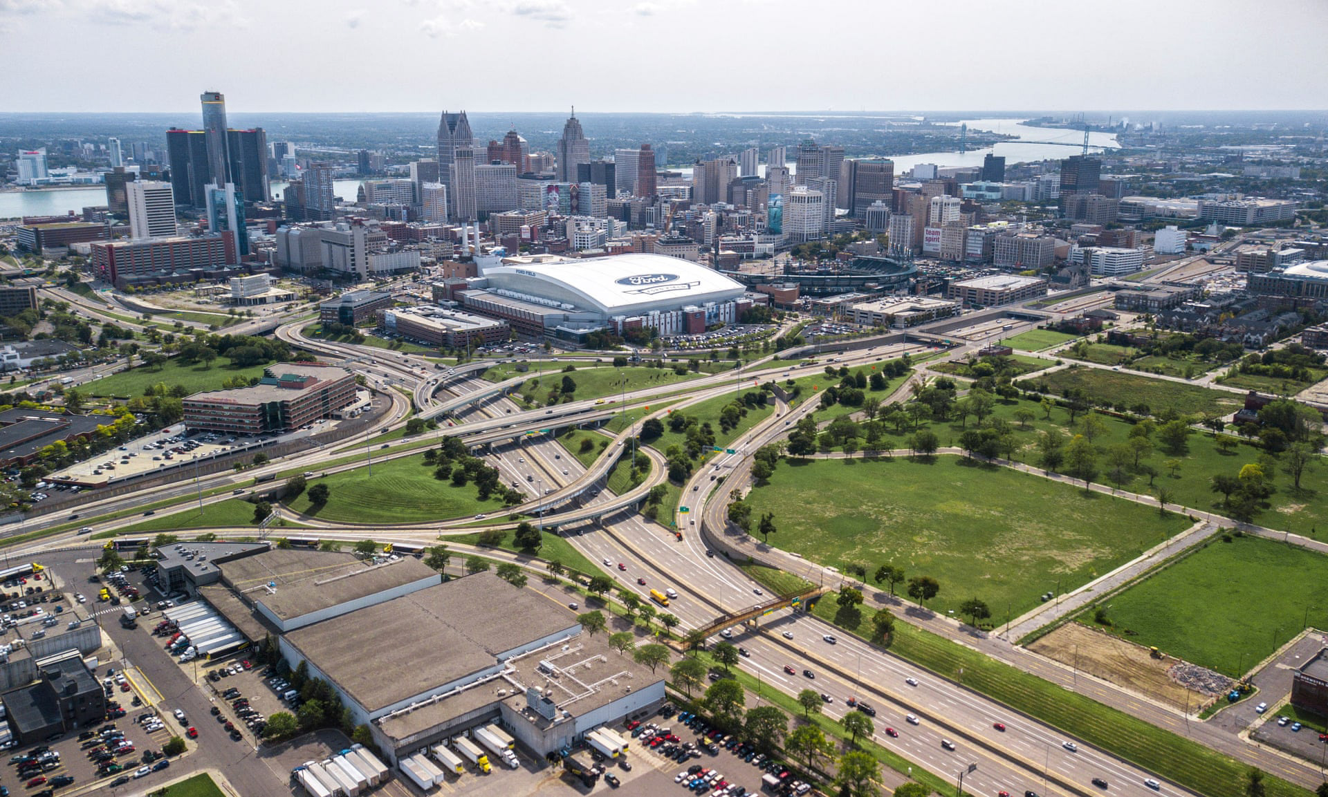
The I-75/I-375 interchange sits where Black Bottom used to be. Large areas surrounding the road, which used to house thousands of black families, are now empty fields.

aerial image of detroit streets

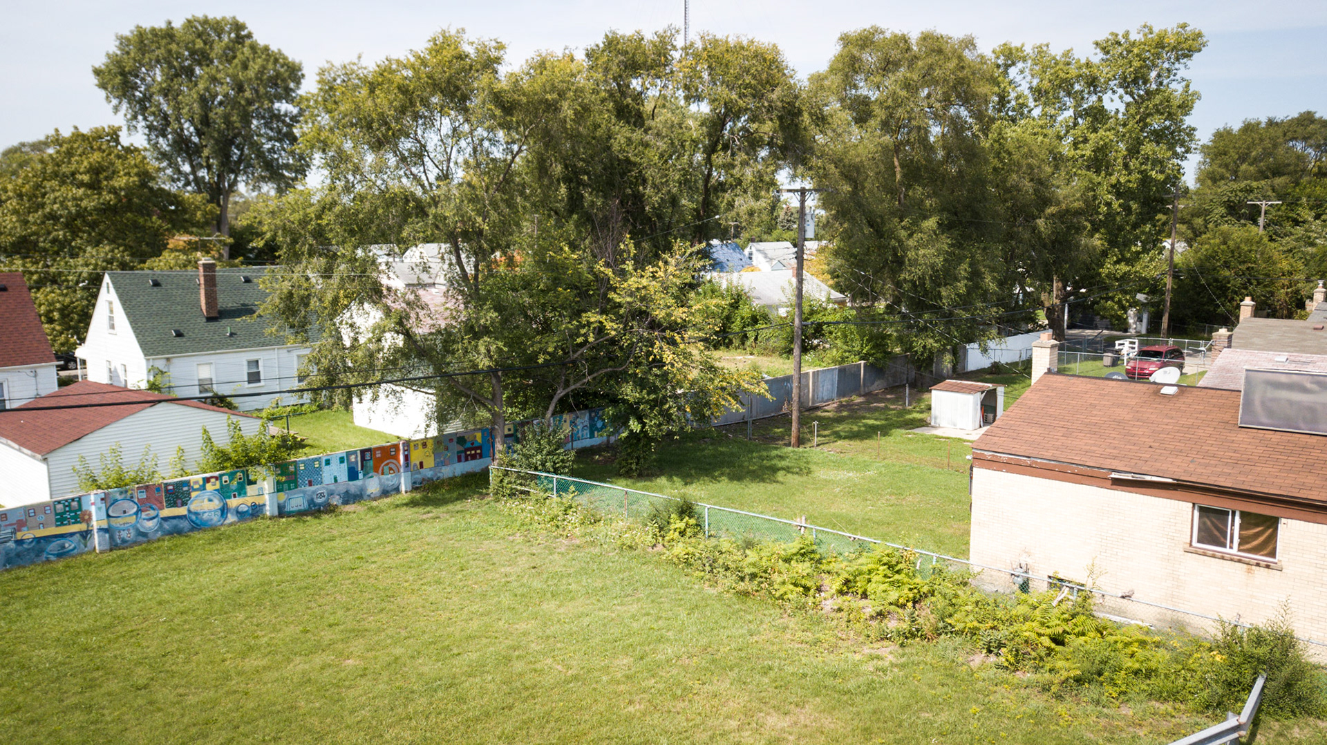
A colorful mural stands at the site of the 1967 Detroit riot, alongside a road now known as Rosa Parks boulevard. “Murals in the community provide a perfect platform to welcome new and returning Detroit families to the city" writes Hubert Massey, the artist, "and to expose them to more than 50 years of history."

Factory Cities
Once the forge of American prosperity, Michigan’s cities now bear the scars of industrial retreat. Factories that once roared with promise stand hollow, their rusted frames monuments to a vanished middle class. White flight and redlining carved invisible borders across my family hometowns of Saginaw and Detroit. Flint's decline was immortalized in the film Roger and Me. 
The dream of steady, well-paid work and suburban security curdled into decline, leaving the centers of many Michigan towns a wasteland, some of which are now toxic brownfield sites. Most are now cracked, empty concrete pads. 
aerial image of detroit streets with abandoned buildings

The Highland Park Ford Plant (which the land on the left is part of) was the world's first automobile plant to use a mechanical assembly line, and produced the Ford Model T from 1913 to the late 1920s. Now it's a partially an industrial park, partially a wasteland. 

Flint, Michigan was once a booming auto town. The Buick City factory, now gone, employed more than 30,000 at its peak. 

The former Malleable Iron Plant in Saginaw, which operated for close to 100 years, is now slated to become a county park. 

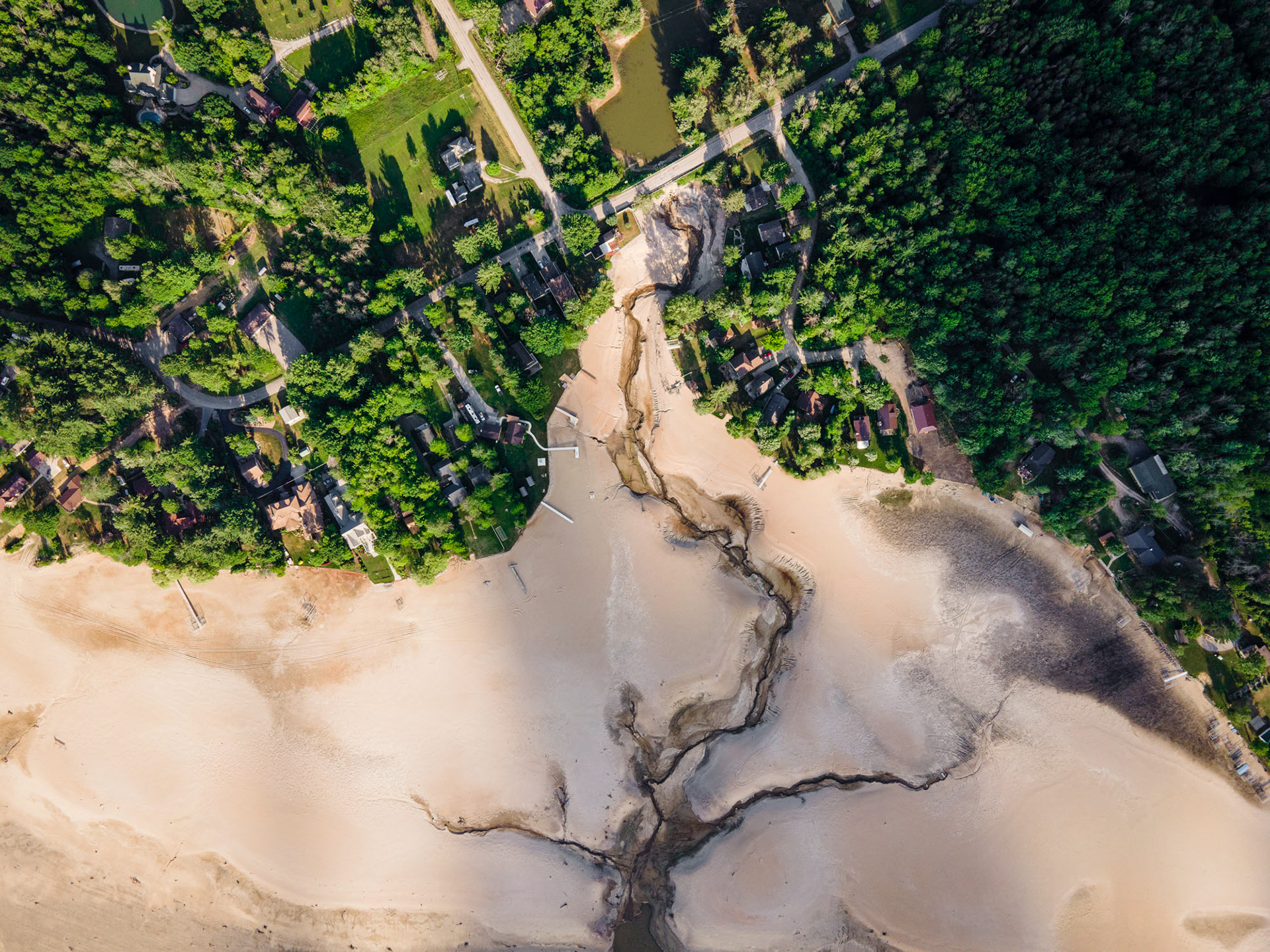
Mismanaged maintenance, coupled with a flood, destroyed two dams in central Michigan in 2020. 

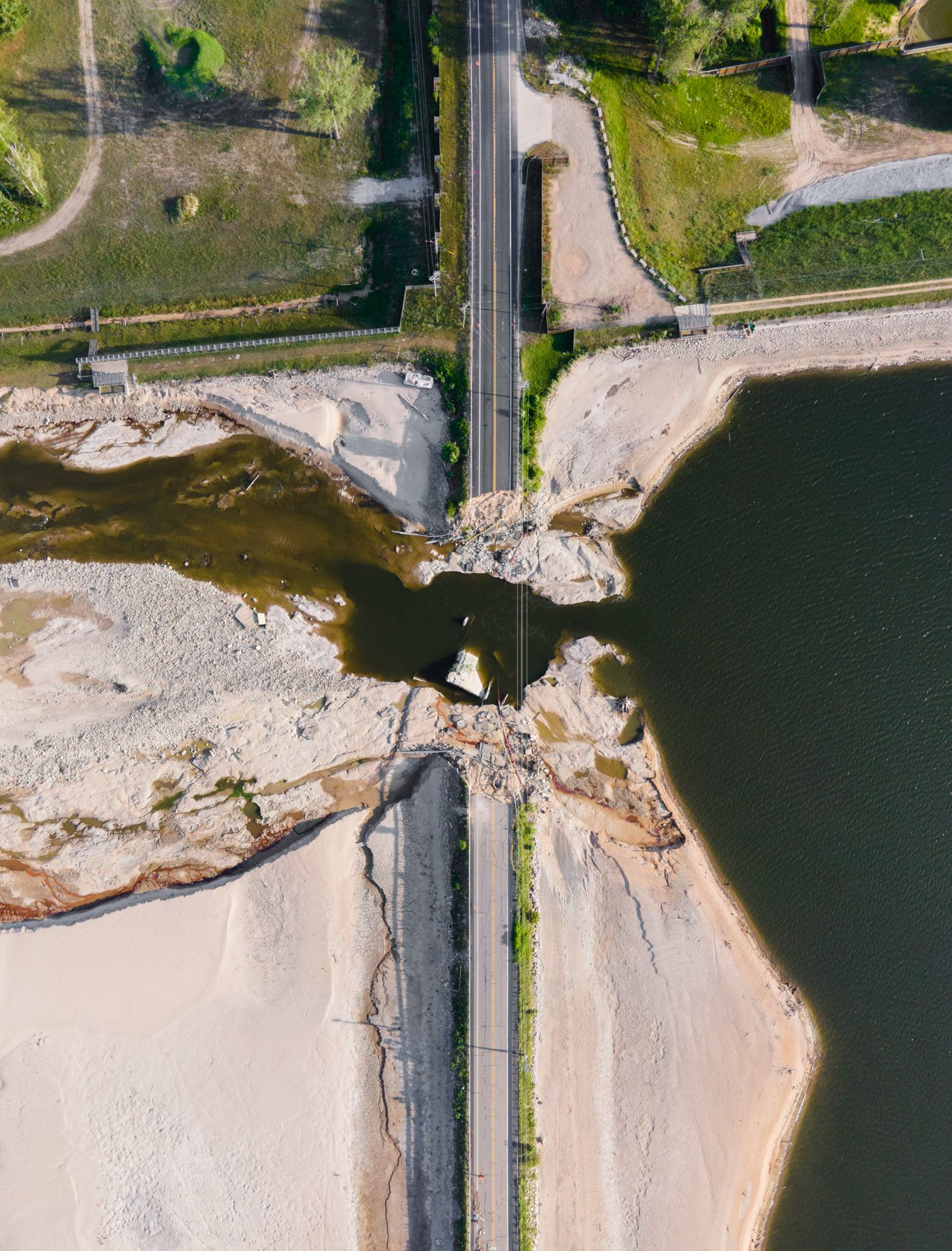
When the Edenville and Sanford dams burst, the floods followed familiar lines—devastating poorer, rural communities left unprotected by decades of neglect and unequal infrastructure investment.

aerial image of detroit streets with abandoned buildings

Jefferson Chalmers, while billing itself "one of the safest neighborhoods in Detroit", still struggles with blight, including this closed elementary school just blocks from Alter Road. 

You may also like

Back to Top