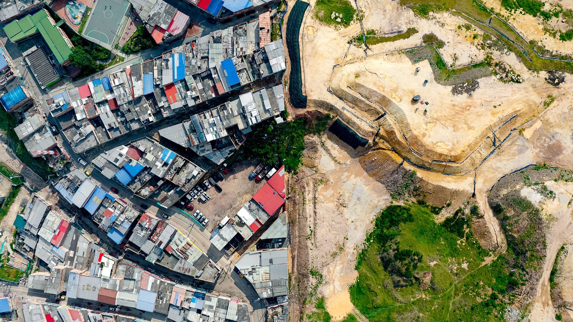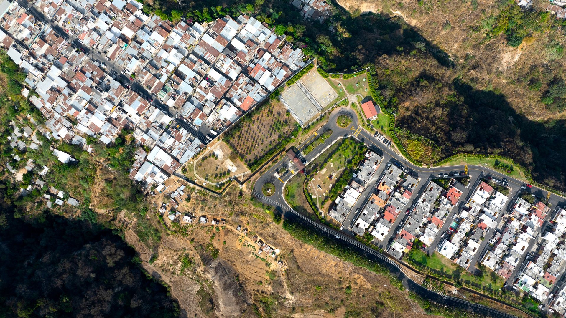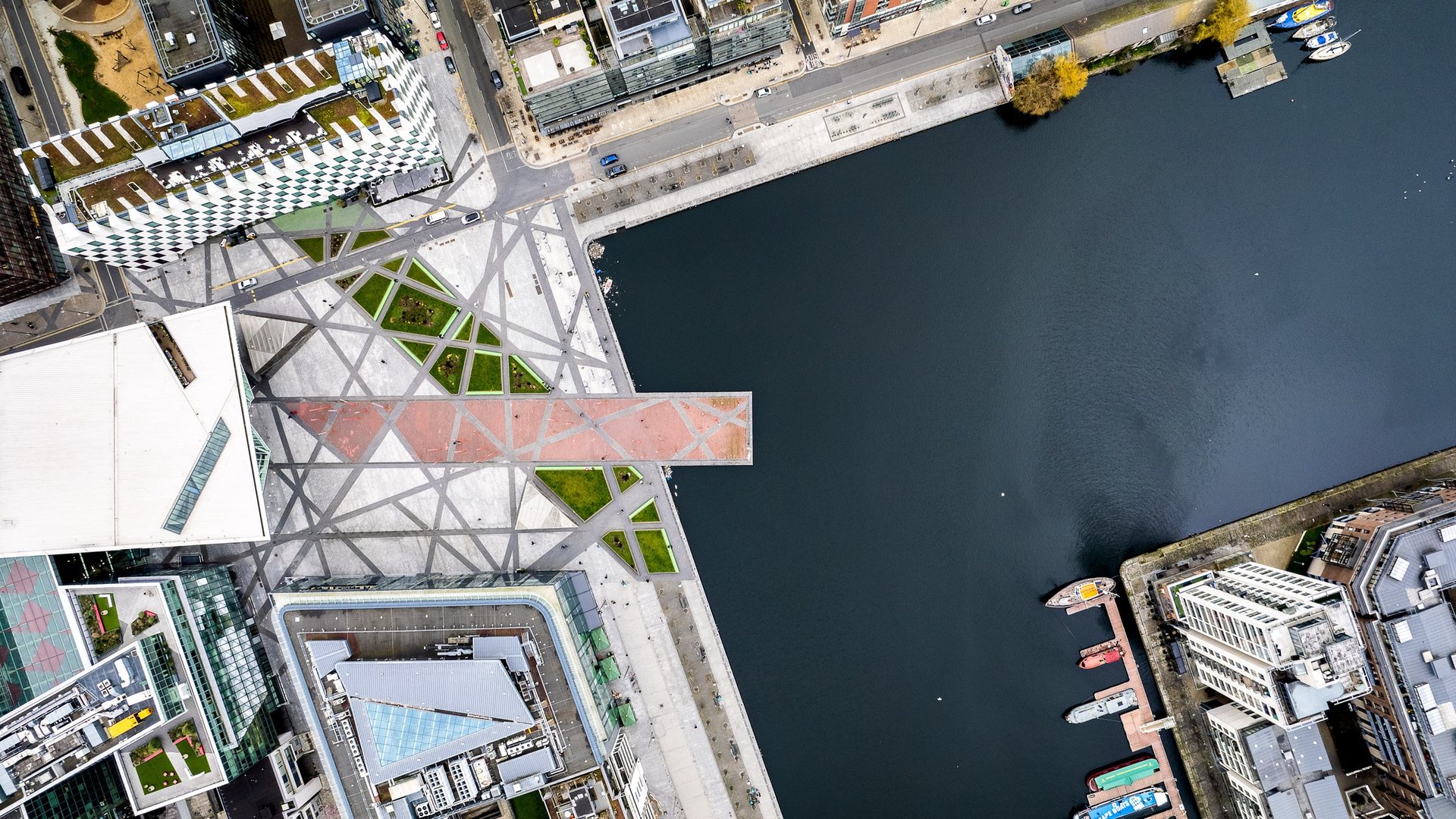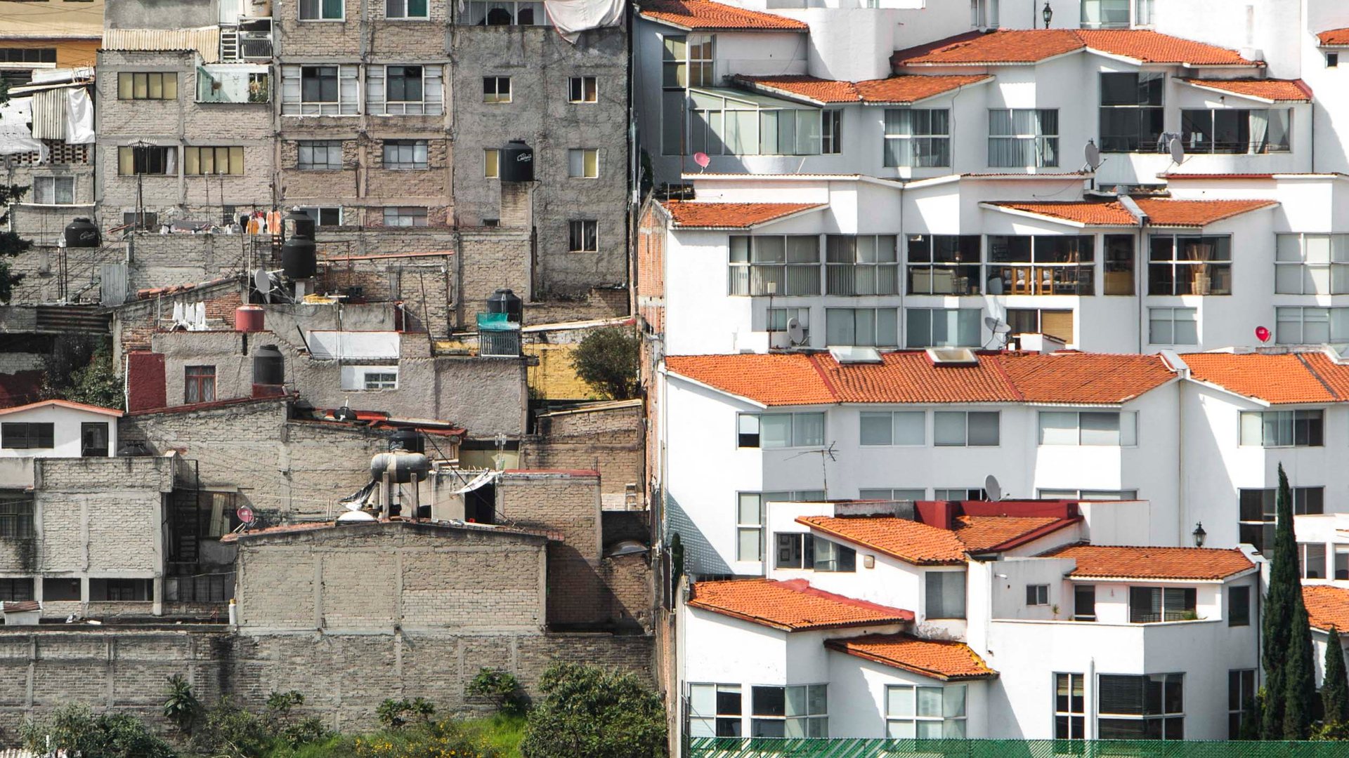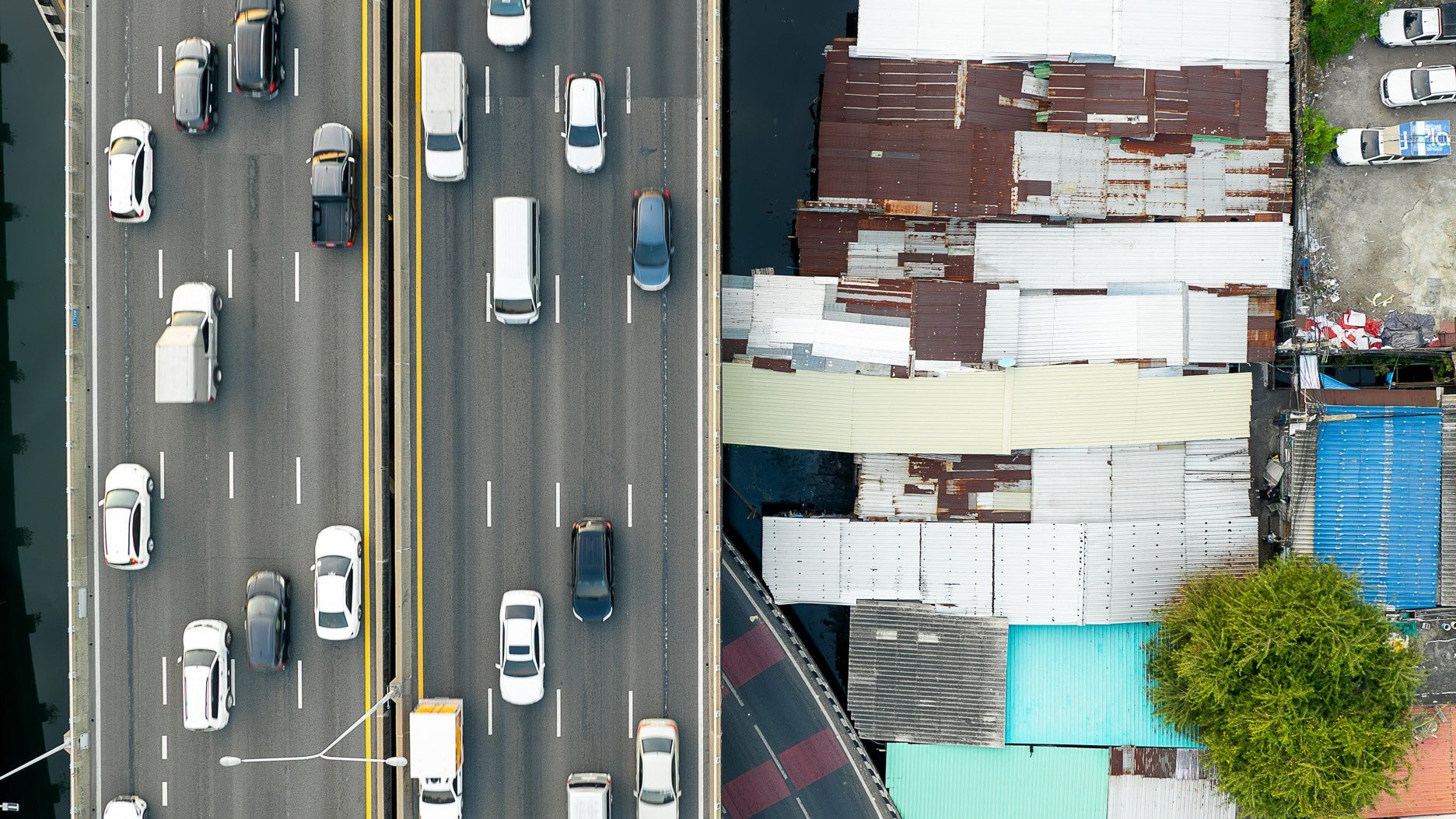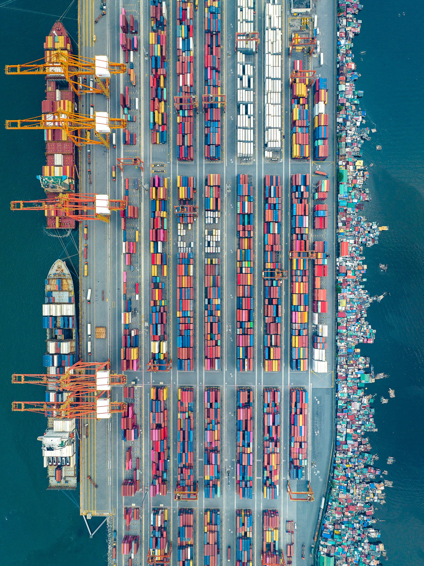
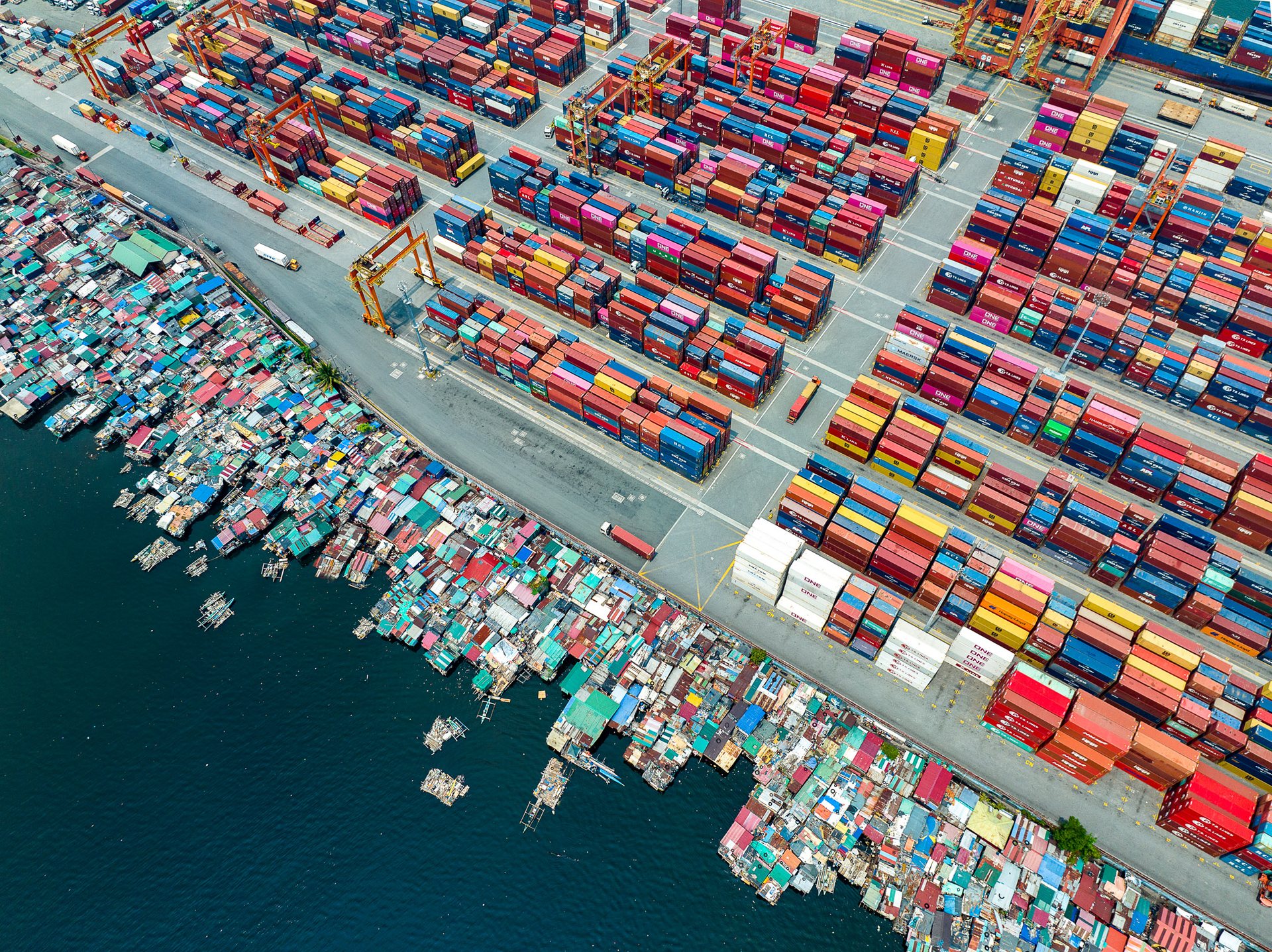
Aerial view of the Port of Manila, Philippines, showing neatly arranged shipping containers alongside floating informal settlements, highlighting inequality in urban logistics zones.

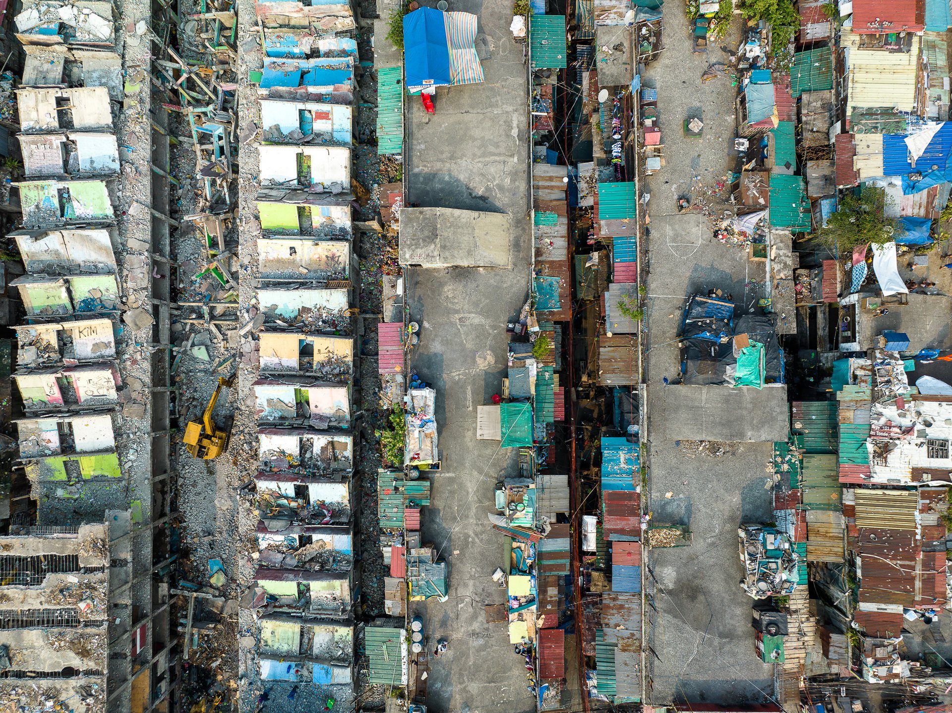
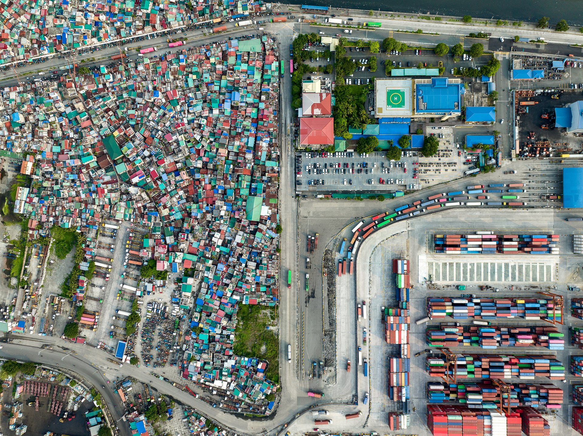
In Tondo, Manila's largest and most densely packed slum district, the container terminals of the Port of Manila press right up against Isla Puting Bato, whose shacks stand on stilts above Manila Bay. The name means White Rock Island; older residents remember when the water here ran clear. Many work the piers, unloading the cargo that towers over their roofs. The bay is among the most polluted in the country, and the settlement is marked for clearance. Fire is constant: in November 2024, a blaze tore through roughly 1,000 homes and displaced some 8,000 people.

Welcome to Manila, the sprawling capital city of the Philippines. Home to over 13 million people, this city is the epitome of contrasts, where towering skyscrapers shadow humble shanties, the wealthy minority lives alongside the majority living in poverty, and modern architecture coexists with dilapidated buildings. This dynamic mosaic paints a stark picture of the socioeconomic and environmental inequality that pervades Manila. 
This has led to what Commoner calls the "deeply questionable mismatch of real living conditions against the supposed energy of our economy that has been spoken of for many years".
___________________________________________
See nearby cities in Asia such as Bangkok and Jakarta.
Drone image of Bonifacio Global City (BGC) and Makati in Metro Manila, where luxury skyscrapers and planned urban infrastructure sharply contrast with densely packed informal housing.

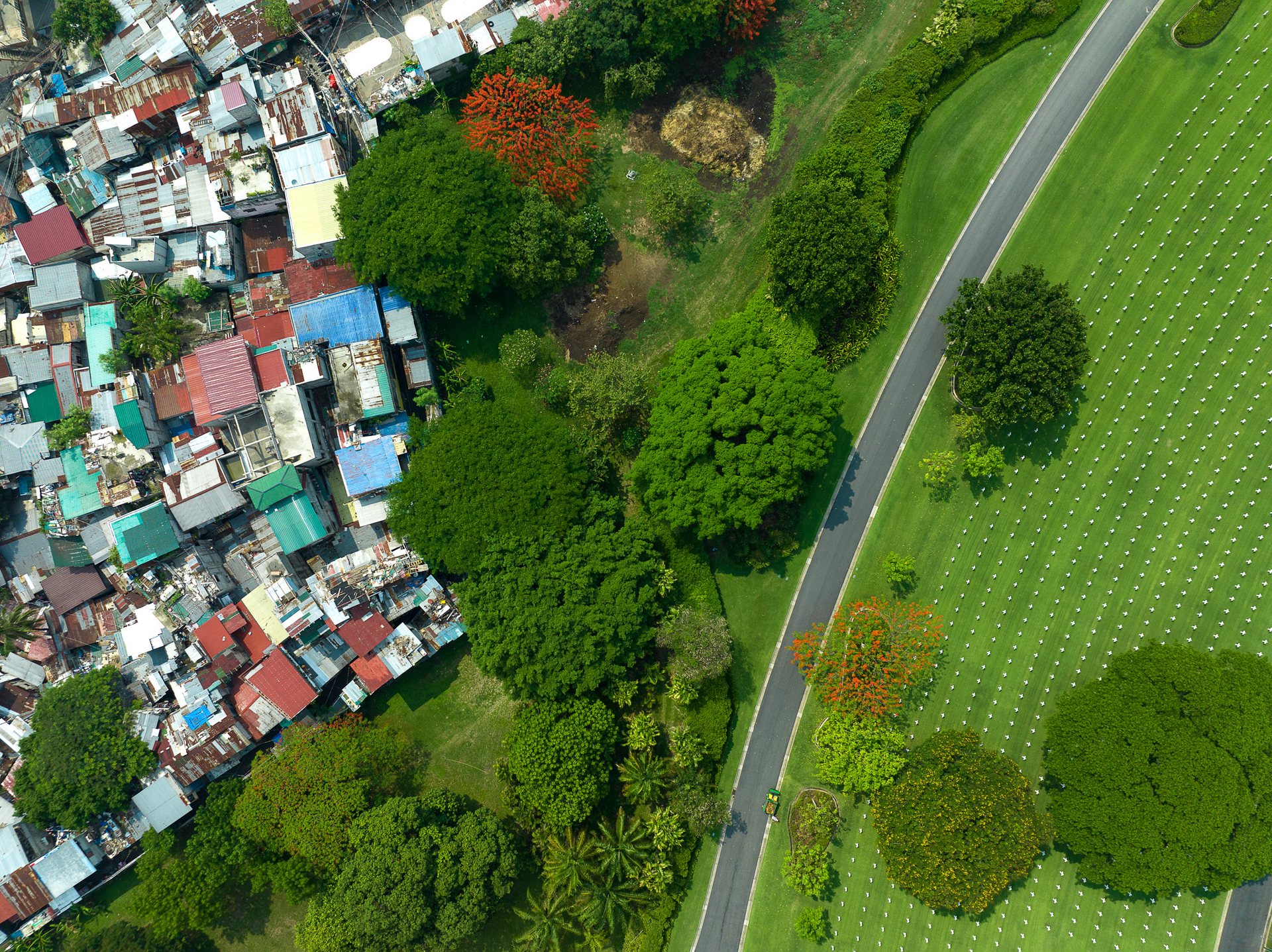
The dense rooftops of Pembo, one of the Enlisted Men's Barrios built for Filipino soldiers sits across a highway from the towers of Bonifacio Global City (BGC), one of Manila's richest areas. Both were carved out of Fort McKinley, a US Army Base, and the Manila American Cemetery where more than 17,000 American war dead from the Second World War still exists (bottom of the image). 

Overhead image of a low-income neighborhood in Metro Manila nestled between the Manila American Cemetery and Bonifacio Global City, highlighting stark urban inequality.

A low income part of Pembo sandwiched in between Bonifacio Global City, or BGC and the Manila American Cemetery and Memorial.
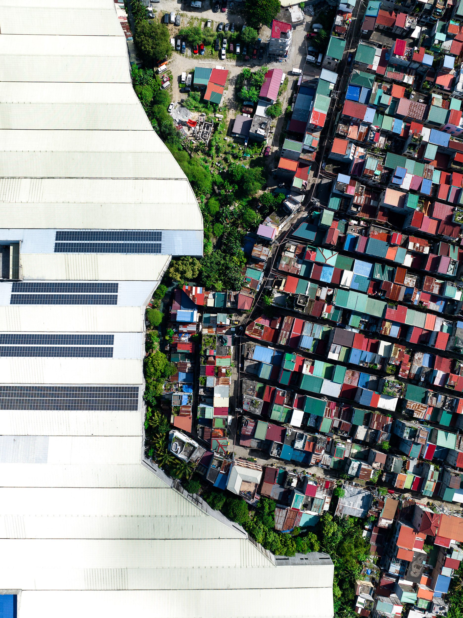
Aerial photograph showing warehouse roofs bordering a dense informal community on the outskirts of Metro Manila, near the boundary with Central Luzon.

Valenzuela is part of Metro Manila's northern industrial belt, a dense grid of factories and warehouses that supply the capital. The work behind these walls is often informal, low-paid, and dangerous. In May 2015, a few kilometres east of here, fire swept through the Kentex factory, which made cheap rubber slippers for the local market. More than 70 workers, most of them women, died trapped on the second floor behind barred windows, with no proper exits. 
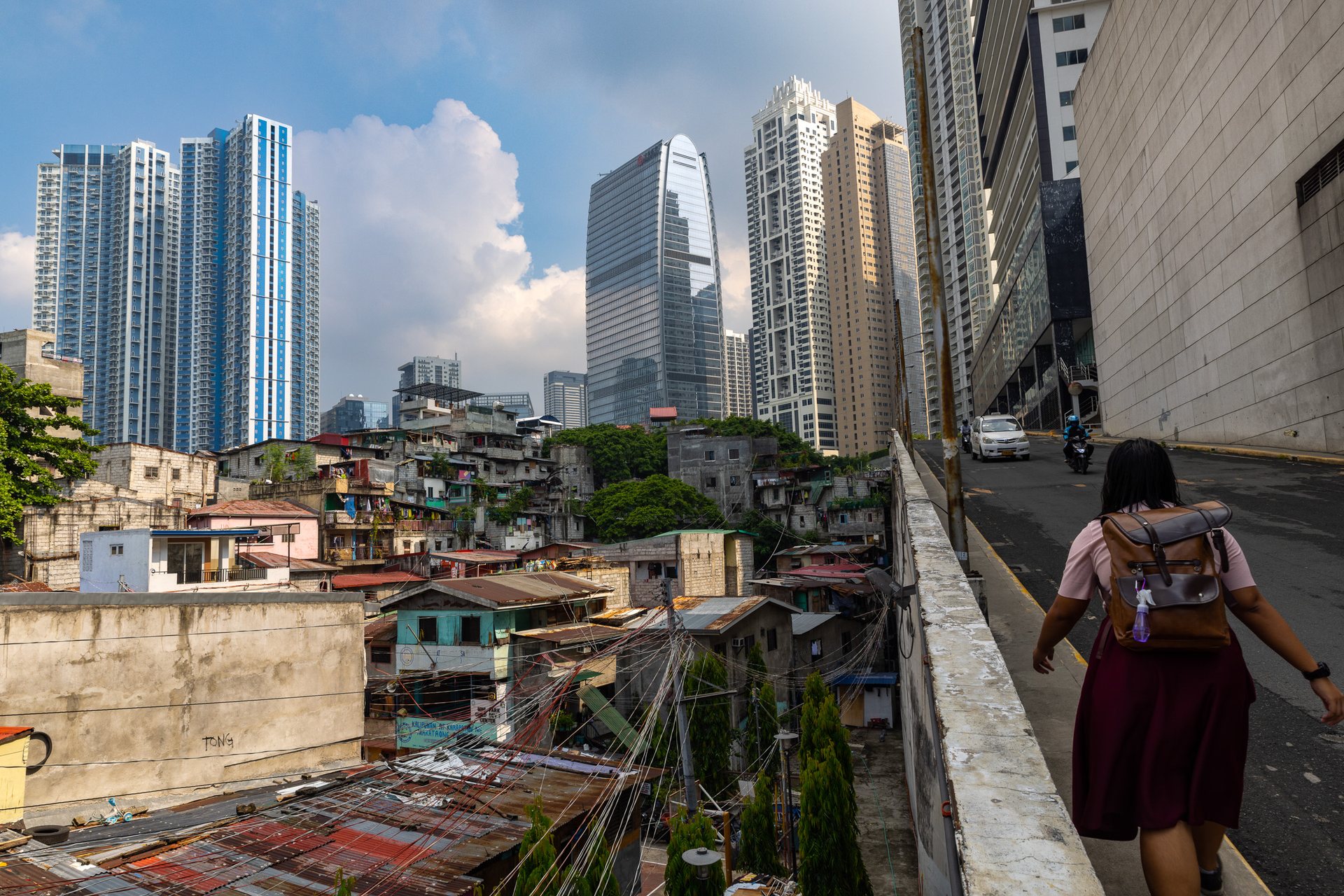
Contrasting cityscape in Manila with a woman walking through an alley bordered by high-rise towers of Bonifacio Global City and informal housing – capturing proximity of wealth and poverty.

The towers of BGC gleam in the distance, an impossible dream for the residents in the low income neighborhoods next door.
As the city expands, the urban environment grows haphazardly and inconsistently. This has given birth to a unique architectural panorama; on one hand, there are upscale condominiums, futuristic office buildings, and state-of-the-art shopping malls. On the other; large informal settlements, known locally as 'barung-barungs', marked by squalor and congestion.
Manila's urban landscape mirrors the city's socioeconomic disparity. The architectural contrast between gleaming glass towers and makeshift shanties reflects the wealth gap. The fact that these structures often stand only meters apart from each other emphasizes the stark segregation of wealth and opportunity in the city.
On one hand, the city's architectural boom provides opportunities. It has spurred economic growth, attracting investments and creating jobs. High-end commercial and residential developments cater to the growing middle and upper classes, and international investors. This scenario is also transforming Manila into a cosmopolitan city, with world-class hotels, restaurants, and shopping malls.
However, the current trend of urban development also exacerbates inequality. The real estate boom has primarily catered to the upper class and expatriates, leading to a rising demand for luxury condos and gated communities, such as in BGC and Makati. This not only widens the economic divide but also the spatial divide between the rich and poor. Additionally, these developments often displace the city’s poorest residents, who are then pushed towards the periphery of the city or into already crowded informal settlements.
Efforts have been made towards inclusive urban development, but these are often overshadowed by the pace of rapid urbanization. The demand for affordable, secure housing far outstrips the supply, underlining the urgency for sustainable and inclusive urban planning strategies.
Top-down drone image of Manila showing a tightly packed informal neighborhood adjacent to a major shipping yard, bisected by a road filled with truck traffic entering the port.

Heavy truck traffic is constant, with the port entrance accessible via the the road which bisects the adjacent neighborhoods. 
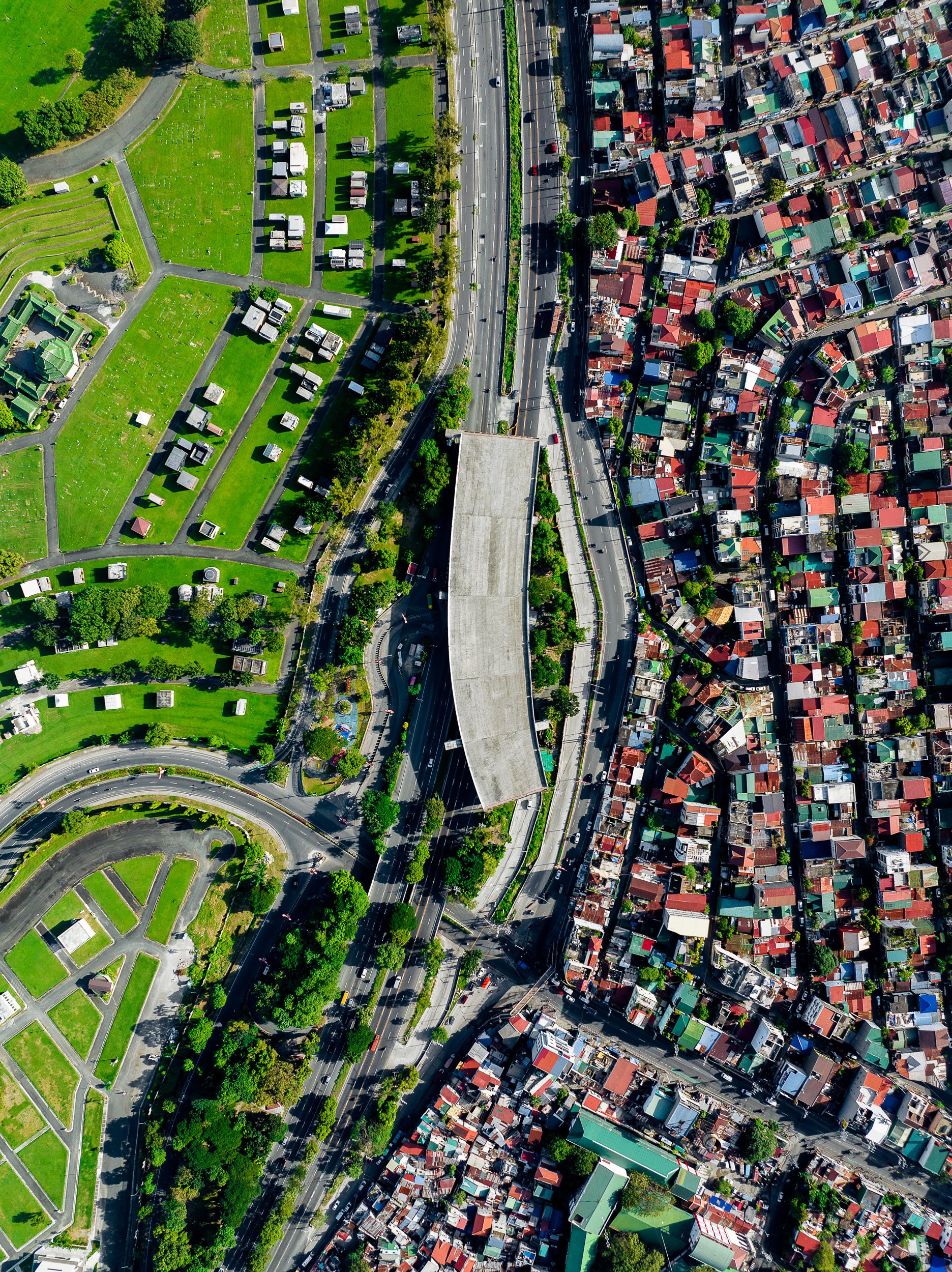
Aerial photograph of Manila showing a highway dividing a cemetery with green lawns and orderly plots from a high-density urban residential neighborhood with narrow winding streets.

The first pieces of the infrastructure needed to connect the new Skyway 4 express highway with Arca South are being laid. Some of the worst traffic in the world is in Manila, with a population projected to hit 38 million by 2035.

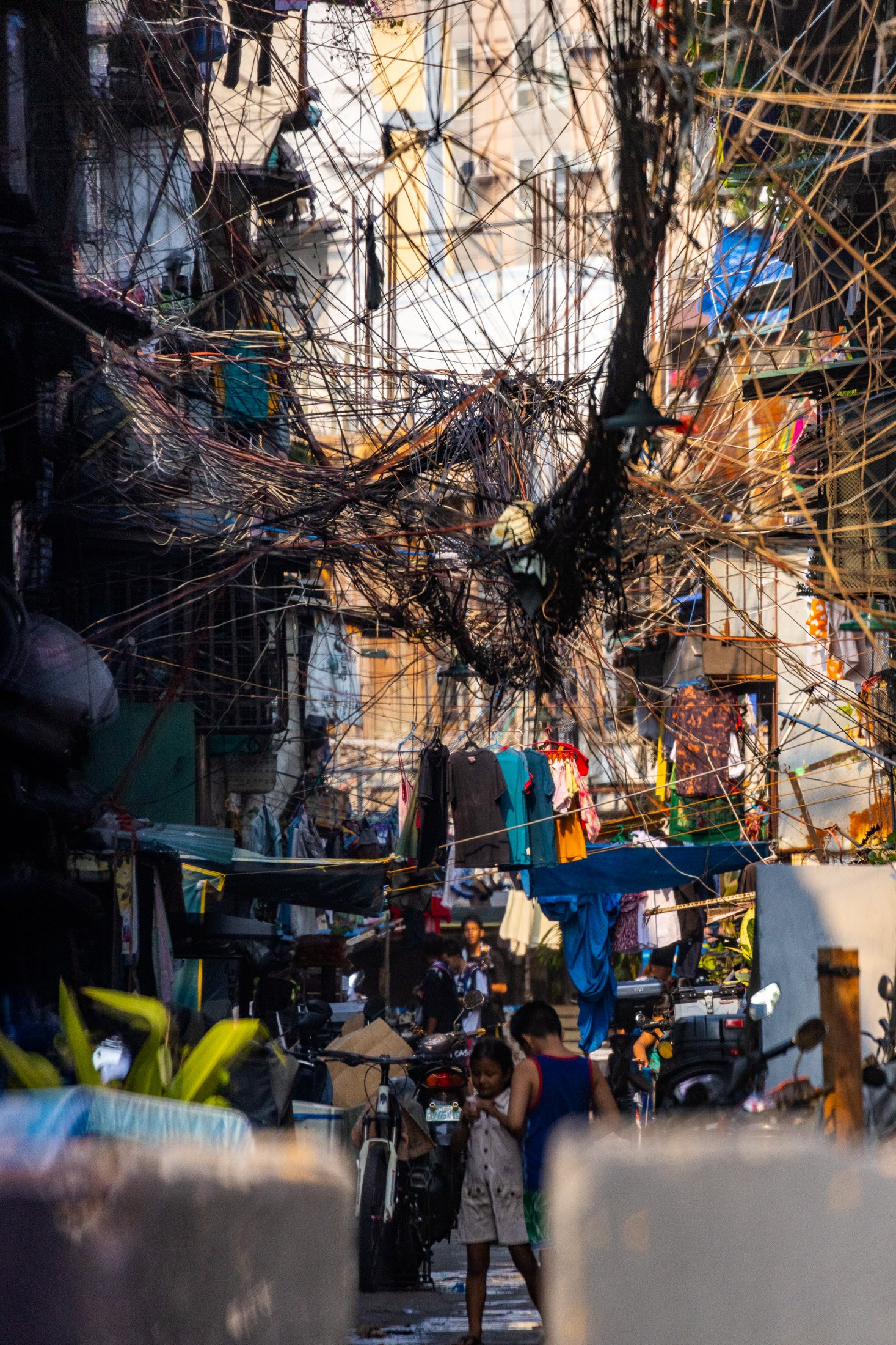
Electrical cables hanging above streets near the Port of Manila that locals call "Spaghetti".
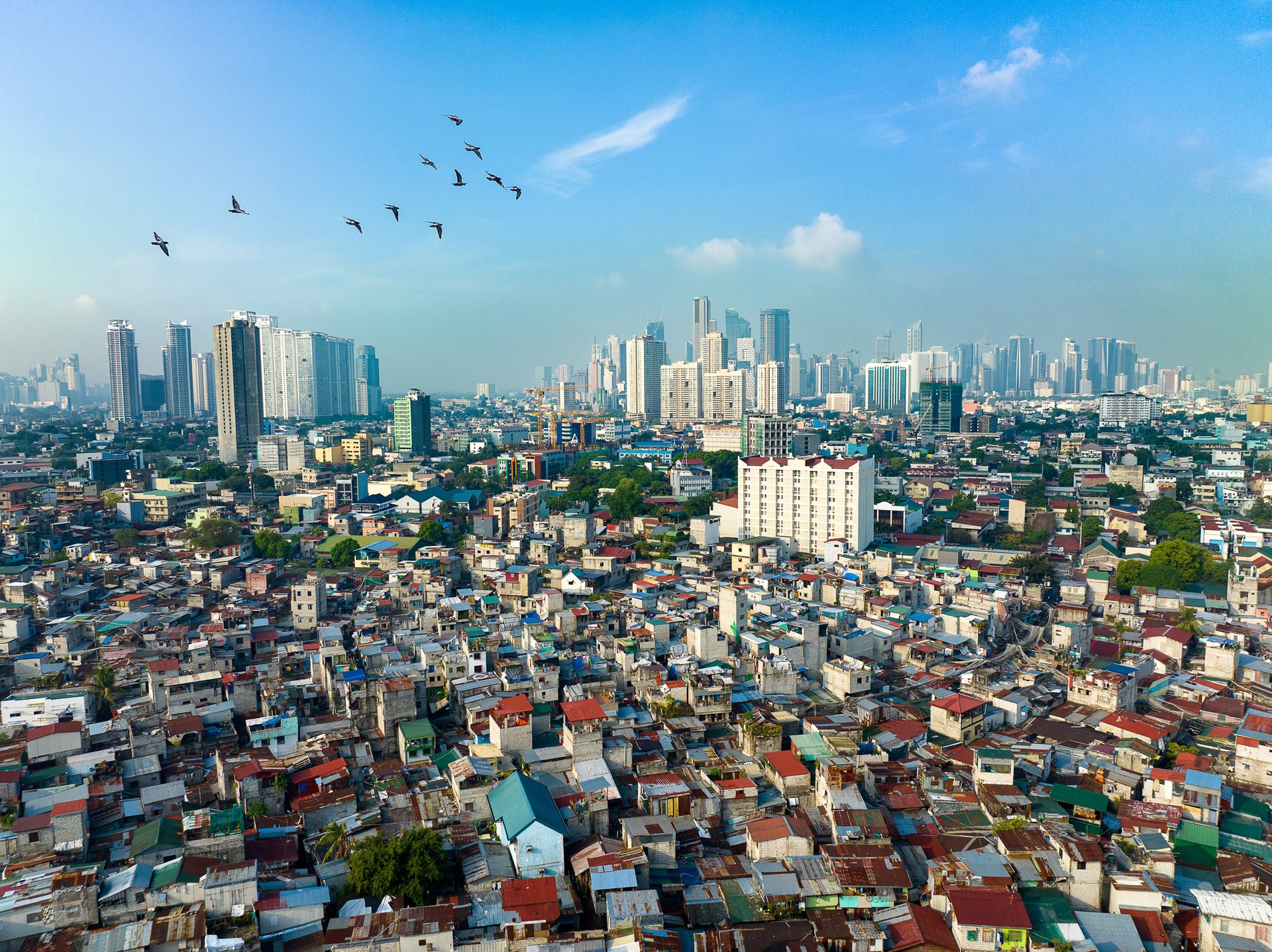
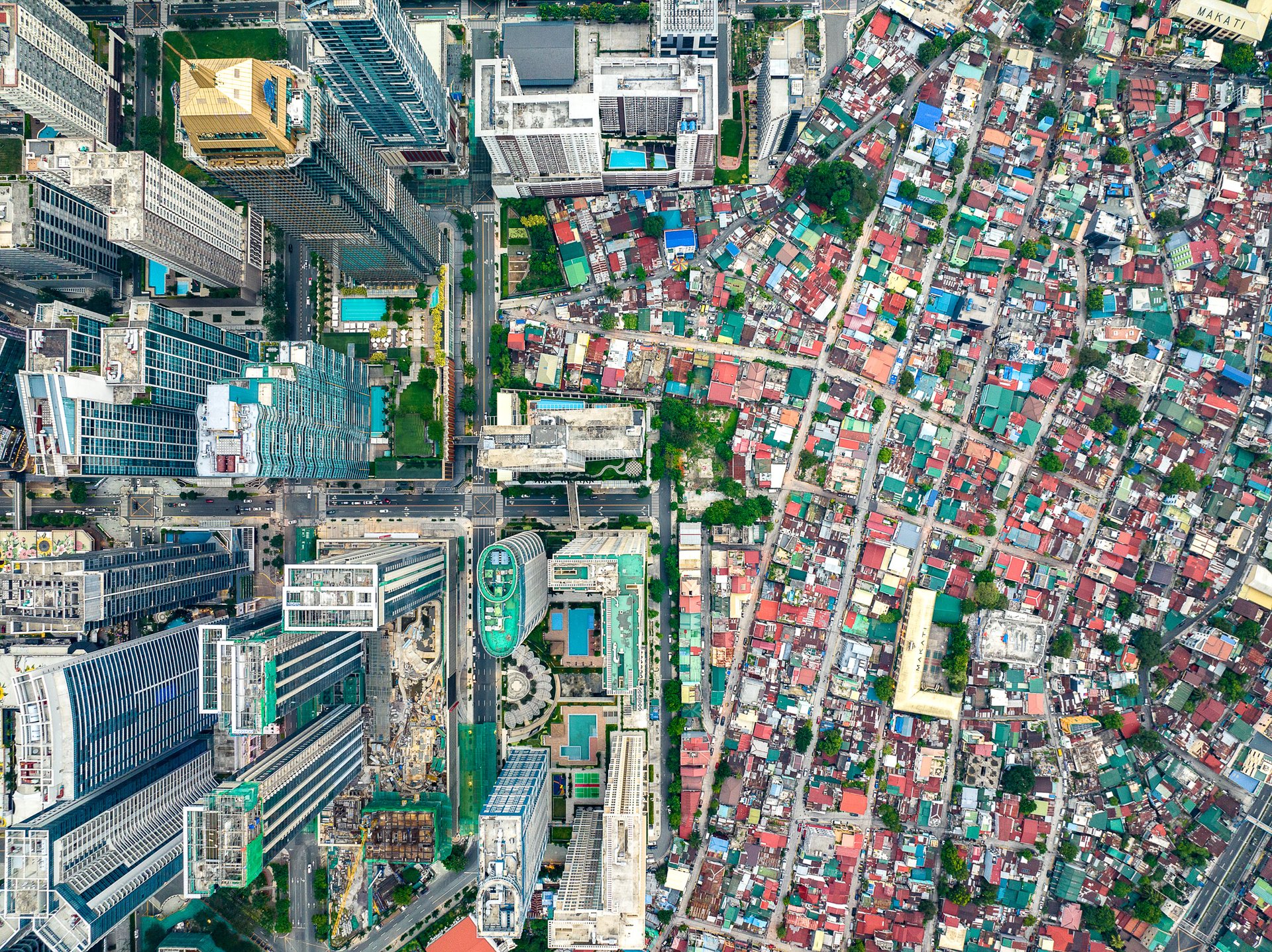
Aerial view of Mandaluyong’s dense housing with Makati skyscrapers in background, showing stark inequality.

Mandaluyong, looking toward Makati.

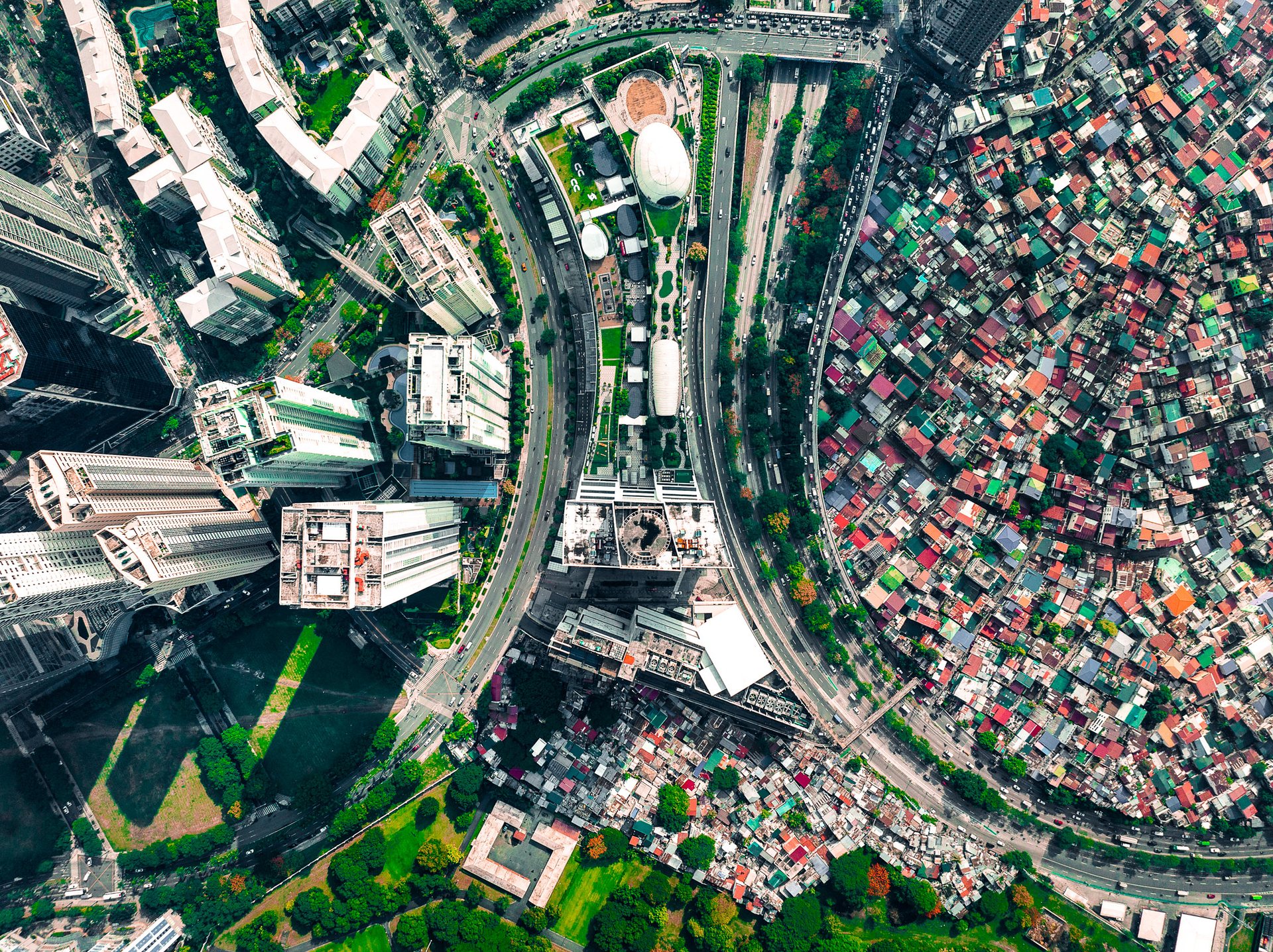
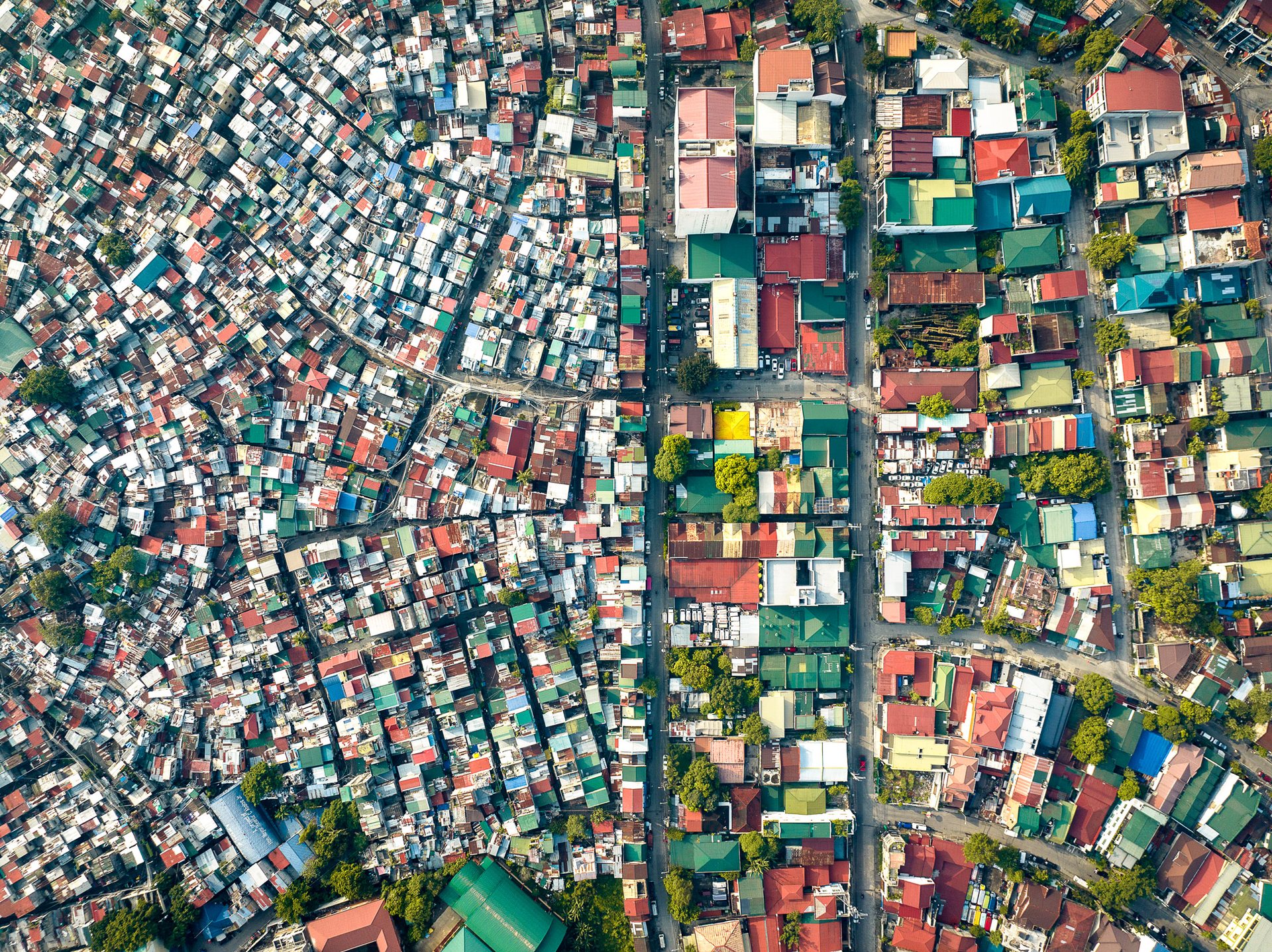
Drone view of Manila showing gleaming skyscrapers of Bonifacio Global City (BGC) standing in stark contrast to the adjacent lower-income South Cembo neighborhood with compact housing.

In Taguig, the gleaming towers of Bonifacio Global City rise beside the dense, low rooftops of South Cembo. Both sit on the same former military base, Fort Bonifacio. One part was sold off and built into BGC, now one of Metro Manila's most expensive business districts. The other remained South Cembo, a barrio first built for enlisted soldiers and their families.
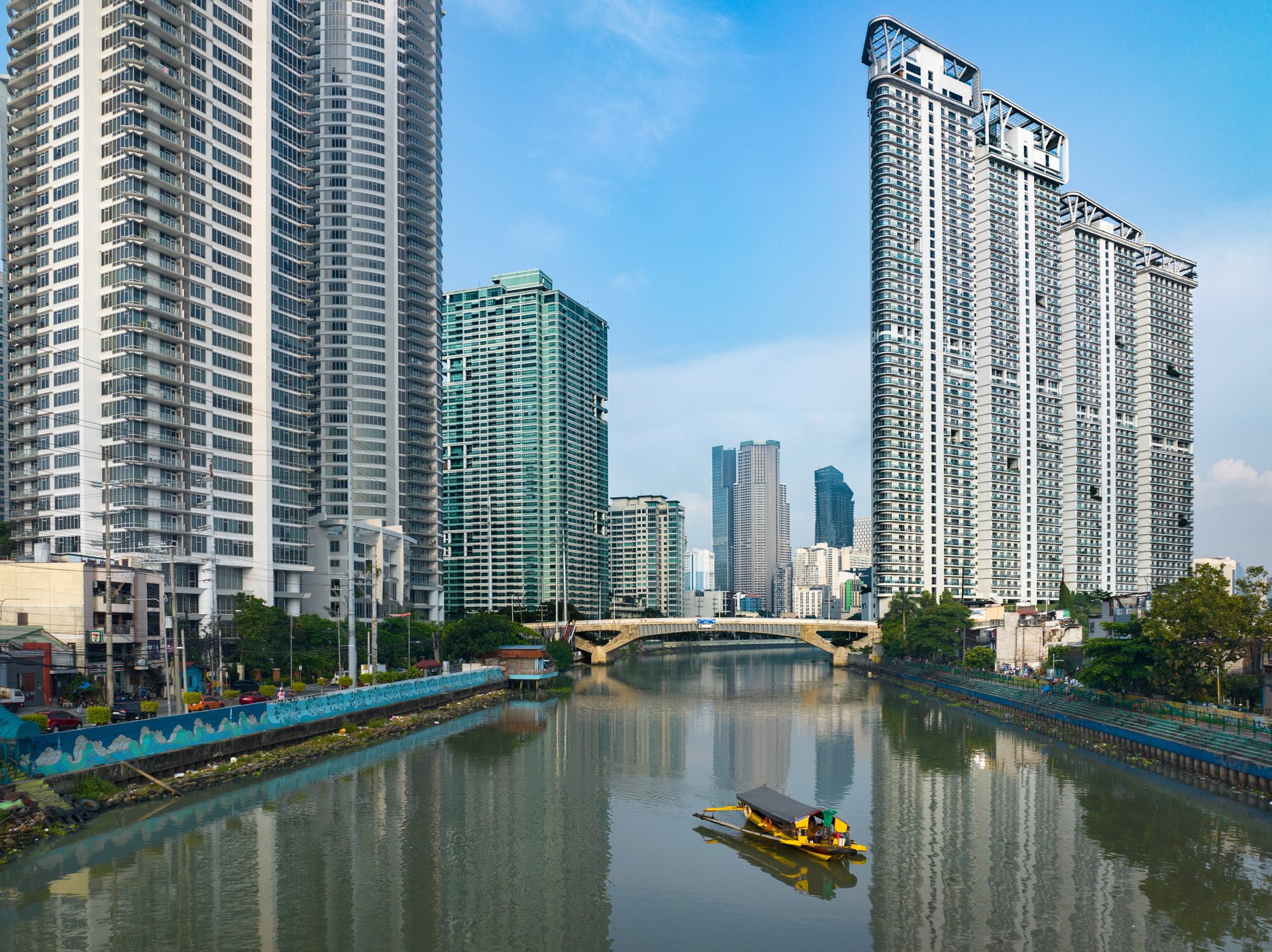
Photo of an informal ferry crossing the Pasig River in Manila, with modern high-rise towers of Makati in the background – highlighting disparities in transportation access.

An informal ferry transports residents across the Pasig River to the gleaming towers of Makati.
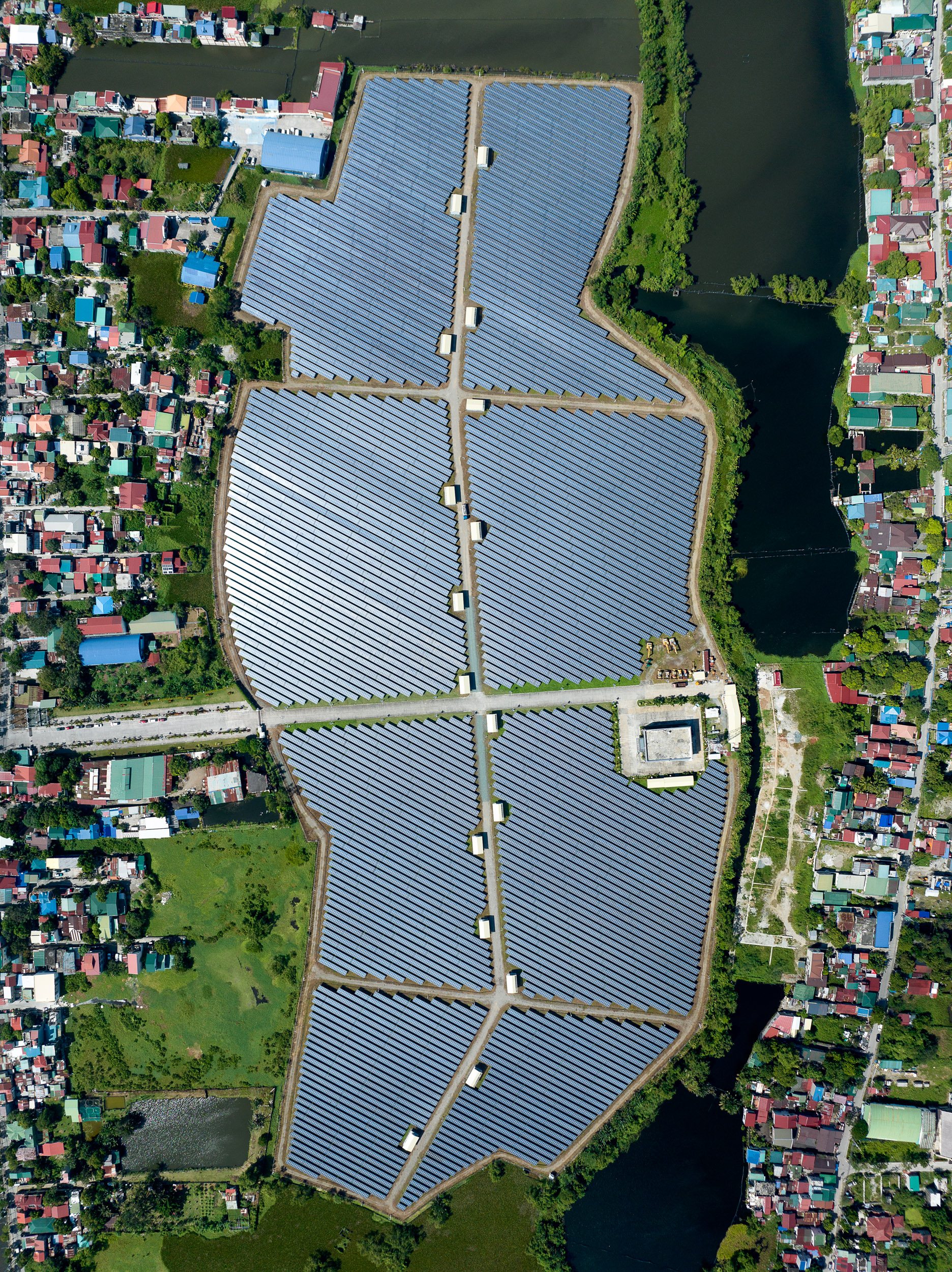
A solar power installation in the neighborhoods to the north of the city.
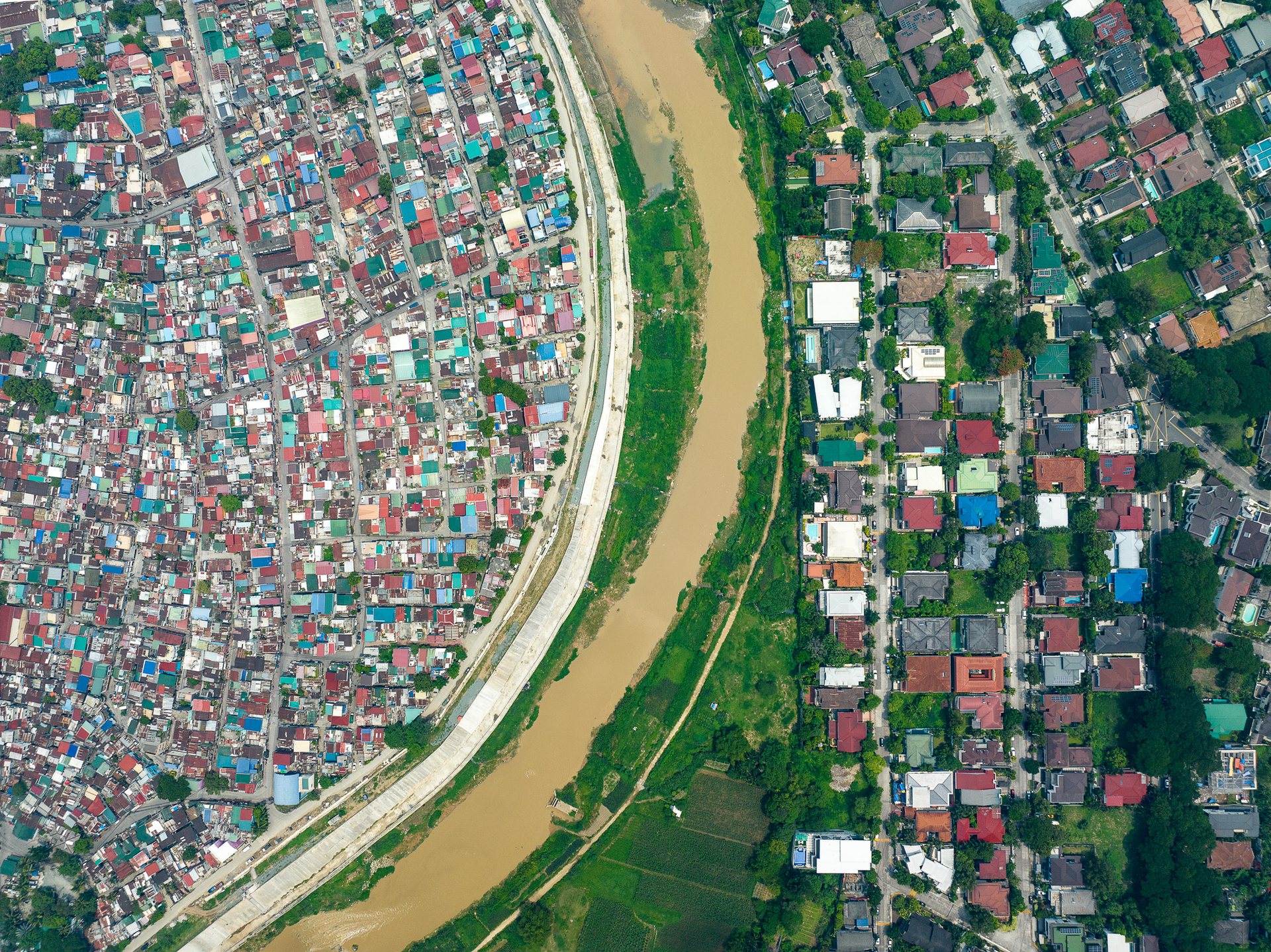
Aerial view of Pasig River dividing the informal settlement of Malanday from the middle-class neighborhood of Loyola Heights in eastern Manila, showcasing spatial inequality.

The Pasig River divides Malanday from Loyola Heights, in eastern Manila.
Manila's environmental scenario is also a reflection of the inequality it harbors. The rapid urban sprawl coupled with unregulated development and poor waste management has given rise to significant environmental issues. While the affluent can escape the city's polluted air and litter-strewn streets, the poor bear the brunt of these environmental hazards.
Moreover, the city is increasingly vulnerable to climate change. Manila sits in a low-lying coastal region, and informal settlers often live in areas prone to flooding and landslides. The wealthy, on the other hand, reside in areas equipped with better infrastructure and disaster mitigation strategies.
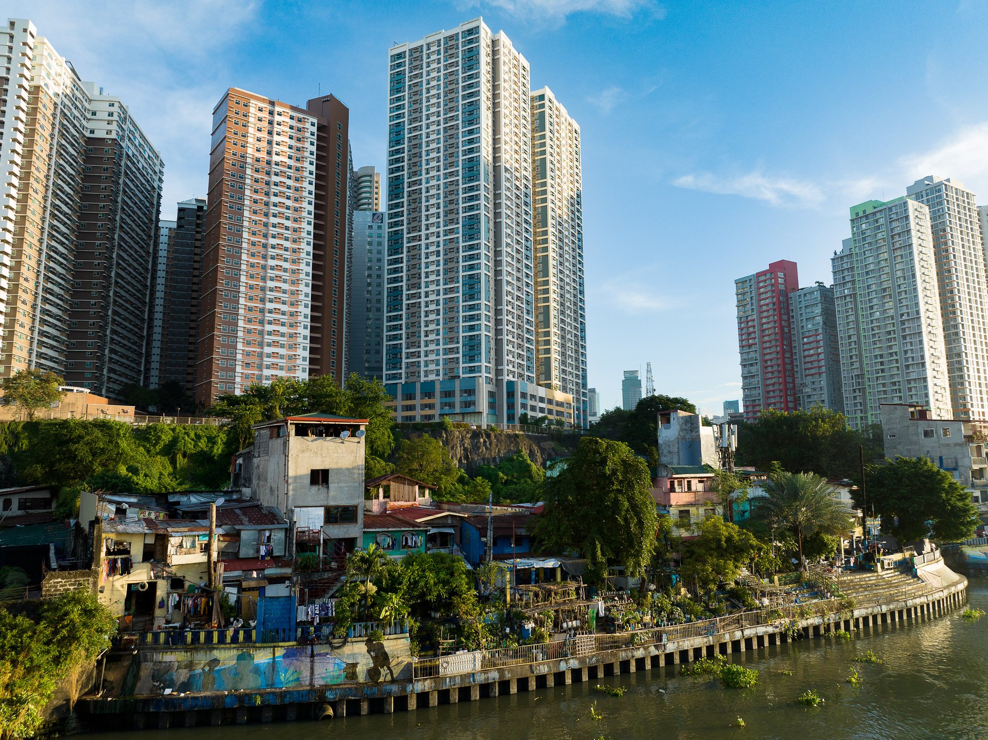
Juxtaposition of gleaming high-rise towers beside informal riverside homes.

Gleaming towers and humble homes line the Pasig river near Guadalupe. 
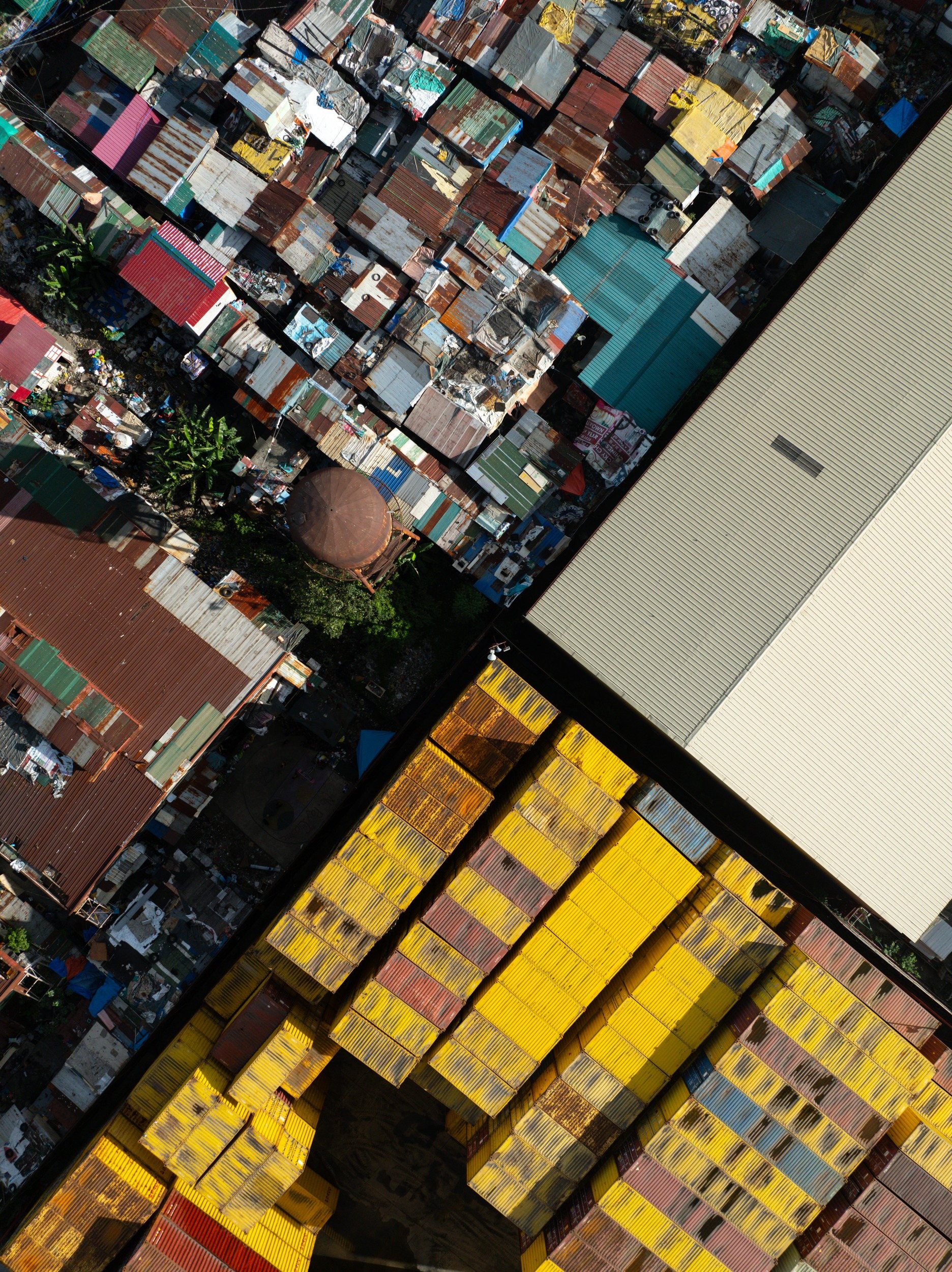
A dense cluster of homes surrounding bright yellow cargo containers at the Port of Manila.

A dense jumble of informality at the Port of Manila. 
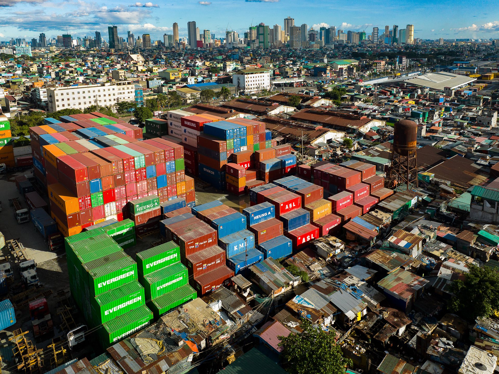
Overhead view of colorful shipping containers stacked beside an informal settlement at the Port of Manila, with Manila's skyline rising in the background.

Informality and industrialism coexist within one unique, symbiotic organism, called the Port of Manila. 
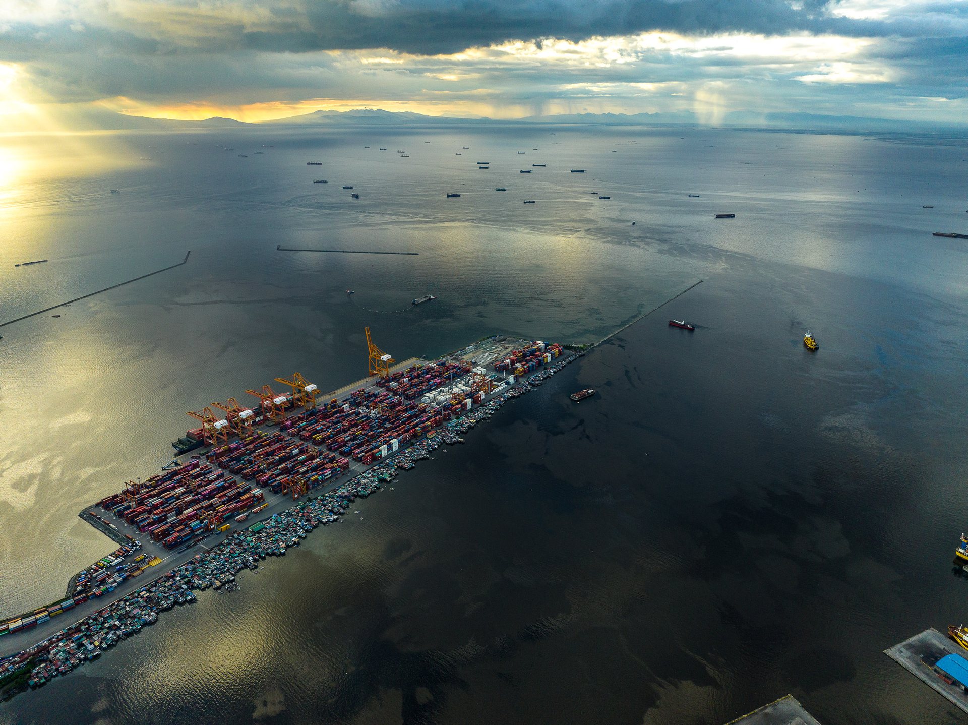
Wide-angle drone view of the Port of Manila at sunset, with container terminals and shipping lanes surrounded by calm water, highlighting nearby informal dwellings on port-controlled land.

The Port of Manila is one of the world's busiest, but that hasn't stopped hundreds of thousands from living in informal conditions adjacent to, within, and on top of Port-controlled land. 
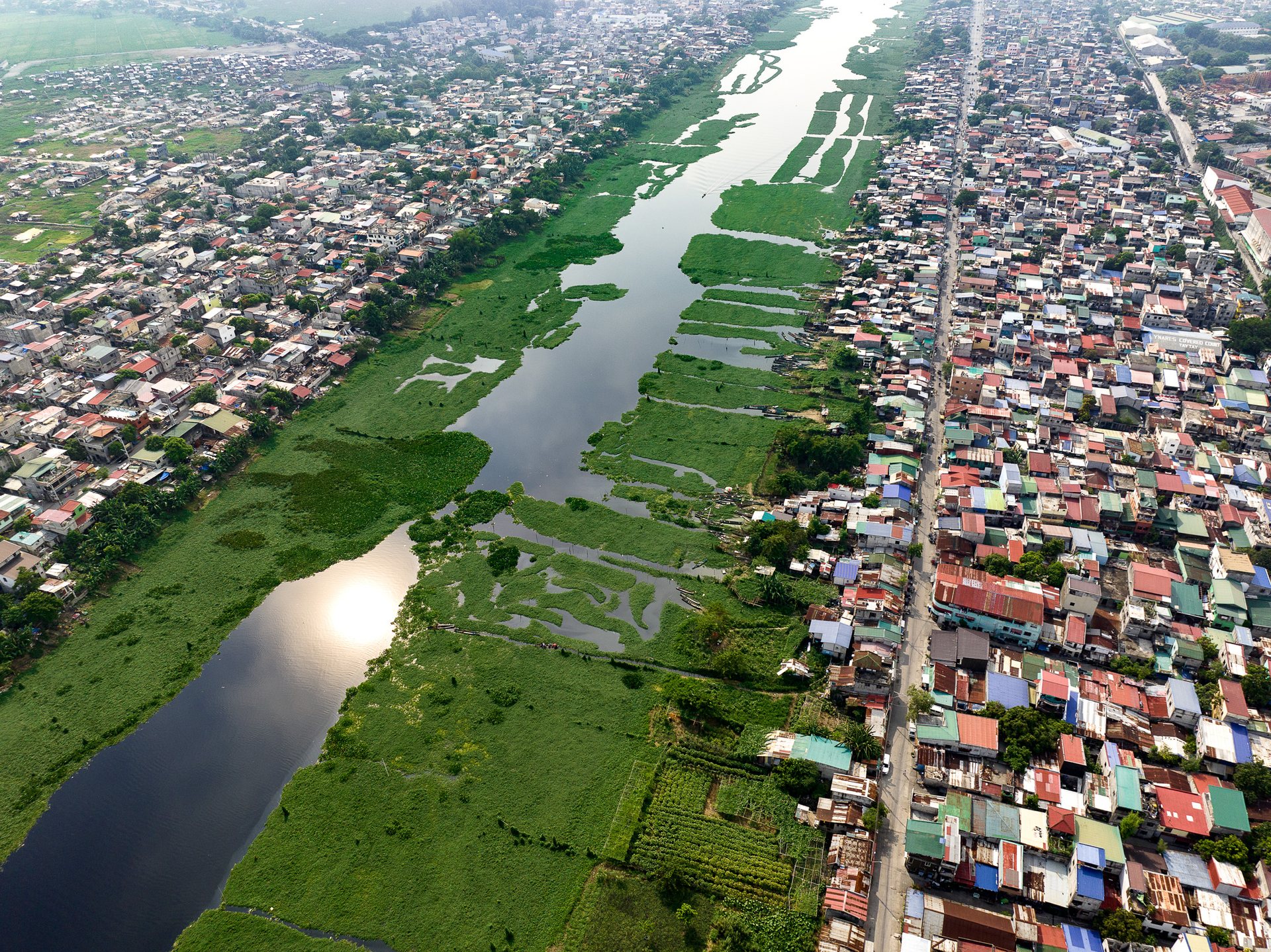
Aerial view of the Manggahan Floodway in Manila, choked with water lilies, dividing densely populated urban neighborhoods on either side.

The Manggahan Floodway, choked with water lilies.

On September 26, 2009, at about 6:00 pm PST, the 50-mph "Tropical Storm Ketsana" (called "Ondoy" in the Philippines) hit Metro Manila and dumped one month's rainfall in less than 24 hours, causing the Marikina River system, including the Manggahan Floodway, to burst its banks very rapidly. It is thought that blocked pipes and a poorly maintained sewer system, along with uncollected domestic waste, were major contributory factors in the speed with which the flood waters were able to engulf the surrounding area. The illegal settlers especially were blamed for flooding since their houses reduce the effective width and blocked the flow of the floodway.
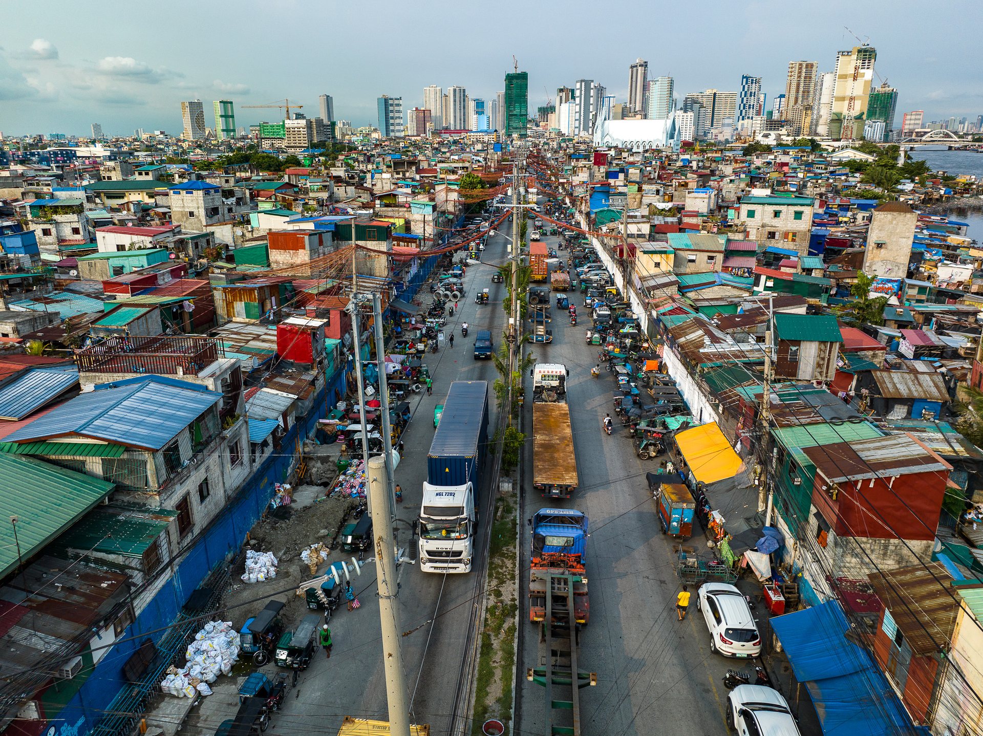
A busy road cutting through informal housing in Manila, crowded with trucks and power lines, leading toward the high-rise skyline in the background.

The road to the port traversed by heavy trucks and endless spaghetti wires.
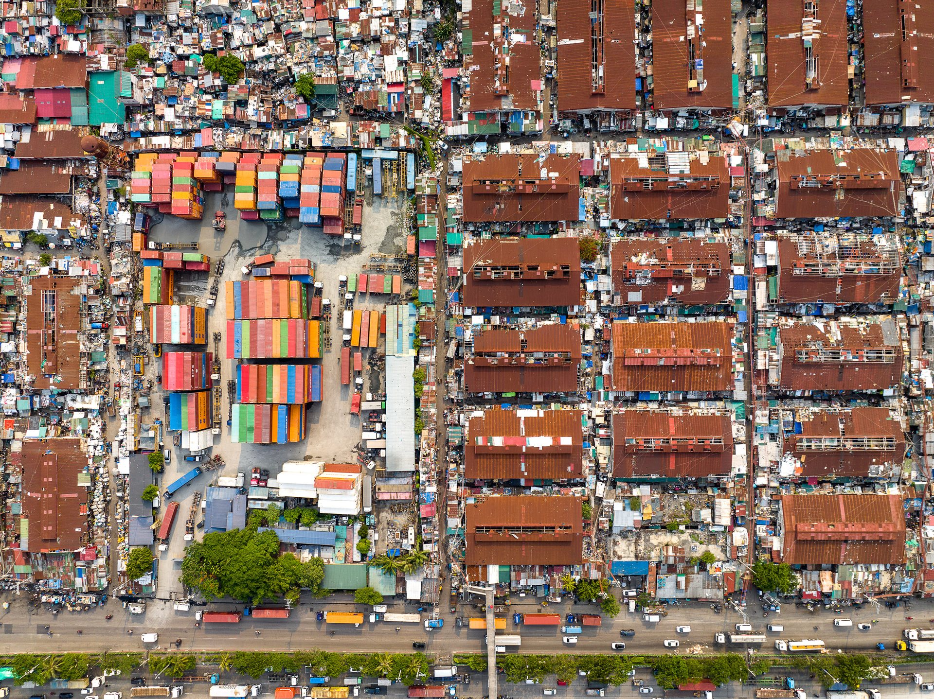
Tightly packed informal housing and cargo containers form a dense, orderly grid near Manila’s port, illustrating extreme spatial congestion.

Extreme crowding near Manila's port.
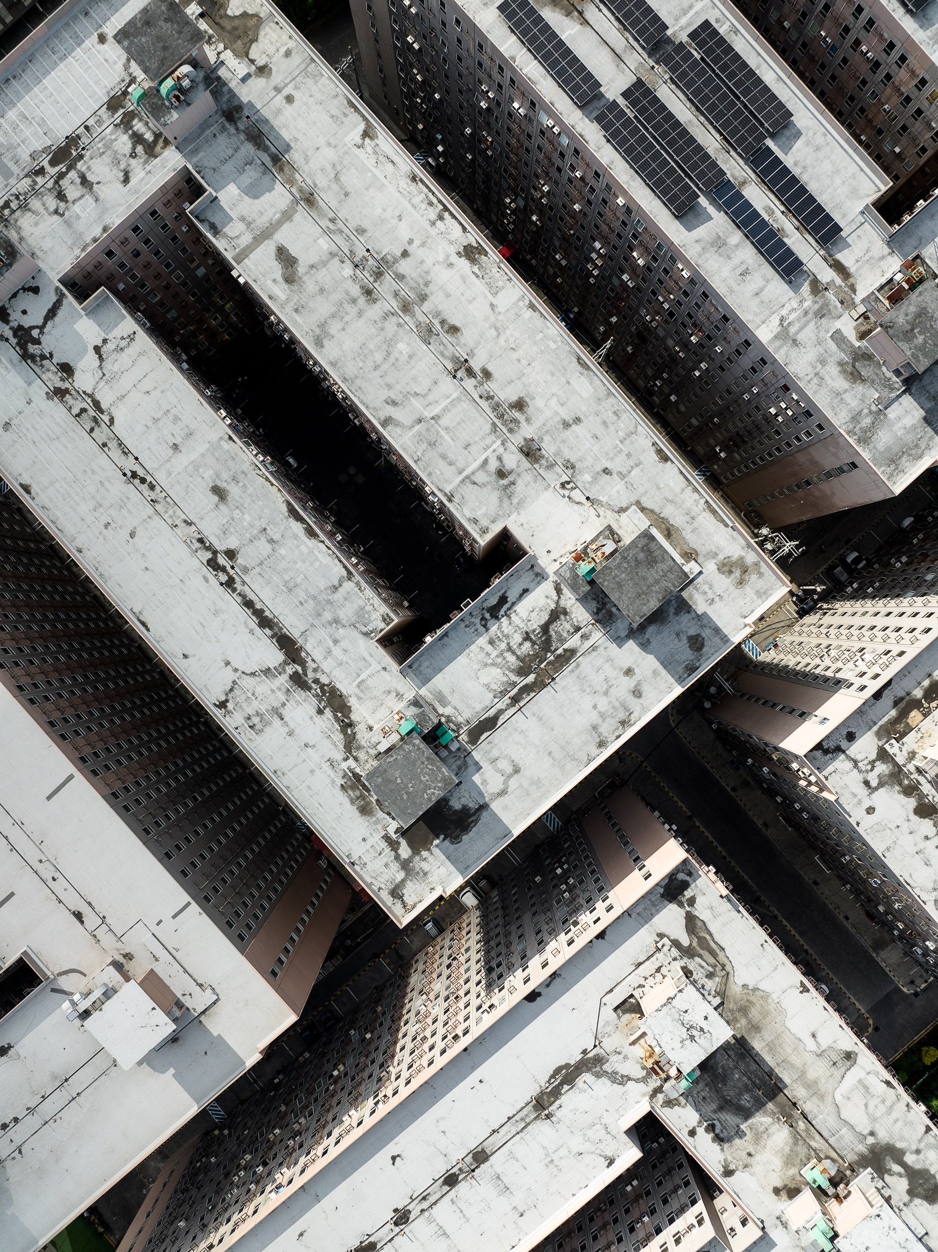
Brutalist social housing blocks in Manila's port area.

Social housing near Manila's port looks almost dystopian, especially juxtaposed with the dense crowding and colorful nature of the surrounding informal area. 
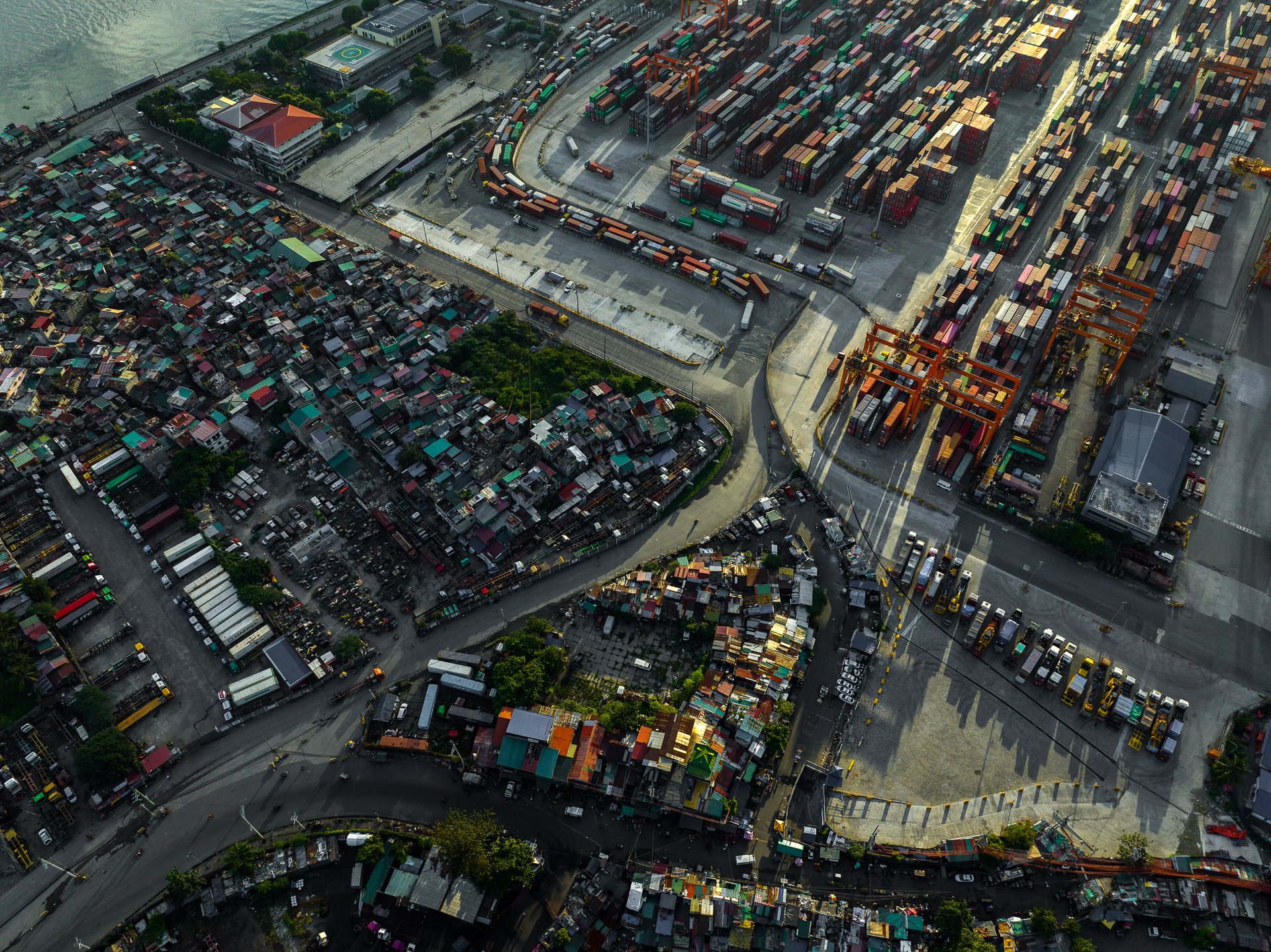
Aerial view of Manila’s port district showing stark contrast between dense informal settlements and an industrial shipping yard filled with shipping containers and cranes, highlighting spatial inequality in the Philippines.

Heavy trucks snake through the neighborhood near Manila's port, belching exhaust and creating noisy traffic jams within meters of tens of thousands of people. 
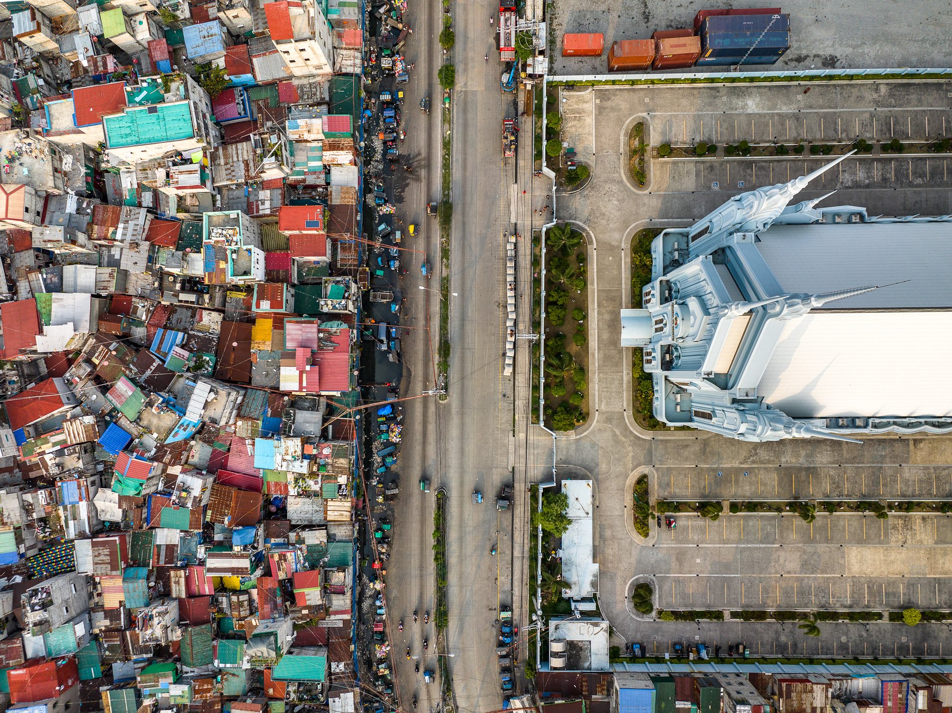
Aerial photo of Iglesia ni Cristo in Manila beside tightly packed informal housing, showing stark inequality.

This church near the Port of Manila belong to Iglesia ni Cristo, the Church of Christ, founded in Manila in 1914 by Félix Manalo and now the largest homegrown church in the Philippines. It rejects the Holy Trinity and holds that Manalo was God's last messenger. It is the largest church in the city of Manila and was the denomination's biggest house of worship until 1984. It stands here for a reason. Tondo, this dense port district, was one of Iglesia ni Cristo's earliest strongholds, its base among the urban poor. 

In a country where about 79 percent are Roman Catholic, Iglesia ni Cristo is the third-largest faith, roughly 2.8 million members, behind Catholicism and Islam. Its house of worship rises over Tondo, one of Manila's poorest and most crowded districts.
The politics of inequality in Manila further exacerbate this divide. Patronage politics often trump good governance, feeding the cycle of poverty. Political dynasties thrive, benefiting from the nation's wealth while the majority remain in poverty. 
President Rodrigo Duterte's War on Drugs has been one of the most controversial facets of his administration since he assumed office in 2016. This campaign has sparked intense debate regarding its effects on inequality in Manila, and the broader Philippines.
Duterte's hardline approach was framed as a public safety campaign, aiming to eradicate the drug trade and the associated crime. However, the way it was carried out has raised significant human rights concerns and exacerbated the city's existing inequalities.
Primarily, the campaign has disproportionately targeted impoverished communities. The urban poor, particularly in Manila, bore the brunt of the aggressive drug war. Thousands of extrajudicial killings have occurred, often justified with dubious evidence. Families were left grieving without closure, as perpetrators mostly remained unpunished.
Almost everyone I spoke with mentioned the War on Drugs as fundamental to understanding the grievances of the city's poor.
Aerial image of Mandaluyong, Manila, showing a sharp divide between dense slums and planned housing.

Division in Mandaluyong, Manila.

Manila housing demolition site with cramped flats and new developments, showing urban transition and inequality.

Housing upgrades involve tearing down dark concrete blocks of overcrowded flats and replacing them with more modern housing near the port. 
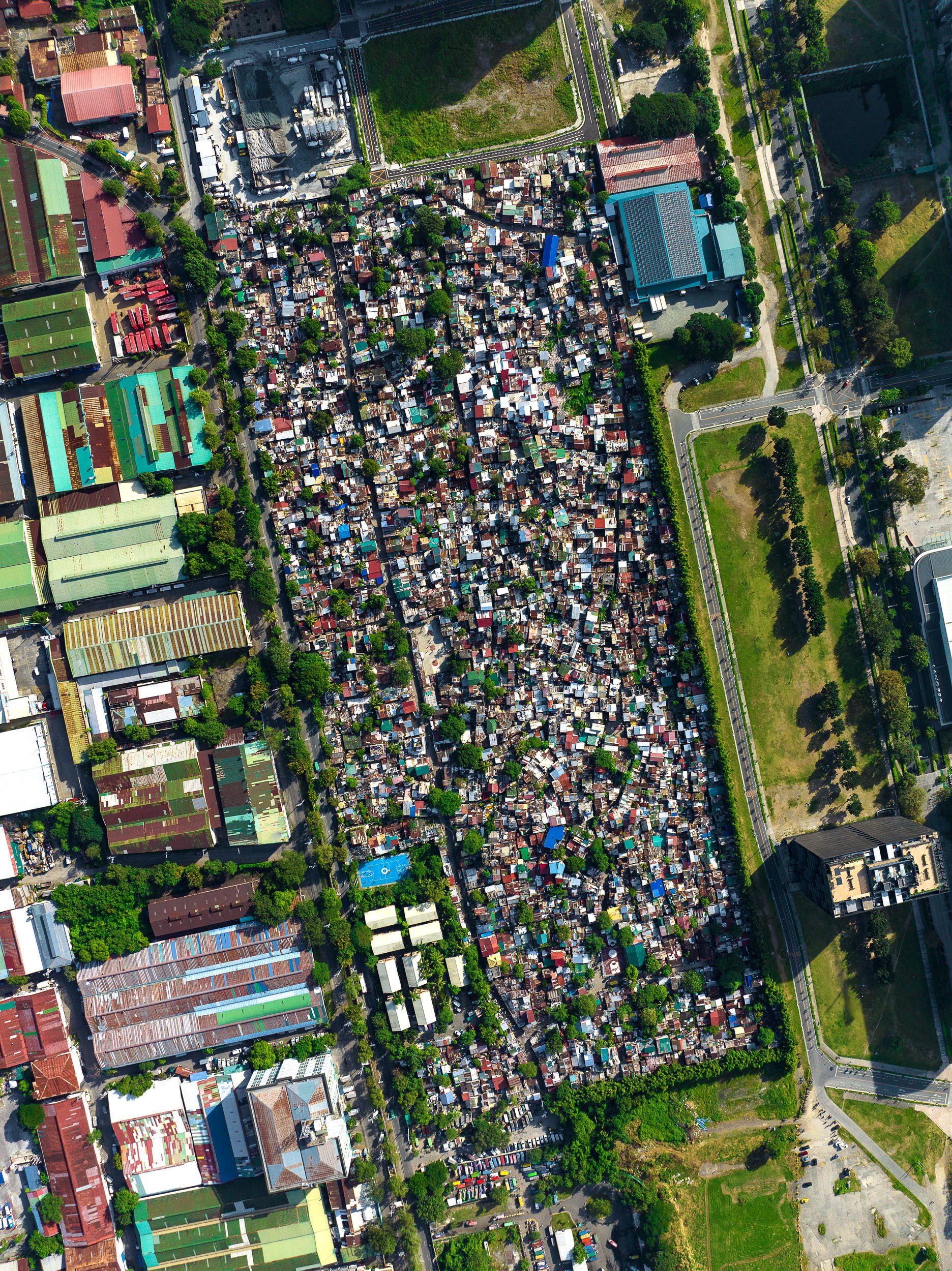
A dense neighborhood in a quickly developing area of Manila called Arca South.
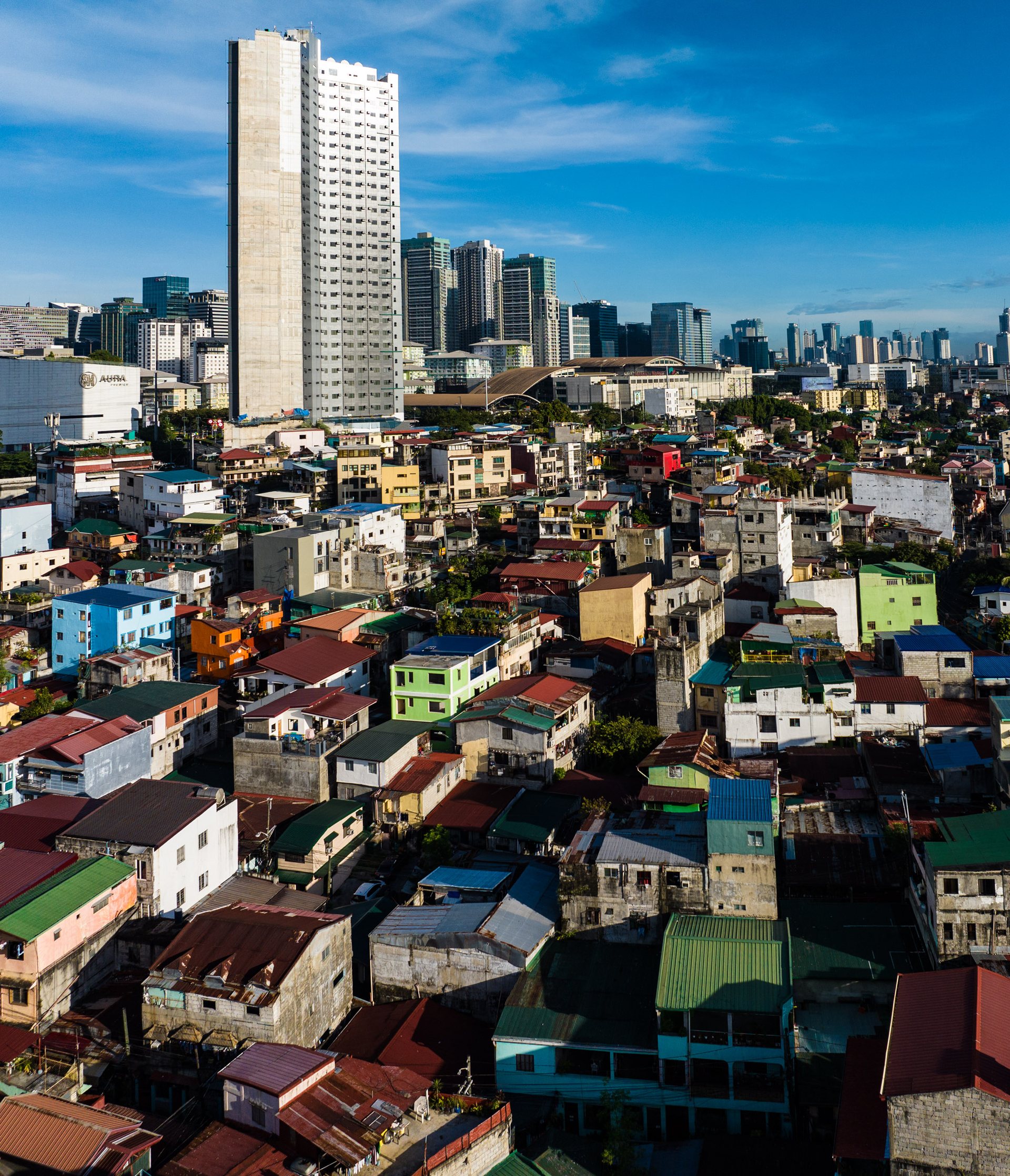
Contrast between Pembo’s crowded housing and BGC’s high-rises highlights wealth disparity in Manila.

Pembo, with the wealthy neighborhood of BGC behind it.
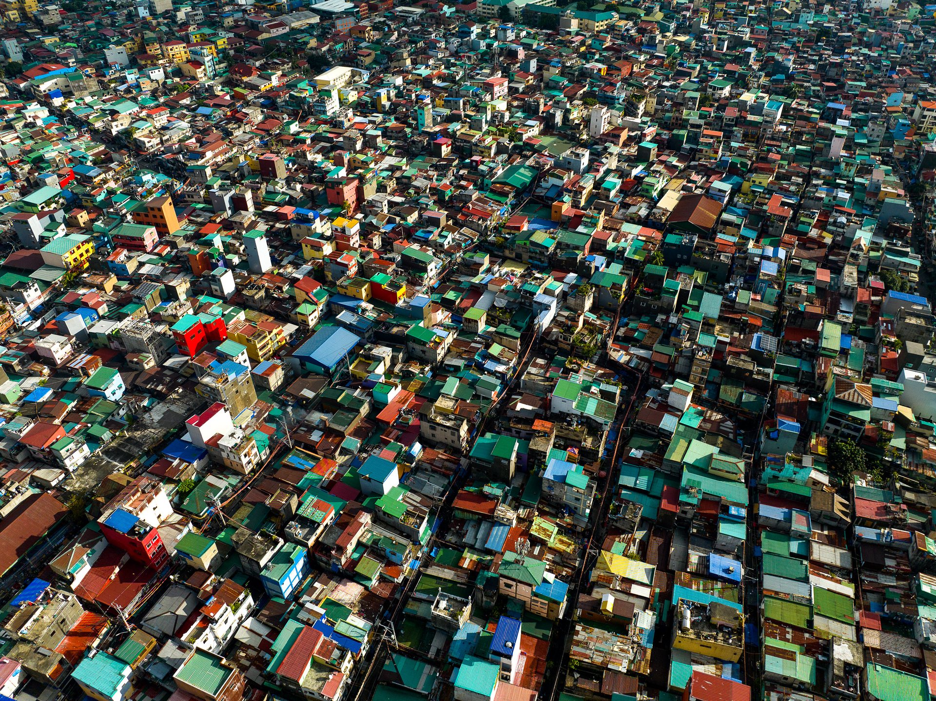
Top-down view of dense rooftops in Pembo, Manila, showing high population density and housing compression.

Dense neighborhoods in Pembo, Manila.
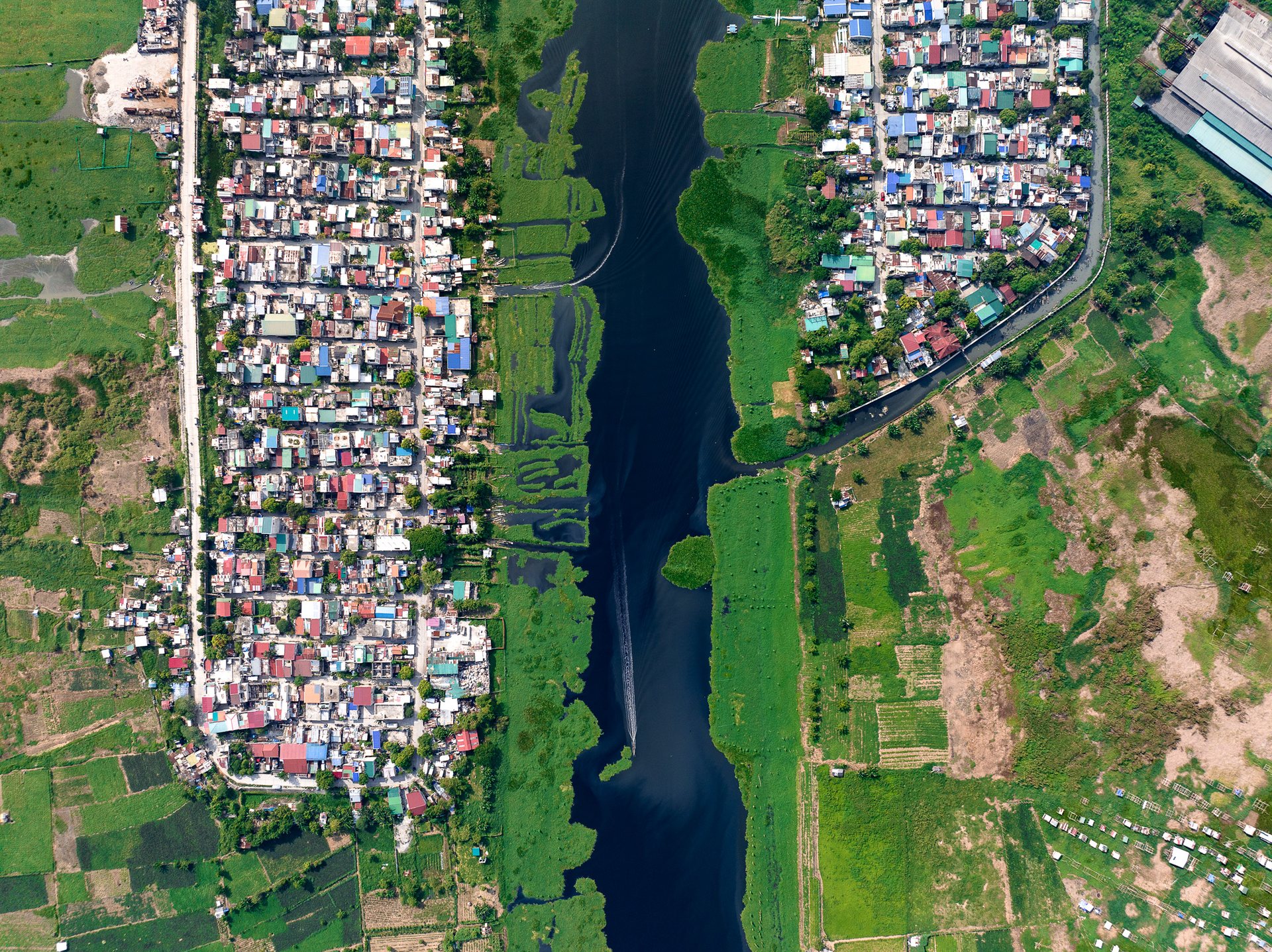
Typhoons often bring heavy rainfall to the region, and with the city's vast concrete landscape and insufficient drainage, this quickly translates into extensive flooding. In the case of the Manggahan Floodway, it was designed to divert excess water from the Pasig River to Laguna de Bay, and then to the sea. However, it has not always functioned as planned, and numerous factors contribute to the exacerbation of flooding.
Firstly, informal settlements along the floodway have led to obstruction and congestion of the water channels. These settlements, born out of the city's vast socioeconomic inequality and lack of affordable housing, are often built precariously close to the water's edge. They contribute to a narrowing of the waterways with waste and debris, which reduces the carrying capacity of the floodway, and hampers its effectiveness during typhoons.
Secondly, climate change is increasing the intensity and frequency of typhoons hitting the Philippines. The warming ocean temperatures provide more energy for storms, causing them to bring more rainfall. This means that even with a functioning floodway system, the volume of water might exceed what the infrastructure was designed to handle.
The effects of these floods are devastating and disproportionately affect the city's poor. Residents of the informal settlements along the floodway are often the first victims. Their homes, built with makeshift materials, stand little chance against the violent waters. Displacement, loss of property, and even loss of life are frequent during these calamitous events.
Urban development bordering green floodway in Manila, illustrating spatial contrast and planning tension.
Urban development bordering green floodway in Manila, illustrating spatial contrast and planning tension.

Informal floating homes beside Manila’s busy container terminal, revealing stark living condition contrast.

Floating homes next to the container terminal.
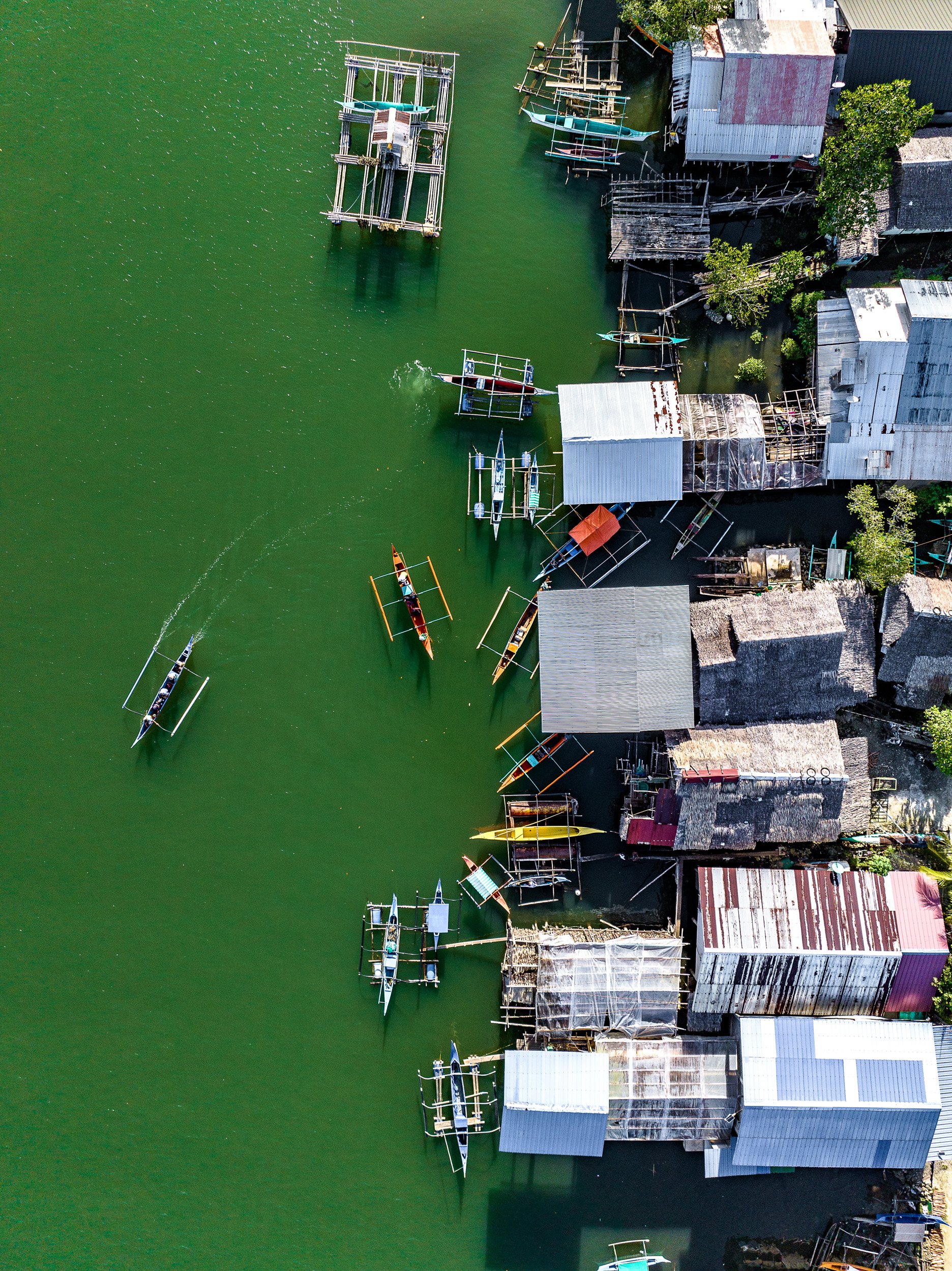
Stilt homes over green water where seaweed farmers work, showing rural livelihoods in the Philippines.

Seaweed fishermen make their living on the island of Mindanao, in the far south of the Philippines.
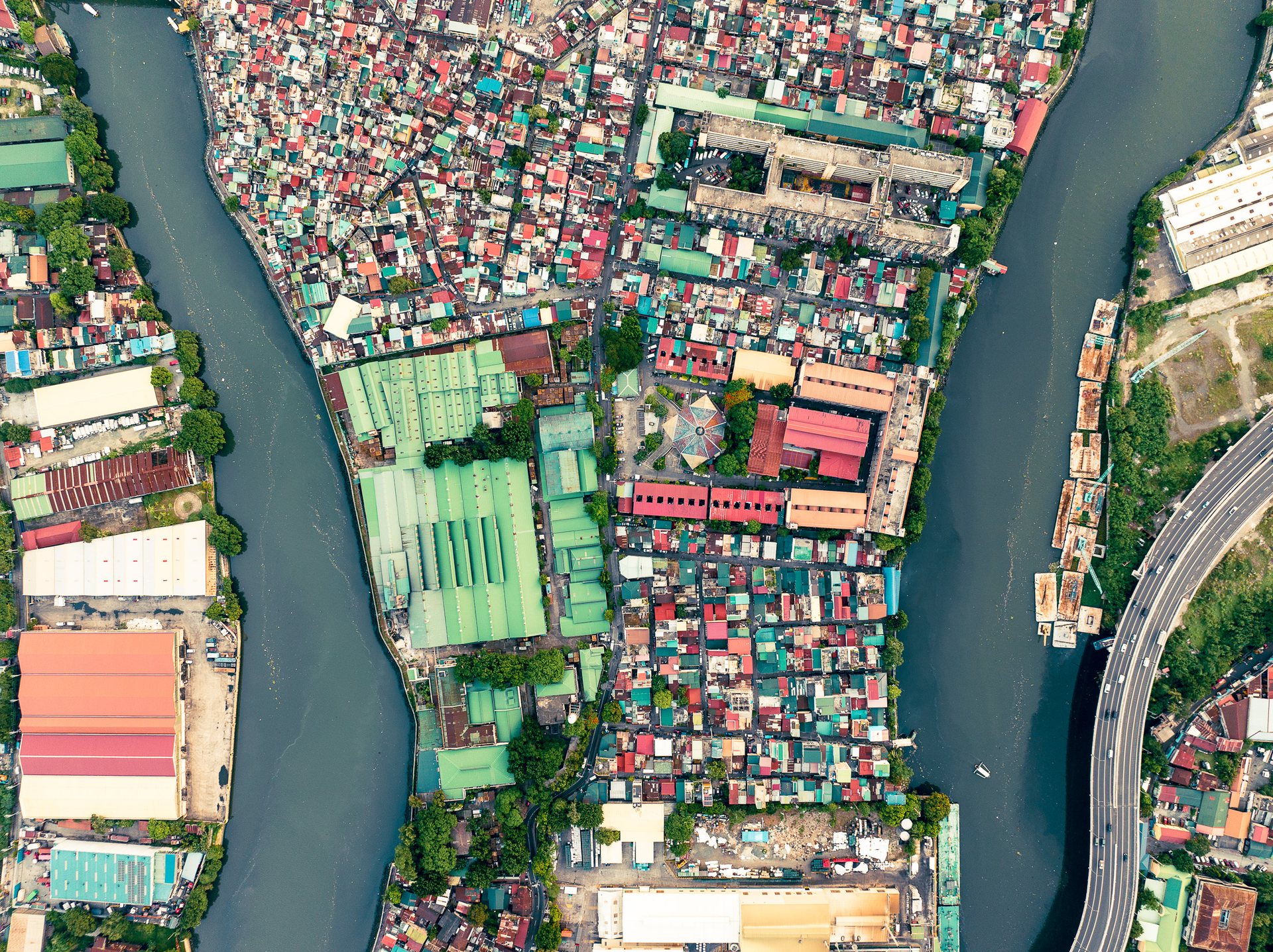
Informal homes packed near Manila port with freight trucks, illustrating pollution and spatial stress.

The Pasig River, artery of Manila, is heavily developed, much of which is low income or informal homes built alongside the river banks.
You may also like

Back to Top