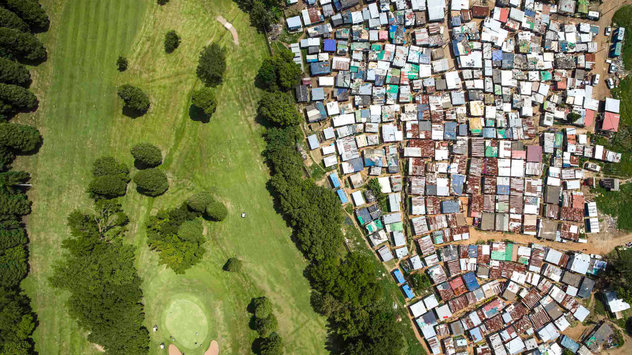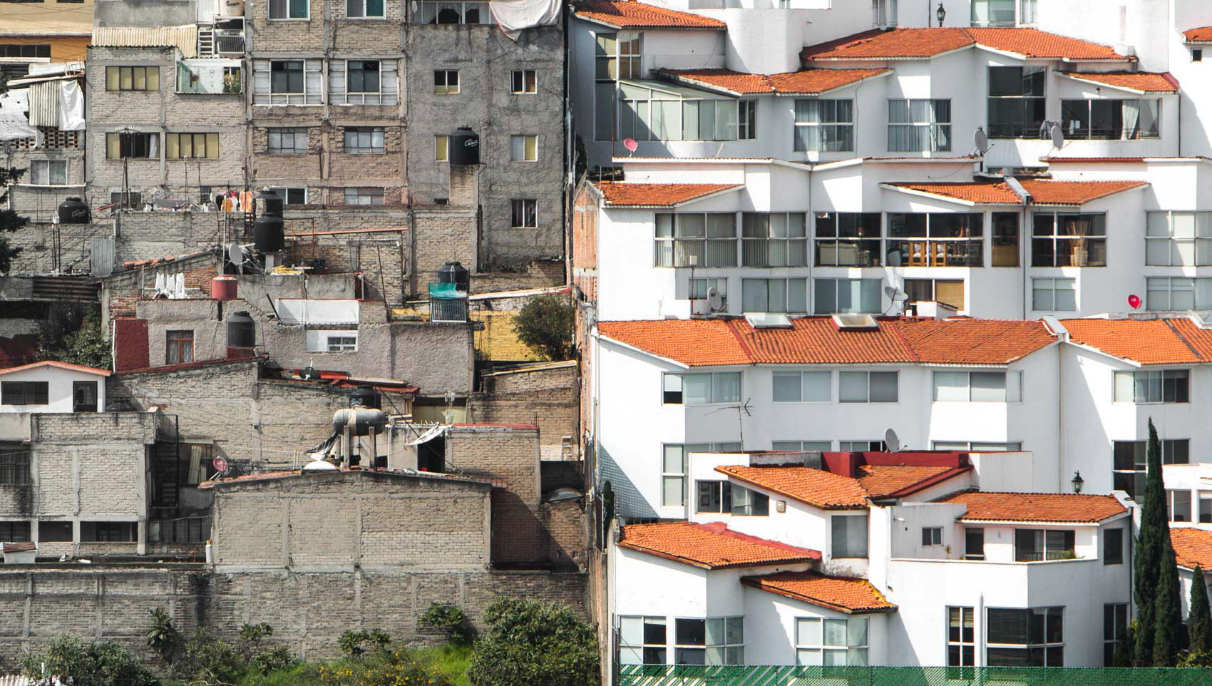
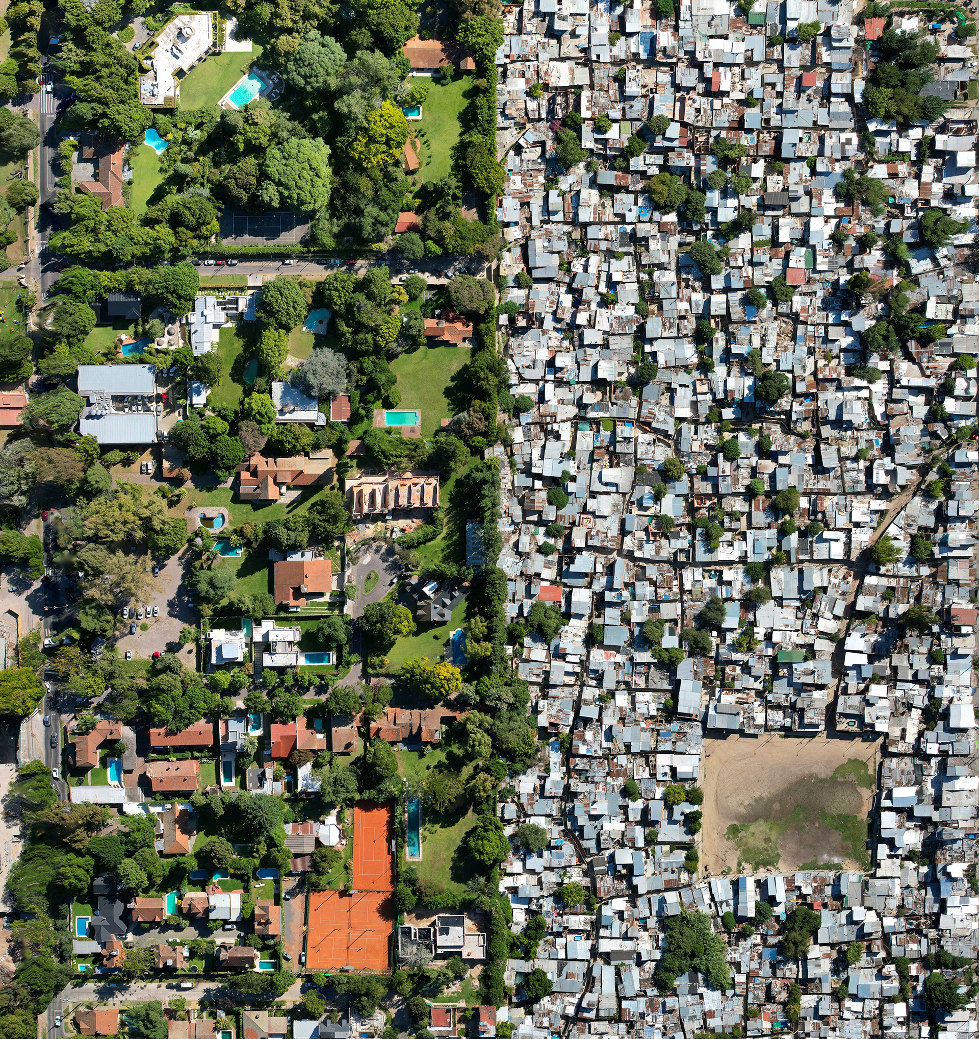
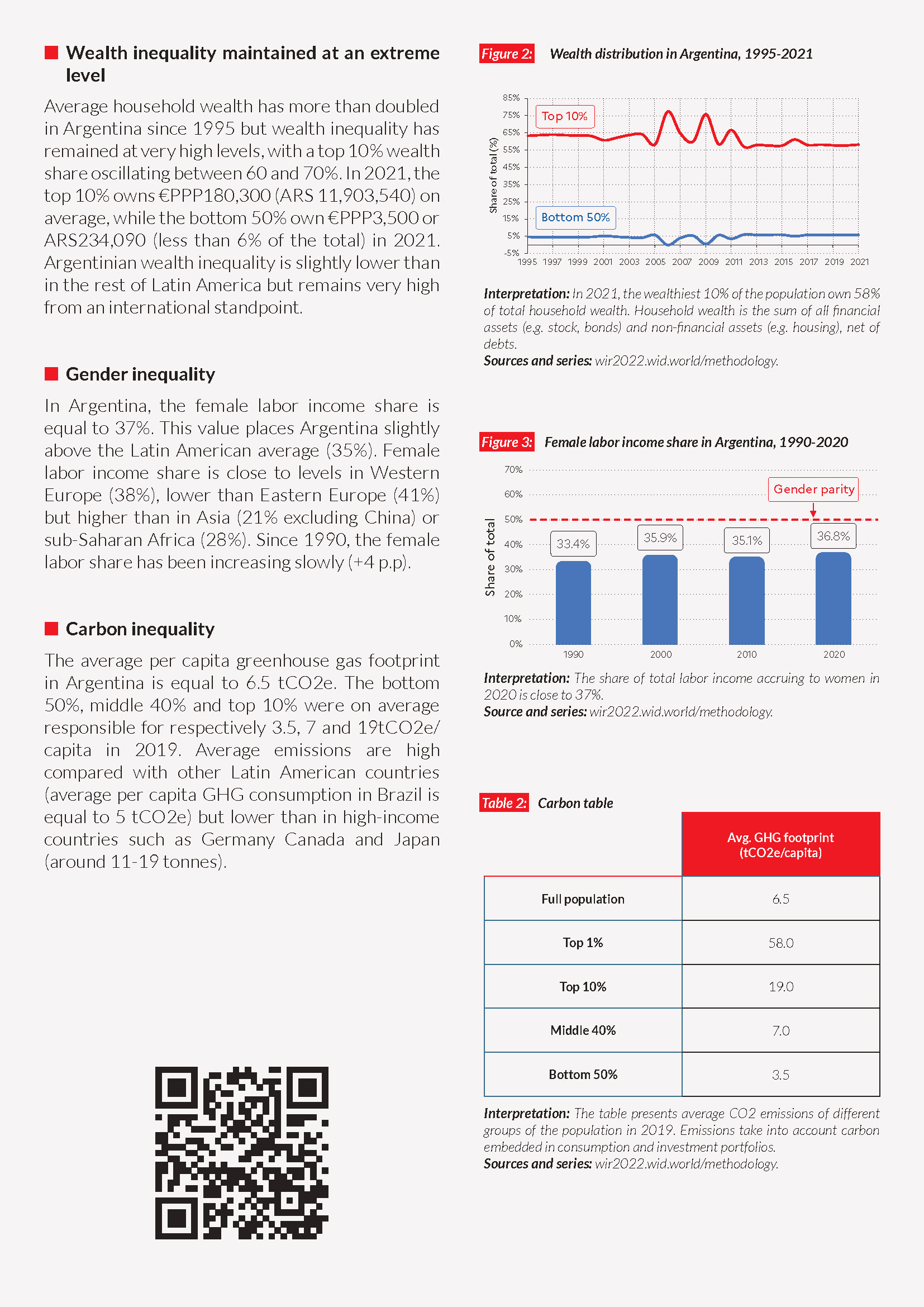
In Buenos Aires, wealthy neighbourhoods sit hard against the informal settlements known as villas miserias. This is in the affluent northern suburbs around San Isidro, not far from where, in 2009, the municipality began building a three-metre wall along its border with poorer San Fernando, citing security. Residents tore it down within days and a court halted the work; the Argentine press dubbed it the "wall of discord." No single wall stands now, but the walls, fences and barbed wire remain, and so does the chasm between the two sides.
Villa Rodrigo Bueno is located on some of the most expensive land in the city, on an ecological park in the shadow of the city's financial district. These informally built homes are currently being upgraded by the city to modern and regularized apartments.
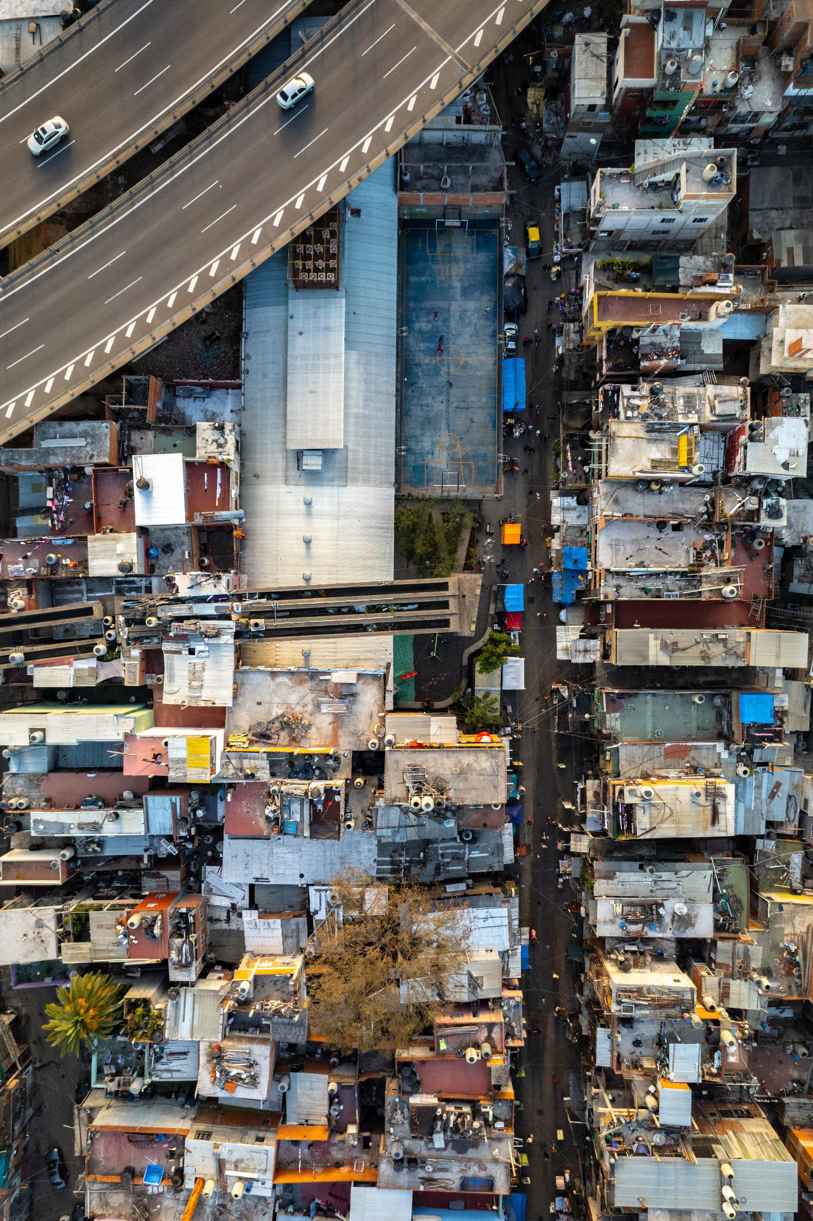
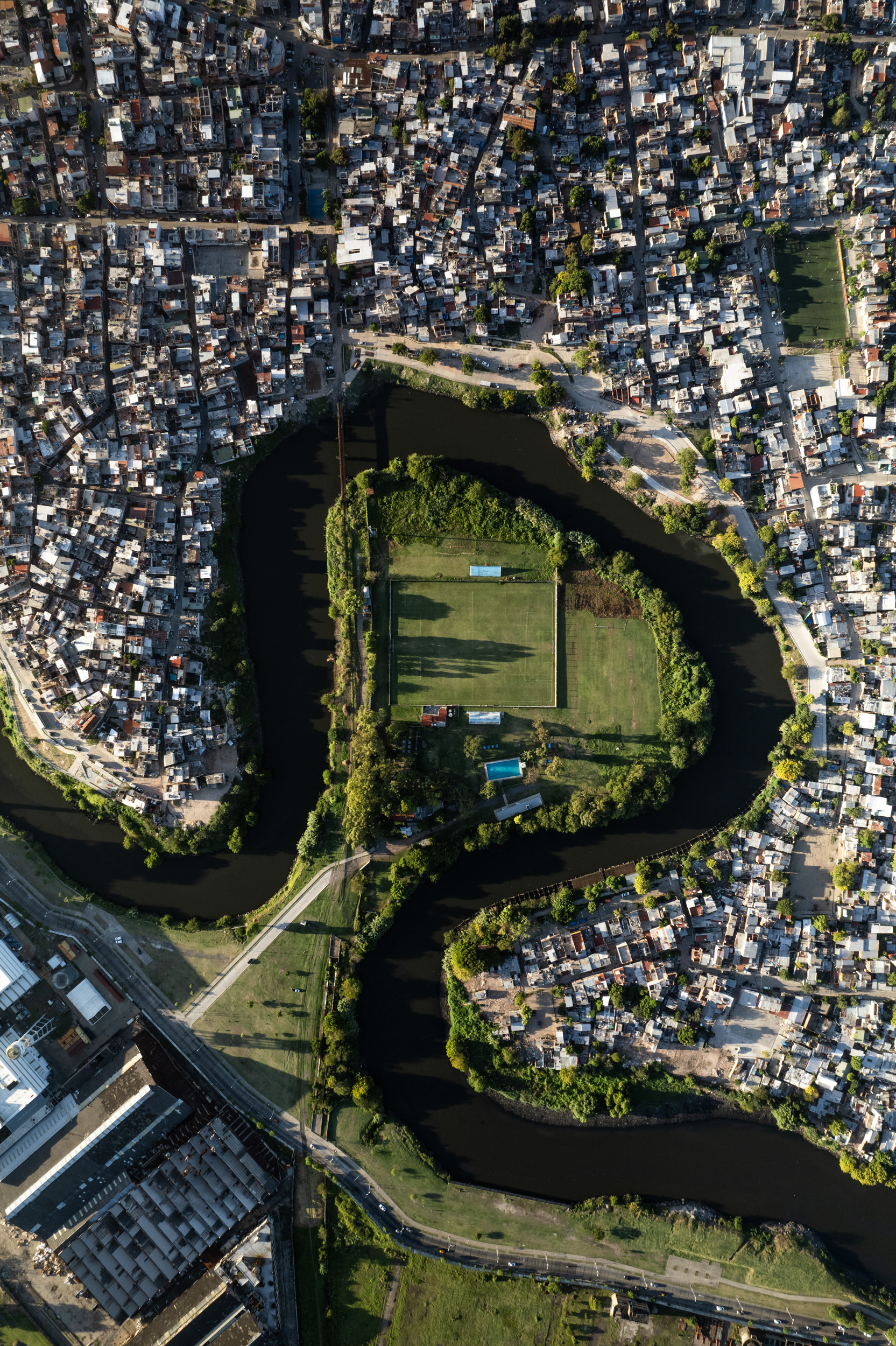
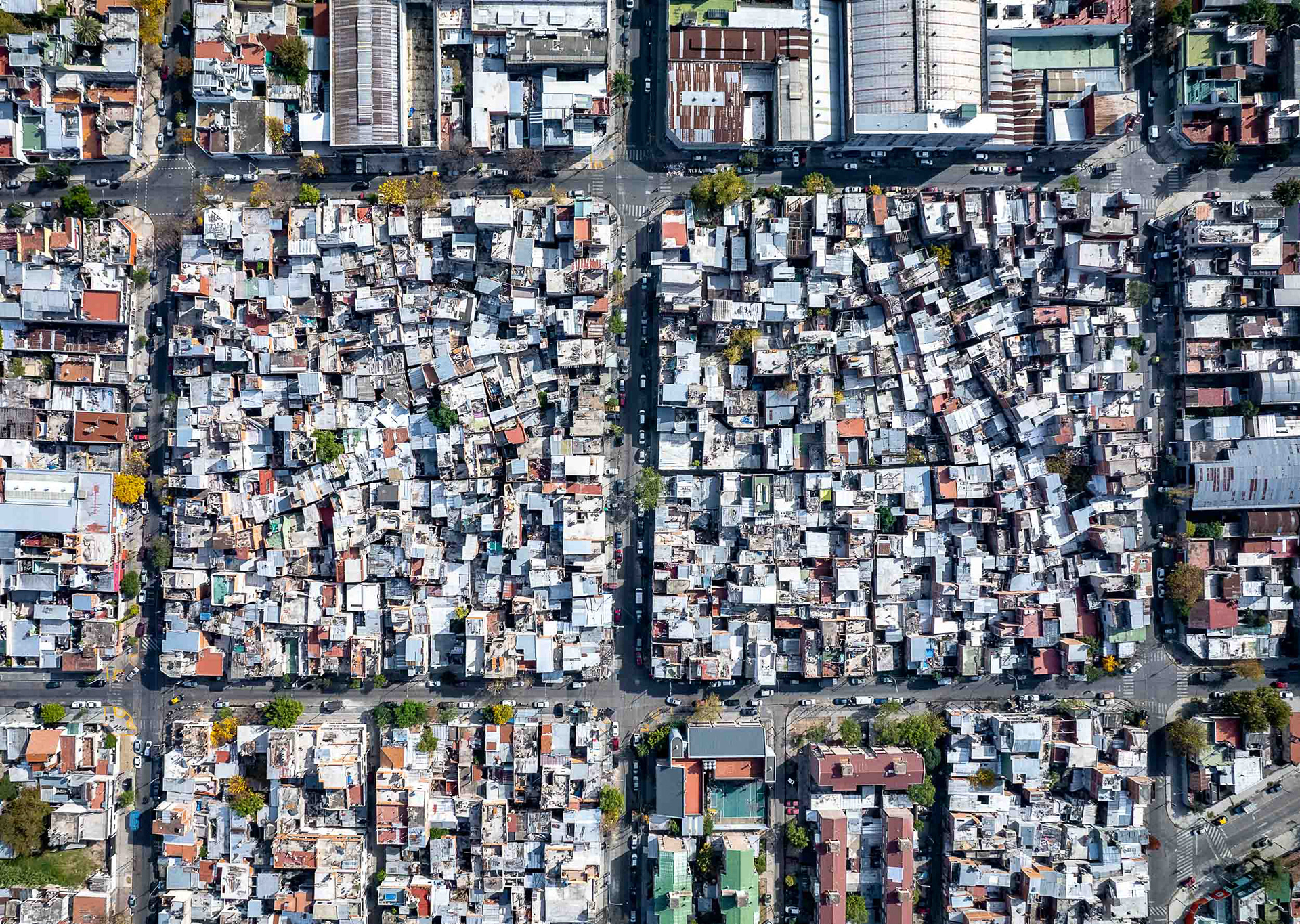
The densely packed Villa 20, currently undergoing an upgrade.
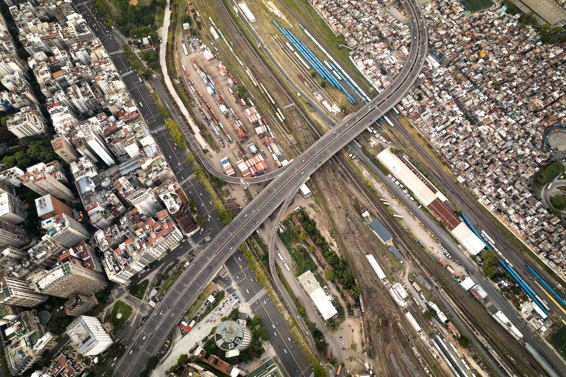
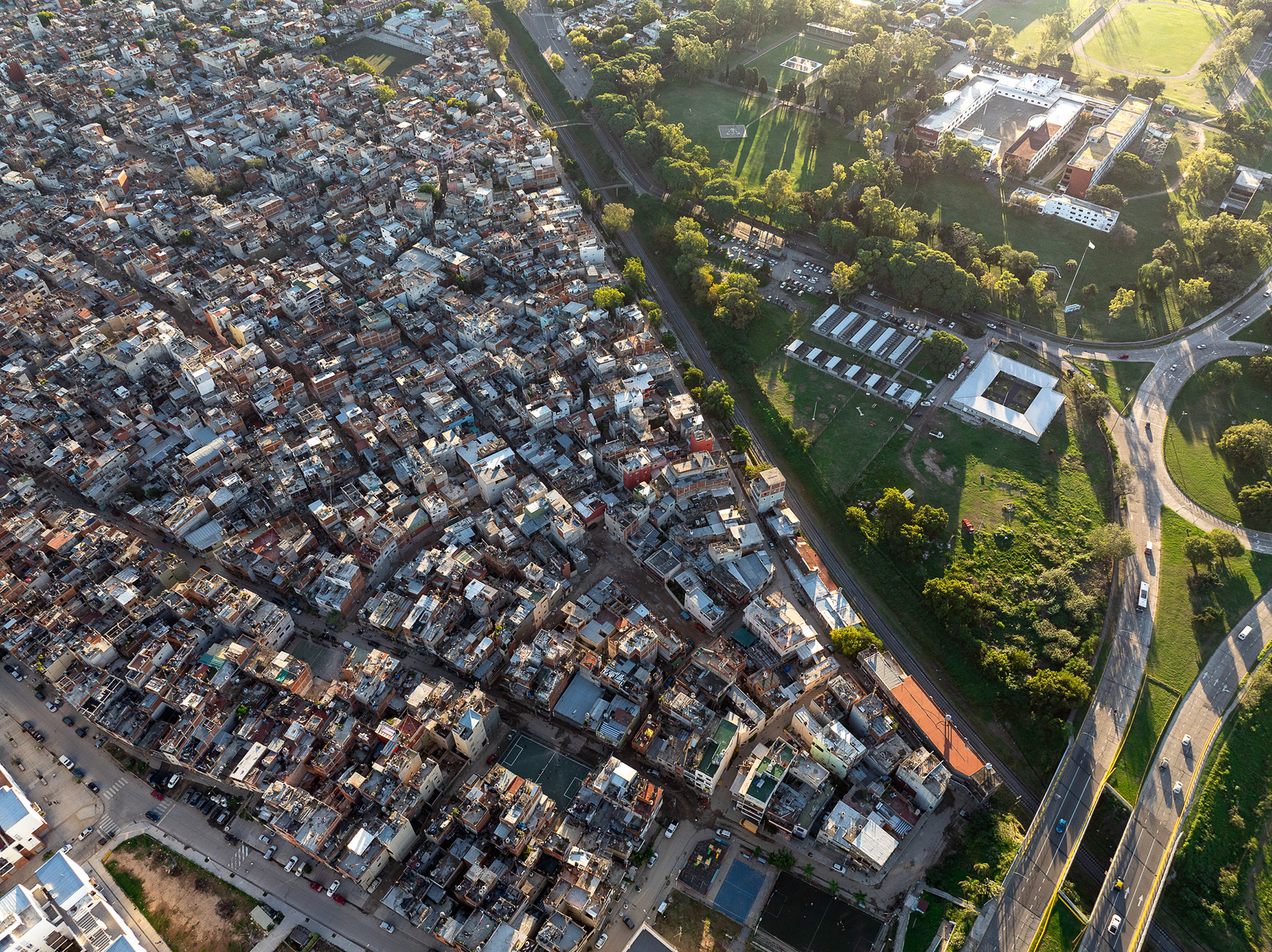
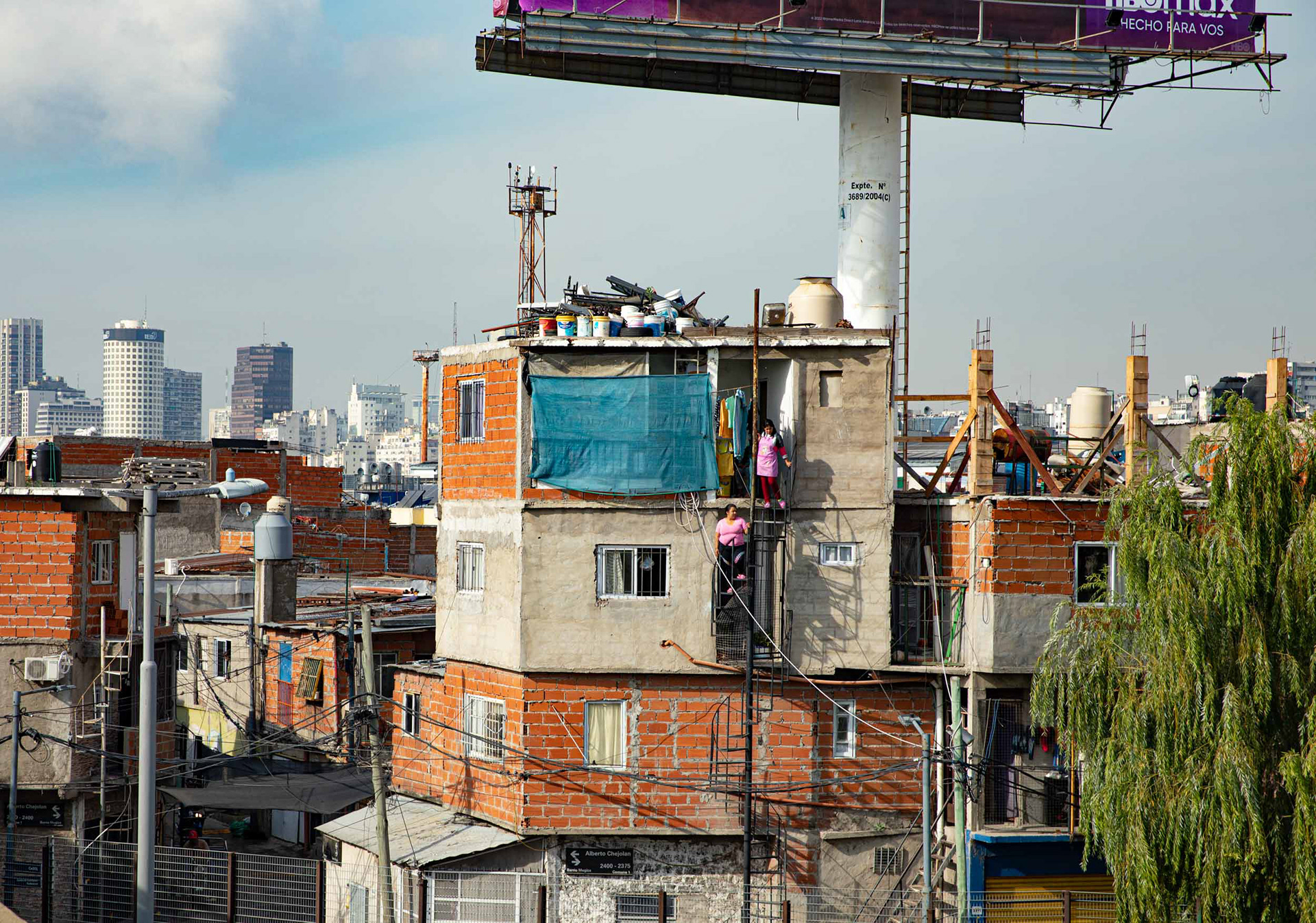
Three Buenos Aires meet in one frame. On one side rise the towers of downtown; on the other spreads Villa 31, an informal settlement of around 40,000 people on prime central land. Between them runs the great band of the Retiro rail yards, the seam that has long separated the formal city from the villa at its edge. Officially renamed Barrio Padre Mugica, the settlement is now a mix of self-built brick homes and newer concrete blocks, its residents drawn from across Argentina and neighbouring countries.
Haphazard and unchecked development in Buenos Aires' sprawling villa miserias is the only affordable option for many families who want to live close to the city center.
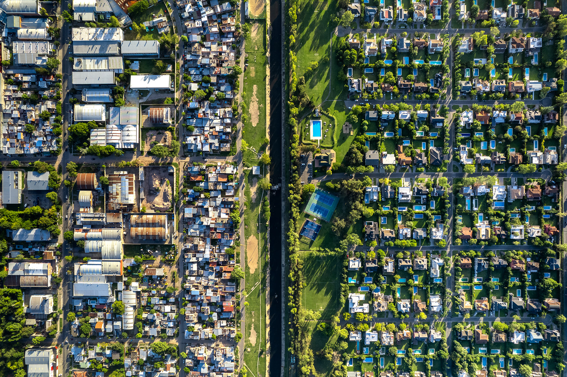
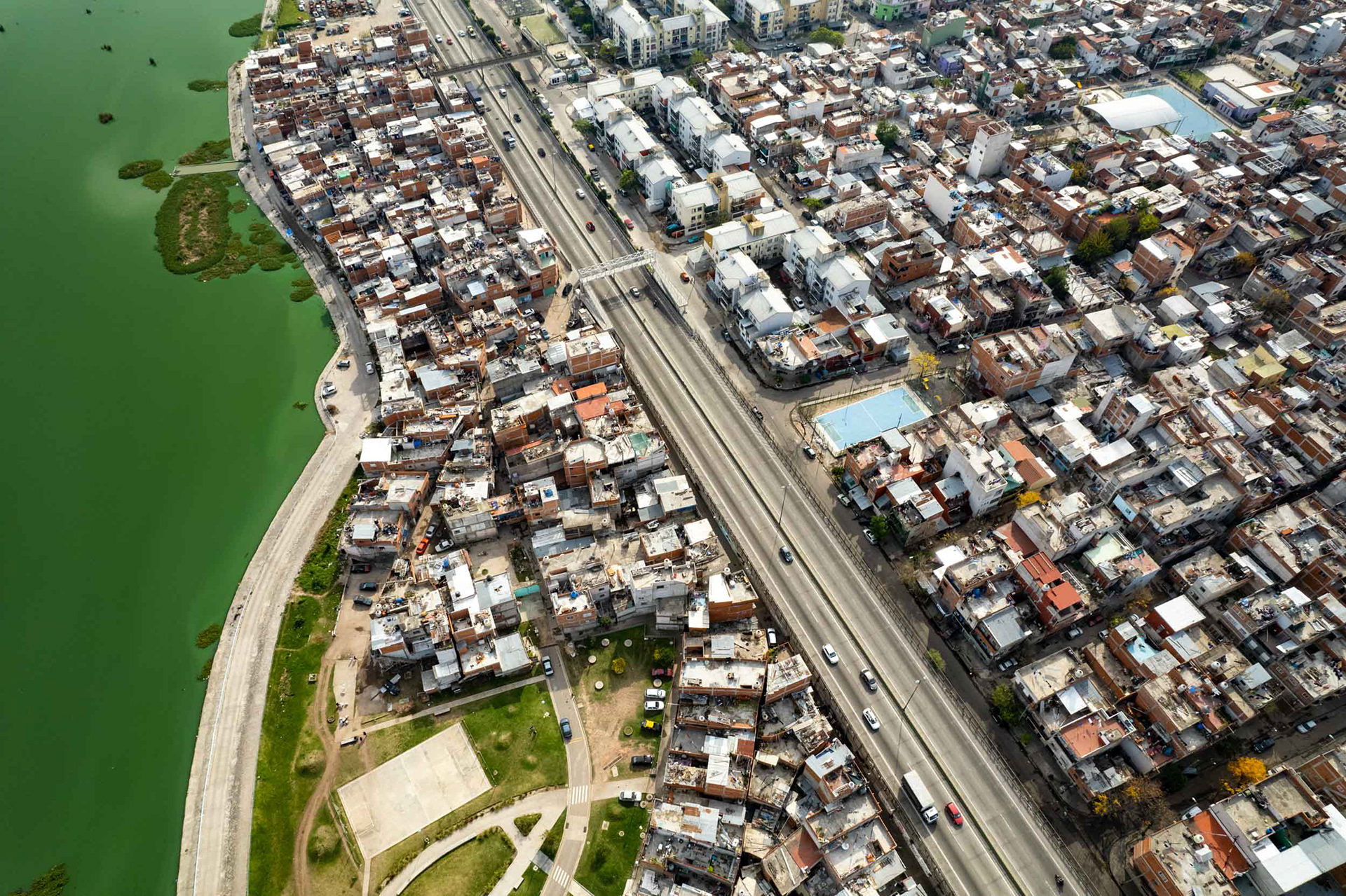
Inequality in Buenos Aires Province, to the northeast of the city. Developments in the Paraná river delta are changing the face of the province closest to the river's edge.
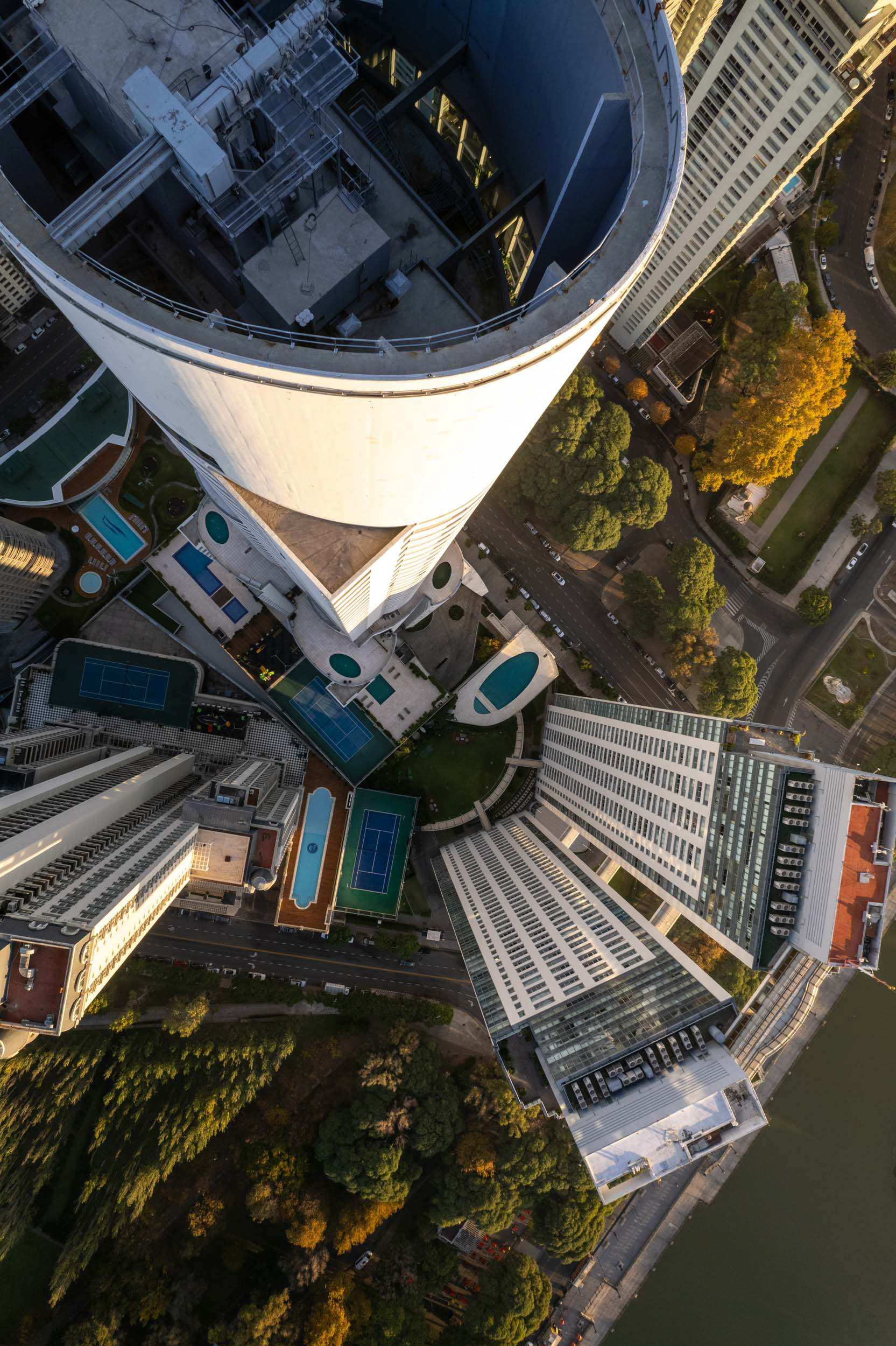
The Alvear Tower, the tallest building in Buenos Aires, and a home for wealthy Porteños.
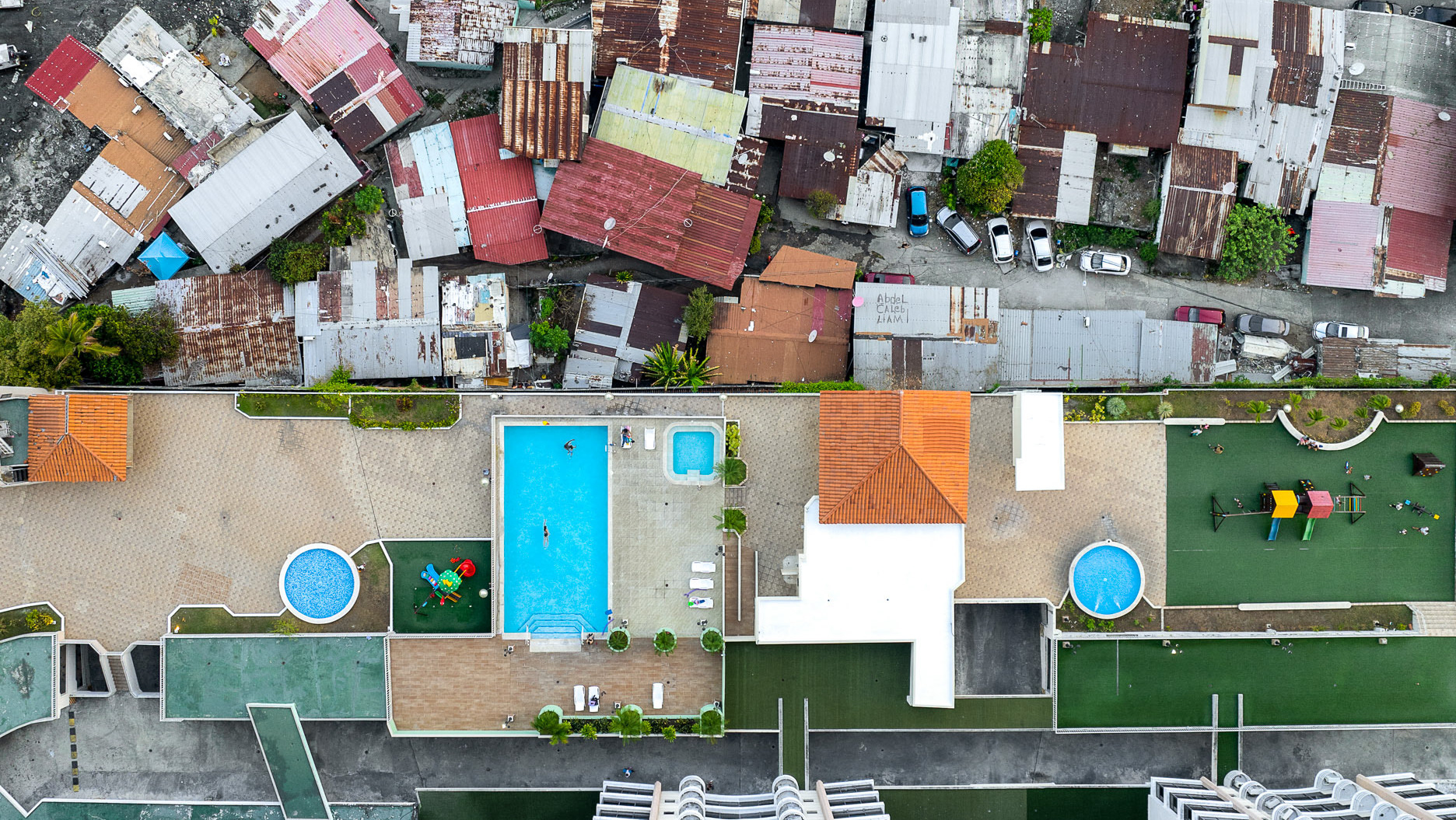
Villa Rodrigo Bueno, opposite a dilapidated amusement park on the river's edge in the affluent eastern section of BA.
The elevated Arturo Illia highway runs straight through Villa 31, its deck passing directly over the barrio. For years families lived in the gap beneath it, in the dark and noise under the traffic. The settlement, officially renamed Barrio Padre Mugica, sits on prime central land beside downtown Buenos Aires, home to some 40,000 people. A city program has since relocated many of those who lived under the highway, clearing the strip below the road.
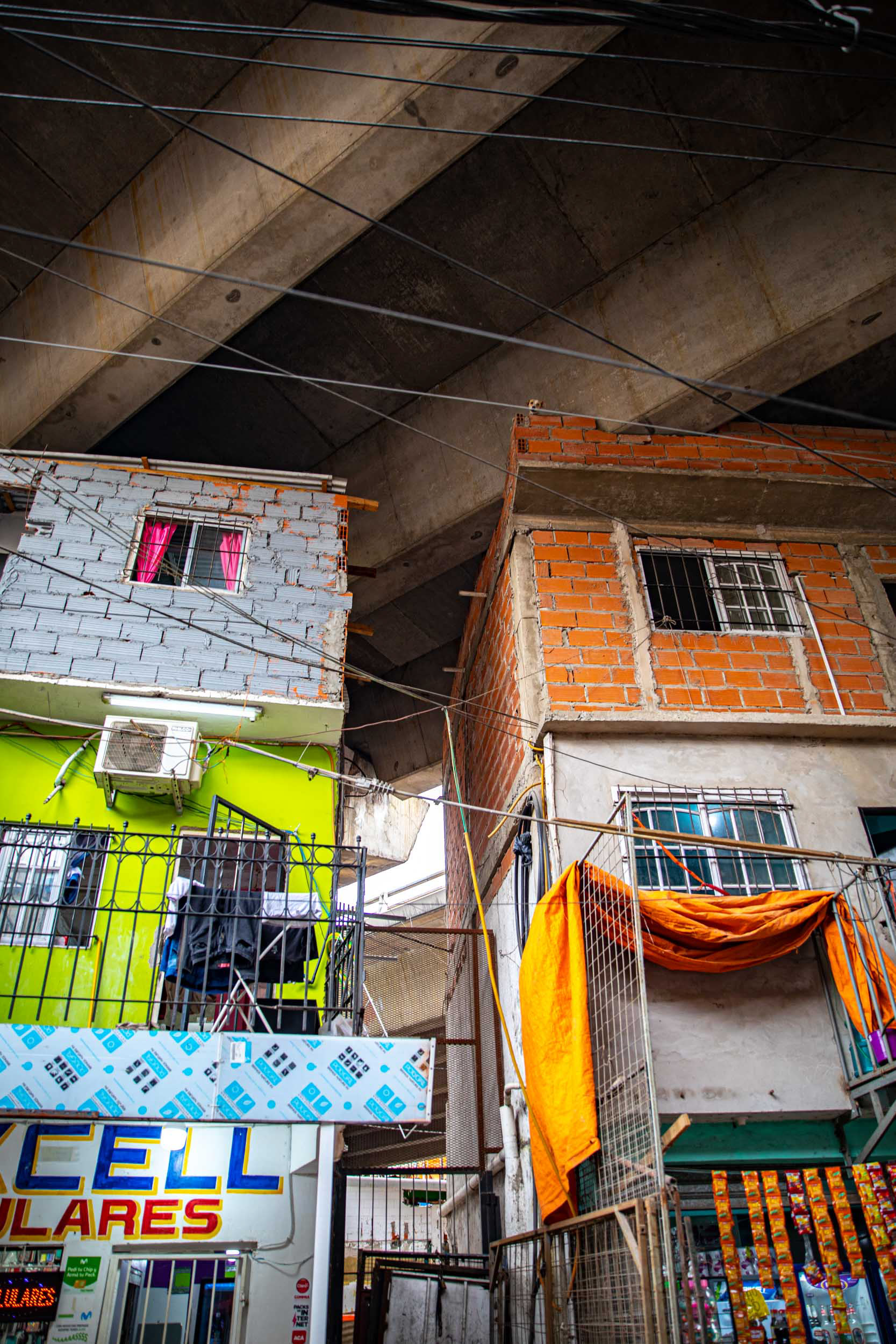
Homes have been built in every conceivable place, including between and under the highway.
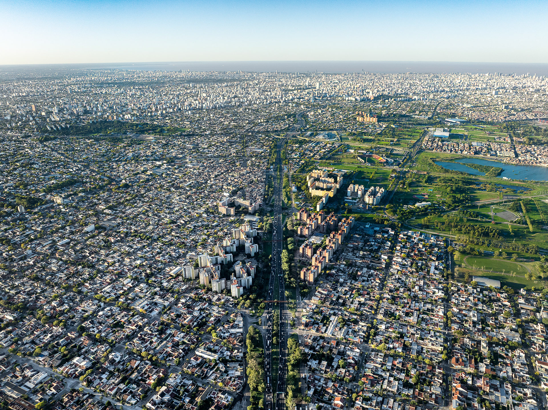
The city is the undisputed political, cultural and economic powerhouse of the country. Fully 1/3 of Argentina's population (15 million people) lives here.
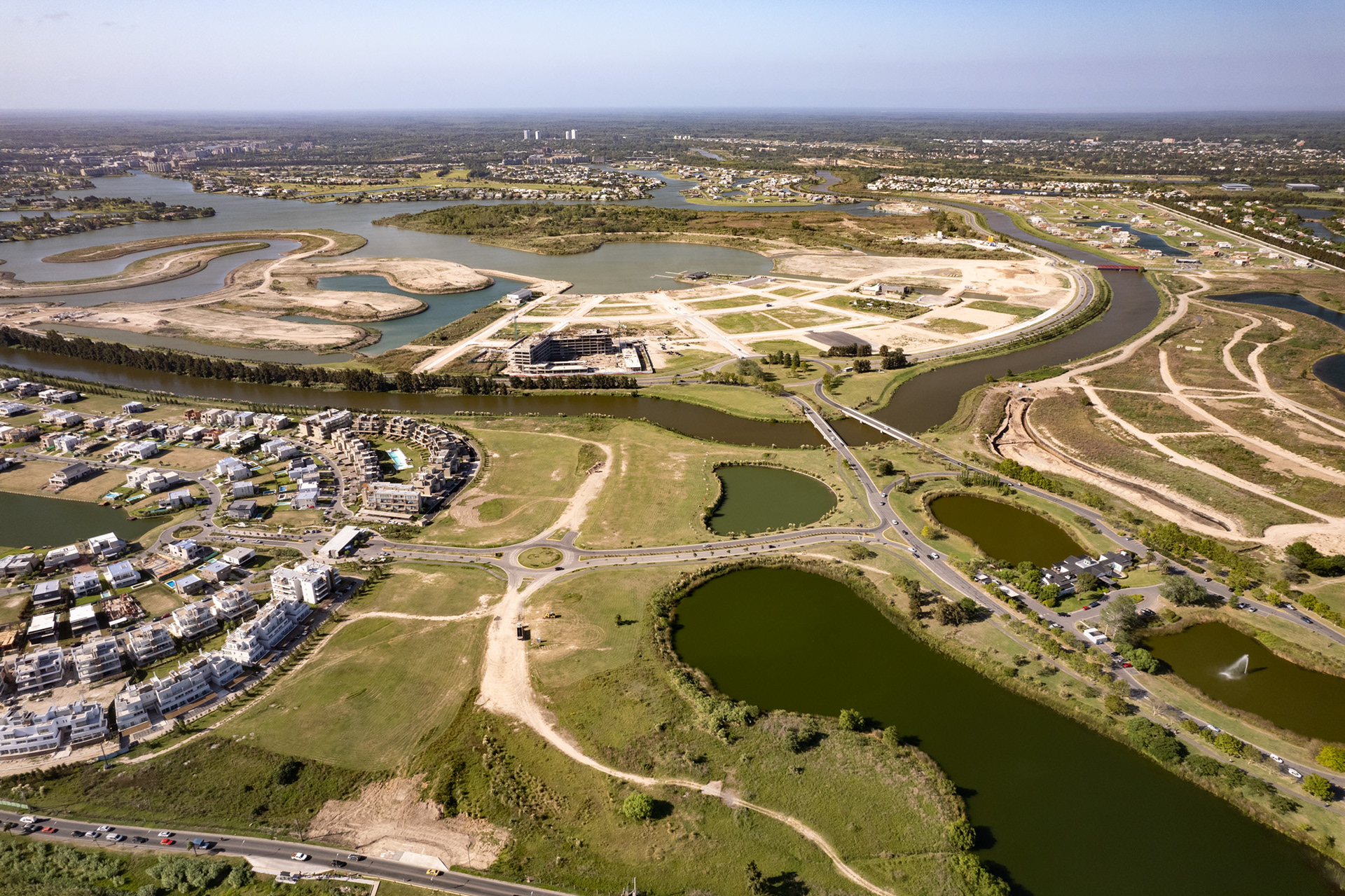
These developments on wetlands north of the city are called "Nordelta". Reclaiming land from the soggy delta has become a gold mine for wealthy "Porteños".
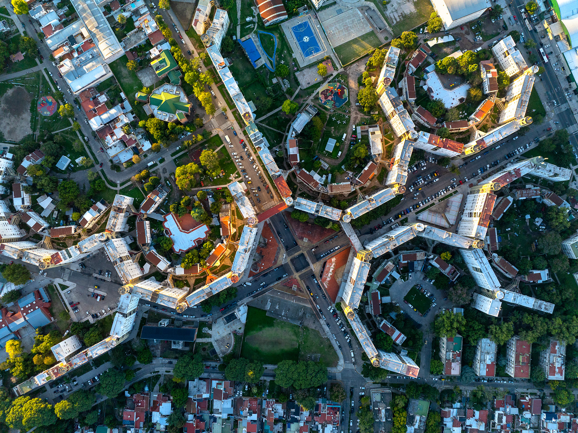
New "regularized" housing in Barrio Padre Mugica.
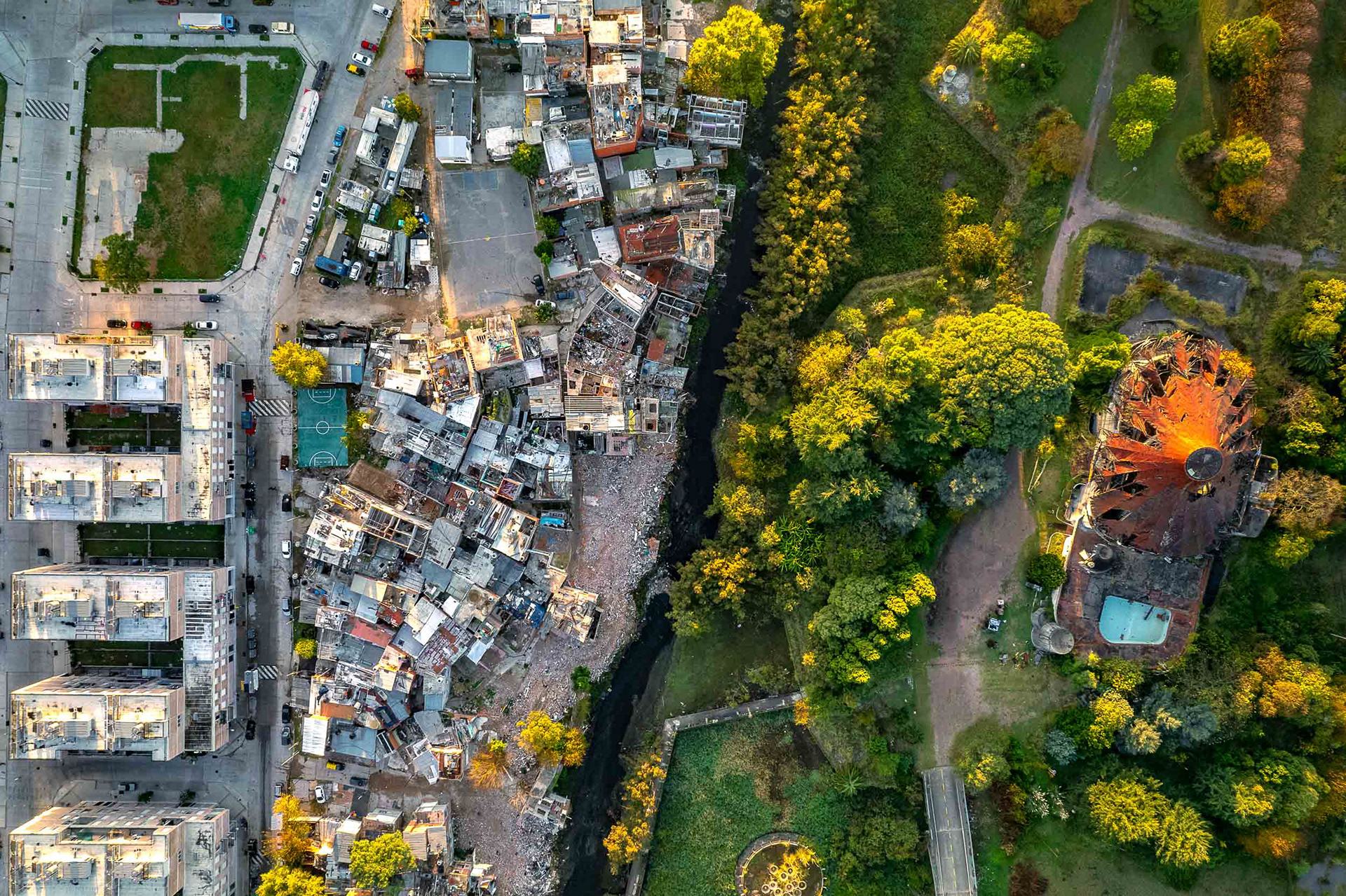
The towns of Quilmes (left) and Avellaneda (right) are split by Calle Caviglia. The informal section in Quilmes, called Villa Azul, was the site of the country's first total quarantine, enforced by the military to mitigate a fast-spreading outbreak in May 2020. No such quarantine existed on the other side. Hailed as a success by the Argentine media, the spread of the virus and the response point to the tale of two worlds that came into sharp focus around the world during 2020.
In a June 2020 interview Quilmes health secretary Jonathan Konfino said, "...this has confirmed that for the occurrence of diseases, the determining factor is much more the postal code, rather than the genetic code. Today that street has become a symbol of injustice, which shows the inequality we live in and the need to advance the political decision to urbanize the neighborhood."
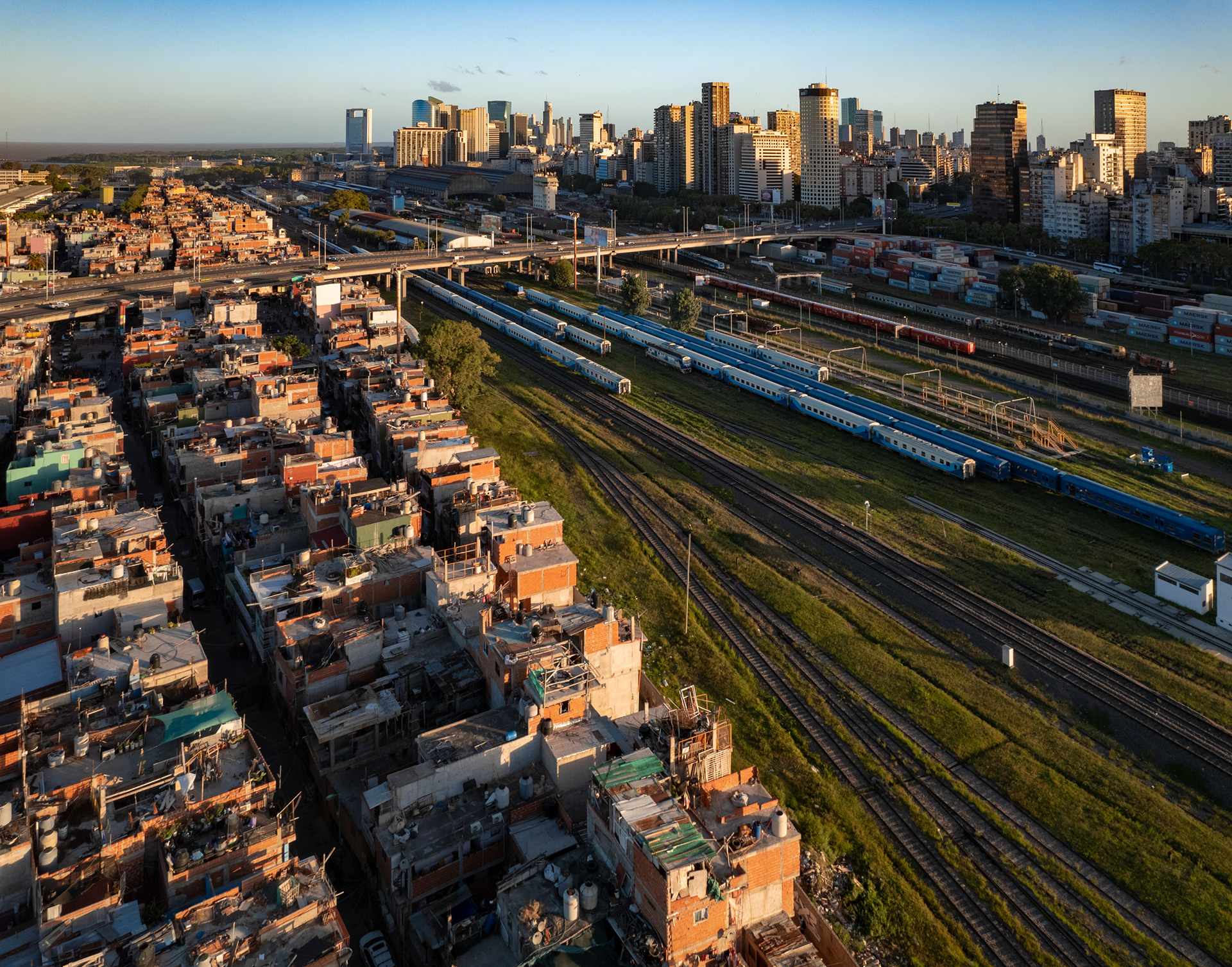
Villa 31 is separated from the downtown core of Buenos Aires by a busy rail yard.
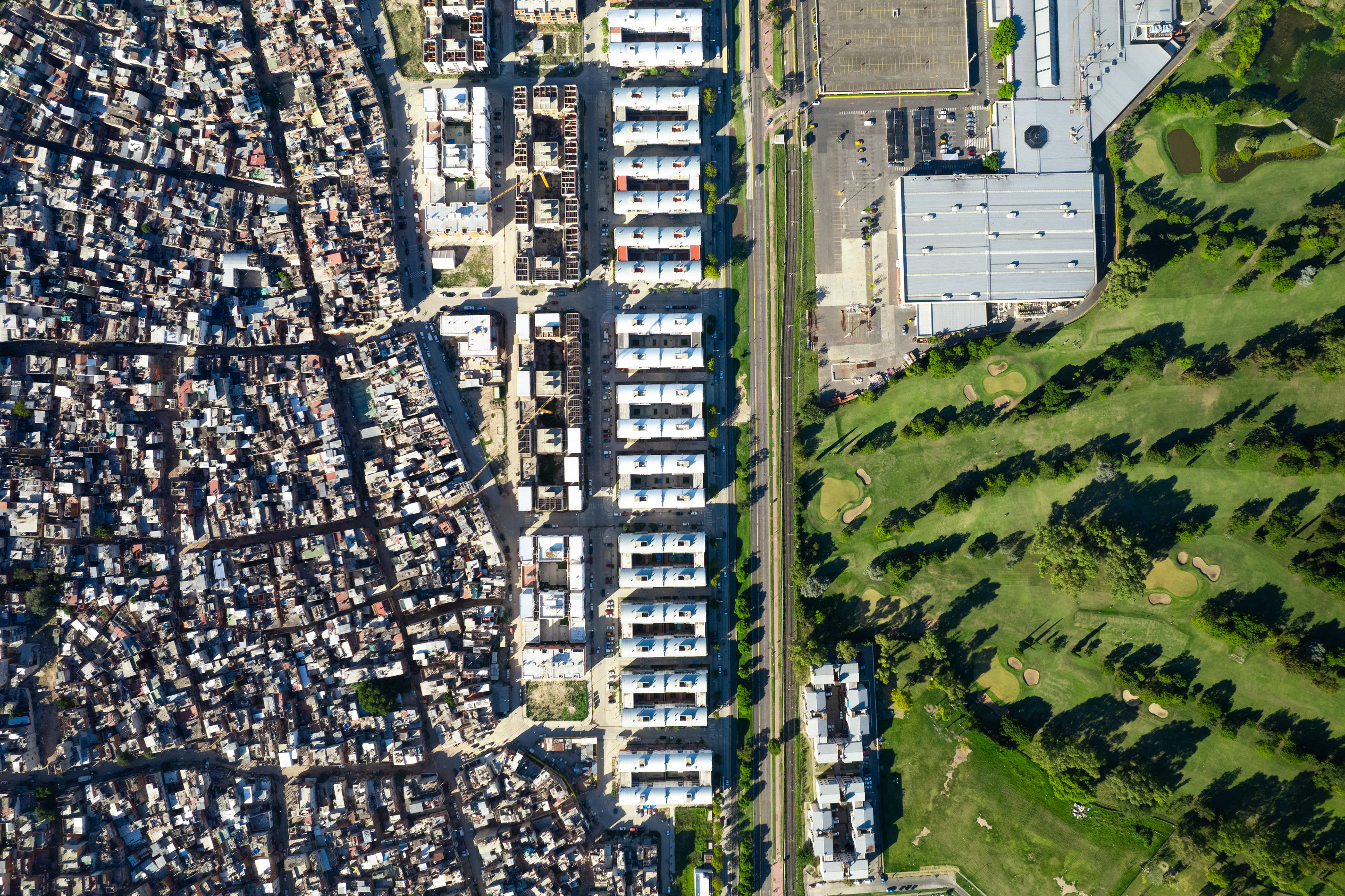
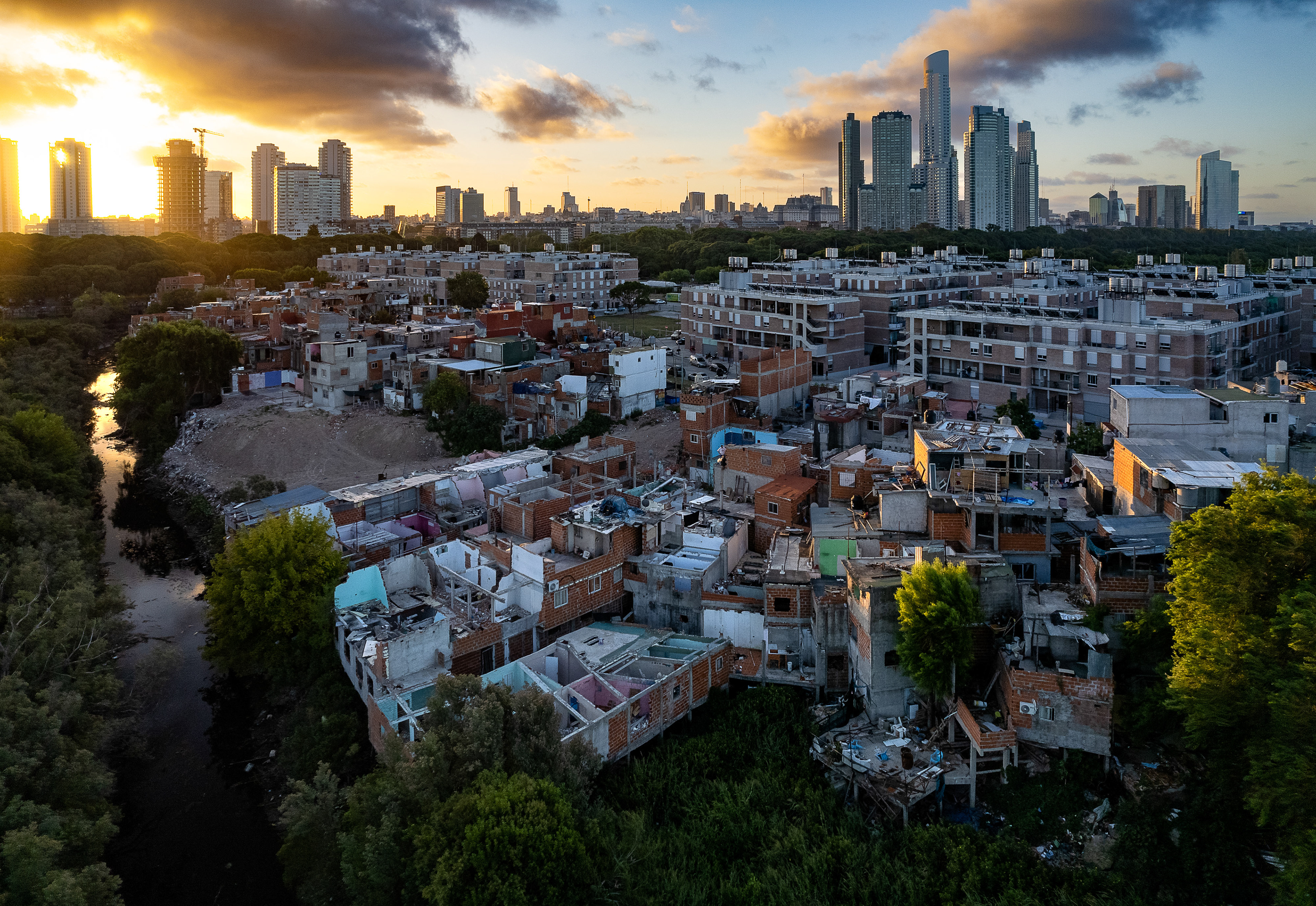
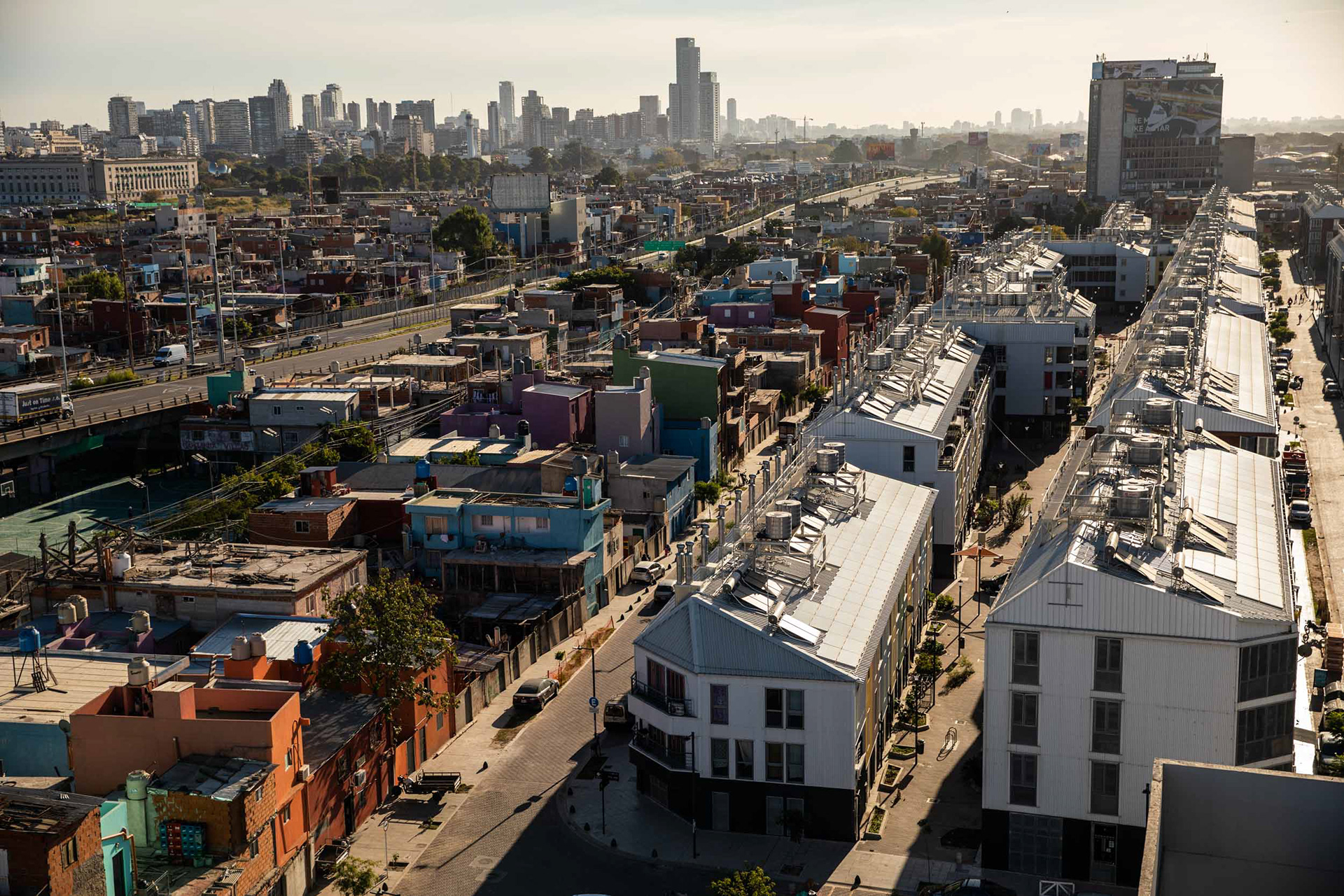
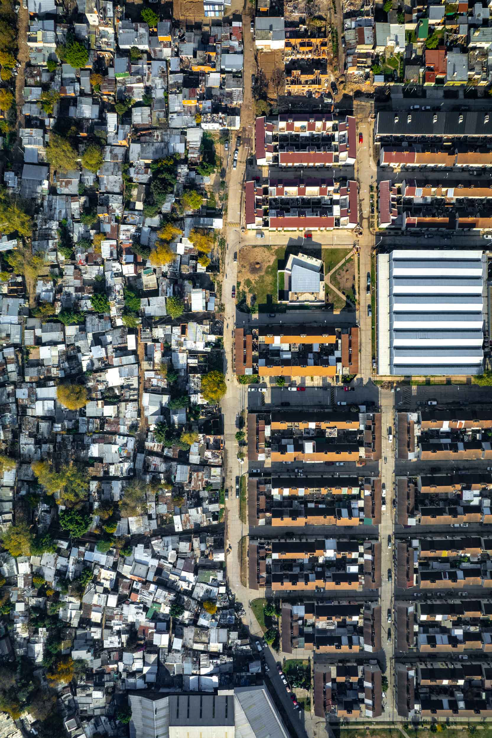
Most of Buenos Aires’ “misery villages” are located in the south of the city. Villa 20 is built directly opposite a shopping center, the Olympic Village (from the 2018 Youth Olympic Games), and a defunct amusement park known as Parque de la Ciudad. Much like other informal neighborhoods in the city, it is undergoing an upgrading process, with new apartment blocks being built in an ever-expanding bid to formalize the city and guarantee basic services.
Villa 21-24.
Barrio Fátima, Villa 3.
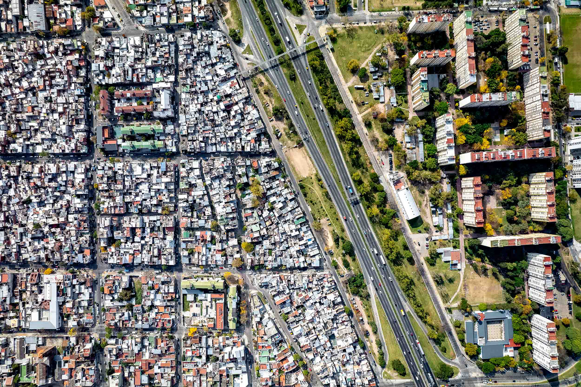
Villa 20.
Villa 20.
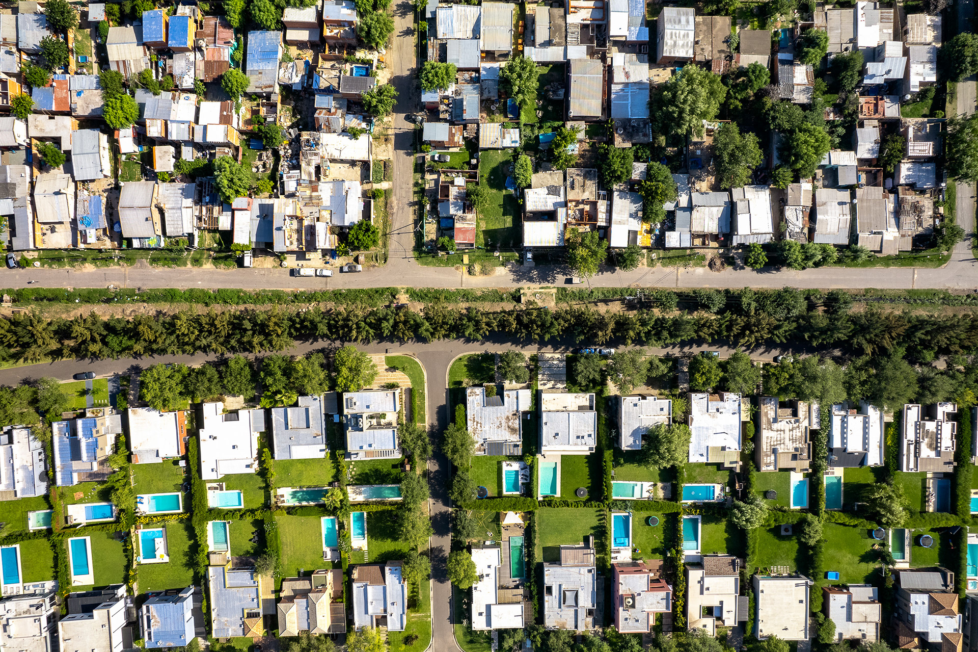
Swimming pools and fences delineate the suburbs into rich and poor in BA province, north of the city.
Barrio Piedrabuena.
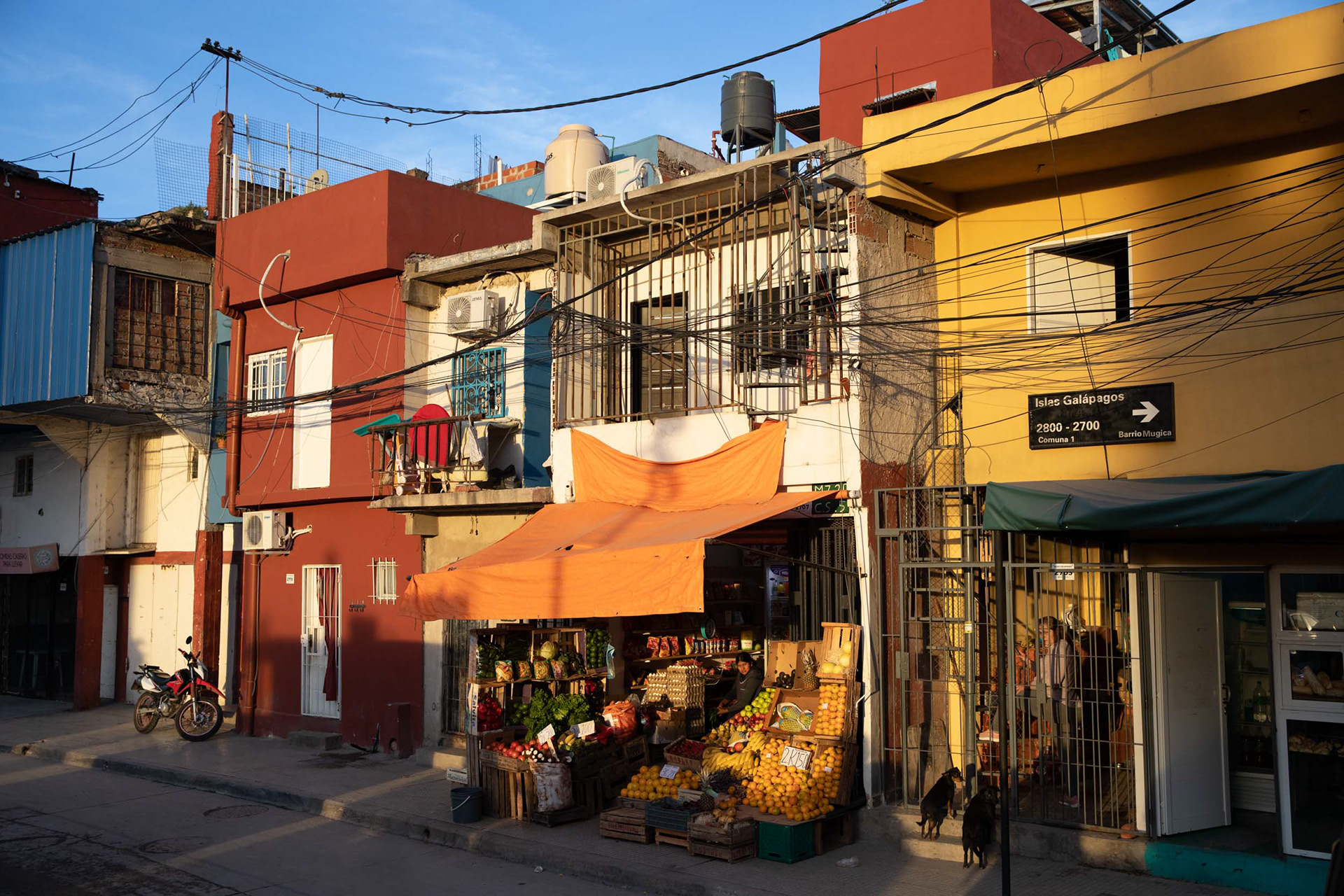
A fruit seller in Villa 31.
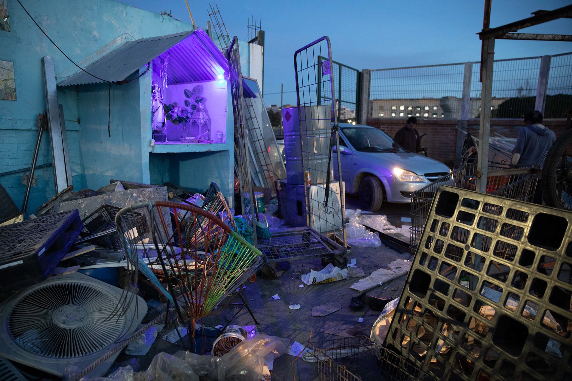
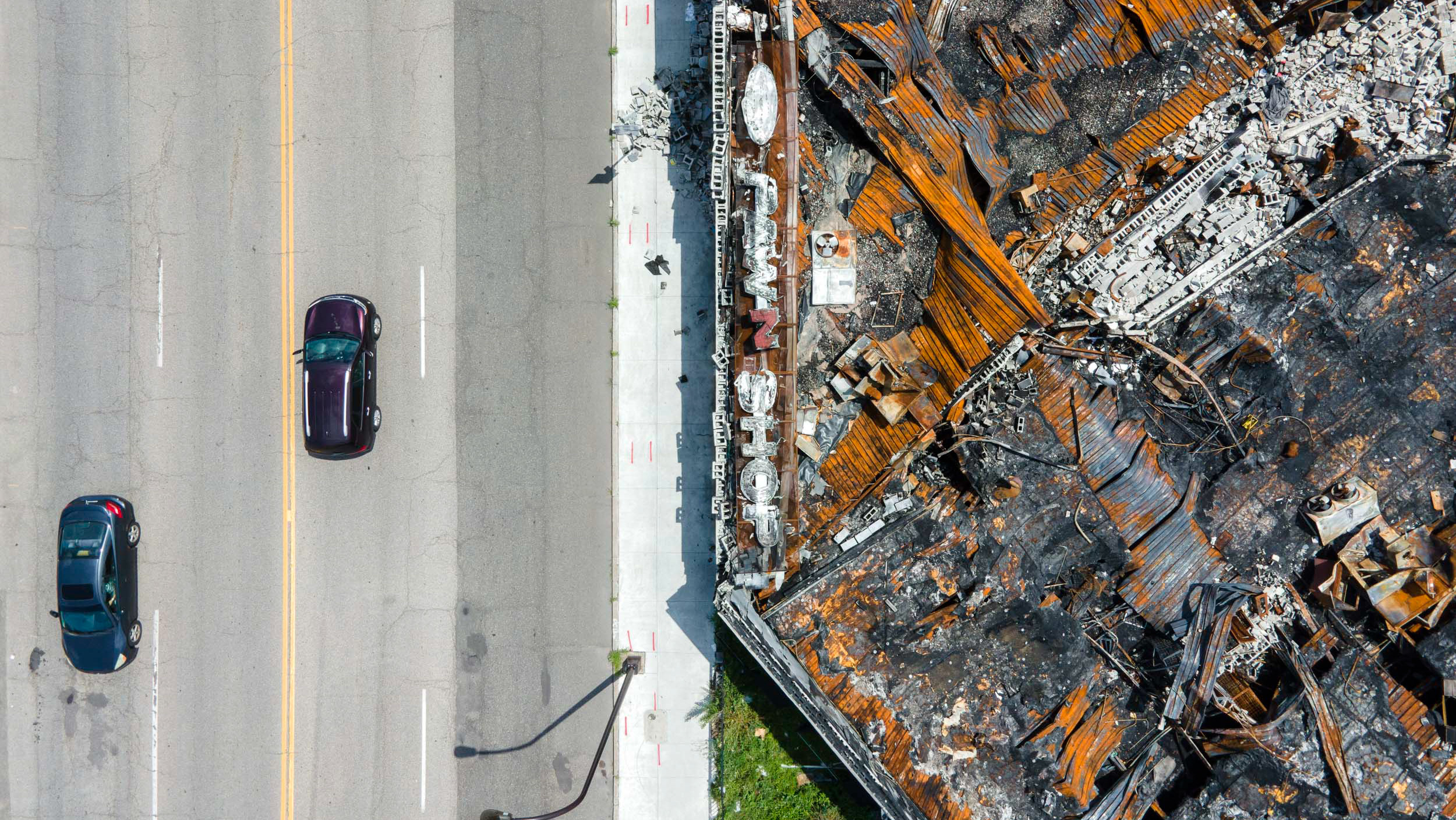
Twilight at the recycling spot.
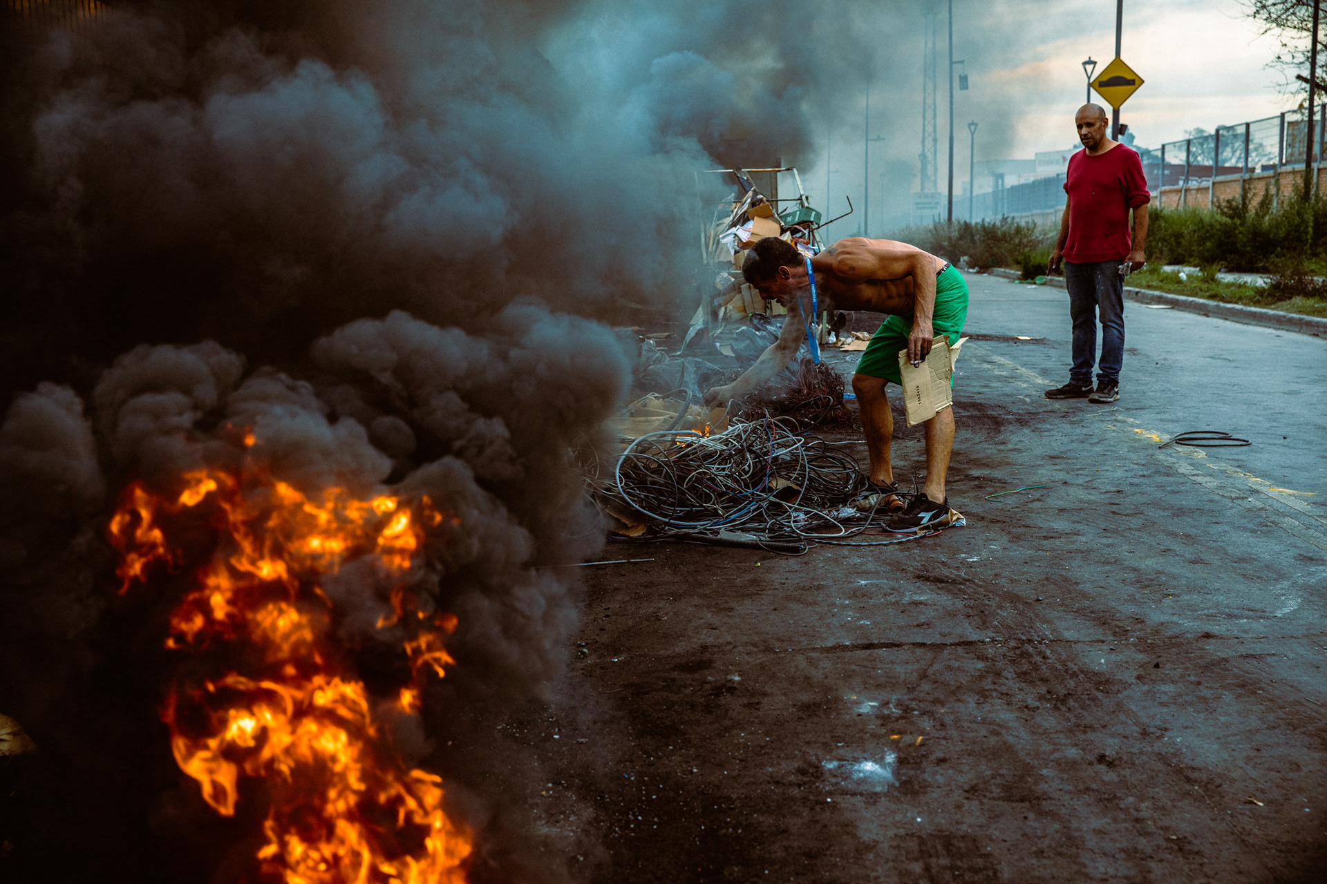
Copper recyclers burn the rubber sheaths off of scrap cables creating toxic smoke in Villa 31.
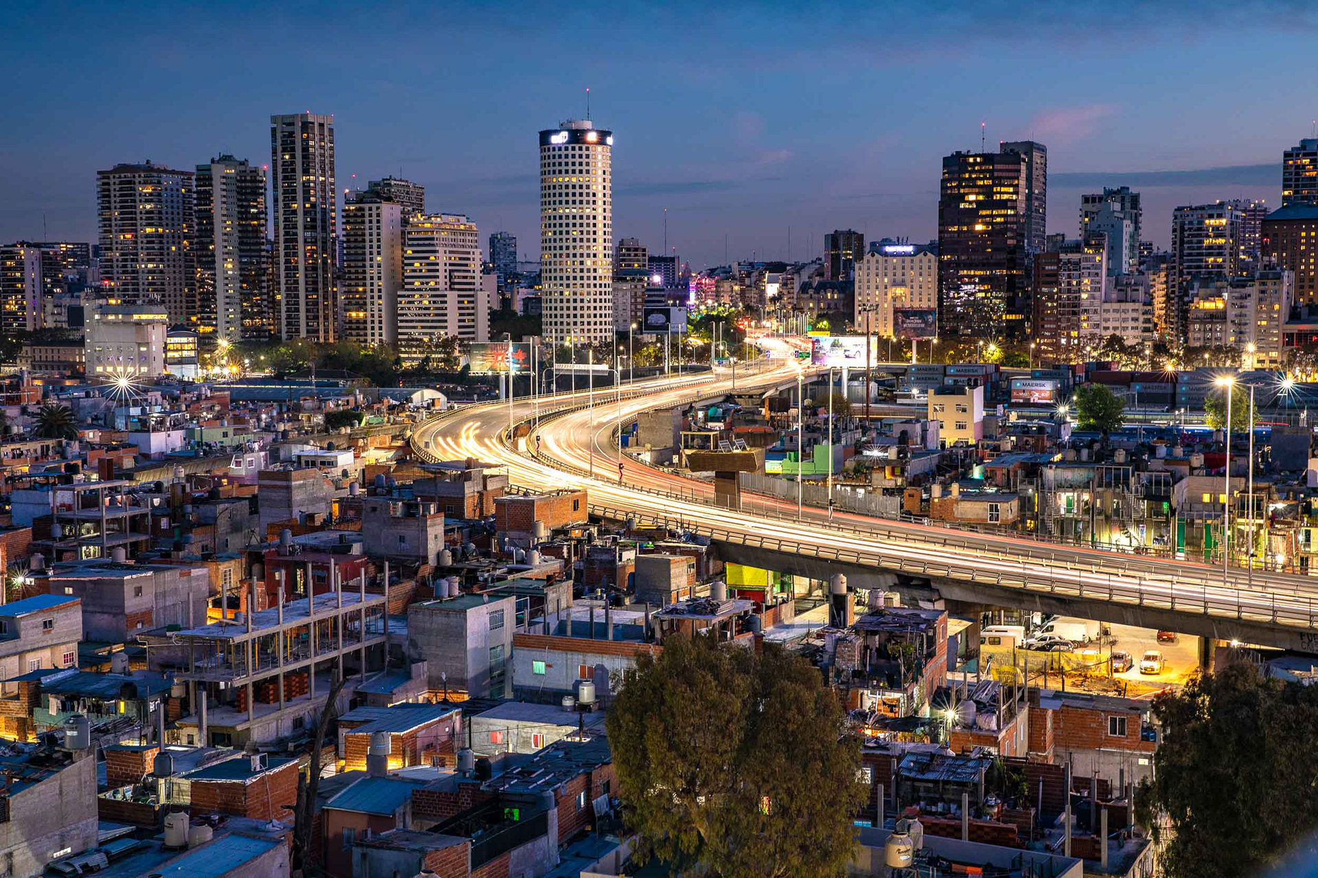
Buenos Aires at night.