The Lower Ninth Ward of New Orleans sits below sea level, ringed by levees and canal floodwalls. When Hurricane Katrina struck in August 2005, those walls failed in at least three places along the Industrial Canal, and water poured in faster than it could escape, rising above the rooftops and trapping people in their attics and on the roofs of their homes. Almost 1,400 people died.
The ward, a historically Black, working-class neighborhood, was among the deadliest hit. The same canal levees had failed here once before, during Hurricane Betsy in 1965.
Dumped tires along an abandoned road in New Orleans.
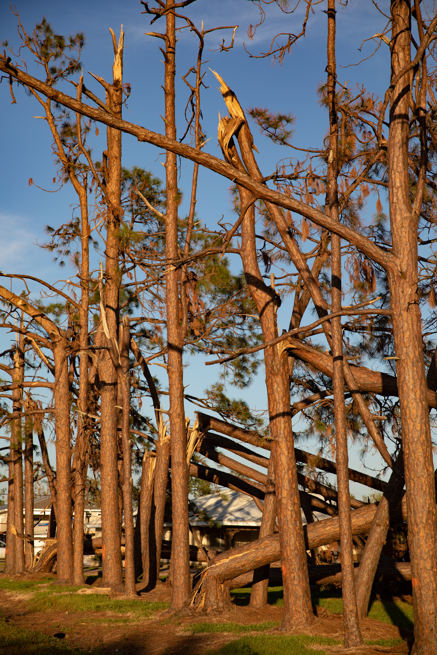
Snapped trees due to Hurricane Ida's Category 4 strength, in Grand Caillou.
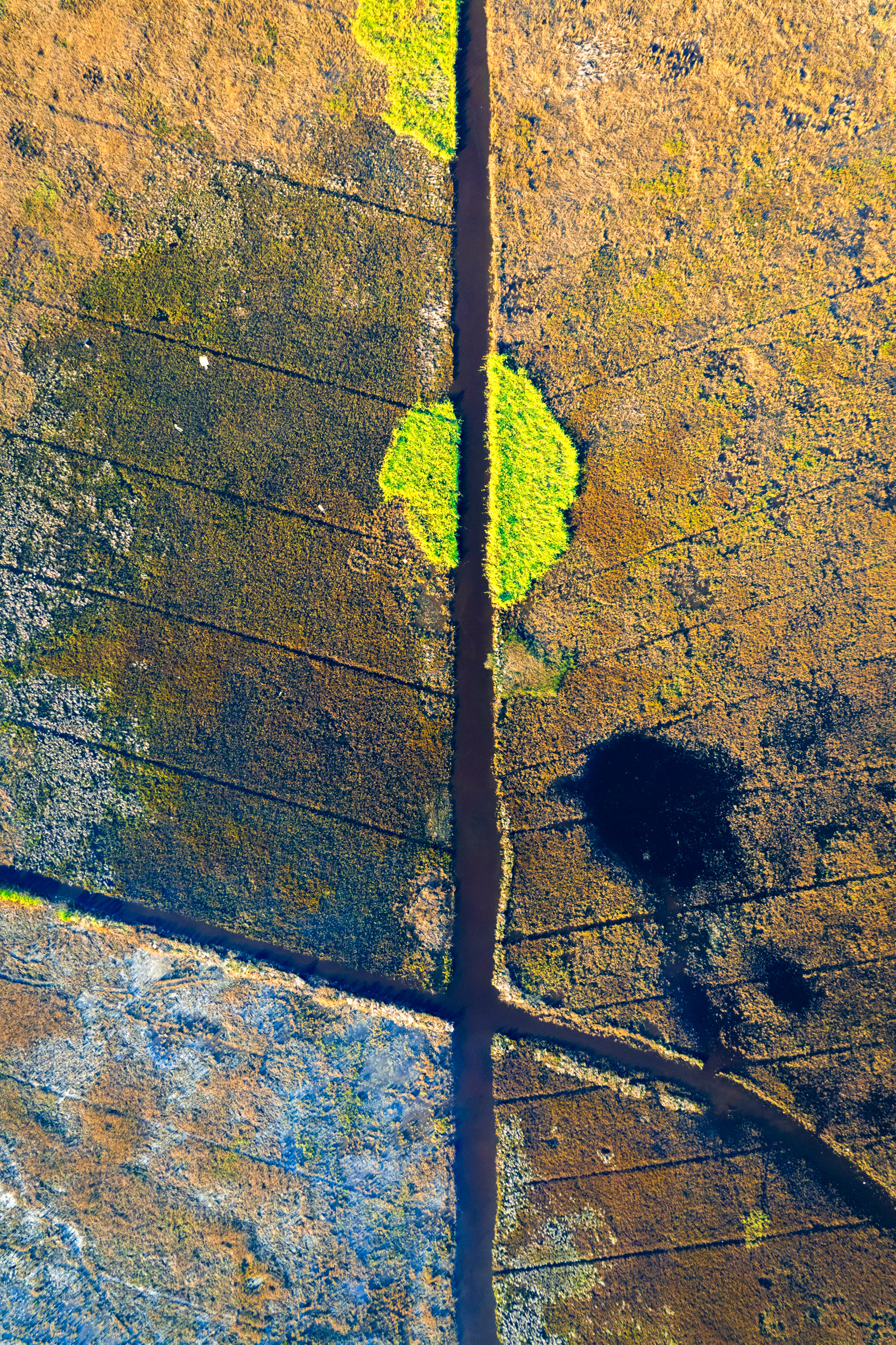
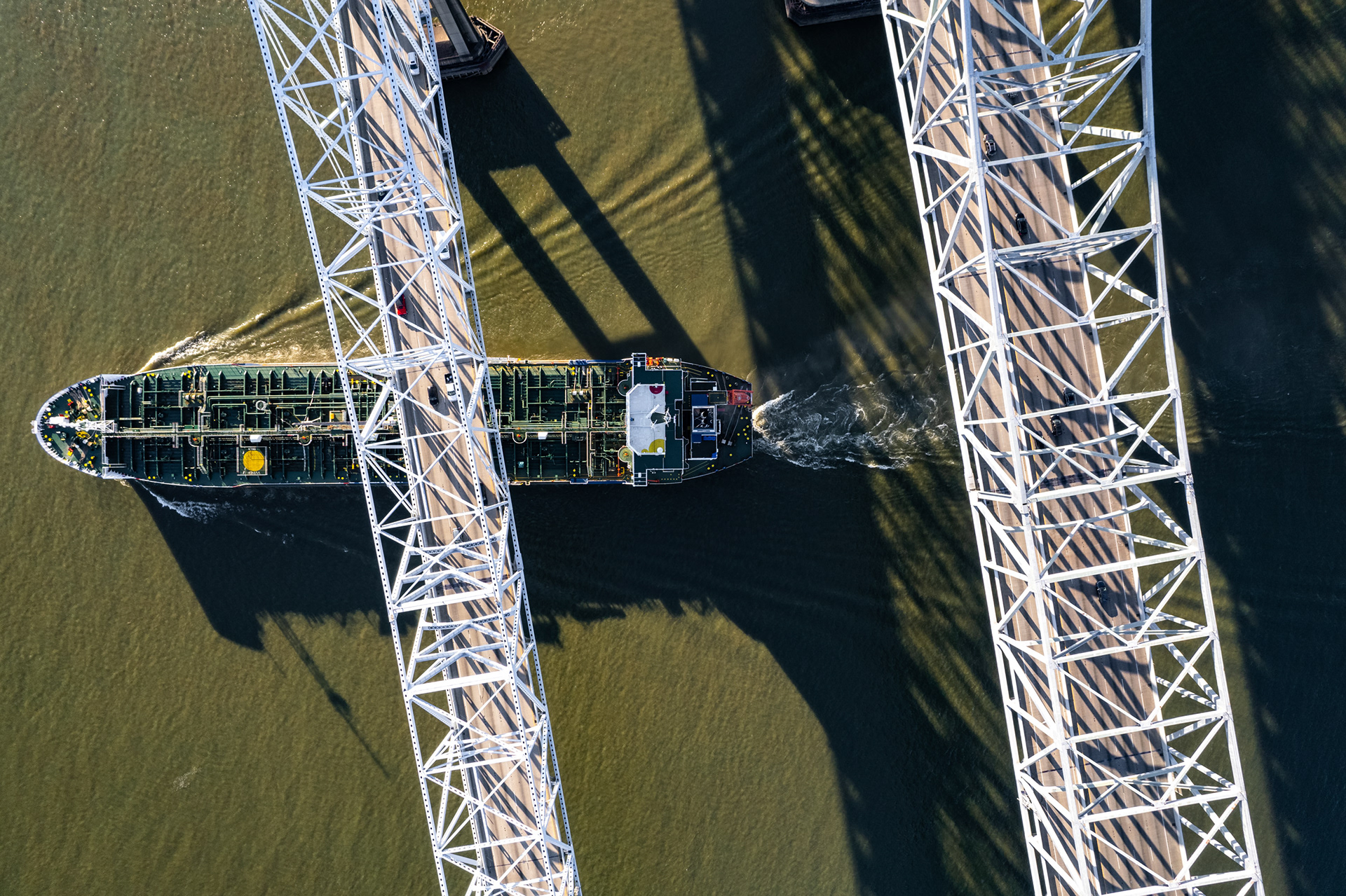
Navigational channels criss-cross the bayou all over southern Louisiana, leaving interesting patterns to decipher from above.
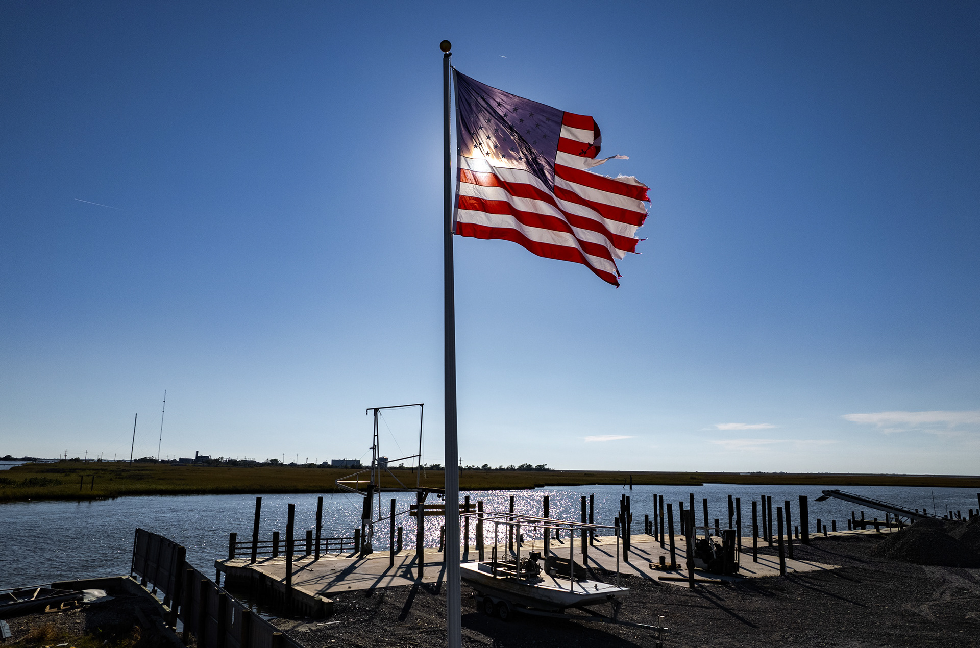
A tattered US flag in Cocodrie, LA just after Hurricane Ida barrelled through in 2021.
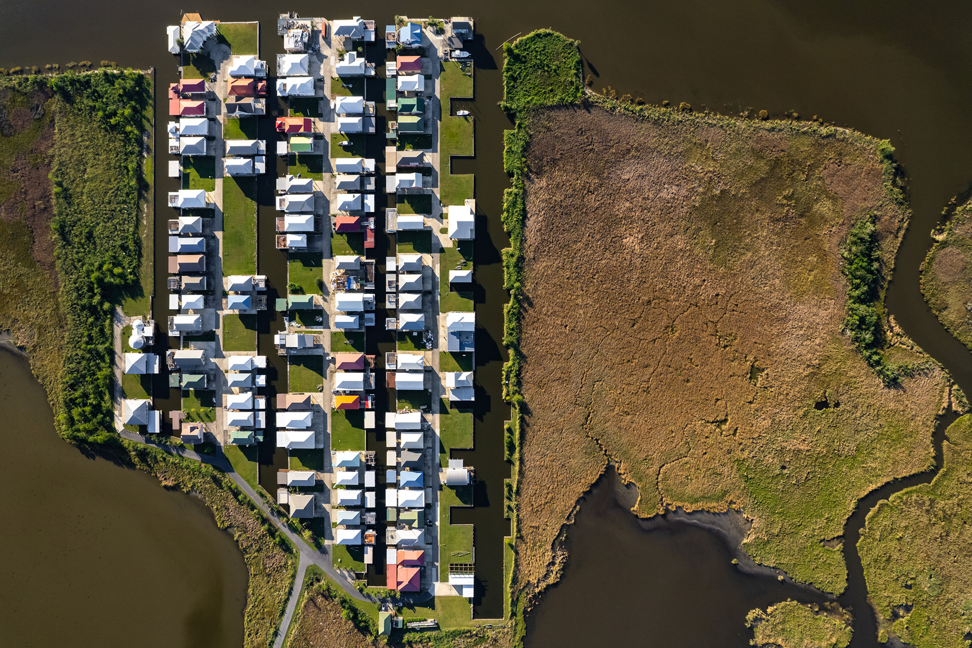
Destroyed and damaged cities, many outside the levee system, south of Houma, which received the brunt of the storm. Many houses are now built on huge stilts, if the homeowner can afford it, preventing flooding from the storm surges which occasionally reach 6m (20ft). The photographer Virginia Hanusik has a great project on coastal Louisiana architecture documenting this.
A bucolic aerial image of New Orleans belies the fact that it has indisputably high crime rates and racial tensions.
In the years after Katrina, displacement fractured communities, and uneven rebuilding deepened racial divides. Wealth returned first to higher, whiter ground—Uptown, the Marigny, the Bywater—while working-class Black neighborhoods faced slower recovery, rising rents, and gentrification disguised as revitalization.
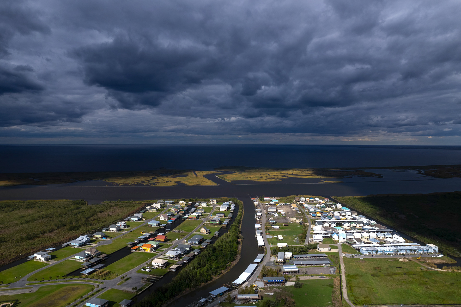
Outside the levee system at Shell Beach, looking out into the Gulf of Mexico. Many residents have built their homes here on tall stilts, anticipating the arrival of another catastrophic storm surge which is all but certain.
Chalmette, just to the east of New Orleans. In 2005, Hurricane Katrina inundated this neighborhood with up to 12 feet of water, causing up to 1m gallons of oil to leak out of a storage tank at the nearby Murphy Oil refinery. The ensuing oil spill spread throughout the neighborhood, affecting roughly 1,800 homes and forcing the relocation of thousands of people. Eventually Murphy Oil settled for $330m in a class action lawsuit. The boundary of where the water affected the homes is easy to see, and the neighborhood immediately surrounding the refinery is now open fields.
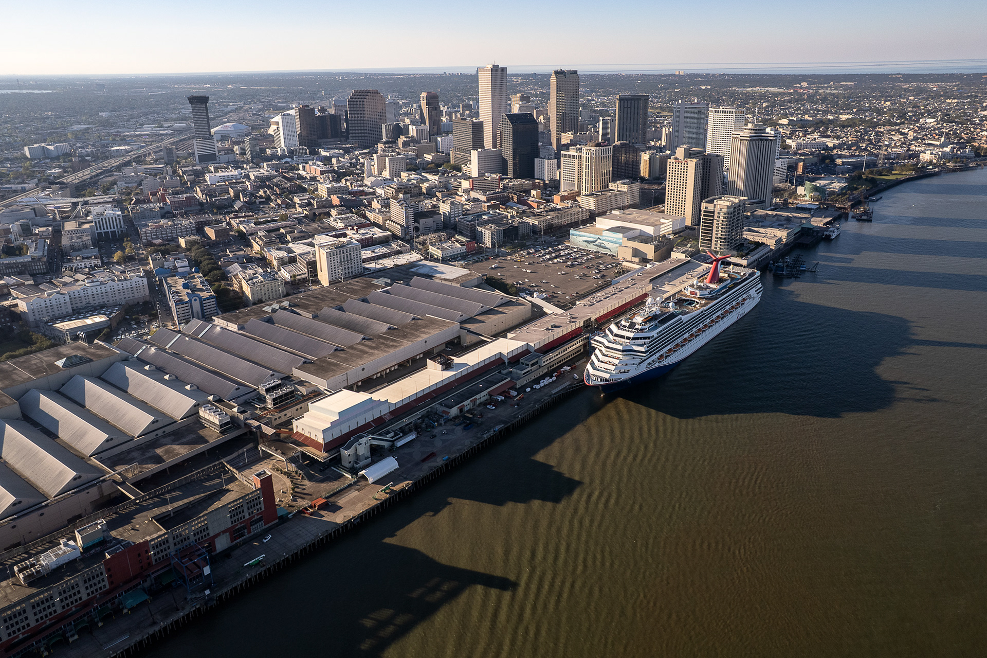
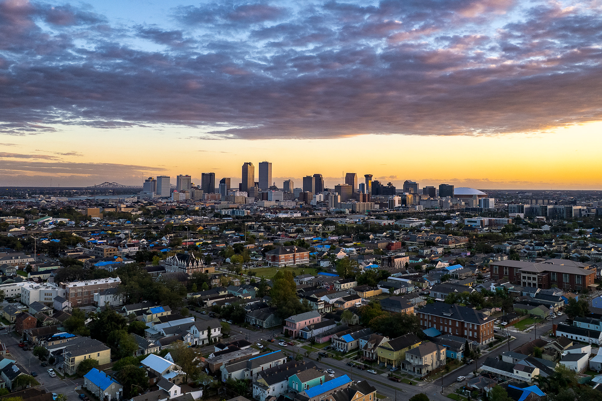
Cruise passenger numbers hit an all-time high in April 2025, an industry that has been growing quickly, injecting tens of millions into city coffers.
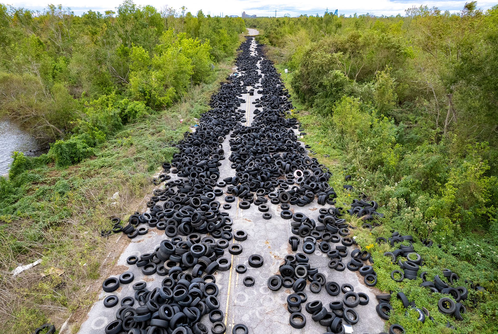
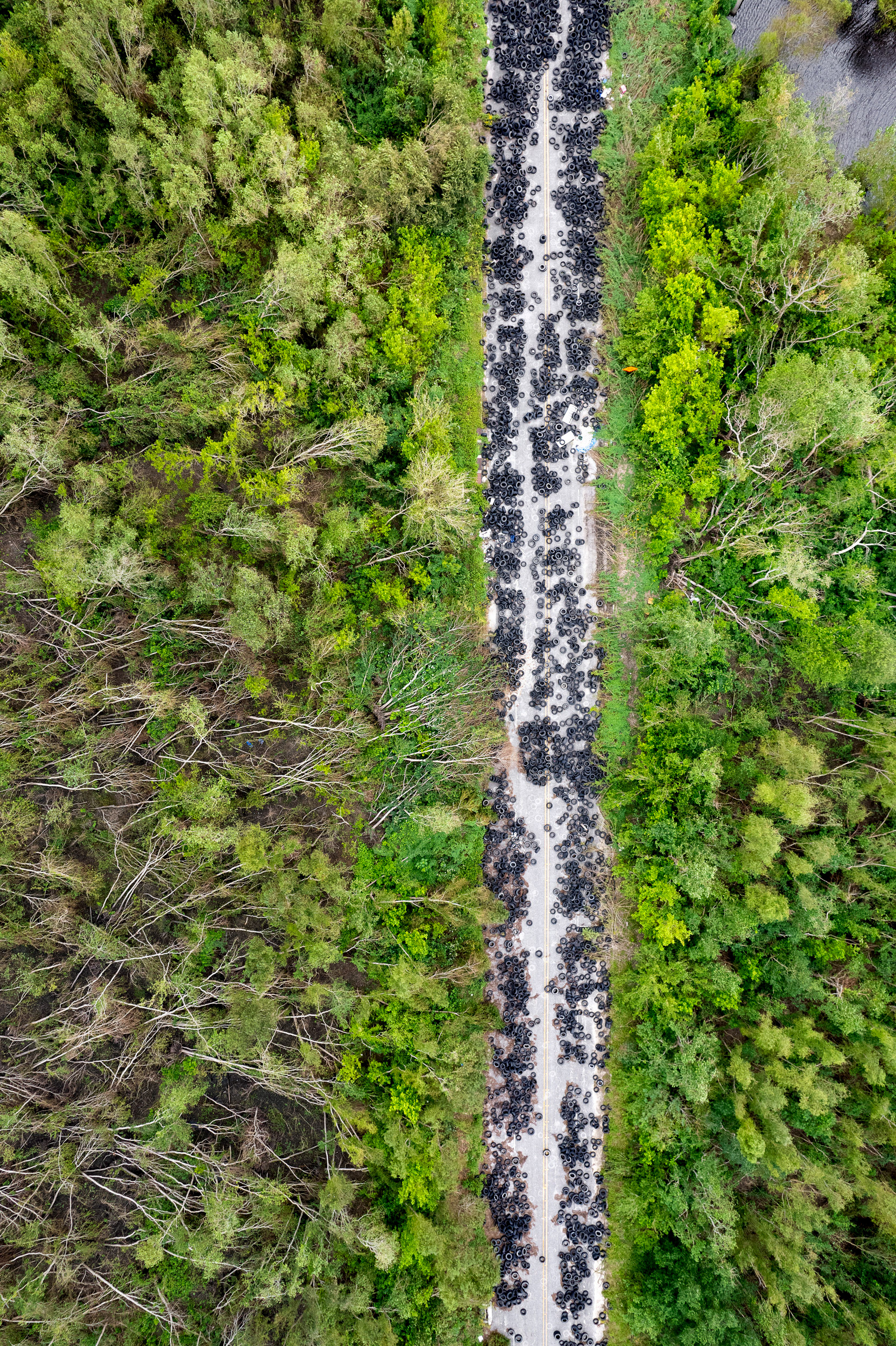
At the interchange of Interstate 10 (I-10) and Michoud Boulevard in New Orleans East, an abandoned service road behind a subdivision has been used for the illegal dumping of thousands of tires.
The Mississippi River, downtown New Orleans.
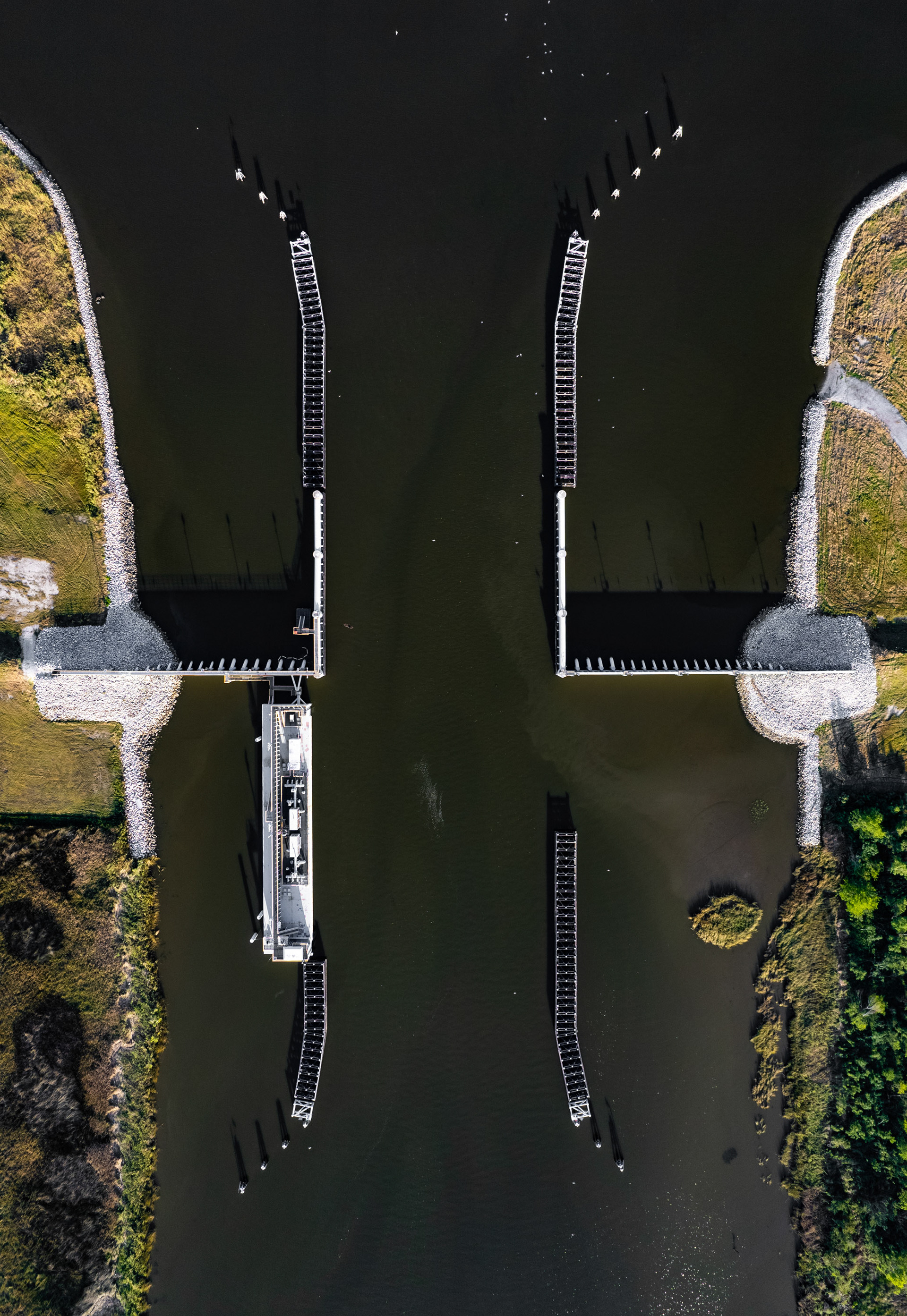
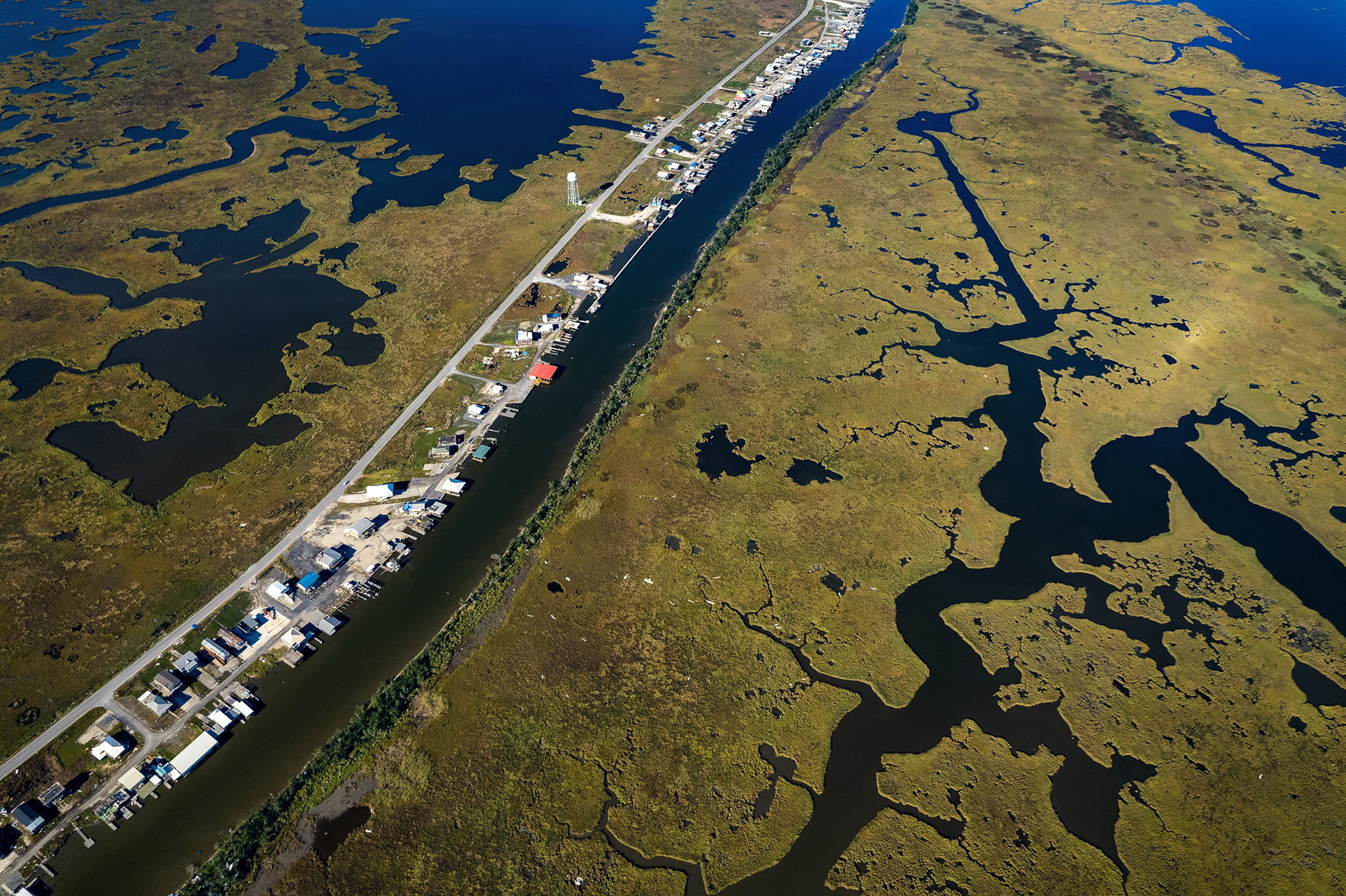
Floodgate, Houma Navigation Channel.
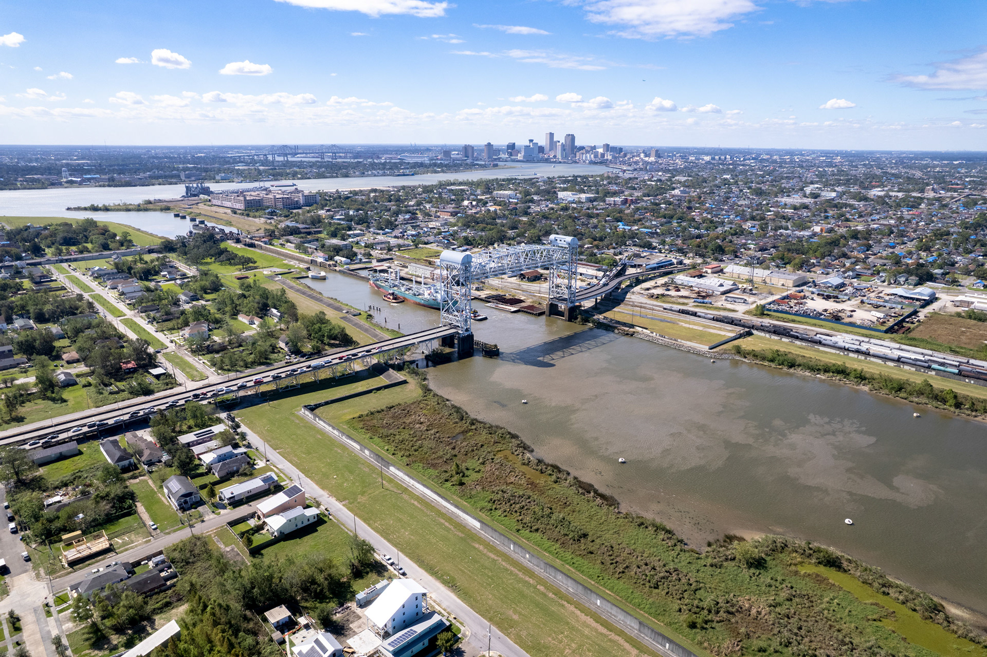
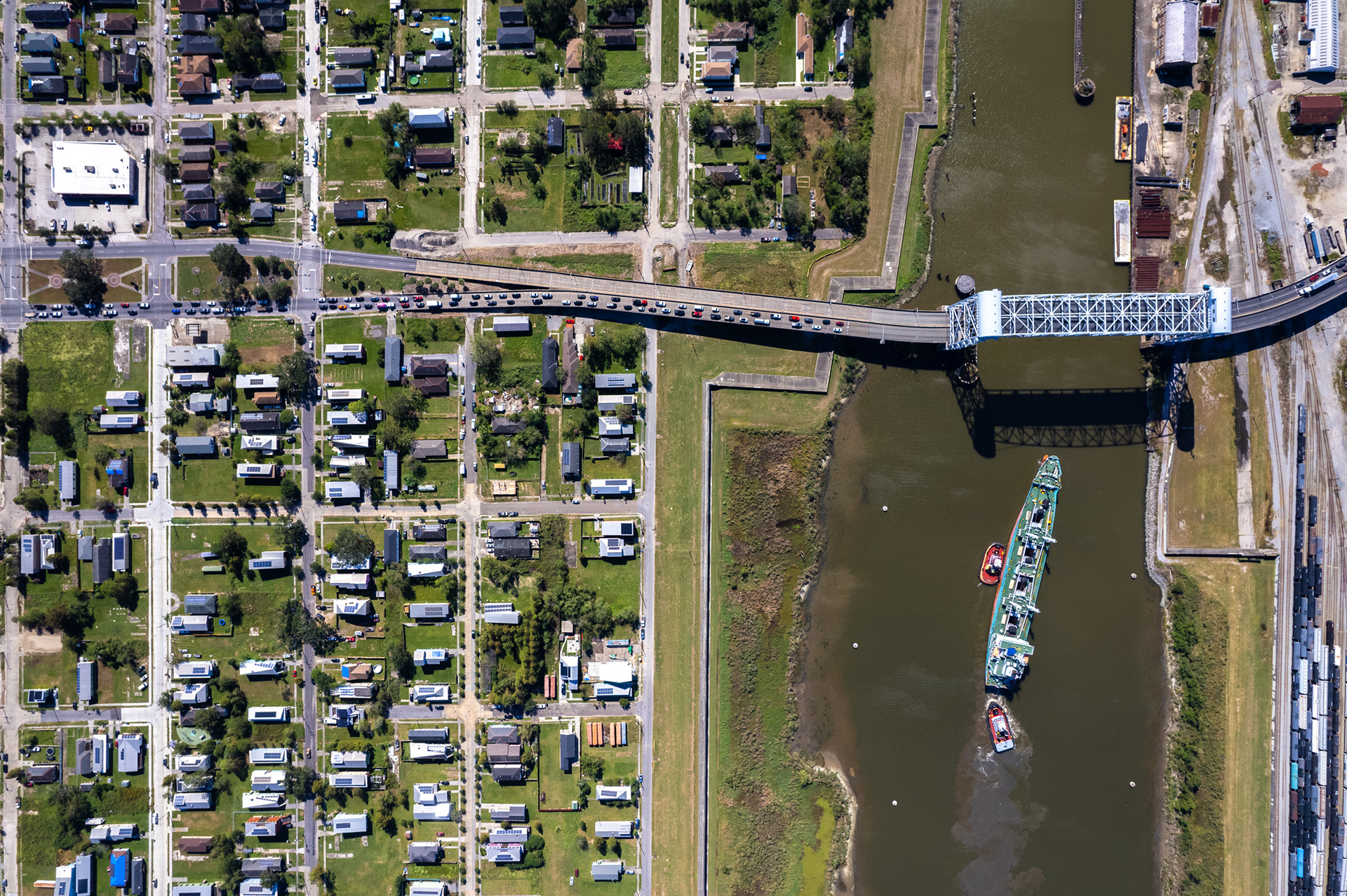
Looking across the bridge toward downtown, the Lower Ninth Ward shows both ruin and renewal. New homes rise among the ghosts of flooded blocks, their bright roofs punctuating a landscape still marked by absence. The levee gleams, stronger now, but the skyline beyond feels distant—prosperity visible, yet unevenly shared.
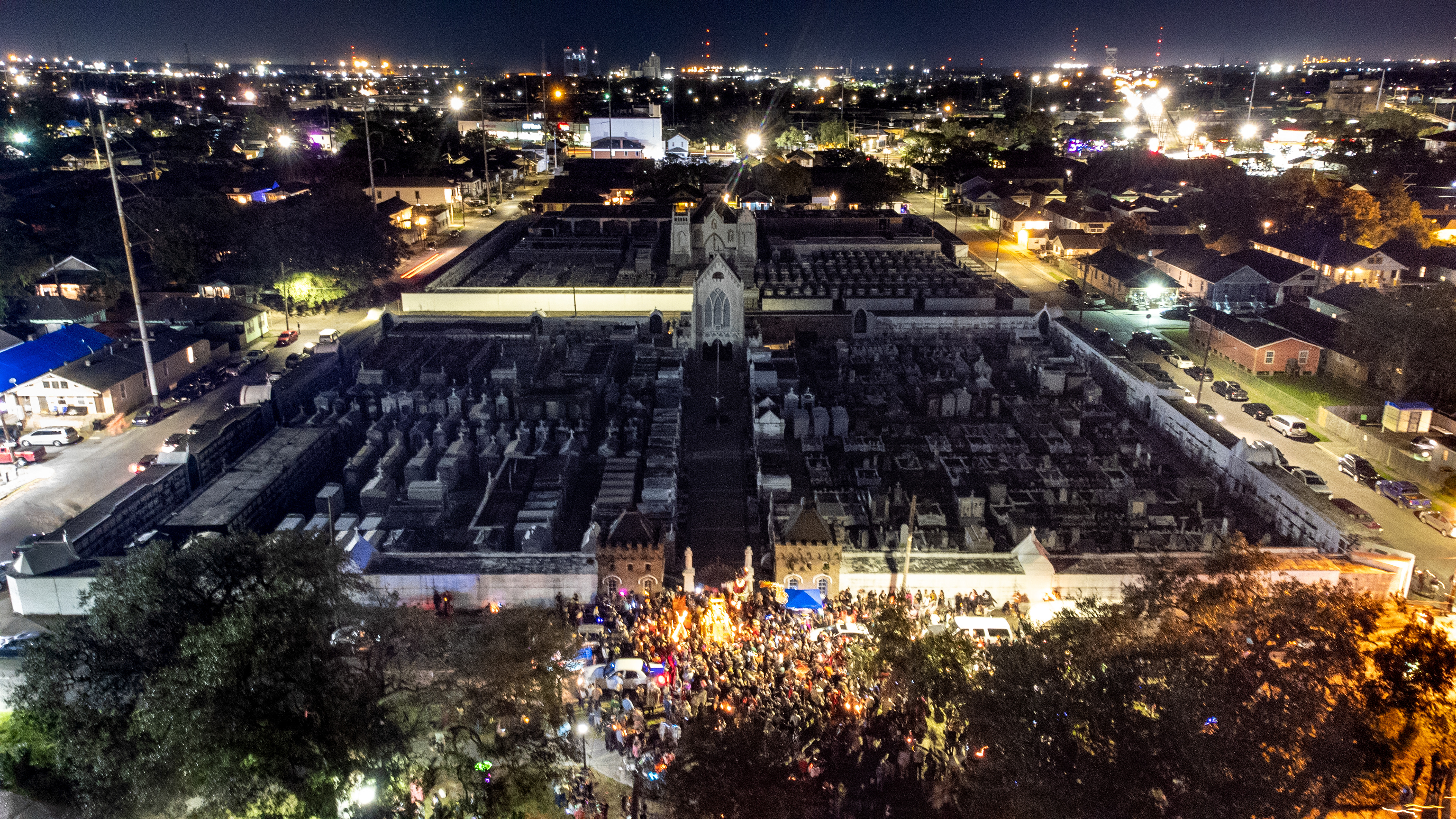
The St. Roch Day of the Dead parade winds through city streets blending Mexican, Creole, and Catholic cultures into a beautiful celebration.
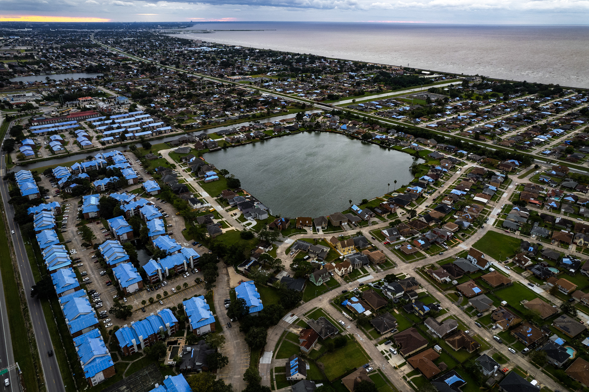
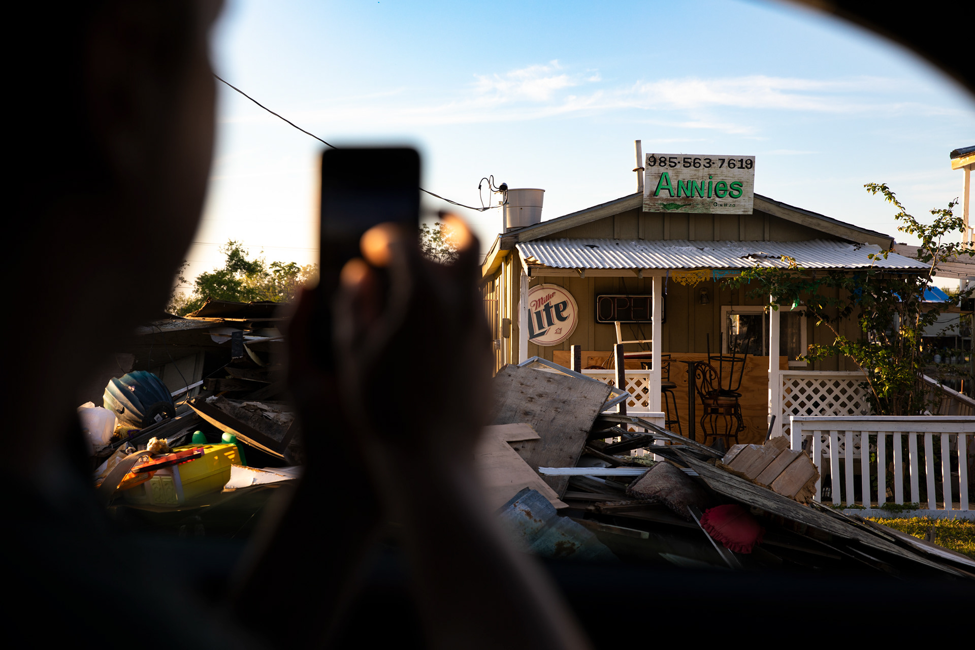
Months after Hurricane Ida made landfall south of New Orleans as a Category 4 hurricane with 150mph winds in 2021, most homes still are covered in blue tarps with wind-damaged roofs.
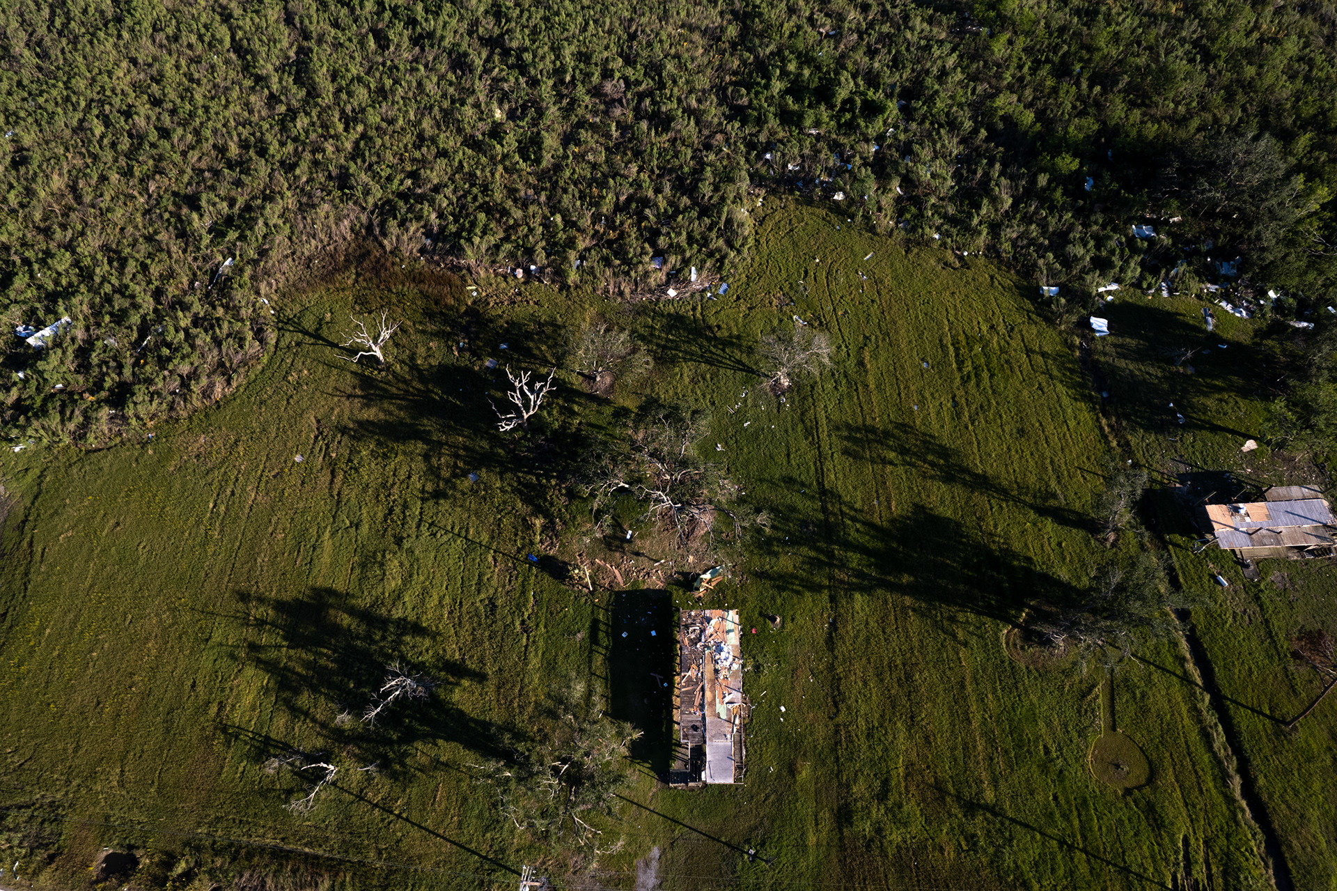
Wrecked home, Grand Caillou.
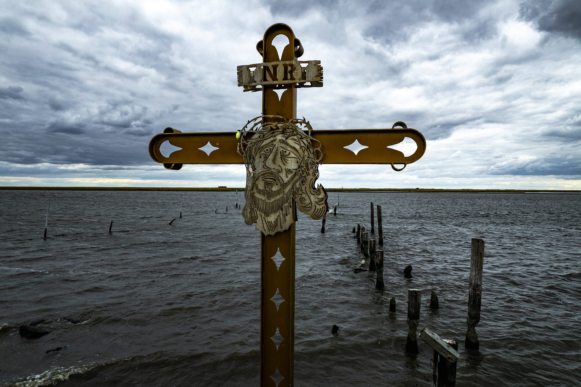
Hurricane Katrina memorial, Shell Beach.
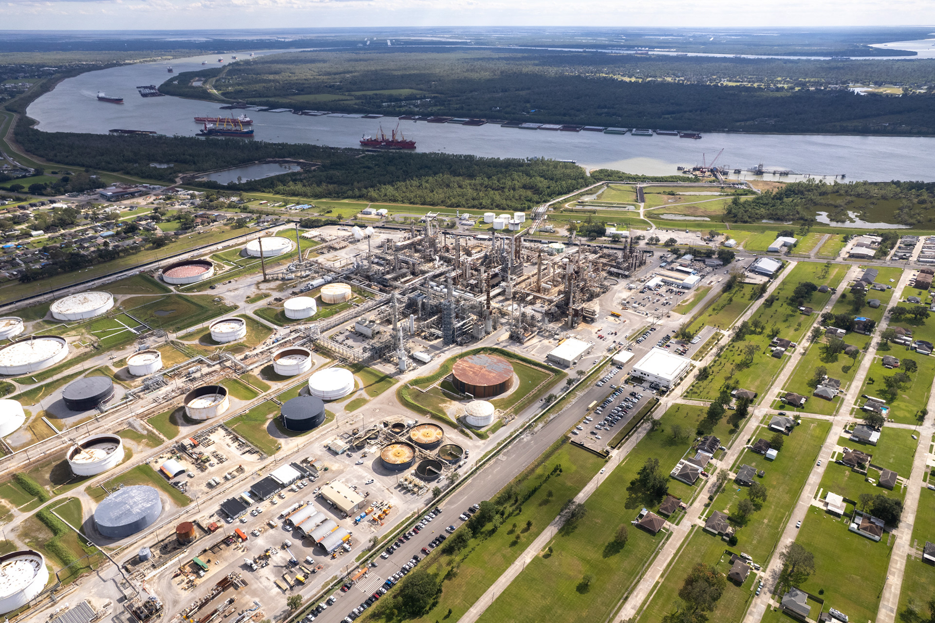
Between Baton Rouge and New Orleans lies the area known as Cancer Alley — an 85-mile industrial corridor where more than 150 petrochemical plants crowd the Mississippi River’s banks. In predominantly Black, low-income parishes, residents face some of the highest estimated cancer risks in the U.S., exposure to carcinogens far above accepted levels, and an unequal share of cleanup and health burdens.
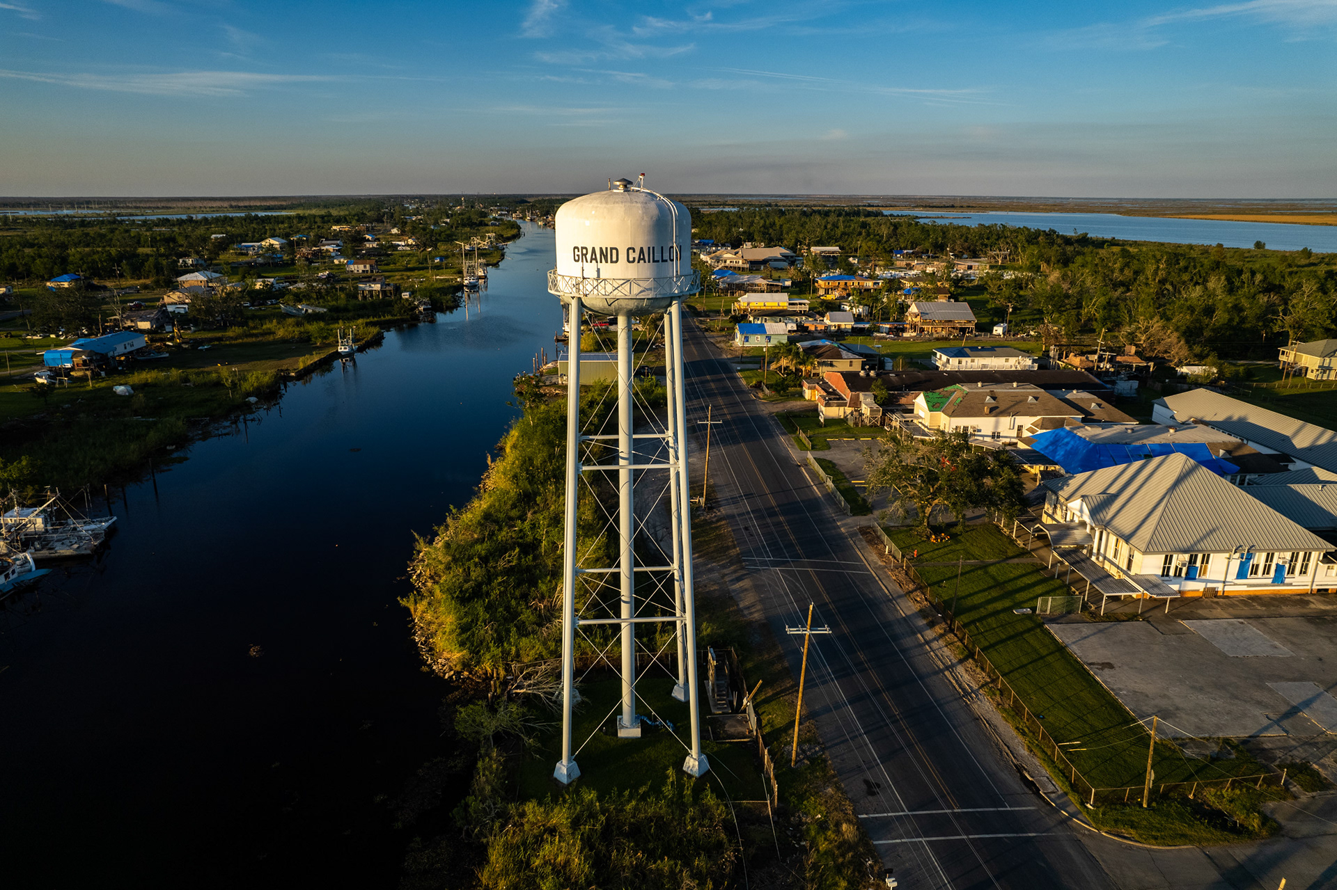
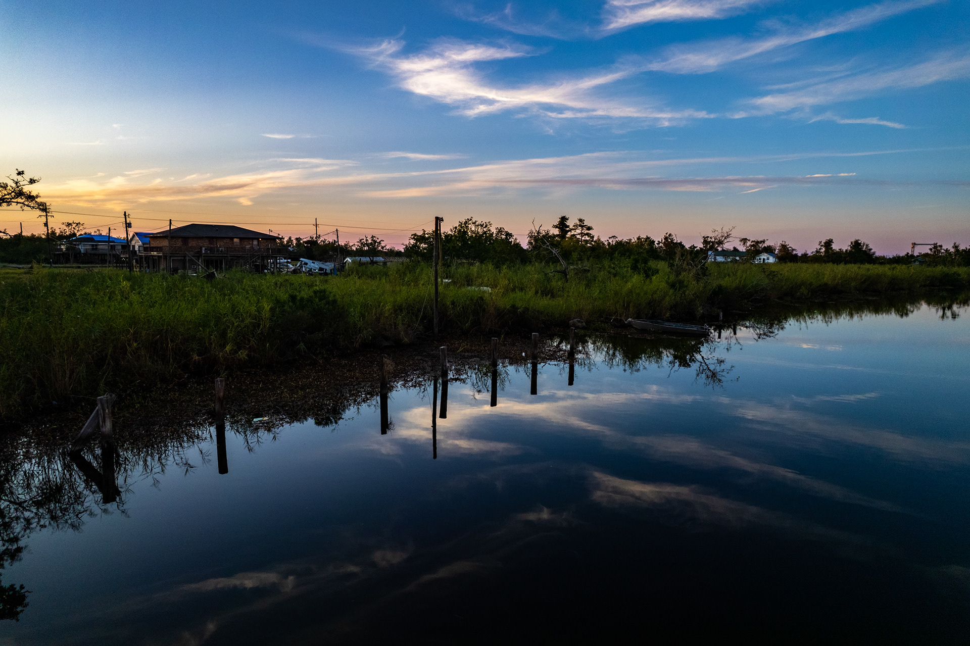
Grand Caillou. Residents are still dealing with the effects from the raging winds of Hurricane Ida, which hit just two months before these photos were taken.
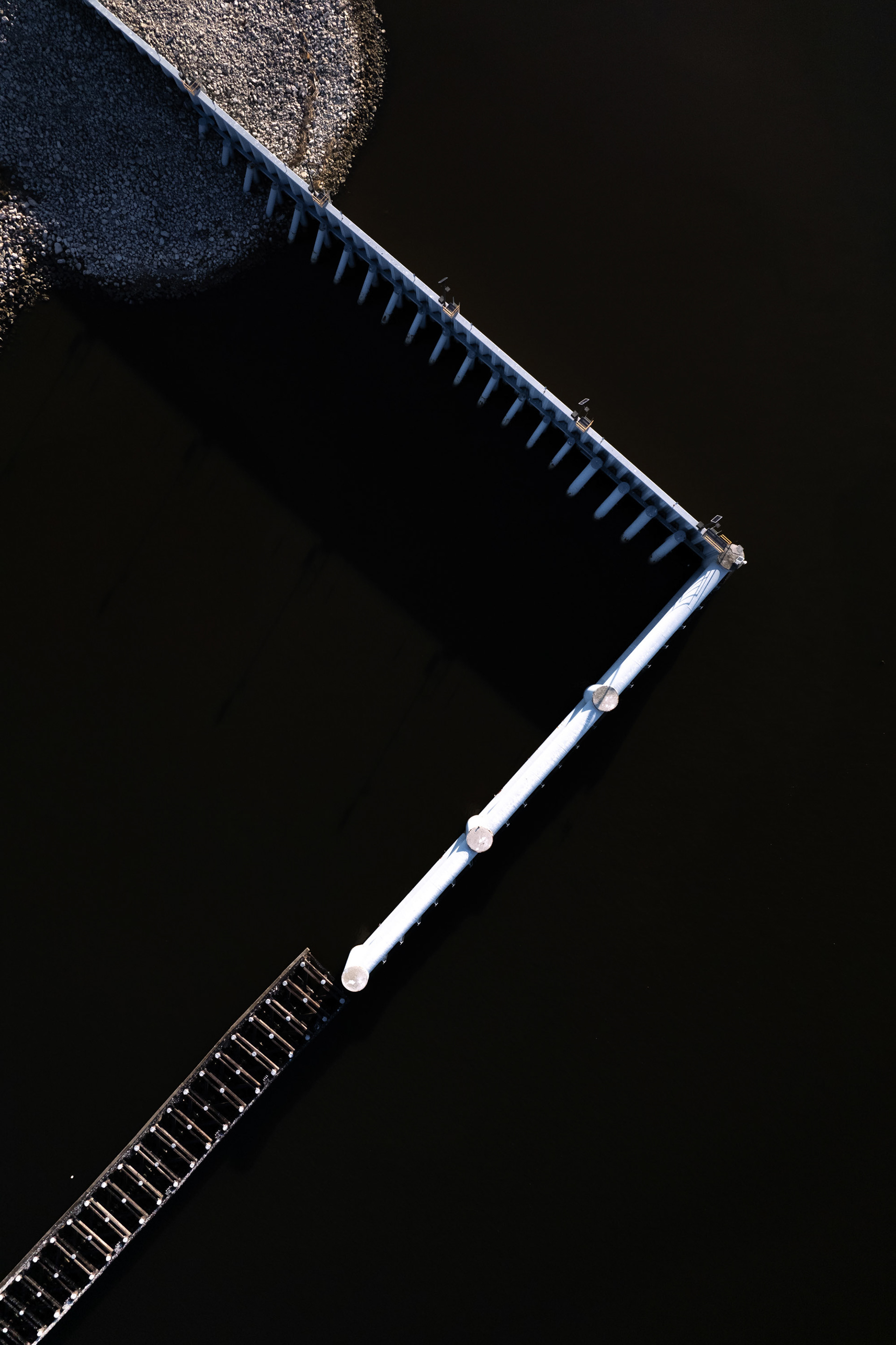
Floodgates along the Houma Navigation Channel.
Coastal Louisiana is disappearing into the Gulf of Mexico. Sea level rise, subsidence, and hurricanes are projected to completely alter the landscape here without massive and costly intervention in the form of levees and other diversions. Fossil fuel companies all along the Gulf Coast, which are the prime contributors to this sea level rise, have effectively outsourced the true costs of their operations onto the surrounding population and state and federal governments. This area will most likely be completely underwater within a few decades.
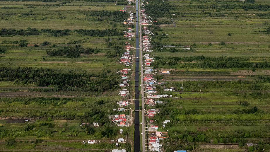
The long road through the delta to Cocodrie.
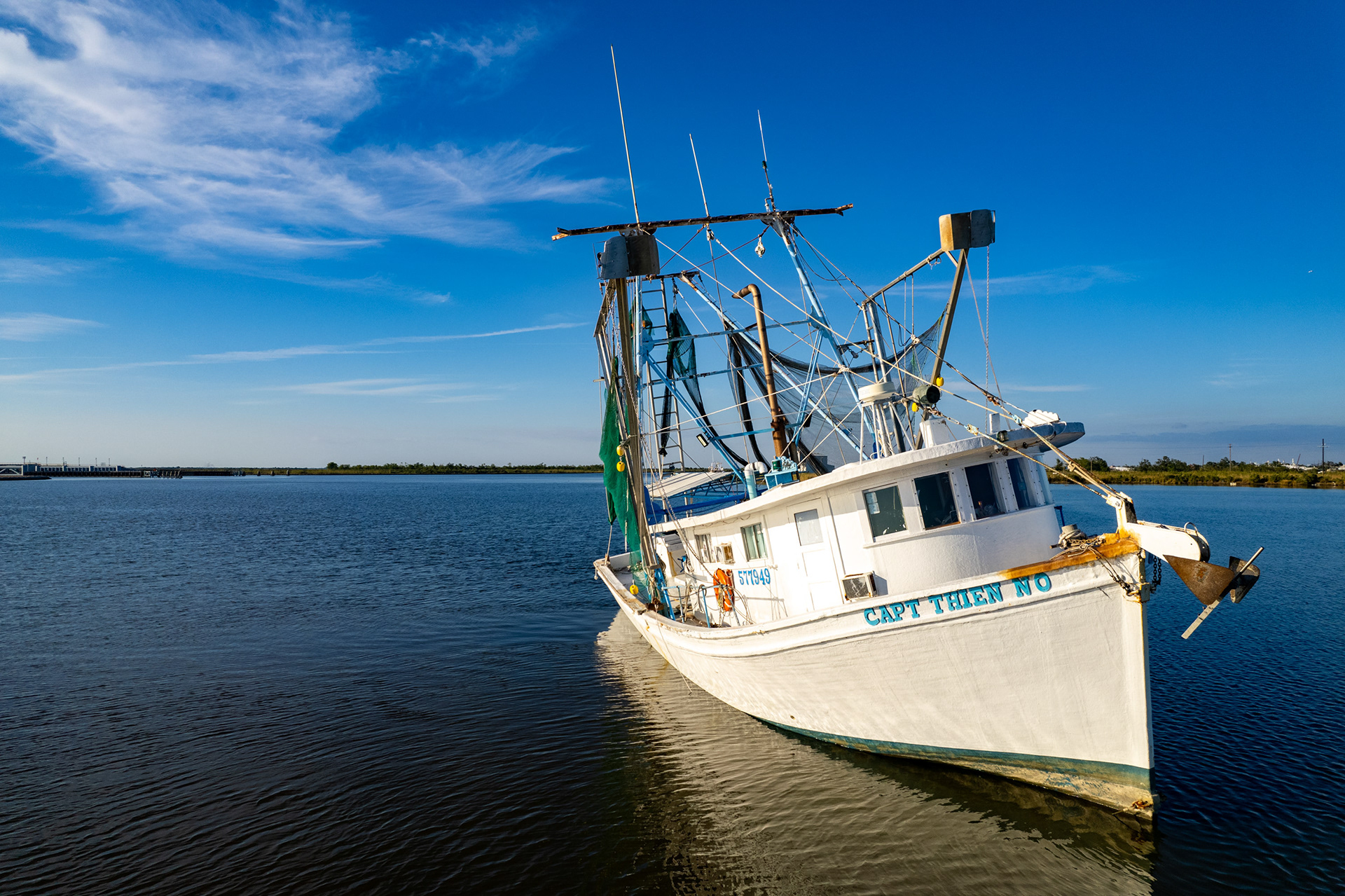
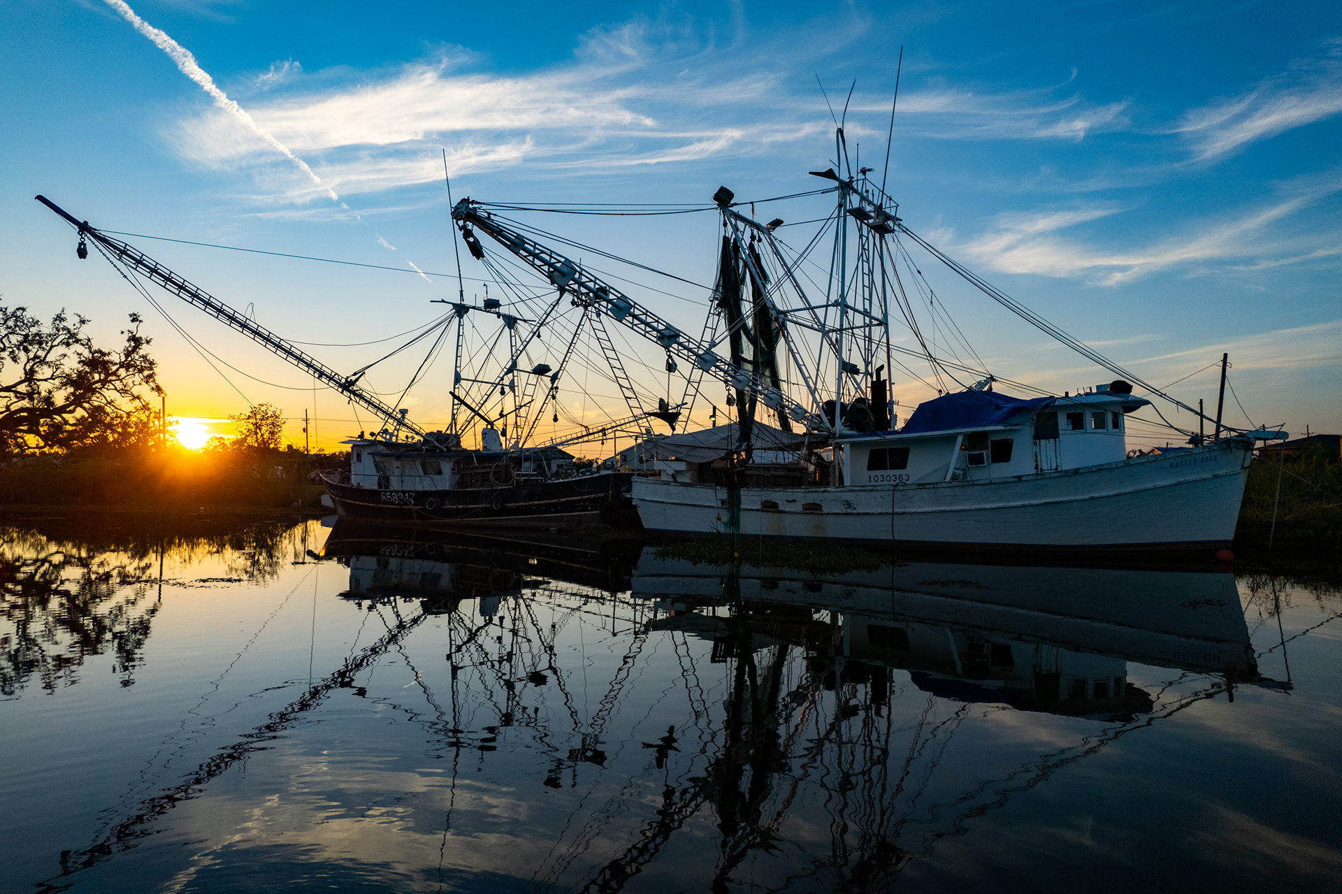
After the Vietnam War, thousands of Vietnamese refugees settled along the Gulf Coast, and many entered the shrimping and fishing industry. Today, Vietnamese-American shrimpers are a vital part of Louisiana’s coastal economy.
They often run small, family-owned boats and have faced recurring challenges: hurricanes, pollution, industrial competition, and post–BP oil spill recovery. Despite that, they’ve maintained a strong community identity, blending Vietnamese culture with Cajun coastal life.
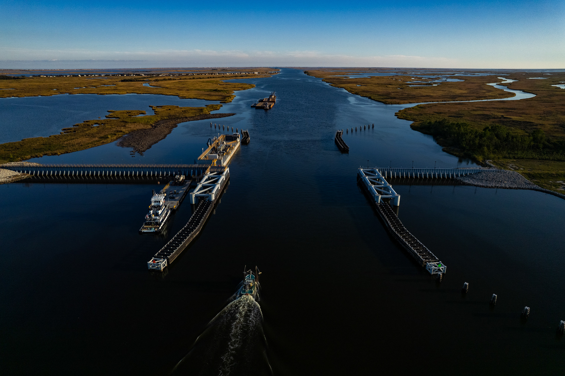
The Bubba Dove Floodgate, a crucial component of the hurricane protection system in coastal Louisiana, opened in 2022.

Bayou in Grand Caillou.
Bayou in Grand Caillou.
Bayou in Grand Caillou.
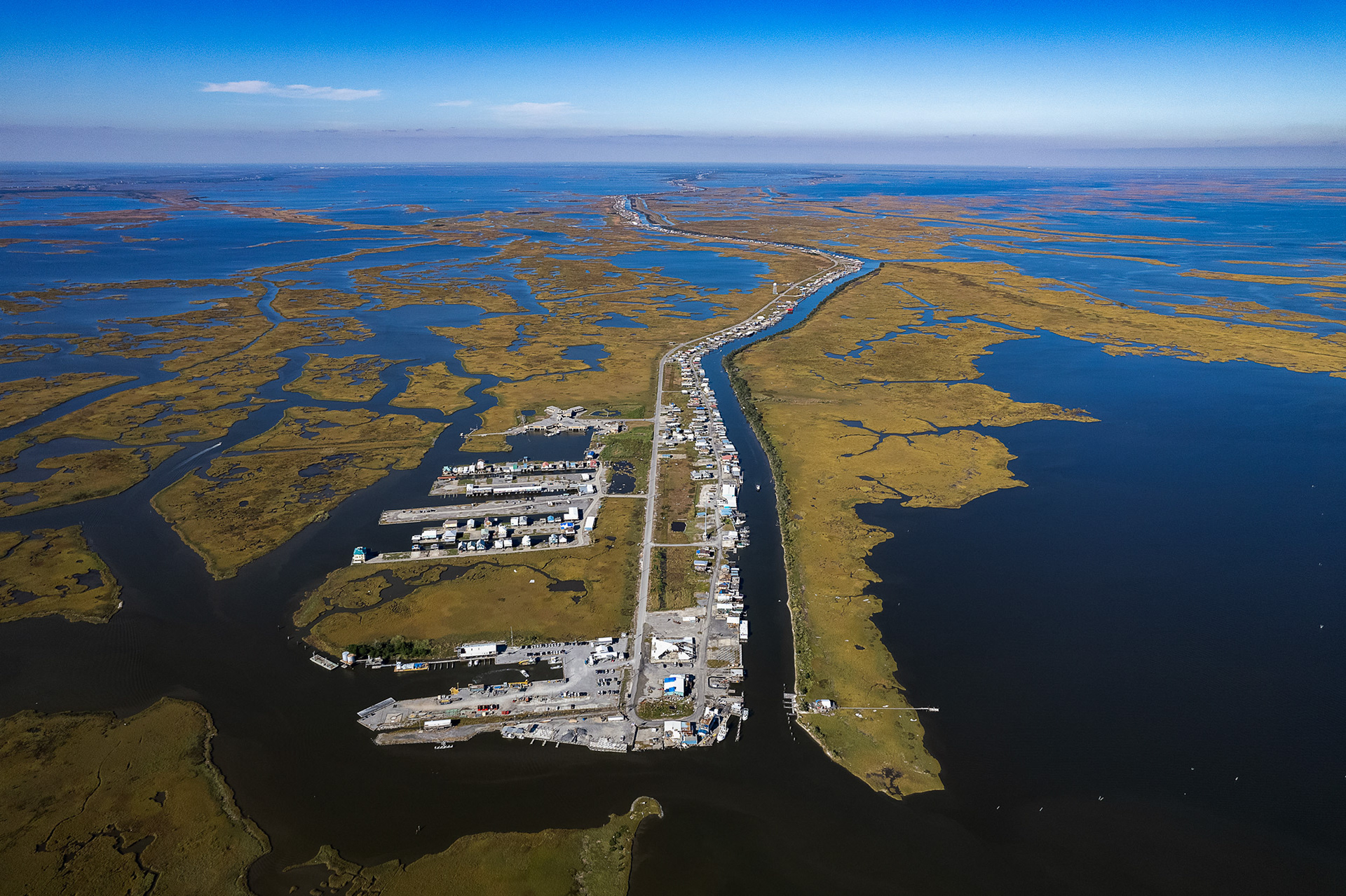
End of the road. Cocodrie, Louisiana.